Rover Location Database
Washington Rover Locations
- WA Map
- WA List
- WA from CN87
- Rare WA Grids
- WA Counties
- CN76 Long Beach
- CN77 Forks
- CN78 Sekiu
- CN85 Portland
- CN86 Centralia
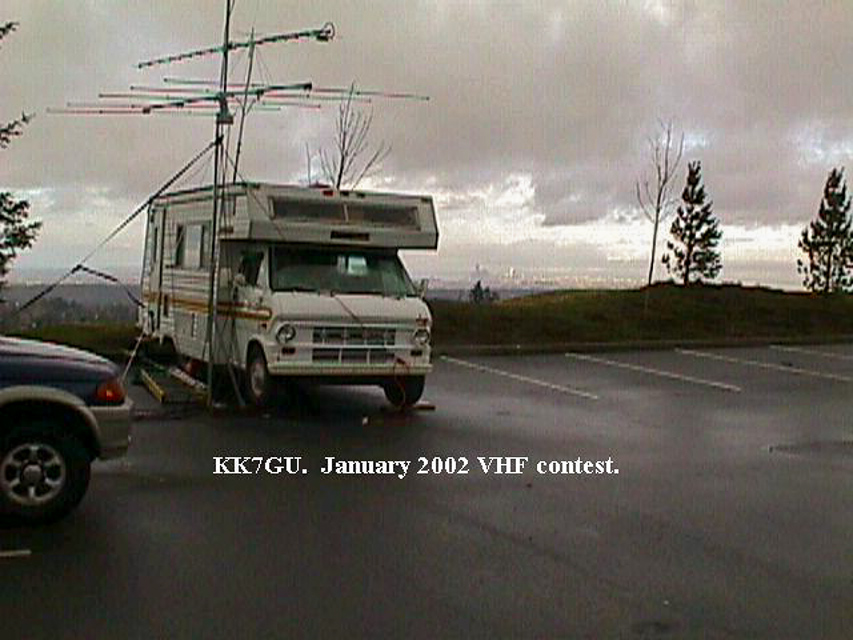
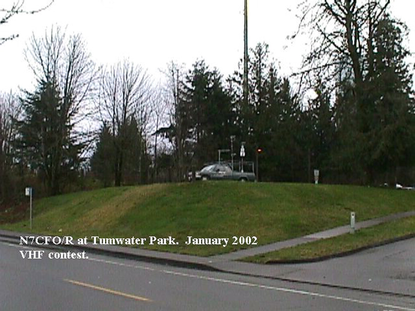
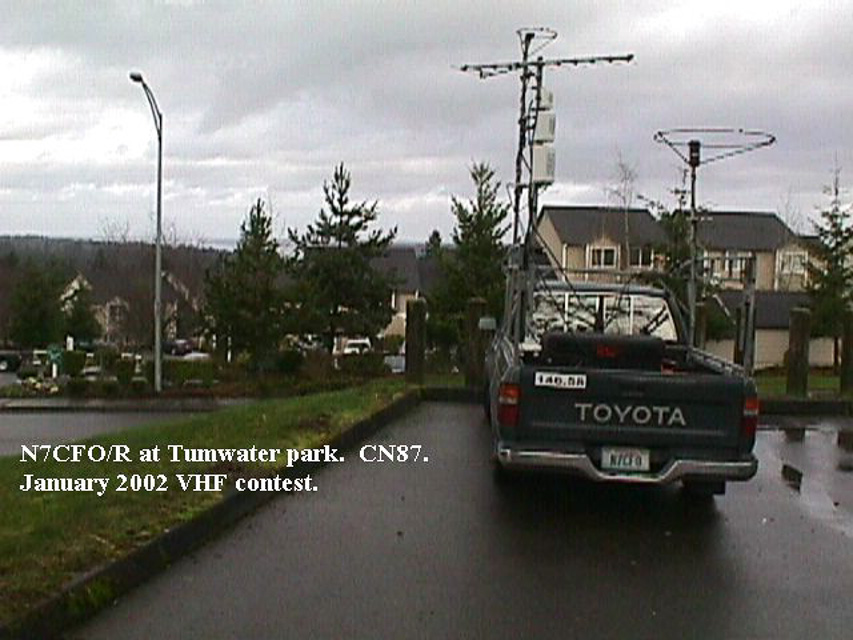
- CN87 Seattle
- CN88 Belling'm
- CN95 The Dalles
- CN96 Yakima
- CN97 Mt Rainier
- CN98 Mt Baker
- DN05 Pendleton
- DN06 Tri-Cities
- DN07 Moses Lk
- DN08 Okanogan
- DN16 Pullman
- DN17 Spokane
- DN18 Colville
- Add a Place
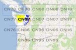
Grid Square CN87
24 locations - Shoreline CC - Brier Park - Forest Park - Horizon View Park - Shoreview Park - Quinalt Ridge - Denny Ahl Hill - Wellington Park - Deer Park - Belfair State Park - McMicken Heights - Mt Jupiter - Mt Crag - I-5 Federal Way - Newport Hills - Overlook Point Park - Skyline High School - Mt Walker - Woodridge Bellevue - Squak Mtn - Skyline High School - Cougar Mtn Park - Skyline High School - Pine Lake Estates
Potential VHF rover sites in Washington grid CN87.
CN87 dimensions are 93.4 by 69.2 miles.
Explore this grid in Google Earth or equivalent:
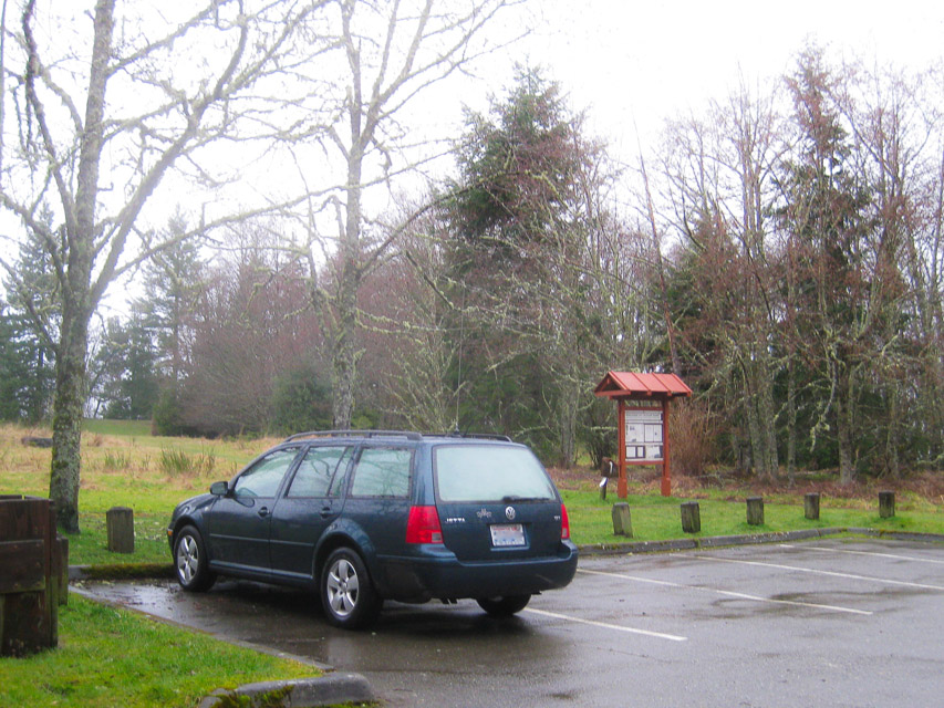
Shoreline CC, CN87tr69
| Latitude, Longitude |
|---|
| 47.746858, -122.365903 |
Shoreline Community College offers large parking lots at the top of the hill.
Restrictions: Be aware of school open times and special events. These parking lots can be used for car shows, antique radio events, and other happenings.
Brier Park, CN87ut70
| Latitude, Longitude |
|---|
| 47.792171, -122.268940 |
Brier Park next to the Brier City Hall has picnic tables next to the kids playground and just to the East where there are very tall trees. It is really good to the SW, S, E, and to the NE. Due West is a hill and not too good for VHF in that direction. There's a nice big ball field. - Chuck WA7BRL
Restrictions: If you park by the kids playground there are high-tension power lines and a major cell tower overhead, so there might be less noise by the baseball diamond.
Forest Park, CN87vx30
| Latitude, Longitude |
|---|
| 47.959400, -122.221140 |
An intriguing spot is Forest Park in South Everett. I’ve gone up there to make 10 meter contacts. Have not tried VHF yet. - Ed N7PHY
Horizon View Park, CN87us65
| Latitude, Longitude |
|---|
| 47.774068, -122.277011 |
Any place with a name like "Horizon View" has got to be good. And it is good.
Restrictions: No overnight camping.
Shoreview Park, CN87ts60
| Latitude, Longitude |
|---|
| 47.751839, -122.365903 |
This is a really nice city park with tennis courts, hiking, big parking lots, and more. At 350' the elevation is well below Shoreline CC up the hill. For VHF purposes, the hiil blocks propagation east.
My friend Alex and I listen in a lot of places around Mountlake Terrace and the best low noise location is Shoreview Park in Shoreline (upper terrace near tennis courts). - Vlad UA6JD /W7
Quinalt Ridge, CN87cj18
| Latitude, Longitude |
|---|
| 47.410254, -123.818296 |
Denny Ahl Hill, CN87ij76
| Latitude, Longitude |
|---|
| 47.401553, -123.268571 |
Denny Ahl Hill is easy to get to and has a great view over the south end of the Hood Canal and across to the Cascades. W7HR went there several times back in the 1970's. He pulled a small travel trailer up there once but has not been there since.
Driving directions: Located 2 miles from the south end of Lake Cushman on a heading of 236 deg.
Wellington Park, CN87ws37
| Latitude, Longitude |
|---|
| 47.779428, -122.137471 |
At one time this was Wellington Hills Golf Course. It is right up the hill from the Woodinville Costco. A little research shows that it was owned by the UW for a potential location of the North campus and purchased by Snohomish County in 2012 as a potential park site. Community opposition to the county’s vision for the site caused them to abandon the plans and the site was sold to Northshore School District as a potential site for a new high school. The same objections to the park development have been raised about a high school, and NSD has not made any decisions about immediate development.
From an aerial view, you can see many large, nicely spaced trees. It would be interesting to find out if a horizontal loop could be raised there, or even a simple dipole.
With the rising slope to the south, this spot is better for HF than VHF.
Restrictions: Park along the busy street. No amenities.
Deer Park, CN87iw97
| Latitude, Longitude |
|---|
| 47.947384, -123.257141 |
Deer Park in the Olympic National Park offers a high altitude campground and trailheads to spectacular hiking.
Restrictions: 18 miles of unpaved roads, not suitable for RV or trailer.
Belfair State Park, CN87nk43
| Latitude, Longitude |
|---|
| 47.430080, -122.875101 |
Nice state park with open water and low takeoff angles to the east.
McMicken Heights, CN87uk68
| Latitude, Longitude |
|---|
| 47.451200, -122.282900 |
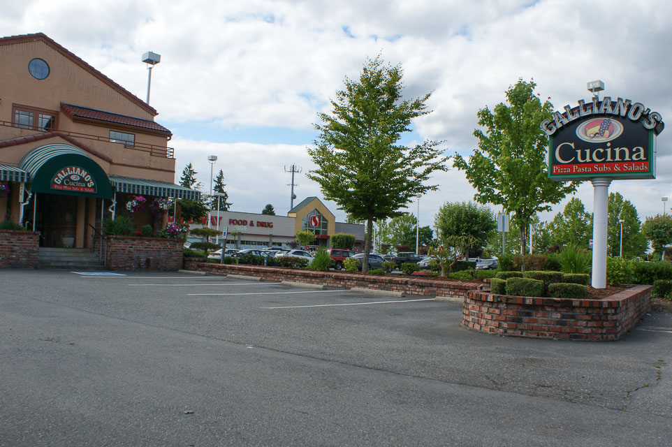
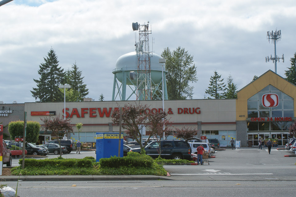
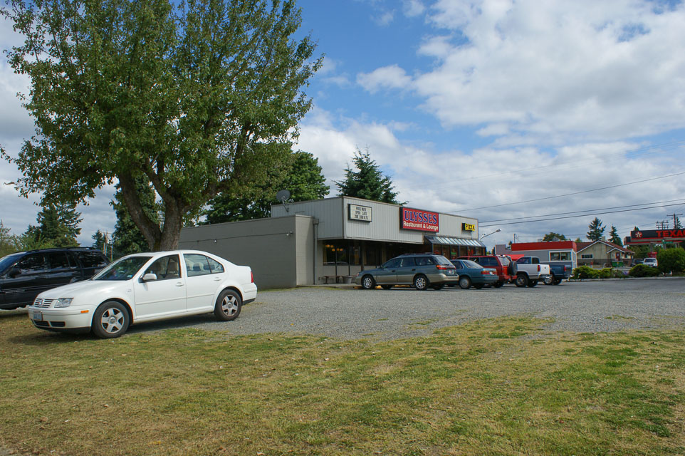
This is a local high point that is easy to get to from I-5 and I-405 for stop-n-shop operation into the greater metro area.
The topmost point behind Safeway is occupied by a large water tower loaded with antennas. You probably don't want to operate from right there, so find an open unoccupied parking area such as Galliano's Cucina (catering!), Safeway (starbucks!), Ulysses Restaurant (wifi + pizza!), Deringer (vacant!), etc.
Driving directions: From I-5 southbound, take Southcenter Parkway exit
- Turn right (west) onto Southcenter Parkway
- Take the first left onto 42nd Ave
- Climb the hill and you will find yourself in McMicken Heights on high ground
- Find an open parking area away from wires, water towers, etc
- To return to I-5 or 405, don't go back the way you came
- Go west to International Blvd and then north to 518, for easiest highway access
Mt Jupiter, CN87mq64
| Latitude, Longitude |
|---|
| 47.687300, -122.948000 |
1730 foot elevation west of Brinnon on the Olympic Peninsula.
Driving directions: Driving south of Brinnon on Highway 101, after a few miles, watch for the Mt Jupiter road sign.
- Take the right turn (west)
- Follow the main road (which is paved at first, but quickly turns to gravel)
- Follow signs to the Mt Jupiter trailhead.
- Once you get to the trailhead, you will understand why you can't operate there, so turn around and backtrack a little to find a suitable turnoff to the right.
- It's not great for Vancouver or Victoria, but excellent for everything else.
- The shot to CN72 on 2m is a PIPELINE.
There is also a second location:
- Shortly before getting to the trailhead, the road Ys, with the left fork going to the trailhead.
- The right fork goes to the spot which, if you succeed making it across the trench, is a short drive
farther to a wide spot on the spur road.
- This second spot may be better to operate from if you're willing to risk getting stuck in the trench.
- It certainly is more level here. (K7CW)
Mt Crag, CN87ms03
| Latitude, Longitude |
|---|
| 47.766099, -122.997608 |
These roads wash out often. There may be no one around to help you. Shoulders may be soft, and may drop you 100's or more feet. We have taken regular passenger cars and RV's up these roads with no difficulty. If you see something you feel is not safe, don't attempt it. You are probably lost. Turn around and try to find the last known location.
Driving directions: Get to Brinnon on Hwy 101, south of Quilcene.
- At the north end of town is Dosewallips Road which starts west between a gravel pit and a motel.
- Set or check your odometer, as all distances will be referenced starting from Highway 101.
- Drive 1.1 miles and watch for the 2620/Rocky Brook Rd on the North side of the road.
- There is a "farm" with old equipment on the south side of the road.
- The road starts out rather steep and looks like a residential access road at first, but suddenly becomes a narrow one lane forest road.
- Go 2.9 more miles to the intersection of 2620 and 2630. 2620 is the road we stay on and it goes to the right. (4 miles showing from 101).
- Go another 1.1 miles on 2620 to the intersection of 2620 and 030. 2620 is the road on the left and we are now 5.1 miles from highway 101.
- Continue on 2620 another 3.2 miles, (8.3 from 101) to the top of the pass between Buck Mtn and Mt Crag.
- As you reach the summit of the pass there is a storage area for road building materials on the west side of the road. The road we want is numbered 050.
- Turn west (left) on 050, travel .8 (8 tenths) miles to the intersection of 050 and 053.
- Stay to right (uphill) and go another 1.25 miles to the intersection of 050 and 056. 056 starts at the top of a very sharp hairpin turn and runs .75 miles to the end of the Mt Crag ridge.
- You will pass a very steep hill rising on your left, before the end of the ridge. This goes up to a repeater site.
- Stay to the right on the narrow road that skirts the side of the road that rises.
- Headings can be confusing, so if you get a chance to see Mt Rainier or Mt Baker, make a note of where they are.
Restrictions: Per KD7TS the road is gated at Forest Road 056. (September 2011)
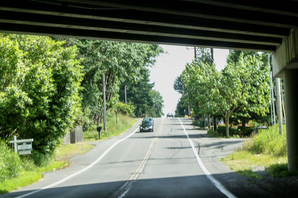
I-5 Federal Way, CN87ug25
| Latitude, Longitude |
|---|
| 47.271354, -122.314583 |
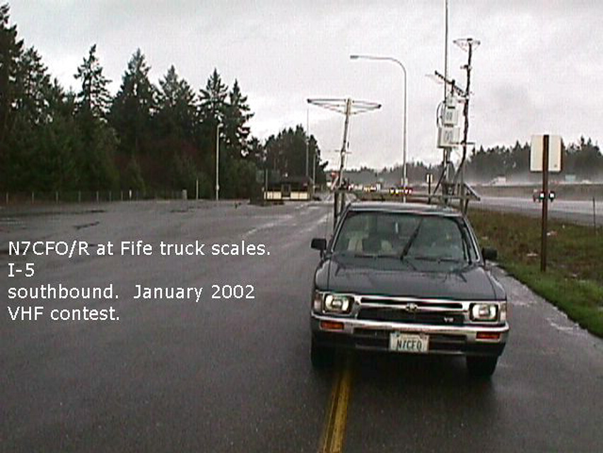
This is a truck scale located next to a rest stop. The best operating location is in the scales area. The rest stop has a lot of trees that hamper UHF operation. This is not a great spot, but it is quick, and restrooms are handy if you need them. There are good paths to the south, and you can usually work the locals on UHF if nothing else.
Driving directions: I-5 northbound: just past milepost 140, take truck scales exit. Bear left.
I-5 southbound: just past milepost 141, take truck scales exit.
Newport Hills, CN87wm28
| Latitude, Longitude |
|---|
| 47.533970, -122.143190 |
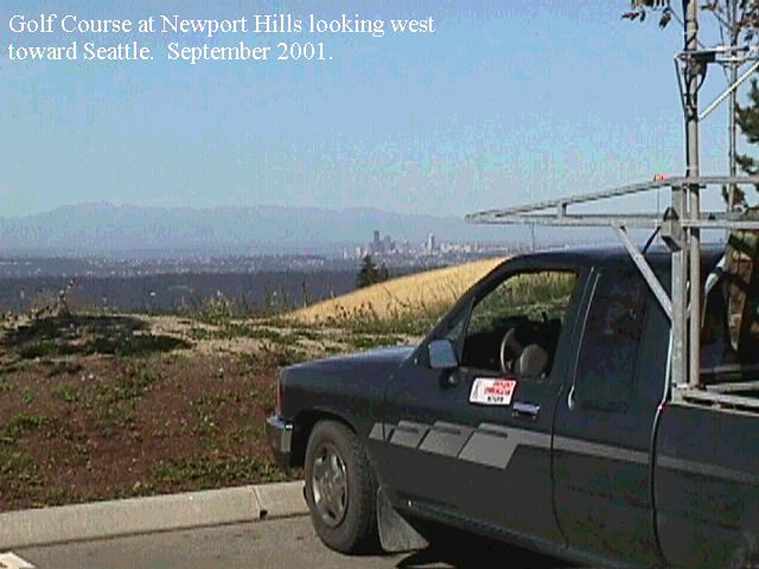
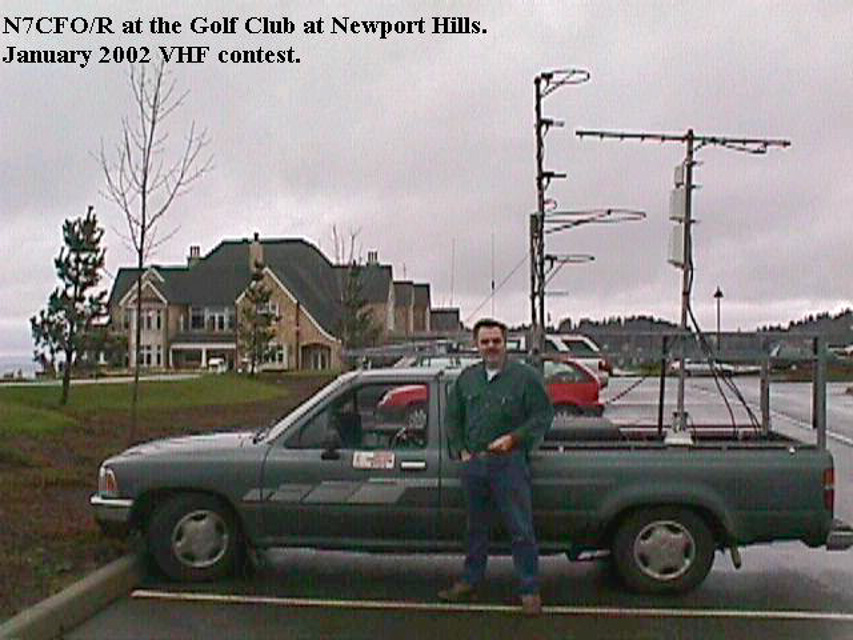
This is a commercial golf course about five miles east of I-405. The best operating location is the southwest corner of the parking lot. There are excellent paths to the north, west, and south, and not bad to the east. The course staff are ham-friendly and have been very cordial.
Driving directions: Take exit 10 off I-405 onto Coal Creek Parkway.
- Go east 2.5 miles to SE 72nd.
- Go left on SE 72nd 1/4 mile to 133rd Ave. SE.
- Go left on 133rd Ave SE 1.6 miles to a road on the right. The road does not have
a sign, but there is a large "The Golf Course at Newport" sign on the corner.
- Go up this road 1/4 mile to an intersection and then take a right up the hill on
"Six Penny Lane". (Do not go straight up the service road.)
- Go up Six Penny Lane .7 miles past the clubhouse to the parking lot.
Restrictions: 5/3/2003: Lynn N7CFO went up there for the UHF sprint, and the operations manager asked that in the future that hams call Jim Rupp, the facilities manager at (425)793-4681 to ask permission to operate. This is important - we don't want to lose a prime operating location for lack of making a phone call.
Overlook Point Park, CN87ma93
| Latitude, Longitude |
|---|
| 47.014966, -122.916799 |
This site is a public park parking lot on a ridge. It is about five minutes off I-5. The north end of the lot has excellent VHF/UHF exposure to the north. The park closes at dusk, but the police don't seem to mind. There are restrooms and water available.
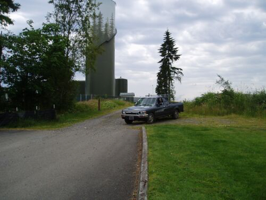
June 21, 2005 update by Lynn: I was in the area and noticed from I-5 that the hill had been logged off, so I drove up there. The hill behind the park has been clear-cut and there is now an excellent north/south exposure from this location. There is a gate at the top of the road, but it was open so I was able to get to the top of the ridge. The best location is likely east of the water tanks. If the gate is closed there is still a pull-off next to the gate that offers good north/south shots.
This photo shows the best operating position if the gate is closed. You can see the gate just beyond my truck. If the gate is open go around to the left behind the water tanks.
Driving directions: I-5 exit 102
- West to Second Avenue
- North on Second Avenue to Linwood Ave
- Left onto Linwood Avenue to 7th/Barnes
- Up hill approx 1 mile to park on left. Look for water tank.
Restrictions: This is in a populated area, and the line of fire to the north is over several apartment buildings, so there could be a TVI/RFI problem if you are running a lot of power.
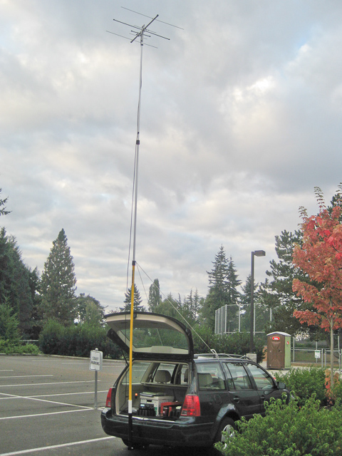
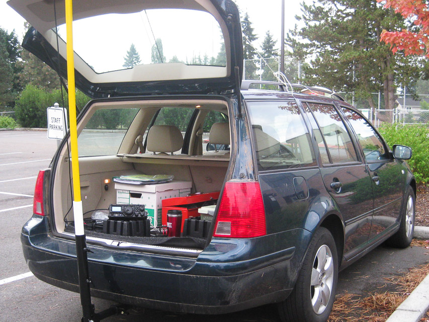
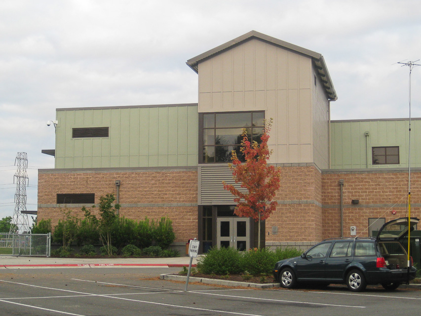
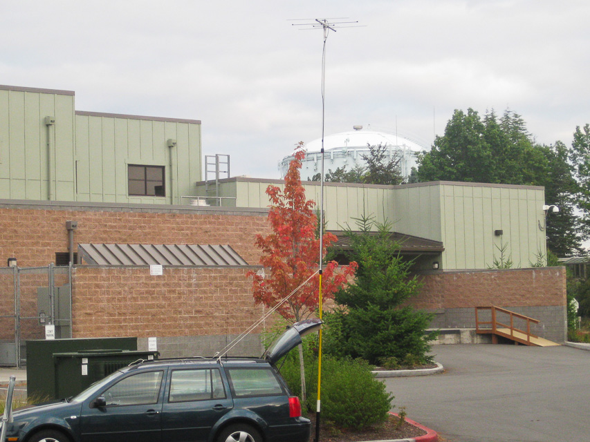
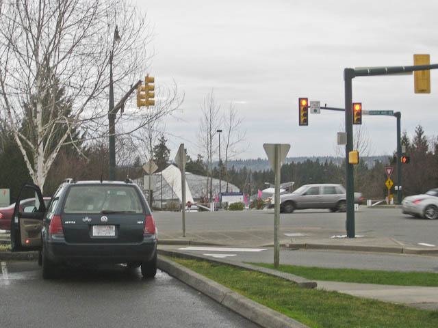
Skyline High School, CN87xo64
| Latitude, Longitude |
|---|
| 47.601000, -122.032833 |
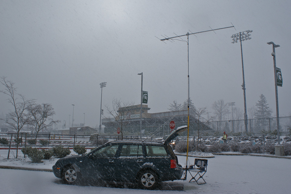
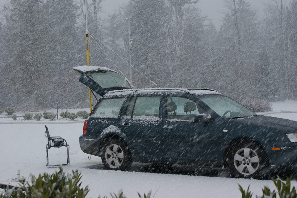
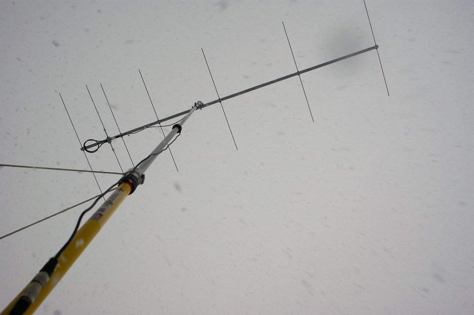

It was a cold and snowy January day, but I simply had to try out a new M2 antenna before the VHF contest next week. So I parked on the nearest hilltop at Skyline High School. I've used this location before, so it makes a fair comparison. However, today I parked out in the open area of student parking on the north side. The weak-signal net had a light turnout, but I made three contacts: Kirkland (12mi), Monroe (CN97au, 21 mi) and Sunnyside (CN85rk, 150 mi).
Signal reports about the gain and directivity of the new 2M7 antenna revealed that it is clearly better than my Cushcraft 3-element beam that I've employed to date.
Mt Walker, CN87ns18
| Latitude, Longitude |
|---|
| 47.785900, -122.901300 |
If you're on the Olympic Peninsula, there is a great hilltop named Mt Walker. It is fairly good elevation at 2800' with a flattish table on top of a knife-edge ridge. There is parking and a great shot to the east and perhaps north. All of Puget Sound and Seattle is visible. The dirt road and gate might be closed for the winter, but it sure is fun in the summer. It should have less traffic and visitors than nearby Hurrican Ridge.
It's due west of Poulsbo, on the edge of Quilcene Bay. When driving southbound on Hwy 101 (aka the Olympic Highway) (and aka Pacific Coast Scenic Byway) turn left onto National Forest Road 2730 and follow the mountain road about 4.4 miles up to the peak.
Woodridge Bellevue, CN87vo92
| Latitude, Longitude |
|---|
| 47.592783, -122.173330 |
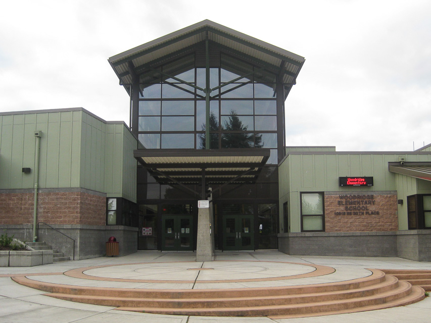
This open and exposed rounded hilltop near downtown Bellevue has pretty good propogation to the south, west and east. The lat/long is in the east parking lot of Woodridge Elementary School, near the freeway interchange of I-90 and I-405.
Note that high-tension power lines run N-S along the edge of this site, and a water tower bristling with cellphone and microwave antennas is nearby. As it turns out, these did not interfere with 2-meter reception unless I pointed directly at the water tower.
This was fun to visit -- I went to school here for a few years until 1965 and now it's barely recognizable. The trees were smaller then and the school itself was much smaller.
Squak Mtn, CN87xm40
| Latitude, Longitude |
|---|
| 47.503982, -122.047420 |
Squak Mountain is the middle of the chain of Cougar - Squak - Tiger mountain range marching east from Bellevue. These are wonderfully tall peaks visible for many miles around.
This might be primitive forested national park area. Although google maps shows roads, I suspect it is accessible only by 4-wheel drive vehicles. Local reports say it's usually gated 100 yards in, and a really nice hike to the top in summer.
Skyline High School, CN87xo53
| Latitude, Longitude |
|---|
| 47.599052, -122.035017 |
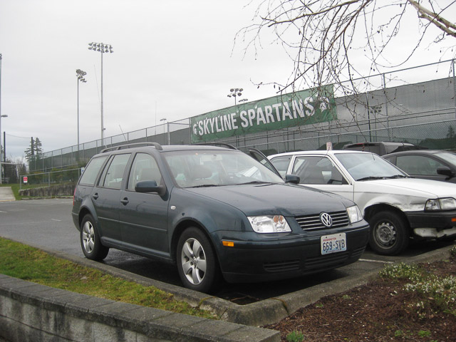
I parked at Skyline High School in the city of Sammamish, with an open view in most directions. I checked into the PNW Weak Signal Net on the regular Sunday morning schedule at 8am. Made three contacts: Kirkland (12mi), Monroe (CN97au, 21 mi) and Woodinville (CN87ws, 15 mi).
Here are notes and to-do list of the visit:
- It worked very well to have an antenna switch to easily compare the 2m beam with the two little mag mount whip antennas.
- Figure out ergonomic mounting of FT-480R radio on passenger seat. The front panel needs be tilted up, and the radio was precariously balanced.
- Find a better antenna mast mount then the driver's window.
- Measure radio current draw; estimate car battery life.
- Fix powerpole connectors, they were prone to intermittent connection.
- Always sign as "portable" so that people won't steer their beam to the wrong (home) location.
- If you sign as "mobile" then Net Control assumes you are moving and puts you first in net rotation. You should say "portable" if you're parked and stationary.
- Get QRZ.com databse on the laptop to look up antenna bearings.
- Buy one more antenna switch so it can be dedicated to portable use.
Cougar Mtn Park, CN87wm68
| Latitude, Longitude |
|---|
| 47.533355, -122.113587 |
I parked at the old anti-aircraft site on the peak of Cougar Mountain, a part of the city of Bellevue. In 45 minutes of trying, no contacts were made on SSB and the regular weak-sign net was not heard. As far as I can tell, everyone (wisely) slept in this morning as a result of advancing the clocks today for Daylight Savings Time.
But my time was not wasted. I tested the SWR using a "new" VHF swr meter purchased at the Puyallup hamfest yesterday. The Cushcraft 3-element beam measured 10:1 while the 5/8 magmount whip measured 1.2:1. This would explain why I can hear people better than they can hear me. Now I know what to work on next!
Here are notes of the visit:
- Park gates are apparently open 24-hours, even though the sign said 8am to dusk.
- Ranger house is occupied full time.
- A nice ranger guy came over to ask what I had going on, under the pretext of emptying the garbage can next to my car.
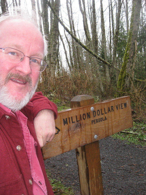
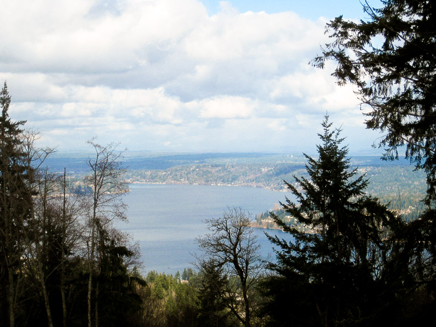
- Ranger suggested hiking from the parking lot a very short distance west to the "Million Dollar Overlook" for direct line-of-sight communication.
- Curiously, the peak is in a cellphone radio hole. Almost no signal strength.
- Simplex contacts on FM had very poor coverage in the nearby valley or flatlands. But I had good signal into Shoreline area of Seattle.
My white PVC antenna mast leaves room for improvement:
- It is raining heavily outside
- Water runs downhill
- My car window is open
- I'm holding a plastic water pipe vertically up through the open driver's window
- Water runs down the outside of a water pipe as easily as the inside
- Water sticks to a pipe until it's diverted
- I'm holding a plastic water pipe
Skyline High School, CN87xo53
| Latitude, Longitude |
|---|
| 47.599052, -122.035017 |
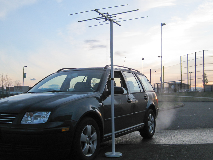
Finally, a very successful trip to a nearby hilltop. The transmitter strength was excellent and several people had no problem hearing me.
My antenna tuning yesterday was very helpful. The 3-element beam was very sensitive to the exact adjustment to the gamma match. The final placement for 144.240 MHz was 54mm (2-1/8 inch).
Rod WE7X joined me in the parking lot and setup his 3-watt 817 transceiver, battery, tripod, 2m 3-elt beam. He could receive well but others could barely hear him. Perhaps his equipment needs adjustment, or possibly the nearby cyclone fence was affecting performance.
Things for my checklist:
- No bathrooms on most hilltops. Esp along a busy road by a popular high school. Don't load up at Starbucks along the way.
- Tune gamma match for maximum forward power. This may or may not coincide with minimum SWR.
- My transmitter's power output (Yaesu FT-480R) is very sensitive to antennu tuning. It varies from 5w to 15w across small adjustments of gamma match.
- My transmitter's frequency display reads too low by 400 Hz. For example, the proper dial readout is 144.240.4.
- Get a magnetic door sign to look official. Rod WE7X suggests "Amateur Radio Bear Tracking".
- It would sure be nice to have callsign lookup available.
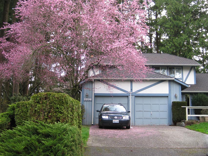
Pine Lake Estates, CN87xn49
| Latitude, Longitude |
|---|
| 47.580694, -122.043798 |
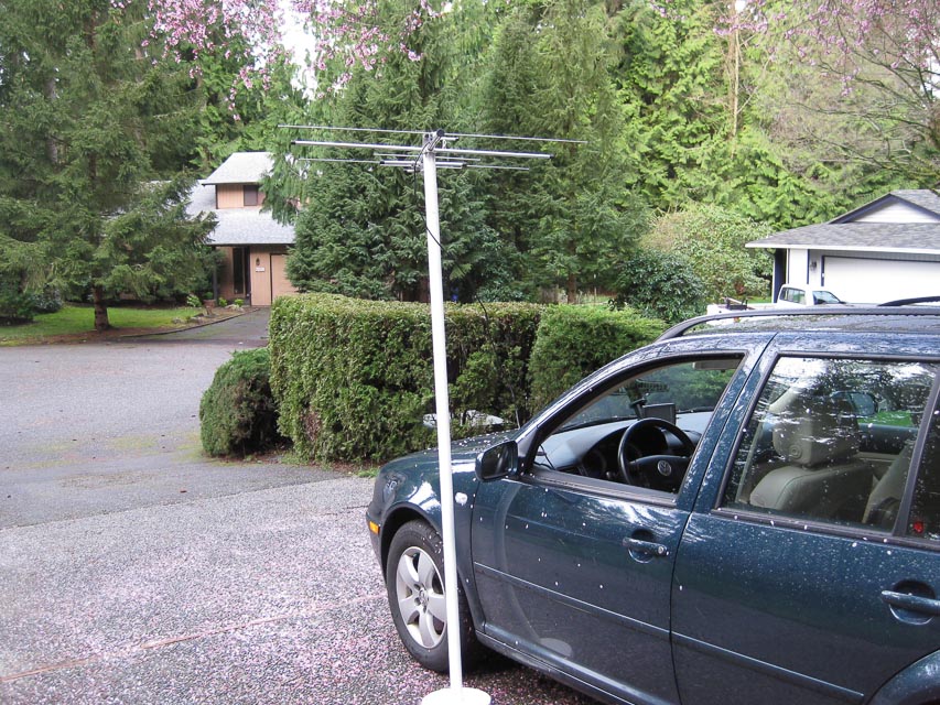
Dist from coffee pot: 60 feet W
I wonder how things sound from my driveway? The results are in: Things sound not quite as good as other places; I made a marginal contact to Stanwood and I was not heard in Portland. Today's propagation was fluctuating and Portland stations briefly rose above the noise floor but not enough to complete a contact.
Interestingly, another local station coming in weakly was using vertical polarization so I swiveled my beam from horizontal to vertical but got no improvement. However, conventional wisdom suggests a large improvement, 30 dB, can be obtained by matching receive and transmit polarization. It didn't do much for me, so perhaps the signal rotates through the path, or my beam was too close to the car and other objects.
I want to try this location again with my new roof-mounted beam and see what happens. Also I'm still having trouble with my cheapo mast stand on anything but level pavement. Note to self: build a drive-on mast stand base.
| < Previous | Page 11 of 24 | Next > |
©1998-2024 Barry Hansen