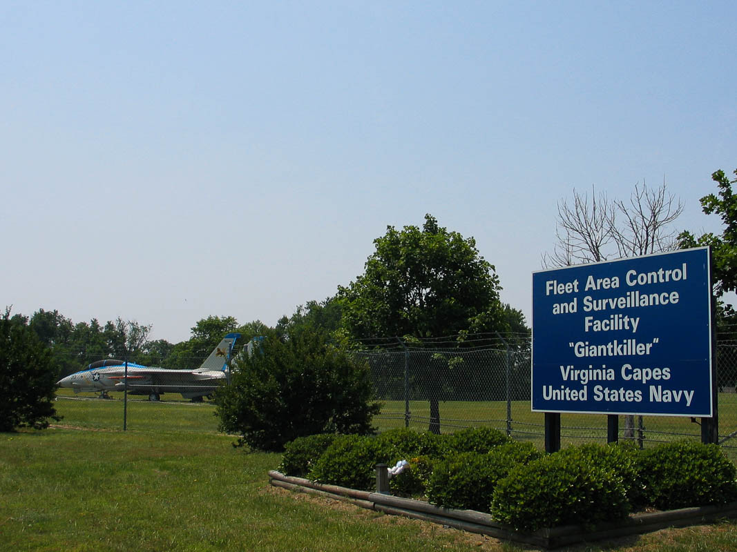
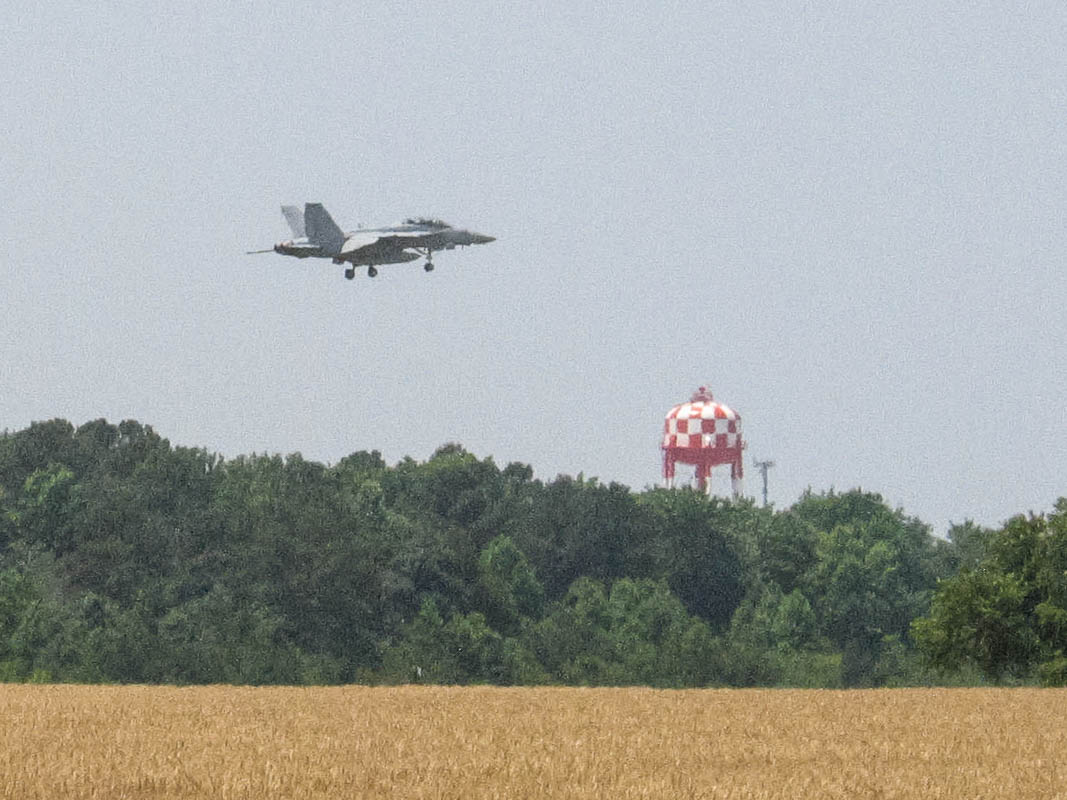
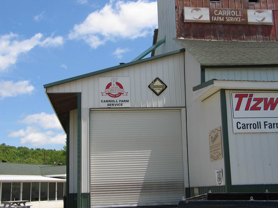
NAS Oceana is the largest Navy air training base in the country. Hillary and Alex live in Virginia Beach only a mile from the base. We often see F-18s ripping by low overhead, often on full thrust for takeoff or landing. This is like having the Blue Angels here every day!
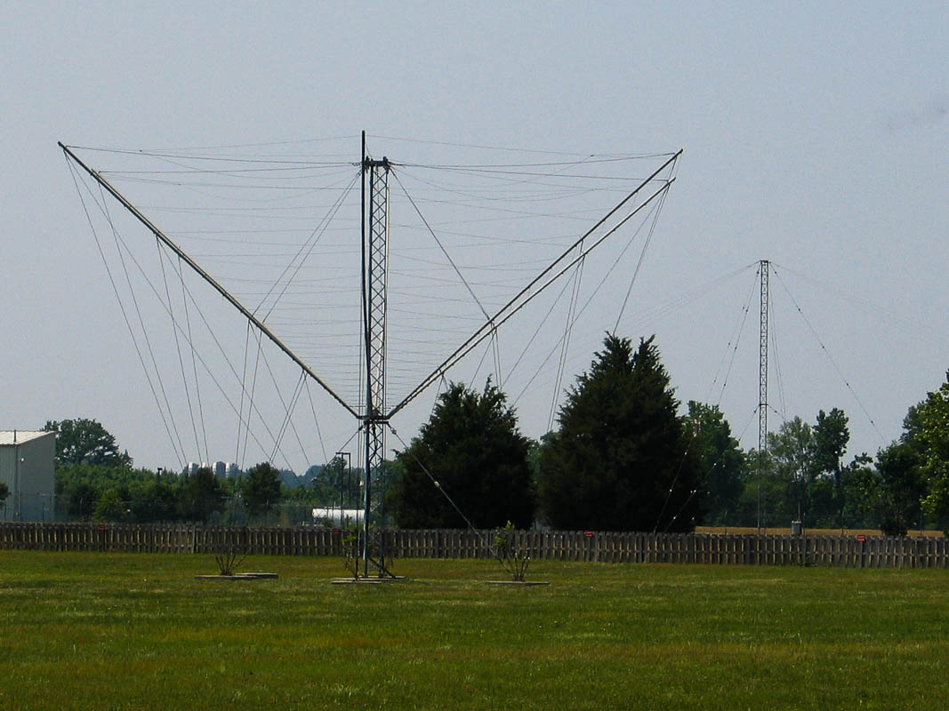
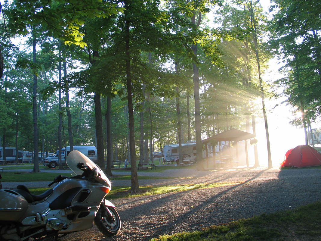
What is that antenna? Seen at NAS Oceana near the F18 on display.
May 30 2011
Day 21: 11th Street Taphouse
Have I really been gone three weeks on this trip already?
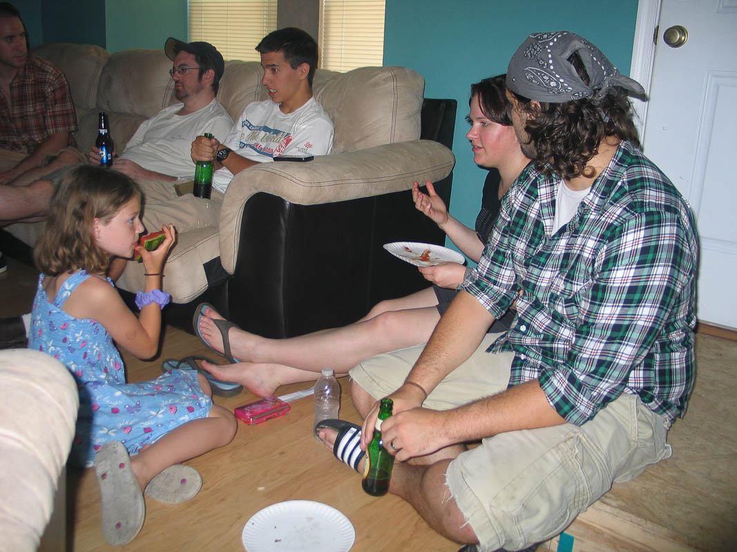
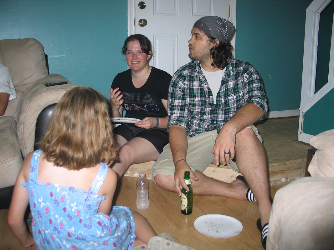
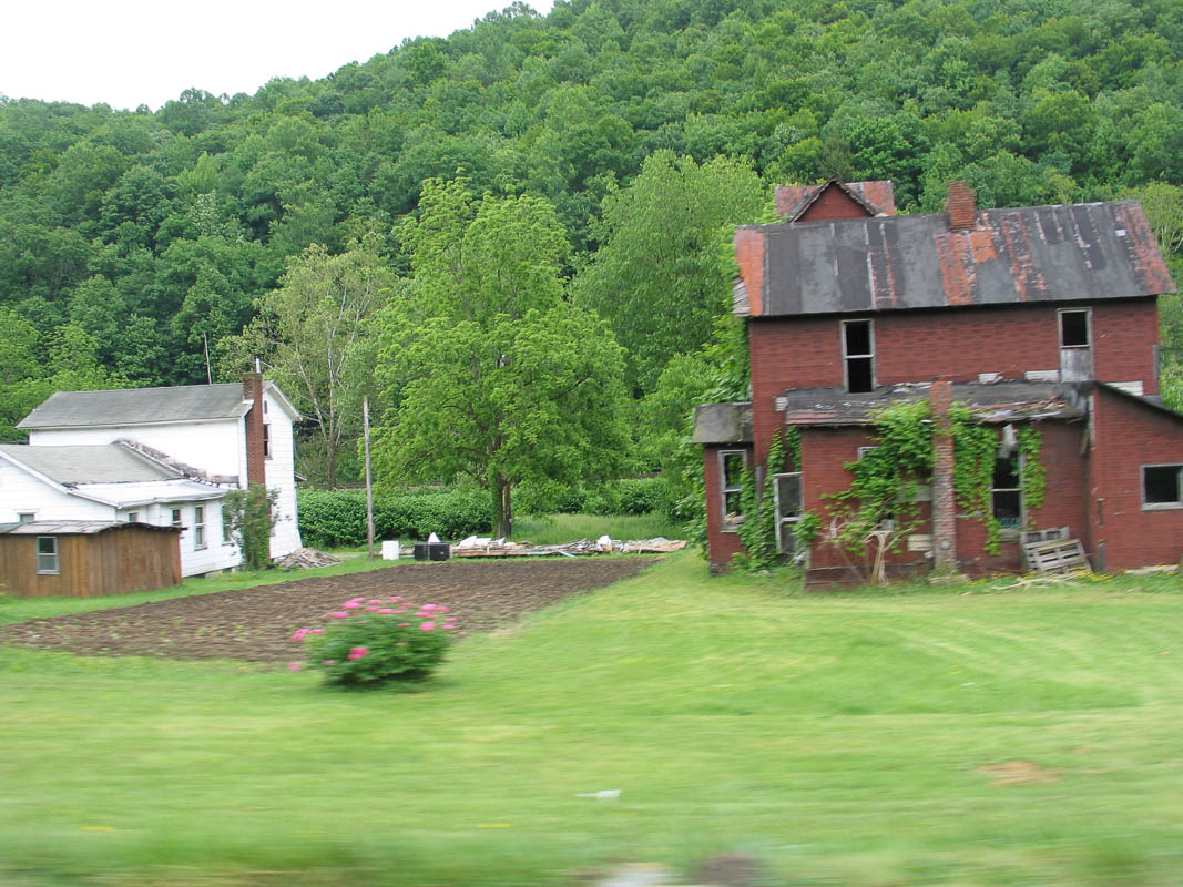
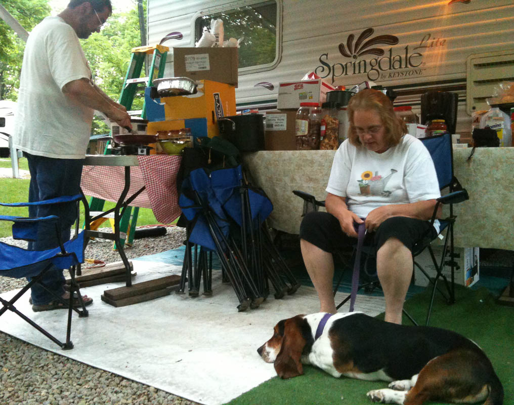
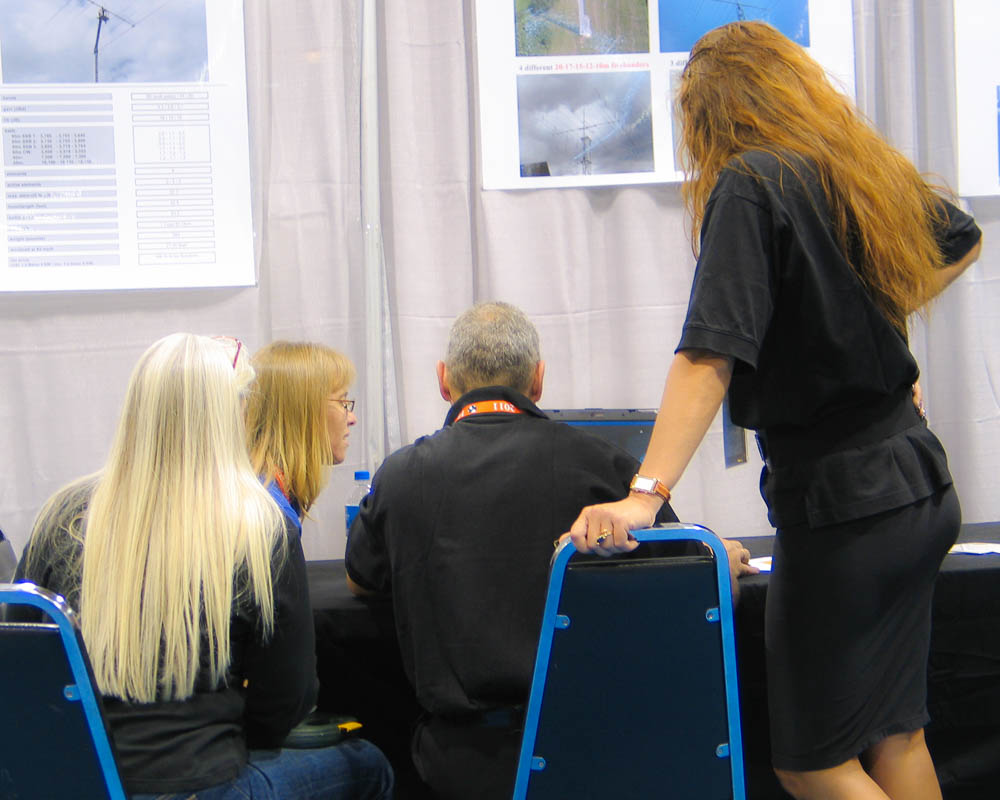
Today is Memorial Day so we joined Hillary and Alex at a local gathering of their friends for grilled hamburgers and seafood. We met Tom (local police detective) and Meg (amateur photographer) and many others.
For dinner, Juanita and I drove to 11th Street Taphouse on the big public beach resort area. Highly recommended. And went for an evening walk on the beach. I will never get used to an eastward beach with a westward sunset! It just feels very strange to me.
It was hot today: 95F and humid. I wish I could find a motorcycle route to Seattle that was cool and pleasant, but I must ride through tornado alley to get home. I will leave Virginia Beach and start home on Thursday 6/2.
May 29 2011
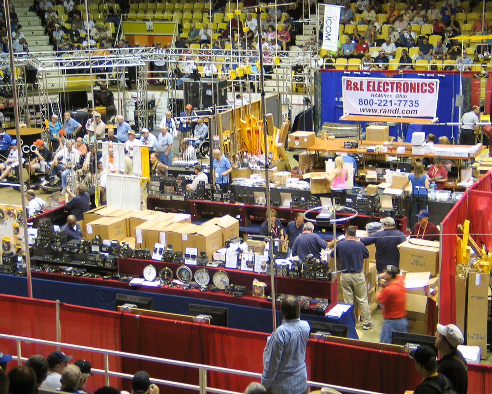
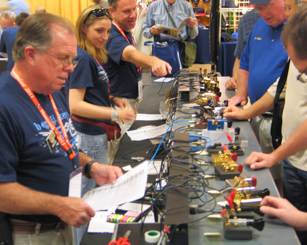
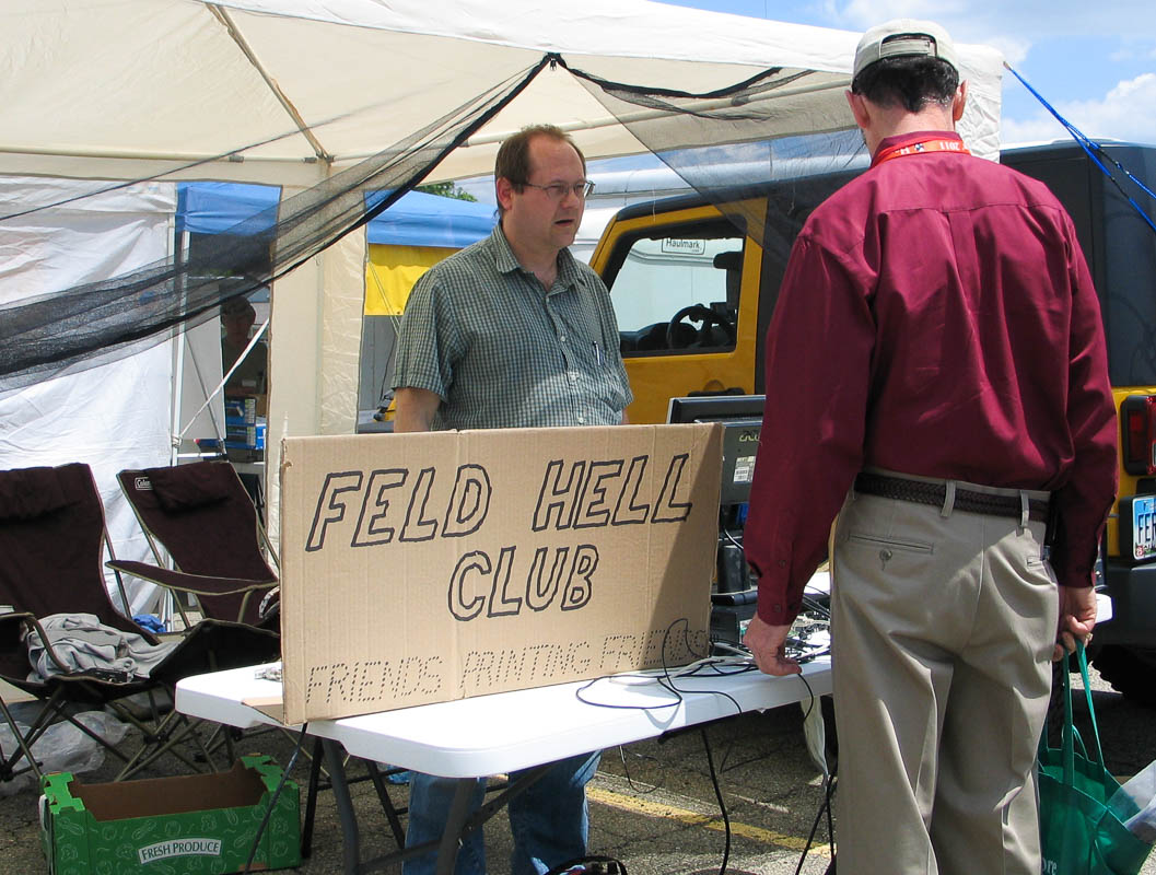
Day 20: Coilgun Hobbyists
What if coilguns could be used to disable improvised explosive devices (IEDs)?
I visited a coilgun hobbyist in Virginia Beach to talk about it. He must have the most interesting job in the world. As a Navy specialist in IED disposal he gets to do lots of fun things: jump out of perfectly good airplanes, use the latest weapons, play with explosives and even build IEDs.
The best thing about coilguns is how they dodge red tape at high speed. Today, a Navy technician must requisition shells containing gunpowder or other explosives to do his job. This requires massive paperwork (“red tape”) to track and protect the dangerous cartridges. But if they could use coilguns the “shell” is an inert projectile and that only requires a nearby electrical generator for charging capacitors. The paperwork, if any, becomes trivial for storing and transporting these projectiles.
Disarming an explosive IED is usually done with more explosives. They examine the IED and identify the battery, trigger and payload. This often means taking an x-ray of the IED. The technician figures out how to disable the circuit without setting off the charge. The idea is that a rifle slug (or other projectile) can open the circuit faster than the trigger can trigger it. The disarming must do its job faster than the IED's triggering mechanism can do its thing; hence, some kind of high-powered rifle is very effective at cutting wires.
A complicating factor are the bullet's side effects. They must also be careful that firing a gun at the IED does not produce a shock wave or do anything to move parts out of the way before the wire-cutting action begins. Although they would like to get maximum accuracy by firing the bullet from a very close distance, the shock wave side effect can cause problems, so they need to move back far enough that the bullet reaches the IED before the shock wave.
Another complicating factor is the cloud of expanding gas from conventional bullets. There are cases when the disarmament technician would really prefer not to surround an IED with combustible or explosive gas. Yes, really. So in these cases it could be a big advantage to use electromagnetic launchers instead of gunpowder.
It would sure improve safety if electromagnetic launchers can do even part of this job!
May 25 2011
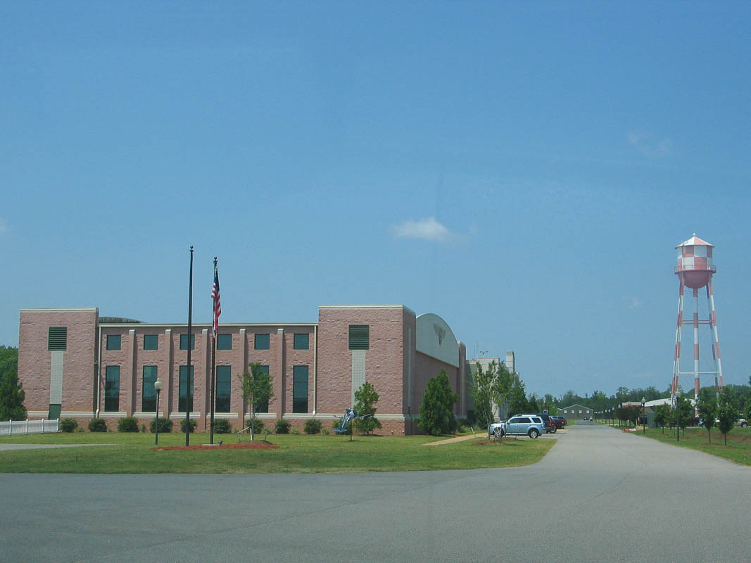
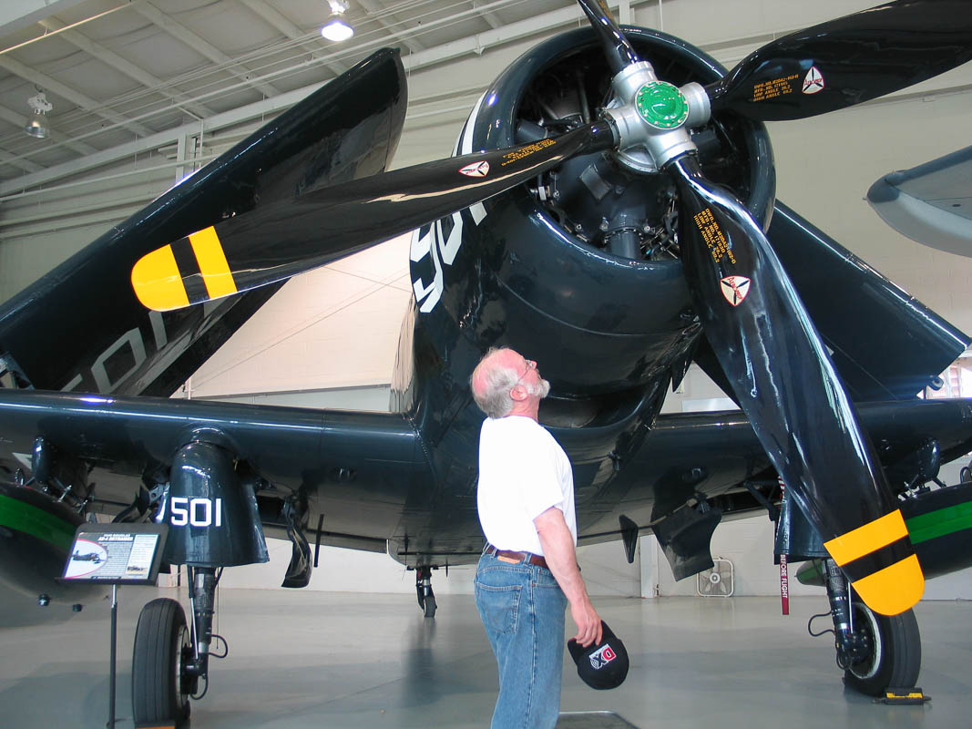
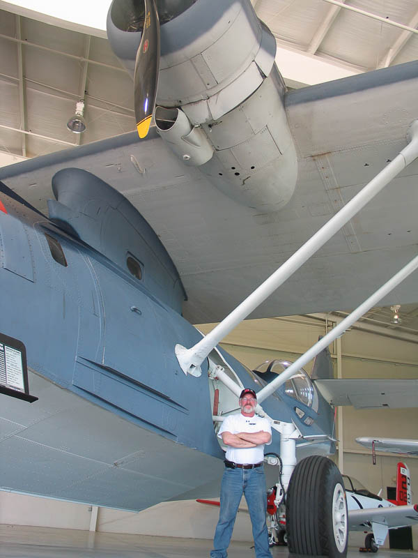
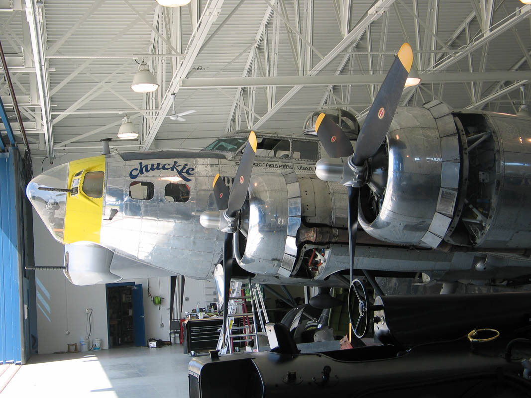
Day 16: Rare Flyable Planes
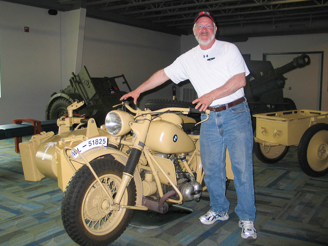
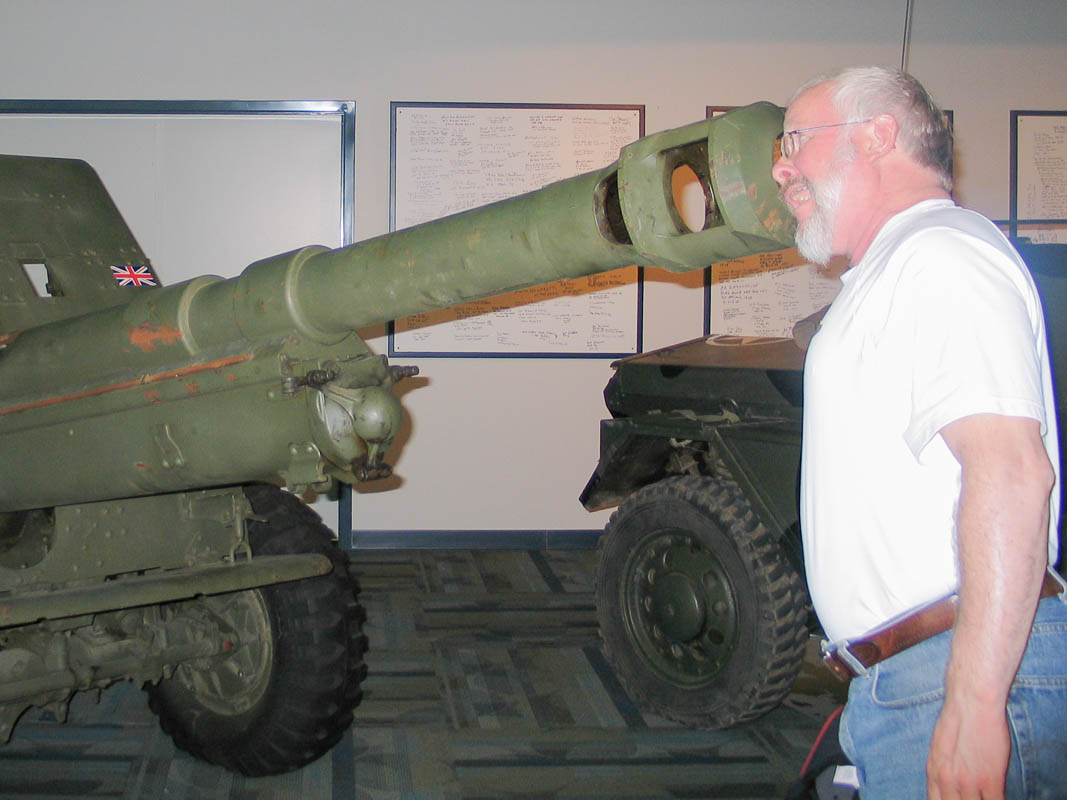
What sort of little air museum can be found near the Oceana Naval Air Station? We had no idea, but Alex and Barry had some time without any girls to entertain. As it turned out, the Military Aviation Museum is very, very good!
The airplanes are shiny and spotless. They look new but date from the 30s, 40s and 50s. All of them are kept inside, protected from the elements and ready to fly.
Even the maintenance hangar is gleaming and clean. The floor has been recently painted and everything is in its place.
It was fun to see a BMW motorcycle with sidecar. Should I trade in my own BMW for this one? And I noticed that even the building sports a propeller, but I doubt it can fly!
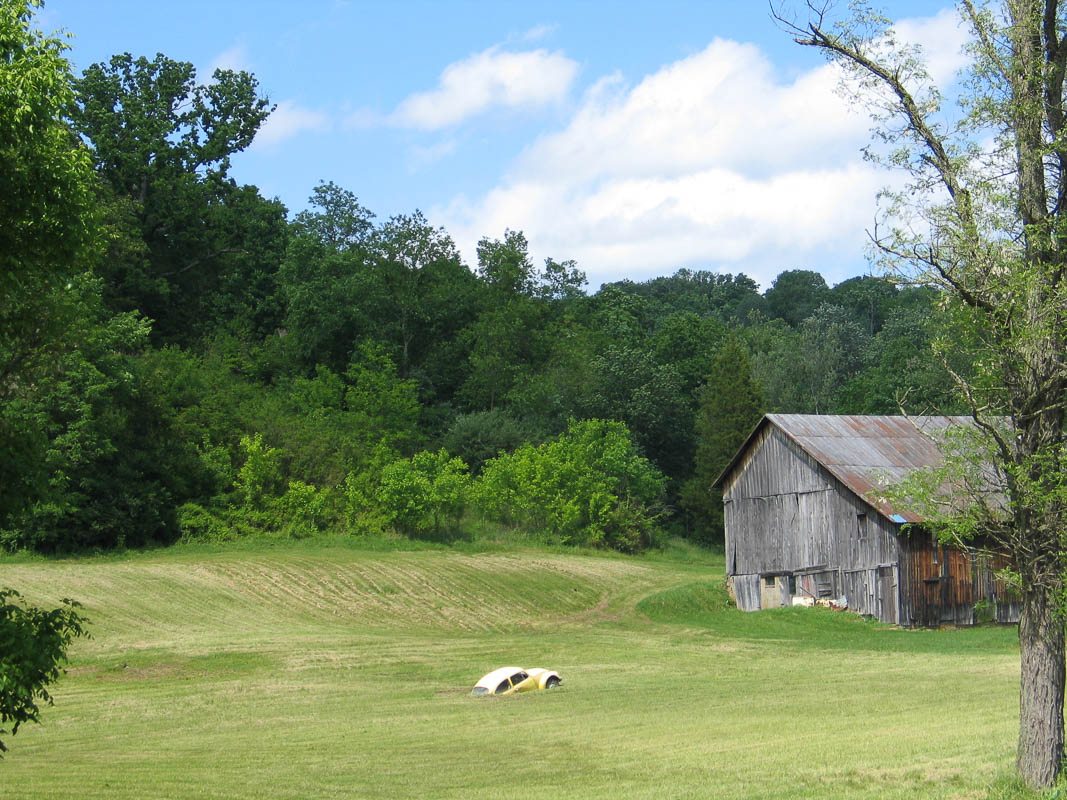
May 24 2011
Day 15: Motorcycle vs. Nature
Mother Nature suddenly realized I was almost arrived and tried to make up for lost time. Although I had come over 4,000 miles in mostly mild weather, she turned everything loose in the last 30 miles.
First I was tricked into taking off my rain gear. Although Skyline Drive was 71F and sunny, temperatures rose steadily coming down off the mountain until I reached the freeway's rest area at a steamy 84F. No rain yet, so I removed my Goretex liner to get a badly needed cooling effect.
This caused the rain to begin immediately. However, Alex said the skies were clear at his place so I rode on without stopping.
This made the rain increase, but it cycled off soon enough that I kept riding. Which in turn made the rain come and go several times, sometimes hard, until I got good and wet.
My full-face helmet is good for keeping my head warm and dry in any weather. I had closed the front vents but figured the rear vents are behind me and therefor no rain could enter. I was wrong, of course. I soon learned that rain can come in backwards and uphill in order to drip slowly down your head inside the helmet. And there is nothing you can do — you can't touch it, and you cannot remove the helmet or it simply rains directly on your head.
Then it got worse. Once I figured I could handle the rain, the wind picked up. It gusted first from one direction then another. This big half-ton motorcycle felt like a tinfoil ball batted around by kittens. Fortunately traffic was light and nothing came of it.
I had been watching a distant lightning storm rip jagged strips in the sky. Now it became non-distant.
One big flash struck nearby and all the freeway's street lights and road signs went dark. Too bad this happened just before my turnoff! But my headlight illuminated the overhead signs just enough that I recognized the proper exit and turned off properly.
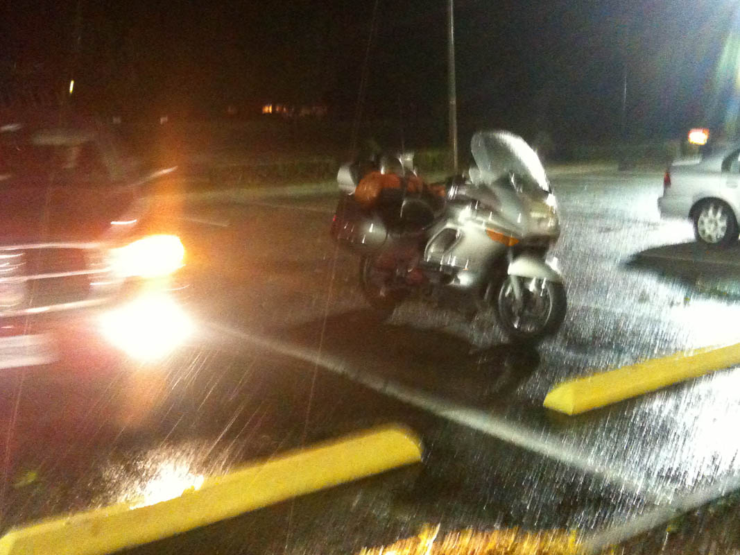
As if this wasn't enough, the side street was completely dark, including its stoplights. This was a problem because my instructions were “turn left at the second stoplight." I guessed where it was (correctly as it turned out) and pulled into McDonald's.
Enough is enough. I texted Hillary and Alex for a pilot guide car home. In this picture, Hillary's Dodge pickup pulls in next to Barry's motorcycle. They were just a block away and brought me in safely.
Today's elapsed travel: 575 miles and 16 hours of riding.
May 24 2011
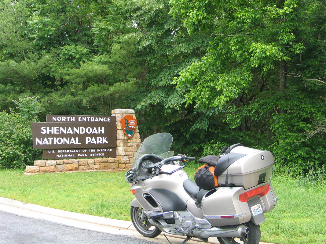
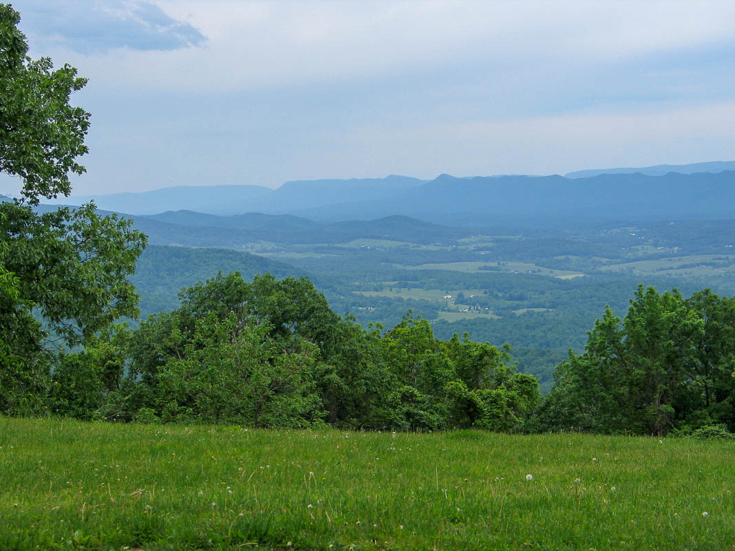
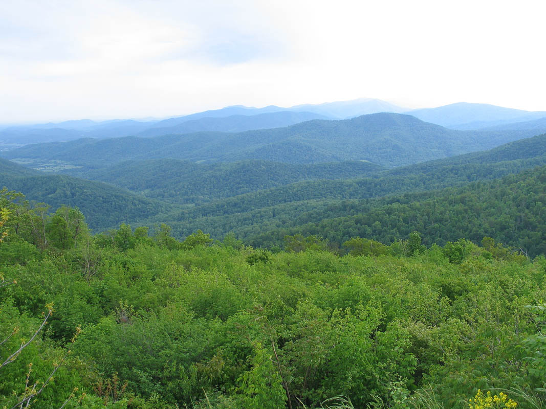
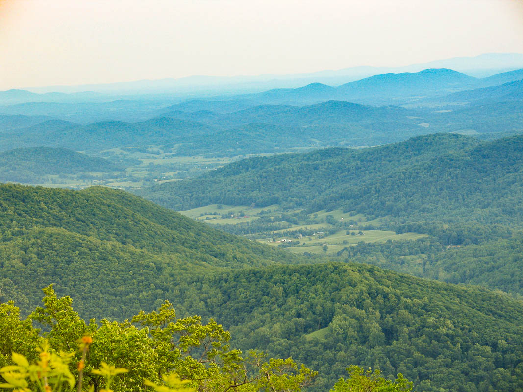
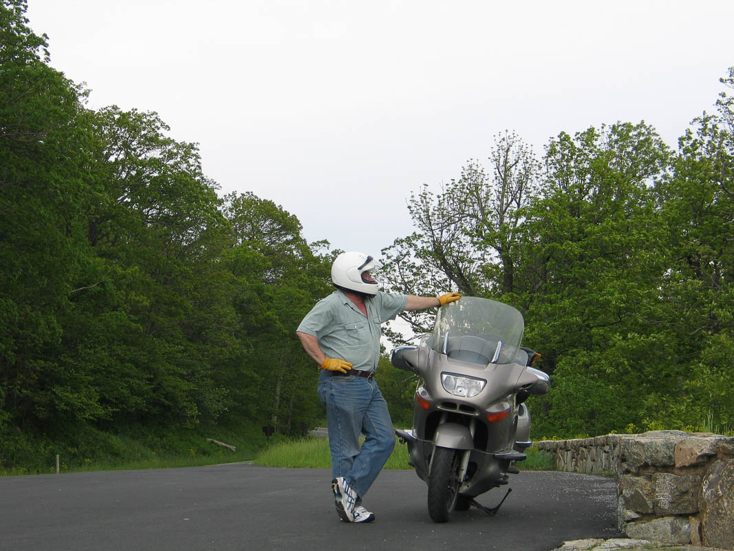
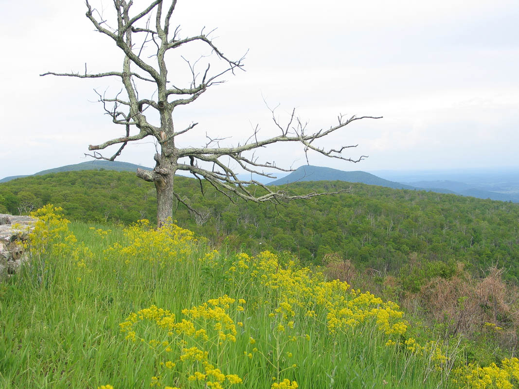
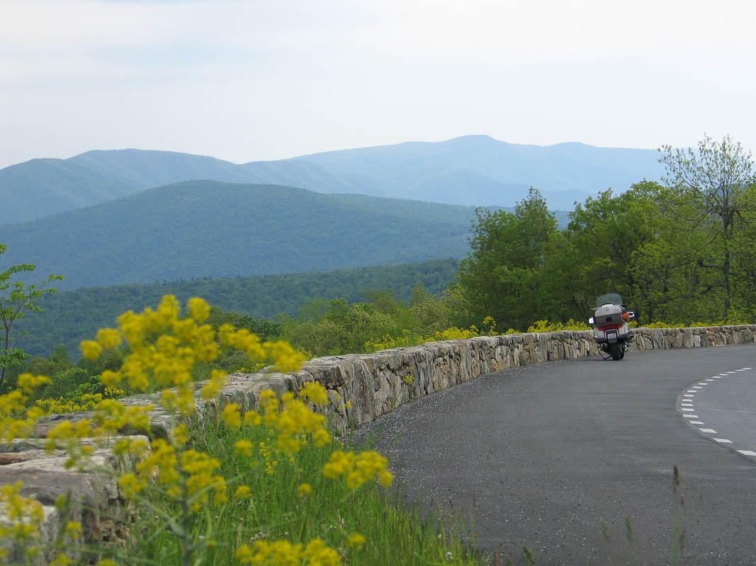
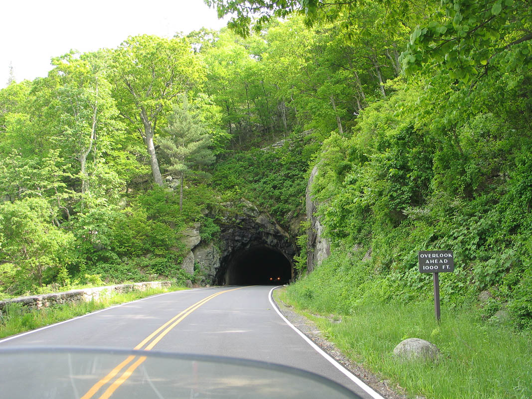
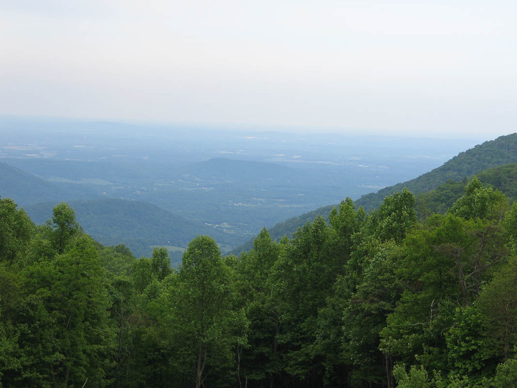
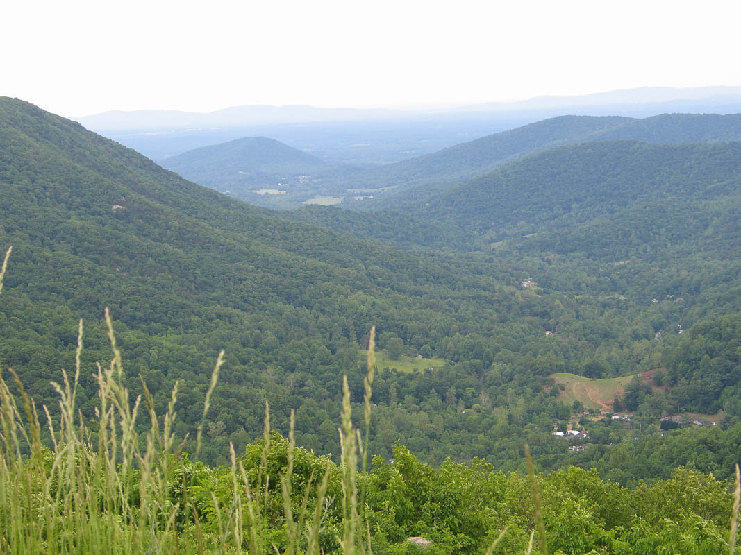
Day 15: Skyline Drive
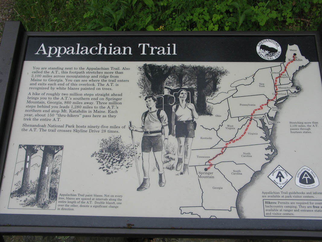
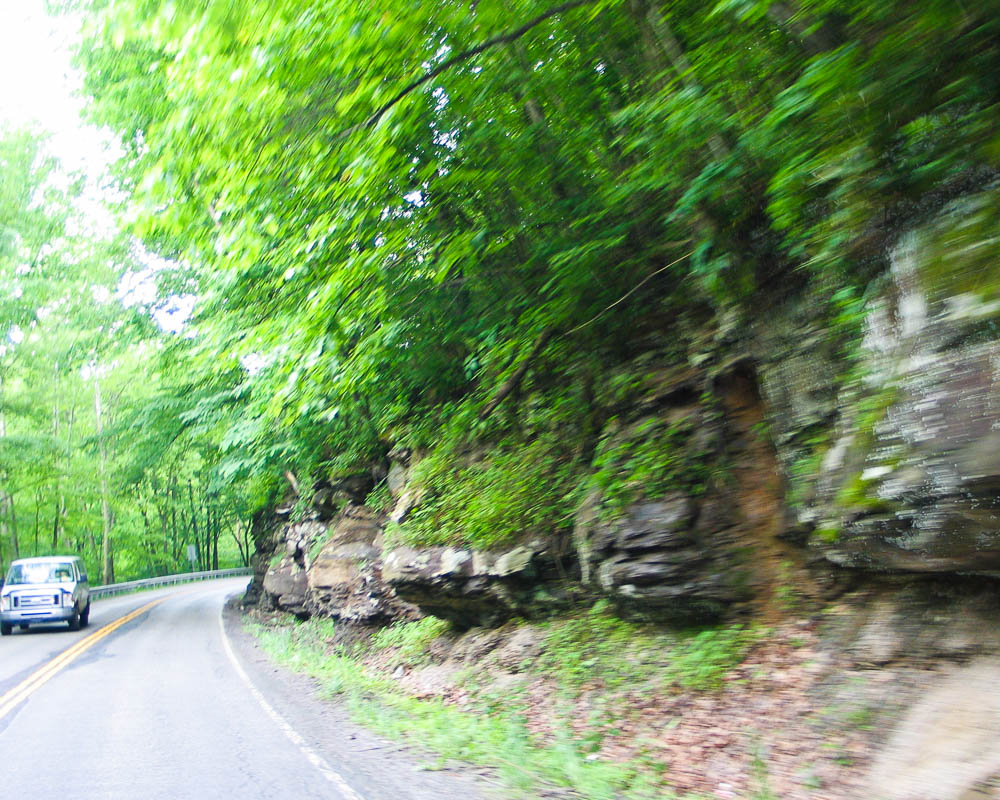
Our country's national park system is an incredible treasure of natural resources. Skyline Drive and the Shenandoah National Park is a shining example. Think of it: 105 miles of winding road along a ridge line on the Appalachian Trail. All of it to preserve natural wildlife and it's all open for our enjoyment.
I paused at the ranger station near the entry for riding tips. They were very helpful. The conversation went like this:
Barry: "Is there any wildlife that may be hazardous to motorcycle riders?"
Ranger: "Pretty much everything is hazardous to motorcycles."
Barry: "Can you tell me about the bears in the park?"
Ranger: "These brown bears mostly keep to themselves, eating things like grubs and berries."
Barry: (Makes a Jedi hand motion) "I am not the berry you're looking for."
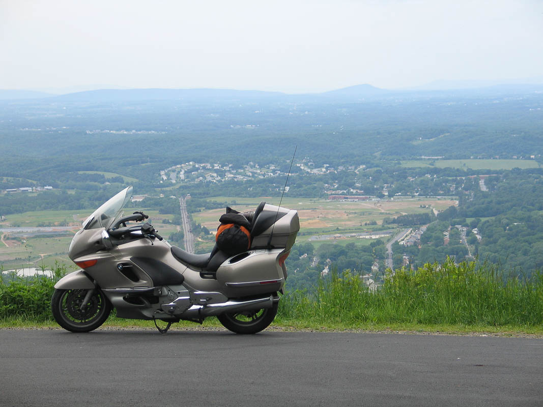
With a park speed limit of 35 mph, it takes three hours to drive the entire length. I took four hours. There are 75 scenic overlooks and I paused at about half of them. Riding a motorcycle makes it very easy to snap a photo without dismounting.
May 24 2011
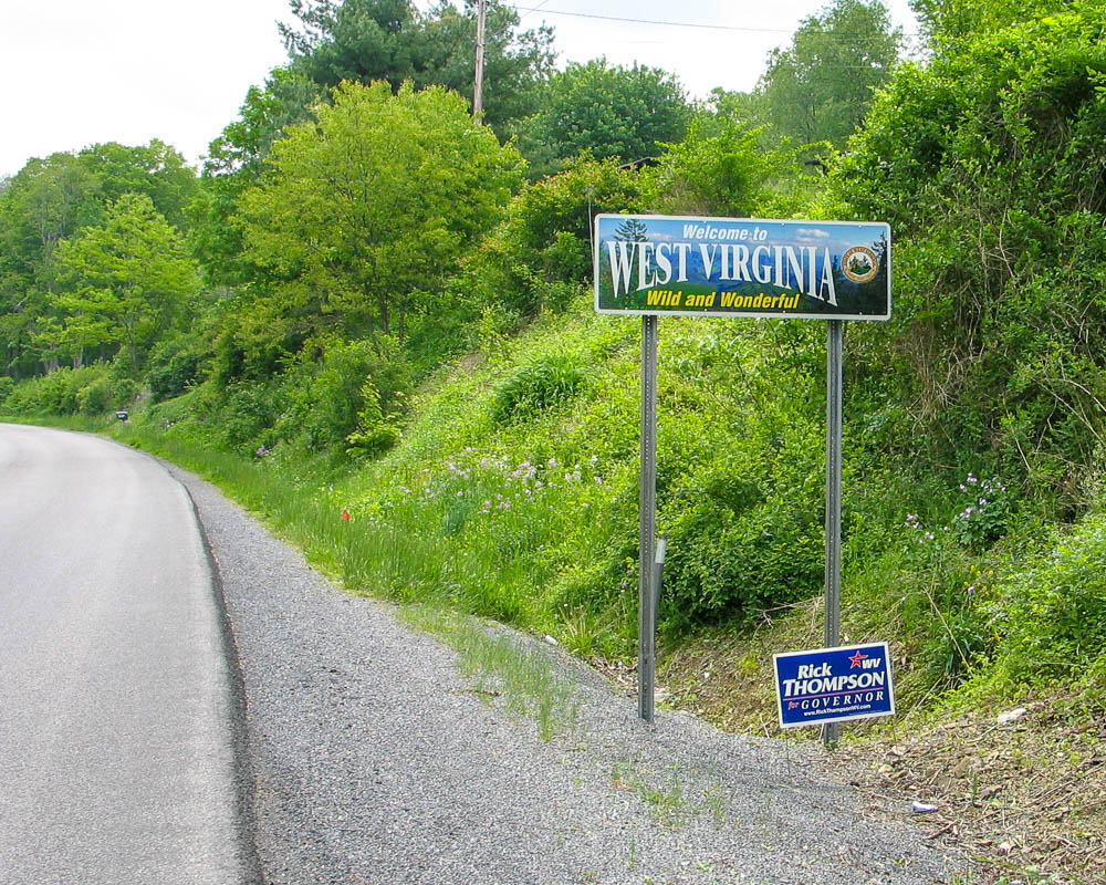
Day 15: "Welcome" to Virginia
Starting in Parkersburg WV and travelling due east on Hwy 50 is a wonderful scenic road through the countryside. First are many miles of smooth divided highway at good speed.
Along the way I saw a turtle trying to cross the road! “Frogger” he is not. I almost circled back to rescue him. I hope he made it.
This almost-freeway road finally gave way to a two-lane road deep in the back country. It winds up and down from valley to ridge to valley again, over and over. This is quite possibly one of my favorite roads to meander of my whole trip. Absolutely wonderful for a motorcycle.
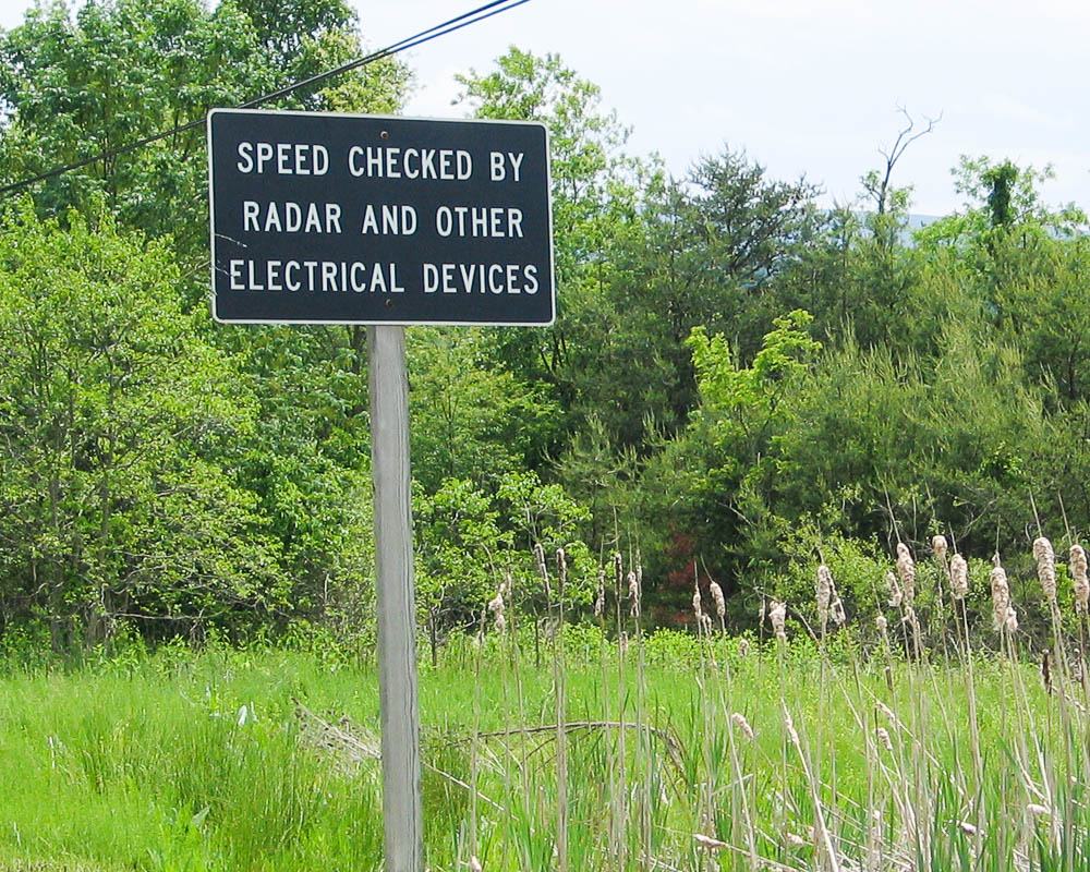
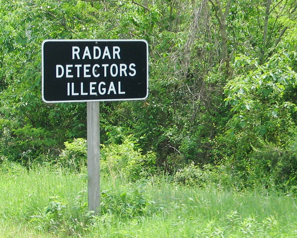
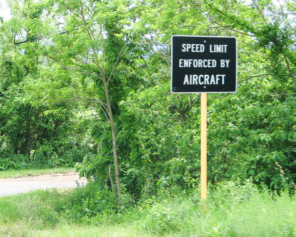
Upon entry to Virginia, I was greeted with a series of road signs:
Welcome to Virginia!
Buckle up Virginia! It's a law we can live with.
Speed checked by radar and other electrical devices
Radar detectors illegal
Speed limit enforced by aircraft
May 24 2011
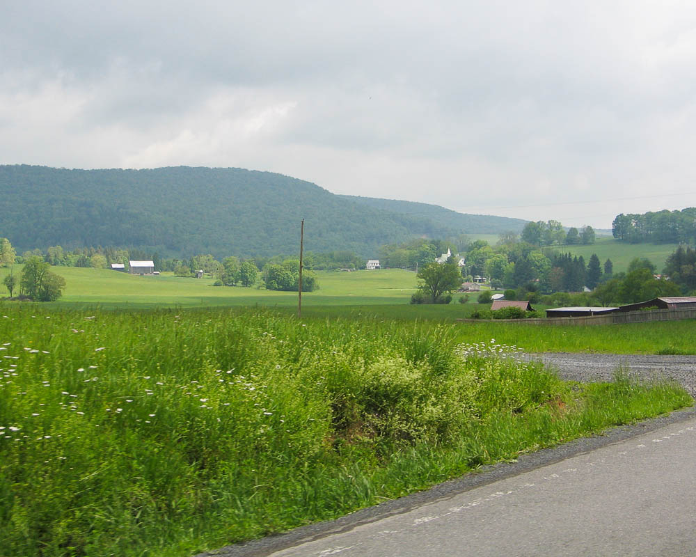
Day 15: Picturesque West Virginia
The morning of Tuesday, May 24th, 2011. It's now exactly two weeks since I left home, and I've ridden 3,688 miles so far.
My original plan was to arrive at Hillary's house tomorrow night but I'm so eager to get there that I'll try to ride all the way today. It's about 500 miles from here, including one of the most famous motorcycle routes in the country: Skyline Drive.
May 23 2011
Day 14: Trip Recap
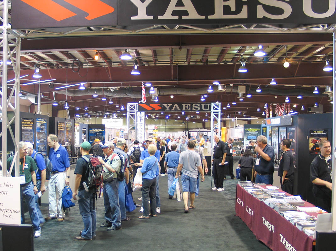
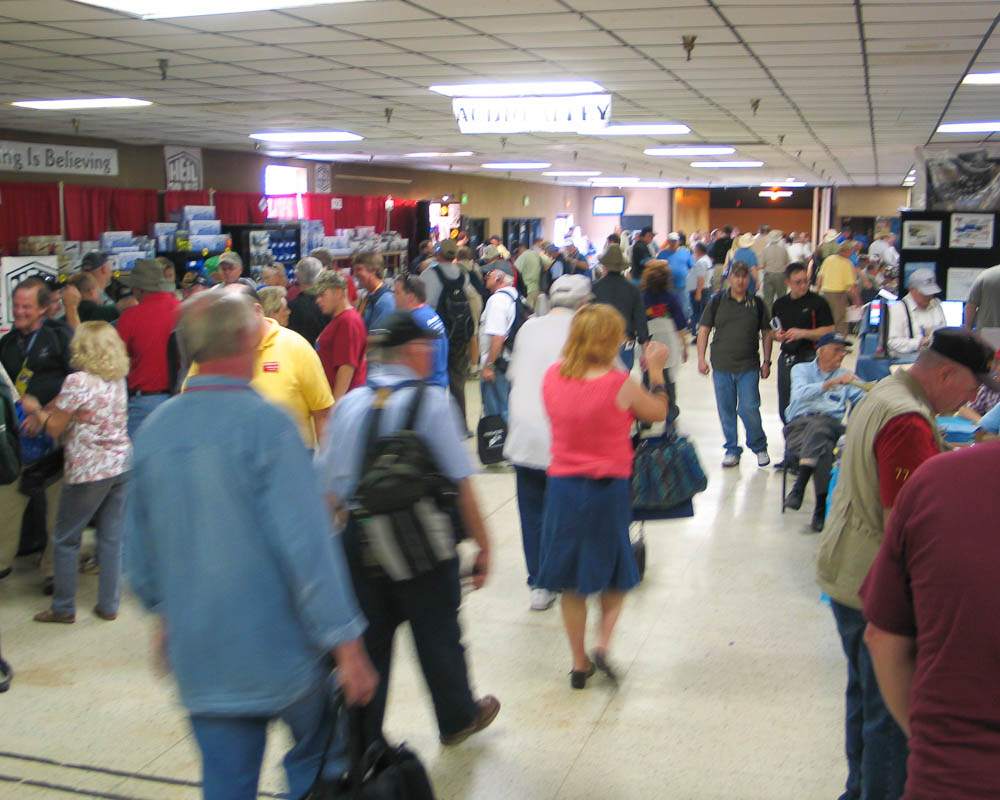
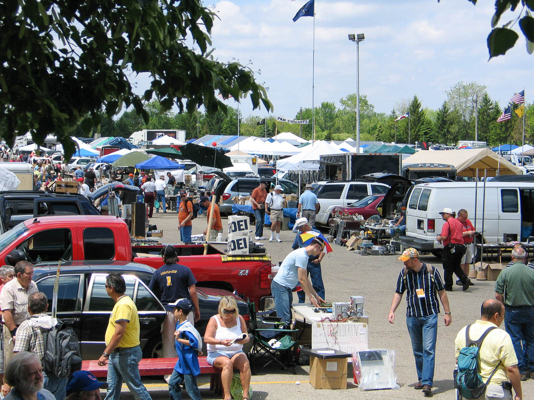
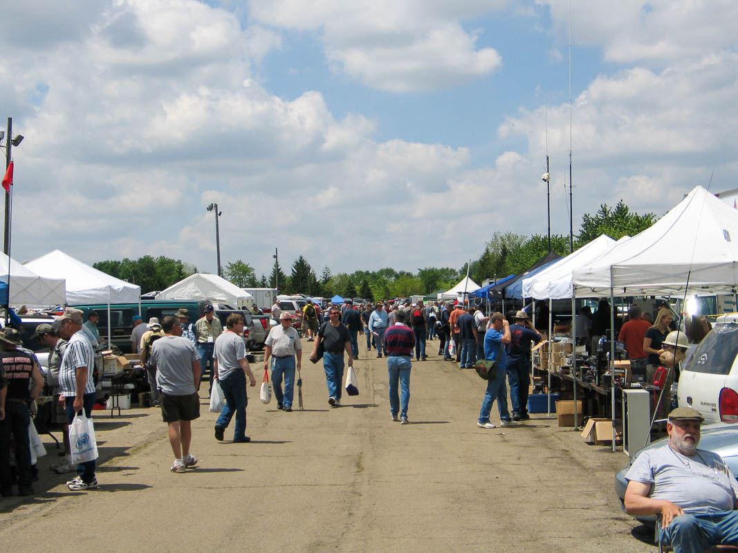
I'm two weeks down the road from home and the trip has been a whirlwind of travel, camping, meeting friends along the way, and then three days of sensory-overload convention. The Midwest has lots of warm welcoming people, it's been fun to meet so many, and they sure make the typical Seattle-ite seem cold and aloof.
The hamvention was fun. A hundred acres of flea market stuff and, although I was somehow expecting a finer quality of crap at the world's largest hamfest, it was all the usual old trash and I left that part and never went back. The commercial vendor participation was outstanding – every manufacturer had all their latest and greatest. Every top developer and famous technical mover and shaker was there. I shook hands with several luminaries that I've read and followed for years. I saw an uplifting presentation by an astronaut. I tried out the rig of my dreams and didn't like it, so I bought something else.
It's now early morning and it's raining hard outside my kabin right now. I was planning to leave for a two-day ride to Hillary's place in a few hours. We'll see.
May 22 2011
Day 13: Hamvention Highlights
Cheescake on a stick
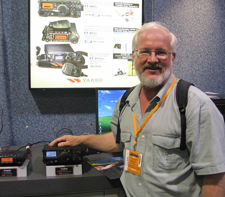
Yaesu FT-897d
A motorcycle with "almost enough" gadgets
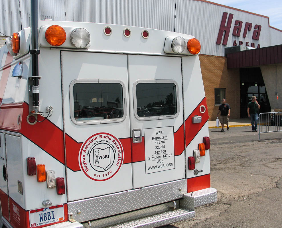
W8BI is the host club for this hamvention (so similar to W7BI Issaquah ARC!)
Closing ceremonies and endless series of fabulous prize drawings
Adopted by new ham family at KOA kampground
May 21 2011
Day 12: Hamvention Highlights
ul>
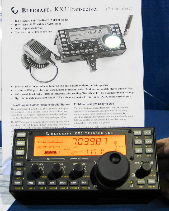
Lots of software-defined radio groups are present. Ten good offerings include: HPSDR, WinRadio, RF Space, Lazy Dog Radio, Flex Readio, QS1R, Softrock, Elecraft (KX3), Tele Post (LP Panadapter)
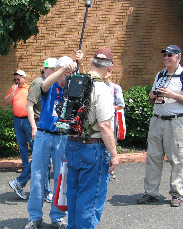
Luso Tower (huge portable telescoping tower, an amazing and beautifully engineered build)
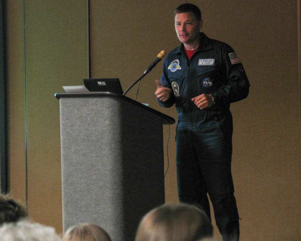
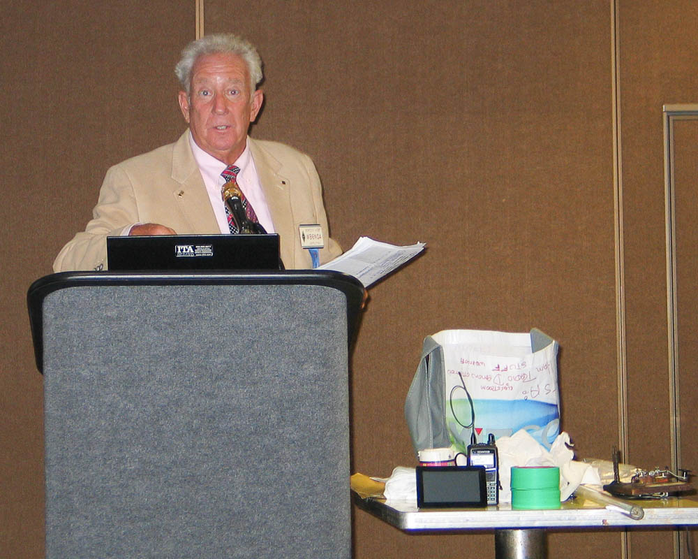
Astronaut Doug Wheelock, Commander of ISS, mission XXIV (earned ham license just before mission, and found that making earth contacts was hugely valuable to him)
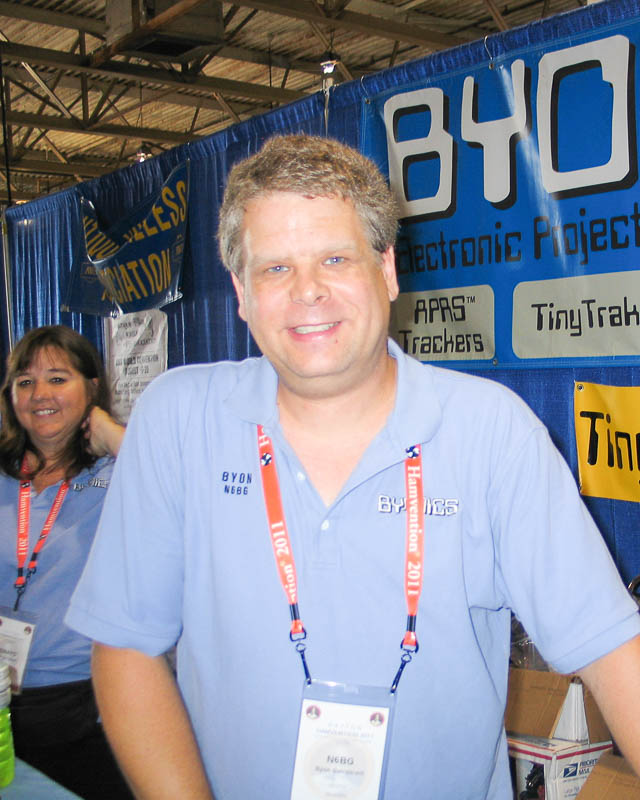
Byon of Byonics re-programmed my APRS beacon for smart tracking (he also gave good tips on improving its performance)
Tried the new Icom IC-9100 (didn’t like the user interface, it has 144 and 440 built-in but even the Icom staff didn’t know how to select them)
I joined the FISTS club (now I am a card-carrying member)
I tried the Begali paddles (great fun!)
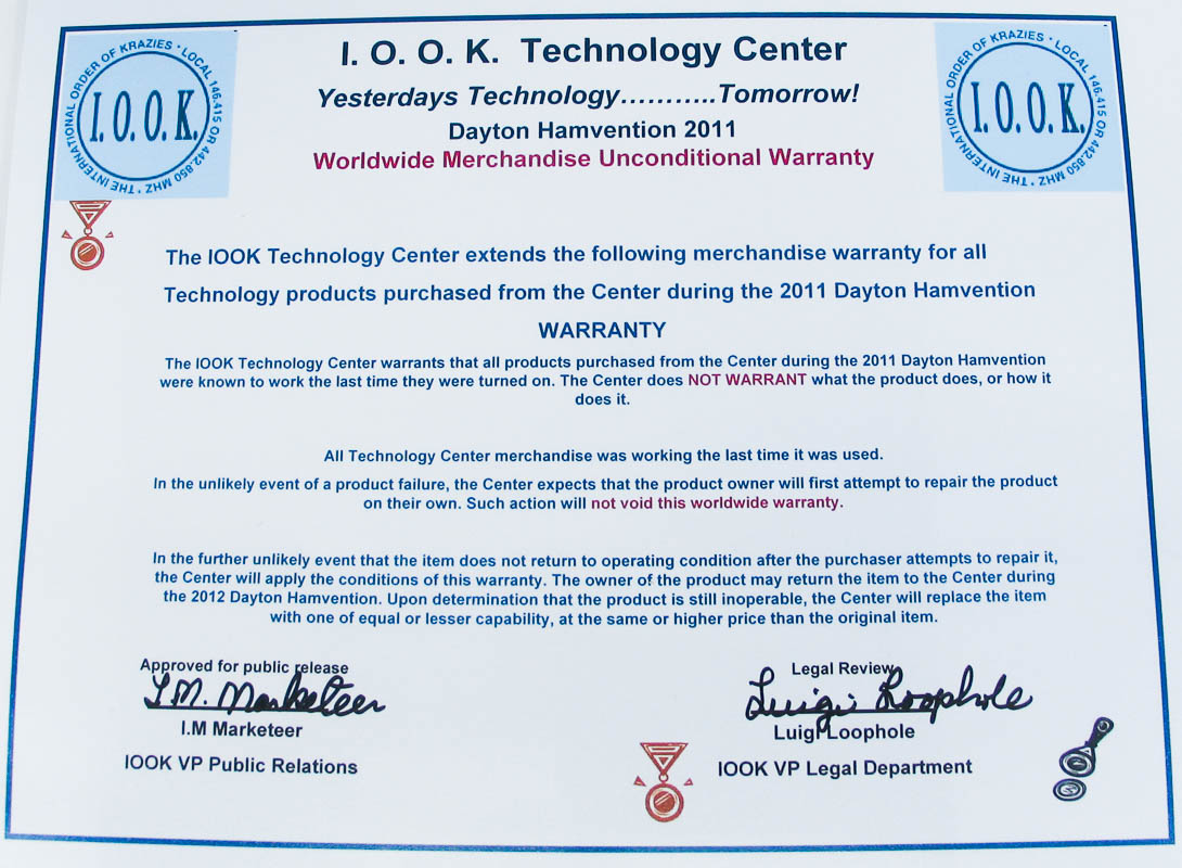
Hamvention full of crap. Kitchens and bathrooms closed. Plumbers called. (We were lucky the Health Department didn’t send everyone home.)
Won a door prize at the Dayton Contest Dinner (ARRL book “Antenna Towers”)
Road Sign of the Day: “Needmore Rd, 1 1/4 miles” seen at exit 58 on I-75
May 20 2011
Day 11: Hamvention Highlights, Fri 5/20
Flea market with everything imaginable.
TAPR presentations by the luminaries of the field: Jeremy McDermott NH6Z with a sweeping SDR techology overview, Bruce K6BP discussed Codec 2, Bob Bruninga shotgunned APRS ideas, Byon N6BG talked about trackers, Don W6GPS introduced the new Avmap G6, Haikki OH7LZB announced new features in http://aprs.fi
Gordon West WB6NOA produces training materials, and demonstrated many techniques to engage students. He’s a terrific public speaker.
“Operating Techniques of the Best Operators” by Mitch W1SJ
“VHF Weak Signal Dinner” where I sat with Marty N6VI, ARRL VHF Director
Then, a lowlight of the day, trying to find my way back to the KOA kampground in the dark. Lost. Late. Dark. Road construction. No GPS. iPhone almost dead. Phone charger back at camp. Finally rode 10 miles west on I-70 toward Illinois and retraced my original approach. Home at midnight.
May 20 2011
Top Reactions to Motorcycle Trip
I wish I could come!
Such freedom! (um, not really, but they like to think so)
I had a bike once … (proceeds to tell me all about it)
Get a sidecar and bring me! (huh? then it’s not a motorcycle)
Get a helmet camera so I can watch
Is that bike new? (no, but it was new in 2000, eleven years ago, when I bought it)
I didn’t know BMW made motorcycles (heard more often in the midwest, presumably because the motorcycle dealers are so far away)
Ride carefully, ride safely, be careful, and many other cautionary wishes
May 19 2011
Day 10: Laporte to Dayton
Taking county roads along the way, I went through Dixon (motto: Birthplace of Ronald Reagan).
Nearby Gas City is a cute creative place (motto: Your low-cost, reliable municipal electric utility). The street signposts are built on miniature iron towers. I stopped for pictures of a quirky old shop “Primitive Inn” and the owner (Leilani) popped out to see what’s going on. It’s not actually an inn, but a shop for home design using “primitive” style. She’s originally from Seattle (actually Sultan) and we had a good time sharing stories.
Arrived in Dayton and went shopping, and had two near accidents. Here I am, 3,271 miles from home without trouble, and the parking lots cause problems. An old guy didn’t yield in the IGA lot, so I honked and parked. He drove over to find me and apologize, and we had a friendly chat (really!) for 20 minutes. And I heard all about his motorcycle experience at 16.
Then in a crappy gas station, the only one handy, the uneven concrete pavement almost tipped me into the pump. I told the manage about their serious safety hazard but, as usual, all he could do is buck it up to the distant cheapskate management chain.
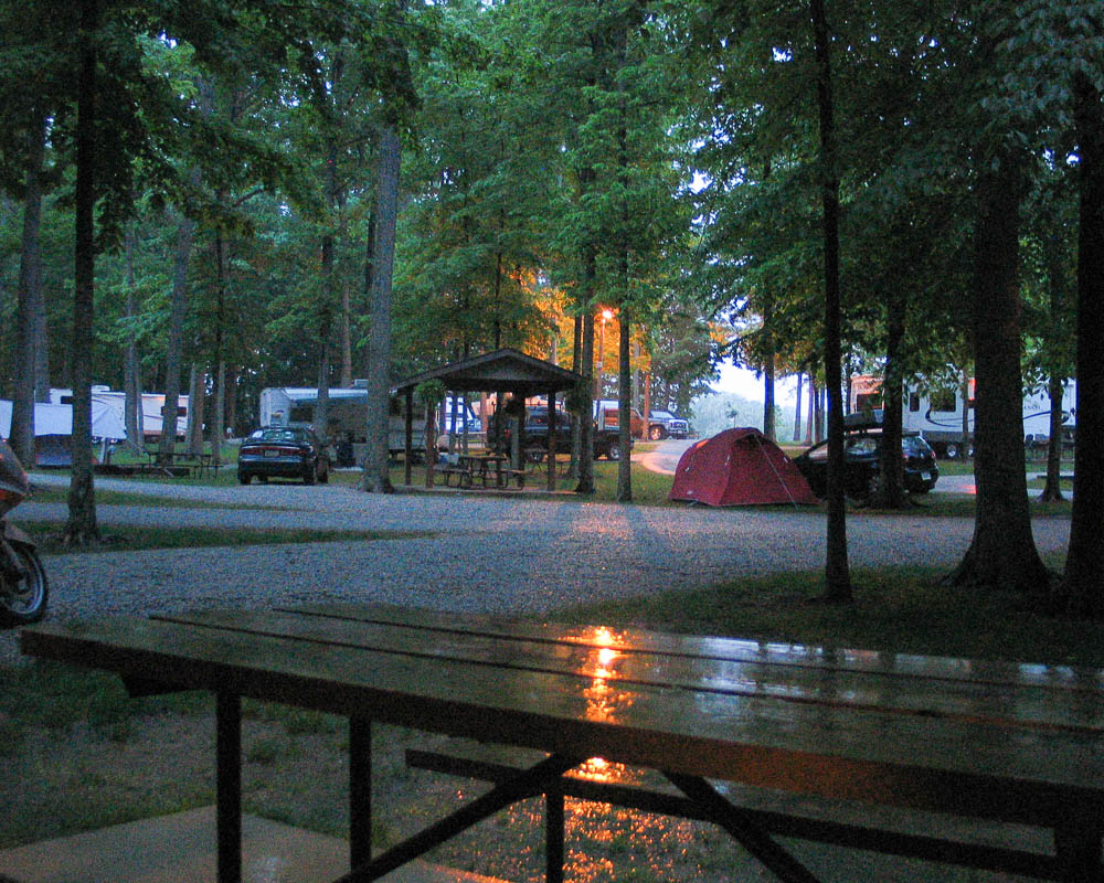
The Dayton KOA kabin can hardly be called “camping”! It has wifi, a flat-screen TV, fridge and ceiling fan. Flowers, brook, quiet location, clean motor homes, satellite dishes, beautiful park, this is not your usual cut-rate kampground.
May 18 2011
Day 9: New Old Relatives
My son-in-law’s grandfather lives in Laporte, Indiana and offered to put me up for the night. So I rode from the Wisconsin Dells to see him.
It was raining lightly all morning and a bit chilly, but I was prepared and it wasn’t bad.
Lunch was interesting. I was trying to make good time along the Interstate but finally had to pull off for a bite to eat. Near Lindenwood is “Grubsteakers” two miles off the highway. The waitress lady is a real ball of fire, friendly, outgoing and engaging. She kept the locals involved, didn’t serve anything she wouldn’t eat, and just got back from a wedding in Kentucky. I could have ordered fried okra, but got onion soup (awesome! how does he make crunchy croutons in a soup?) and country fried steak. Best meal of the trip!
In a haze of delicious warm comfort food, I confidently set off again to avoid the Interstate. This was a mistake. With the overcast sky, light rain and no sun for bearings, I soon was confidently heading NW instead of SE. I did stumble into Dixon Illinois, motto: “birthplace of Ronald Reagan”. Eventually I figured out that nothing I saw was on my map and stopped to turn over the map.
If I make a trip like this again, I’ll pause at the edge of every town to collect their mottos. What a rich variety!
I tried to avoid freeway construction near Chicago. This didn’t work, either. I crept along for half an hour, then escaped the freeway just after the traffic jam ended. Then, riding through Chicago Heights in rush hour was a battle zone. I wore my Optic Orange construction vest for visibility and turned on high beams. They saw me — they just didn’t care. Several times they would drive over the raised middle island separators to make improper left turns. Wow.
It was so nice to see Kate and have dinner at the quirky old Warehouse Pizza. I would never have guessed that Kate is five years older than I. An avid reader (I wonder where Alex gets it? lol), she has the ideal job: she works in the library.
I sure got a warm welcome from Bob Gagle and found we have much in common. We’ve been to many of the same places in Washington, Arizona, Idaho and other places. He seemed starved for conversation, not surprising since with his hearing problems
he can’t participate in crowds or noisy places. His new hearing aid helps but it’s still very limited. As a surveyor for the Army Corps of Engineers, he’s been all over Alaska and other places, he was even familiar with Akutan. His favorite spot is Homer Bay, way out along the Aleutian Islands. Bob was married in Anchorage to Ruth, an army nurse, and enjoyed 50+ years together. Sadly, she was taken by pancreatic cancer a few years ago (as was my own mother in 1995). He spends winters in Casa Grande. It’s always nice to get to know new old relatives.
May 17 2011
Day 8: Backroads Until You Die
All states are the same size. You open the map and there it is, every state fits the page. This is misleading. As it so happens, Wisconsin is a really big state.
It looks good on paper to wind your way winsomely across the wigglies. But damn, it takes a long time to get just a measly half-inch across the page. So … this “one day” trip from Rochester to La Porte will take two good days of riding.
Every stranger has a story to share. If they walk up and start a conversation with Spaceman Sam by his Starship Enterprise then there is something they really want to say. Look, I’m sure I don’t look very inviting in full riding gear and body armor. If someone says ‘hi’ then I really want to hear their story!
Stranger 1: Half drunk old dude with two teenage kids at the cold lonely Cody Wyoming KOA.
Story 1: He used to take his wife 2-up on an old Harley. She liked it but the tiny seat was uncomfortable. The moment she saw an old 83 Gold Wing, they simply had to buy it. He restored it and they love going for rides together. He’s 50-something and she’s 78.
Stranger 2: Sweet young thang waitress at the Viking Family Restaurant in Reedsport Wisconsin. She might weigh 120 pounds if she’s carrying seventeen pounds of food.
Story 2: She had a nice old custom Harley knucklehead, but it just didn’t have enough power to do wheelies with the boys. So she sold it and got a Suzuki. Later traded that for another bike. But had to sell that when she had kids. Now she wonders if you can carry children in a sidecar…
This is God’s country. And God’s neglected cattle. And God’s electric fence with God’s geodetic survey marker.
I love yardbirds and it’s rare to see them. So what a delightful find to discover a good collection!
What a contrast in cultures. I ride over the Mississippi River at La Crosse and am soon gliding along the backroads of Wisconsin. I encounter several Amish people as I ride through this lush hilly country.
This is very disconcerting. I'm riding the best high-performance and comfortable motorcycle that technology has to offer, when passing a horse and buggy. Indeed, the Amish people are only using the reflective orange technology under protest.
I continue riding along for a very long time. A really, really long time at the leisurely pace of these old backroads. The roads are nice and scenic when I’m off the interstate but it’s not exactly high-speed riding. My map shows me a KOA kampground in Wisconsin Dells and it looks nice enough on paper.
I wonder what genius decided to build a campground along a busy rail line. Funny, it wasn’t mentioned on the KOA web page.
May 17 2011
Things I Never Knew About Midwest Farming
Continental Divide in Barry, Minnesota. My host farmer stopped the car at the end of his driveway. “See that field?” he says, pointing to the right. “It drains toward the right into the Red River of the North, backs up and overflows in Fargo, eventually ending up in Lake Winnipeg. Now see that field?” and he points to the left. “It drains southward, ending up in the Gulf of Mexico. As I see it, the north-south Continental Divide is about in the middle of the car between us.”
A new John Deere 9670 combine costs about $300K. Plus a header for the crop of your choice, about $90K each.
A new John Deere crawler tractor costs about $200K. Plus whatever you want to pull behind it. However, it does include such farming necessities as satellite radio entertainment systems.
Modern tractor navigation systems can let you drive once around the field’s border; then in fills in entire area automatically with perfectly straight rows. For a price. (Hillary, wasn’t this your summer Rose-Hulman project for a bedroom floor-cleaning system at Catapult?)
John Deere 9670 has a 300 bushel bulk tank. It can unload on the move while still harvesting in three minutes.
In the winter, be sure to park your classic 67 Pontiac next to a big Catepillar tractor. Then, when the barn roof is crushed by snow, it won’t trash the car as badly.
Five years ago, farmland was $1300 an acre @ 12% interest. Today, farmland is $5000 an acre at 6% interest.
This farmer will plant almost 1,000 acres of farmland in corn and soybean in three days. In the fall, he will harvest everything in about three days. His “crew” is himself and his two college-age boys.
The rest of the year is full of other stuff, mostly paperwork and insurance and permits and machine maintenance. He runs a couple other businesses as well: a used car sales, and manufacturing a rock-picker machine.
May 16 2011
Day 7: Graceville to Rochester, MN
335 miles in 8 hours
I leave John’s farm in the morning with a good breakfast in the midst of warm slanting golden rays from the morning sun. Some deer across the road tiptoe along looking for food. They don’t look very hungry. Clear air and dew on the grass is putting a bounce in my step. I love riding in weather like this!
Just a few miles away is a big ethanol-manufacturing plant in Granite Falls. Quite the production. The product was loaded onto black tanker railroad cars. They even had their own tender to move cars around.
John has pointedly explained that ethanol manufacturing is an enrichment step in the food chain. The corn goes through the process, creates ethanol, and the output is fed to farm animals again anyway. It does not remove material from the existing farm processes.
This day’s ride was through county roads all the way to Rochester. My time on Highway 14 was a battle with headwinds and oncoming tractor-trailer backwash. Things were much more pleasant on the side roads. Hint: When a detour takes off in some direction, even if it looks like the wrong direction … follow it. They actually do know more about the local routes than a visitor (like me!) from 2100 miles away.
I see that Zombies have now commercialized and automated their feeding process. Here is a secret BRAIN STORAGE facility conveniently located deep in the midwest. How handy!
In Appleton MN, I got up close and personal on a first-name basis with Officer Morris. We had a long chat on the streetside. Mostly about BMW motorcycles. He really wants one but is worried about the distance to the nearest BMW dealership. I had stopped to take pictures of an old WW2 tank on display next to the National Guard building; he just stopped by for a chat. Now, where is that list of dealerships I printed? I’m sure that I have it here somewhere and there can’t be that many places to look. I can’t find my printout and later this comes back to haunt me in several ways at Dayton, none of them good.
I continue riding through Minnesota, feeling so much at home in familiar territory. We worked for IBM for twelve years (1981 – 1993) and started our family here.
It was SO nice to see Carol and Ray again in Rochester. We went out to dinner at the very-popular family/bar restaurant Beetle’s, and then I found my way across town (somehow!) to stay the night with my previous neighbors, Chris and Doug. This was the hardest part — the roads have changed drastically since we lived there, with the addition of a bypass and ring road.
May 15 2011
Things I Never Knew About North Dakota
Devil’s Lake is the largest natural body of water in North Dakota. Fifty years ago it didn’t exist. A hundred years ago it DID exist and paddleboats busily moved cargo all across it.
Devil’s Lake has no outlet. It has grown to inundate many thousands of acres of farmland.
Devil’s Lake is expected to rise until it merges with Stump Lake, and then flow naturally into the Sheyenne River, though the lake has not reached this level in approximately 1,000 years.
Some people want to create an outlet on Devil’s Lake to regulate the water level. Canadians do not. They don’t want this isolated ecosystem and its incompatible salinity and sulfates to flow into Lake Winnipeg.
The lowest point in the state of North Dakota is the northeast corner where it meets the borders of Minnesota and Canada, in the form of the Red River of the North.
Devil’s Lake is not full of carp. But it could be. The Red River Valley basin has “common carp” which, if they invade Devil’s Lake, have no predators and would reproduce rapidly.
North Dakota is the 19th-largest state by area in the U.S. It is also the third least populous.
North Dakota’s state population of 670,000 in 2010 is one-third the total of King County and about equal to the City of Seattle.
May 15 2011
Day 6: Bismarck to Barry to Graceville, MN
Travelling eastbound on I-94 toward Fargo, then south to the cities of Barry and Graceville. Clearly these two names are related. :-)
Favorite North Dakota billboard: “Hunt With Your Kids” with picture of proud dad looking at 10yo holding two rifles.
Another billboard: “Be an American, use ethanol”. Well, if it makes the fuel better and lowers the cost, then I’ll buy it. But I won’t buy it to simply subsidize our farmers.
North Dakota is the land of long, straight roads. Every so often I take a short break on a little-used overpass and watch the traffic go by.
Indications of late spring and heavy rains are all over. The fields and gullies are muddy and pools of water everywhere. A few side roads are underwater. A farmhouse is on slightly raised soil in the middle of a lake that must be 1/4 mile across. Obviously it should be a tilled field.
I continue through the flooding with no problem. The freeways are open and traffic is light. Later, on my return trip, this was no longer the case. Flooding would return and close I-90 again two weeks later; I avoided Minnesota and North Dakota on my return.
Coincidentally, Minnesota contains cities named “Barry” and “Wendell” not far apart. So I scooted over there for souvenir photos with my first name and middle name.
My host, John M, is a farmer in Graceville, Minnesota. He has the latest farm equipment and lets me climb around in their cabs, play with the controls and make motor noises with my mouth. I love these things! And new John Deere tractors are wonderfully high-tech with all sorts of computer controls.
The farm toys are great fun to climb around. John and his two boys show off their equipment, opening doors and inspection panels all over. The feeling in the high-tech cab of the John Deere 9670 combine was quite futuristic, with thumb controls on a joystick. I kept looking for laser turrets and guided missile launchers.
John’s farmland is on the Continental Divide. He drove me around his fields at sunset. Just before entering his driveway, he stopped. John pointed left and said “that field drains south to the Missouri River.” Then he pointed right, “that field drains to the Red River of the North.” I’d never thought about the north-south continental divide before and here I am on the middle of a road surrounded by miles of apparently flat land that divides our country’s water systems.
I sleep upstairs in his daughter’s pink frilly bedroom. Her colors and trinkets and decorations of motivational phrases make it a whole ‘nother world from the trucks and farm dirt outside the window.
May 14 2011
Day 5: Cold Windy Ride to Bismarck
It’ll be a cold day in Bismarck when Barry arrives. No wait, it really was a cold day in Bismarck today. And windy. And a smattering of rain.
Good thing I brought my GPS navigation unit. It flagged down a passerby to help. So, there I was, driving north from Cody on some country road. I didn’t know what to do at a junction, so pulled over and got out my fancy Garmin Geosat 5 street navigator. Turned it on and, immediately a pickup truck pulled over and offered to help. “Which way to Billings?” I said. That way, he pointed, and gave me estimated driving time including current road construction. My poor Garmin had just reached the “Accept” warning screen. Modern technology lost this round.
Road “construction”? More like road demolition. Eleven miles of pitted gravel washboard. Ten minute wait in the middle for a pilot car to escort us through a war zone. I happened to be first in line and struck up a conversation with the flag lady. She used my camera to take this picture.
I’ve never seen anything like this road construction. Scariest ride of the whole trip! Giant pits like huge graves are dug 6′ deep through the middle of the road so they could work on sub-soil stabilization. We get two miles of a very narrow one-lane dirt track with potholes and loose gravel on a steep sideways slant. Unbelievably slippery. To the left is a gully of boulders and sagebrush. To the right is a 6′ deep pit. I picked my way through slipping and sliding and made it. Barely. It was the scariest riding of anything I’ve ever seen.
Good thing I brought a down jacket. Temperature is in the mid 40s and low 50s all day. Quite windy. I could not possibly have ridden for 11 hours in those conditions without it. Now I should find some down ankle warmers — a gap at my boottops kept my feet and legs cold all day.
There are not many highlights today. The interesting spots are the desperate pleas for any sort of attention in town. For example: Lucky Lil’s Casino, Tavern, Carwash and McDonald’s. But no right turn, lol.
Montana and North Dakota sure are boring after the mountains of Idaho and Wyoming. They are pretty, in a soothing sort of way, but I’m spoiled by the thrill of winding mountain roads.
I taunted some Harley punks on I-90 for excitement. We were eastbound into a bitter cold headwind, all of us barely making the speed limit. I’m certain their noisy unbalanced H-D motors were running wide open to make headway. As I caught up to them, I must admit big BMW was barely doing much better. With my heated grips, bun-warmer and down I was pretty comfortable, but those boys were so chilled they were simply catatonic. They were riding side-by-side in separate lanes blocking my passage.
But those two guys looked so cold and frozen in their leathers and do-rags, I’m sure they would be grateful for a demonstration of how this ride should be done. So I popped up about 20 mph faster, put my feet out on my highway pegs, laid back comfortably on my cushion, and set cruise control so I could give them a cheerful “have a nice day!” wave with my throttle hand as I zipped in between them. I wish I could’ve seen their reaction but I was long gone in no time.
Arrived in Bismarck ND after cold windy 530-mile 11-hour ride from Cody WY. I got a wonderful warm reception from Dennis & Lorna. And a steak dinner. <3
Tomorrow: Graceville Minnesota to see John Murphy, who owns the home in Mesa next to Donna.
May 13 2011
Day 4: Yellowstone Park, Dead Indian Pass, Cody
190 miles in 7.5 hours through Yellowstone Park and out to Cody, Wyoming. The shorter, most direct route through the southern half of Yellowstone is closed and I’m forced to take the north route. The maximum speed limit is 45 mph everywhere in the park.
This is an outstanding day. In fact, each day is the highlight of the trip, surpassing everything that came before.
Yellowstone is fabulous; the animatronic buffalo are very convincing, esp as they amble across the road in front of me. You don’t think those are REAL buffalo, deer, wolves and a bear I’m seeing today, do you? They are simply far too conveniently placed in scenic places and poses to be real. And the elk placidly grazing on the lawn in the village square? Purchased from Disney Studios, I’m certain.
This area got twice their usual winter snowfall. And their “usual snowfall” is 400 inches. So there was plenty of snow pack all around, although the roads are now bare and dry with temperatures in the upper 60s.
However, some major roads in and around Yellowstone are closed due to avalanche. The warm weather makes the top layer of snow very heavy and the lower layers can’t support it. Therefore I cannot not ride to the southeast park entrance as planned, so I’m going to the northeast gate by Cooke City. There I must tank-up and wait until they open the road eastward.
In Cooke City I met a young couple from Australia. They’re traveling around Yellowstone on the cheap, staying with friends and using low-end restaurants. He admired my high-tech motorcycle; I admired his accent but I can barely understand the girl at all.
The scenic byway from Yellowstone is filled with incredible vistas, rugged snow filled mountains, deeply slashed gorges, and the Pride Rock from Lion King. I’ll post photos when I can – I filled up the camera’s entire memory card.
Tomorrow: Make up some time, ride 500 miles to Dennis & Lorna’s house in Bismarck.
May 12 2011
Day 3: Montana, Salmon River to Yellowstone
325 miles from Darby MT, over Lost Trail Pass, down to Salmon Idaho, then through long valleys to reach the west end of Yellowstone
Hwy 93 runs south from Missoula to Darby and beyond. It is not curvy; the road links long pleasant straight stretches through the countryside, offering views of cattle and farmland framed by a mountainous backdrop. This road has the highest concentration of motorcycles I’ve seen.
Temperatures got colder and colder on the long ride up to Lost Trail Pass at 7,600 feet. The snowpack got higher and higher, although the road is bare and dry.
But the main thing on my mind was the rest stop at the summit. Thanks to Miss Shawna’s coffee, I was “fully hydrated” at the B&B this morning. Well, too bad! The rest stop is closed by snow. I could barely see it behind the drifts and under the load. In summary, let me remind you: Don’t eat yellow snow.
Oops, I missed the turnoff at the top of the aptly named Lost Trail Pass. Just as well — temperatures in the 40s make it a cold ride. The planned route would be many more miles of mountain passes and near-freezing air. Continuing on down to the valley warmed up to mid 60s. I guess I’ll have to put up with experiencing scenes like these:
May 11 2011
Day 2: Pullman, Lewiston, Clearwater, Lolo Pass
302 miles, 9 hours, stopping often for pictures
You know you’re in for a good ride when you see a sign “Caution: Curves Next 99 Miles”. Sounds like fixed format overflow. They would have used 3 digits if they could; there are more than 99 miles of curves. Maybe the sign was written using COBOL or FORTRAN. After all, they have been there awhile.
No farm machinery hogging the road today. Instead, I saw giant road hogs on tractors parked on the wayside. These are not the Harley hogs. In fact, these hogs are much too big to be used on a farm. Three gigantic assemblies are making their way slowly westbound, traveling only at night because they consume the entire road.
Let me show you some sights to be seen on this route along the Snake River up to Lolo Pass. Words fail me.
Tried to stop at the Bitteroot Family Campground. It looks good on their website. But just out of the picture is a railroad, highway 93, weeds, busted truck, and barking dogs and barking geese. It’s just as well nobody came out to rent me a spot to sleep. Maybe their website was written using Visual Basic.
I went on down the road, and tried to stop at a cozy row of cabins. Nice little row of log cabins in a gravel parking lot. Sign said “Closed for the season, we’ll open in April”. Oops, off by a month. Maybe the sign was written using C++.
Tried to stop at a cute little B&B and it was juuust right. Run by cute Miss Shawna with boundless energy and smiles. Her partner Michael is a talented architect and we talked late into the night about motorcycles and websites and bragging about kids. If you’re ever in Darby MT then you simply must stop in at River Run Retreat and tell them Barry sent you. The freshly painted house is spotless and filled with authentic western trinkets from bottom to top. Not to mention the two big screen TVs, xbox, wifi, 3G cell access, and the fancy Keurig fresh coffee machine in my room. The back porch overlooks a lush green patch of lawn (in MT! go figure) and the tastefully snow-capped Bitterroot Mountains. Maybe this place was constructed using Flash and Getty Images.
May 10 2011
Day 1: Seattle to Pullman
Springtime is a wonderful time to ride across the country. I’m looking forward to a lovely leisurely ride across Washington state to enjoy the spring colors. This is early May and our trees are beginning to bud and the first flowers are coming out. The fields are green and farmers are active. I am taking a new route from Vantage to Washtucna, instead of the usual Route 26. This will be interesting!
Most accidents happen near home. But why does it have to be a block from home, when starting on a 8,000 mile 5-week motorcycle trip?
My bike is packed and loaded and rolls down the driveway right on time at 9:30am. A block later some coffee-swilling giant Ford F350 juggernaut blasts out of his side road; he can’t be bothered to look both ways or signal or even slow down for his left turn. Good thing my catlike reflexes saved me. Now I’ve got that Close Encounter out of the way, I can relax for the remaining trip, right? (Wrong)
Spring is the best season for touring. The scenery is lush, rich with color and growing things. There are interesting crews and farm machinery working in the fields, preparing and plowing and planting and other words that start with ‘p’. The rivers are full with spring run-off.
The mighty Columbia River is loaded with dams. Most of its height from the ocean to Canada has been tapped for power generation and crop irrigation. I stopped at the Wanapum Dam near Vantage to admire the white boiling raceway of spill water. Here, the blue water contrasts with dry sandy desert hills. Technically, eastern Washington is a desert environment with less than 14″ of rainfall annually. But its rich deep soil, sunny climate, long growing season and French latitude is perfect for apples, grapes and many other crops. Just add water. This makes the greater “Yakima valley” area the apple capital of the world, and more recently the home of any excellent wineries. I’d love to come back again with more time for a wine-tasting tour.
I rode Highway 260 from Vantage down through Mattawa, Connell (nice place due to penitentiary!), Kahlotus (a dump) and then Washtucna. This highway is parallel to our usual route 26 and only adds 25 minutes. It follows the Columbia River for a long time, with miles of tidy neat lush green farms. The grape arbors are trimmed and budding, they’re ready to start vining up the wires. The apple orchards are almost fully leafed out and being dusted by machines that look like little towed jet engines.
When Highway 260 finally veers away from the Columbia and the irrigated farms and heads east, there are many miles of open road and desert sage brush. To my left are the Horse Heaven Hills; we usually see it from the other side at Othello.
The desert colors are rich in Spring. Flowers are blooming and fresh growth lends a soft blue-green feeling to sage.
You would think that I could pull off the road and be out of traffic. The road is empty. I wanted pictures. There is a handy gravel area for an access road. I park 20′ from the pavement. Am I safe? Oh no, of course not. The road is empty because a giant lumbering farm machine is blocking traffic, and he wants my spot to let people by. Headlines tomorrow could be “Motorcycle Attacked by Giant Farm Machine” or possibly “Farm Tractor Plays Chicken with Parked Motorcycle”!
Tomorrow: the canyons of Snake, Clearwater, Leschi and Salmon rivers
May 09 2011
Do You Have Enough GPS Devices When...
Navigation, how do I love thee, let me count the ways. Is this more ways than I need? At least I have it if I need it.
Printed strip maps on my tank bag
State maps
Book “The Most Incredible Roads in America”
iPhone has built-in GPS and Google Maps
Avmap G5 auto routing GPS
GPS adapter plugs into laptop for MS Streets and Trips
Now if I only I knew where I wanted to go. Why can’t I type in “take me somewhere scenic with twisty roads”?
May 09 2011
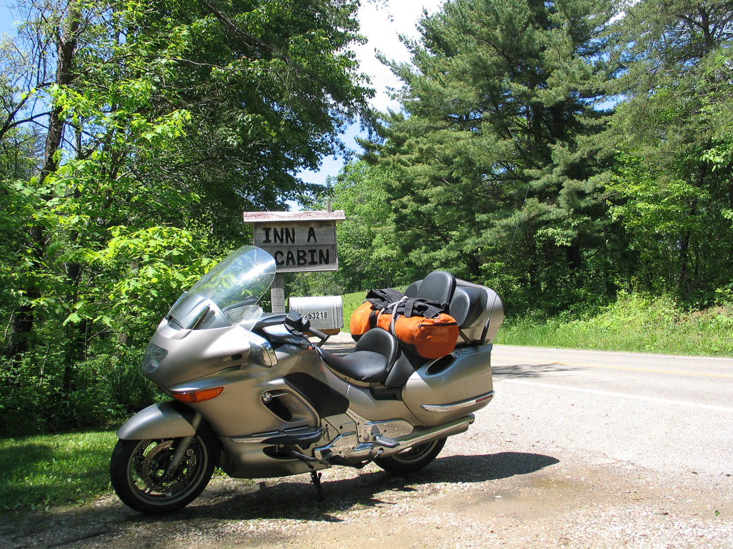
Day 0: Motorcycle Ride to Virginia
Tomorrow I leave on my 2011 summer vacation: a 5-week motorcycle ride, May 10th – June 18th, to visit our daughter and son-in-law in Virginia Beach. These pages have my plans and progress, route and trip diary.
Today, I can’t believe I'm about to ride 3,300 miles to the east coast, and then another equal distance to get back to Seattle.
The main events are :
See the ARRL Hamvention in Dayton Ohio on May 20 – 22
Vacation with relatives in Virginia Beach May 25 – June 1
The strategy is:
Use GPS-enabled ham radio tracking (APRS) for family and friends
Travel the most scenic and spectacular drives in America
Visit with friends, previous neighbors and relatives across the country
Camping in tents and KOA Kabins
Relaxing motorcycle ride with time to enjoy the trip
Take pictures and write up some stories along the way
May 08 2011
Am I Prepared?
Step 1: Update my will. (check!) Step 2: Jettison clothing to make room for laptop, camera, iPod, beacon, Kindle, gps, iPhone, plus all the chargers and data cables ... (check!) Step 3: Load software on laptop until its as full as the bike. (check!) Step 4: Pack, repack, rerepack, then throw out half the stuff so the remainder can barely fit on the bike.
I think I'm about ready. To pack, that is. I've been making lists on the computer for so long that my spreadsheets are turning yellow with age.
May 07 2011
Starship Enterprise
I call my motorcycle the Starship Enterprise.
The driver's seat feels like the commanding position on a spacecraft. You're surrounded by high-tech glossy control surfaces and controlling an exquisitely powerful and sensitive craft. You are weightless with limitless energy to swoop in any direction. All these functions and features are at your fingertips awaiting your command.
Beam me aboard, Scotty!
May 06 2011
Motorcycle = Spaceship
Riding a motorcycle is like a spaceship. Strapping on a helmet, body armor, ear plugs, boots and gloves is like wearing a space suit.
This doesn't sound right — isn't a motorcycle more like discarding the big steel automotive cage and put you closer to nature? Yes and no. Sitting in a blast of fresh air with no enclosure while surrounded by nature flowing by is exhilarating; the freedom and open feeling is much of the fun!
But the process of gearing up for a ride takes time and careful attention to details. (Where's my keys? Oh darn, in my pocket, now take off the gloves, stand up, get keys, sit down, put on gloves…) Once you have everything on, you will think twice before stopping and removing things, even for something as simple as a “quick” stop at a convenience store.
Preparing for a long ride is preparing your spaceship. You plan ahead and carry exactly what you need, no more and no less. You need to be self-sufficient. Weight and size is important. Although in theory you can stop and buy things, but a cross-country trip will carry you places far away from any supplies. You can't just load the back seat with every conceivable thing you might need; no, you must be very selective and plan ahead.
So, once my two-wheeled spaceship is moving, I'm going to fly as far as I can before touching down on Earth again!