Rover Location Database
Travel
- Travel
- April '23 CN76
- Sept '22 CN76
- May '22 CN93
- Feb '22 CN93
- Jan VHF '22
- Dec '21 CN78
- Aug '21 CN76
- July '21 CN78
- May '21 Ely, NV
- July '20 CN98
- June '20 DN08
- June '20 N7G
- July '19 DN27-07
- Sept '18 CN98
- June '18 DN08
- June '18 DN22-43
- June '18 EN02
- June '18 Article
- June '18 EM87
- Summer '17
- Sept '16 CN87
- Apr '14 CN82-92
- Mar '14 Plan
- Jan VHF '14
- Jan '13
- Oct '12
- May '12
- Jan VHF '12
- Sept '11
- June '11
- May '11
- April '11 CN97
- March '11 CN97
CN93 Grid Expedition, The Sequel
Final FFMA Contact for AA0MZ
Green Mountain, Oregon
May 13-16, 2022
This trip was designed around helping Jim AA0MZ “Mike Zulu” finish his last grid for the Fred Fish Memorial Award (FFMA). This expedition during the middle of May is early in the E-skip season; we're not entirely sure that a contact will be possible.
We knew that E-skip will be required; in my previous trip in February, we concluded that meteor scatter was extremely unlikely to ever be successful. This is an awkward distance near the maximum range of meteor scatter and minimum range of skip.
My plan was to camp on a tall peak, bring a kilowatt and 5-element beam, and focus on Mike Zulu until our time runs out. He's accomplished miracles with his modest station (100 watts, log-periodic antenna on an 18-foot mast) having worked 487 grids so far. I hope to do some of the "heavy lifting" with good rover gear to finish his last grid. Not all of this turned out as hoped.
Click on the photos for very high resolution pictures.
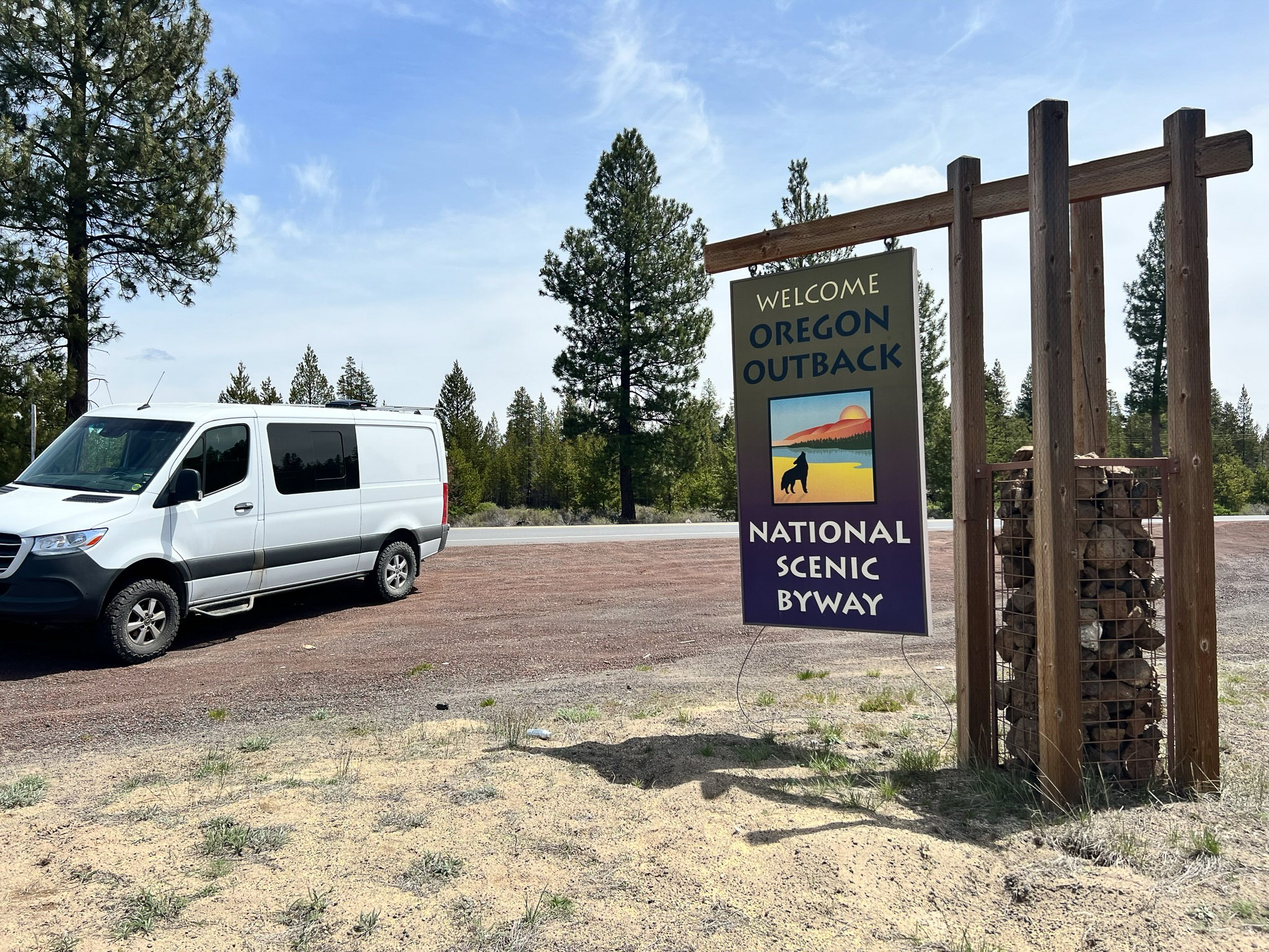
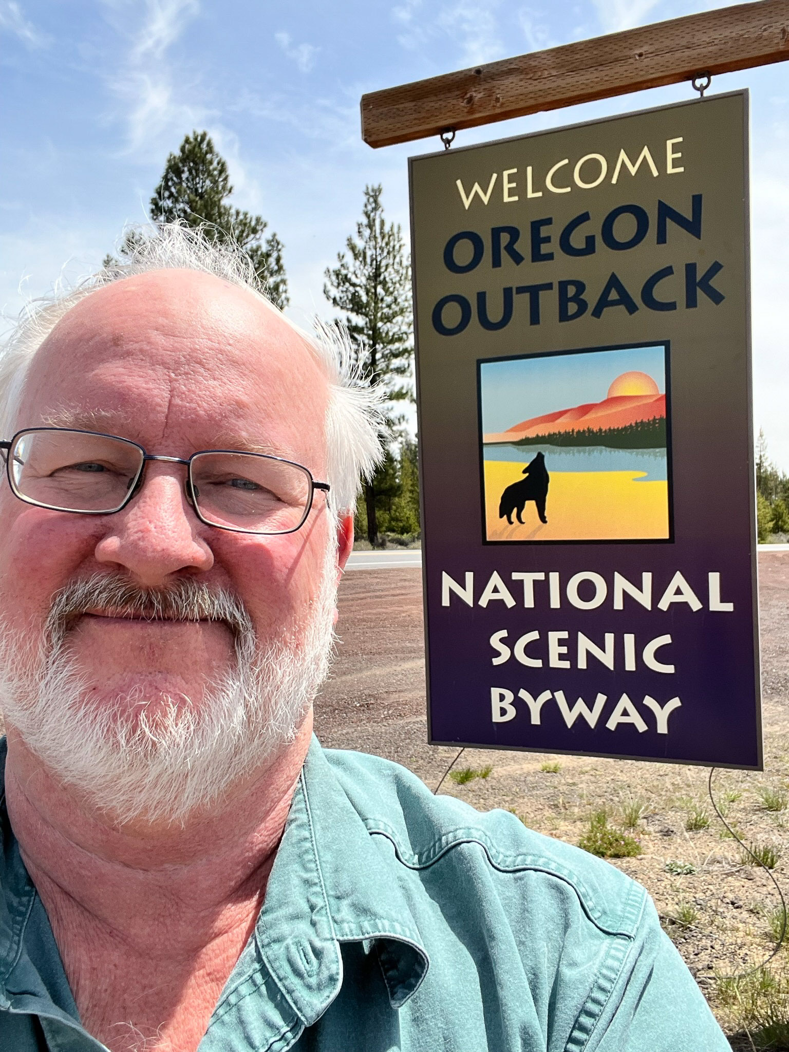
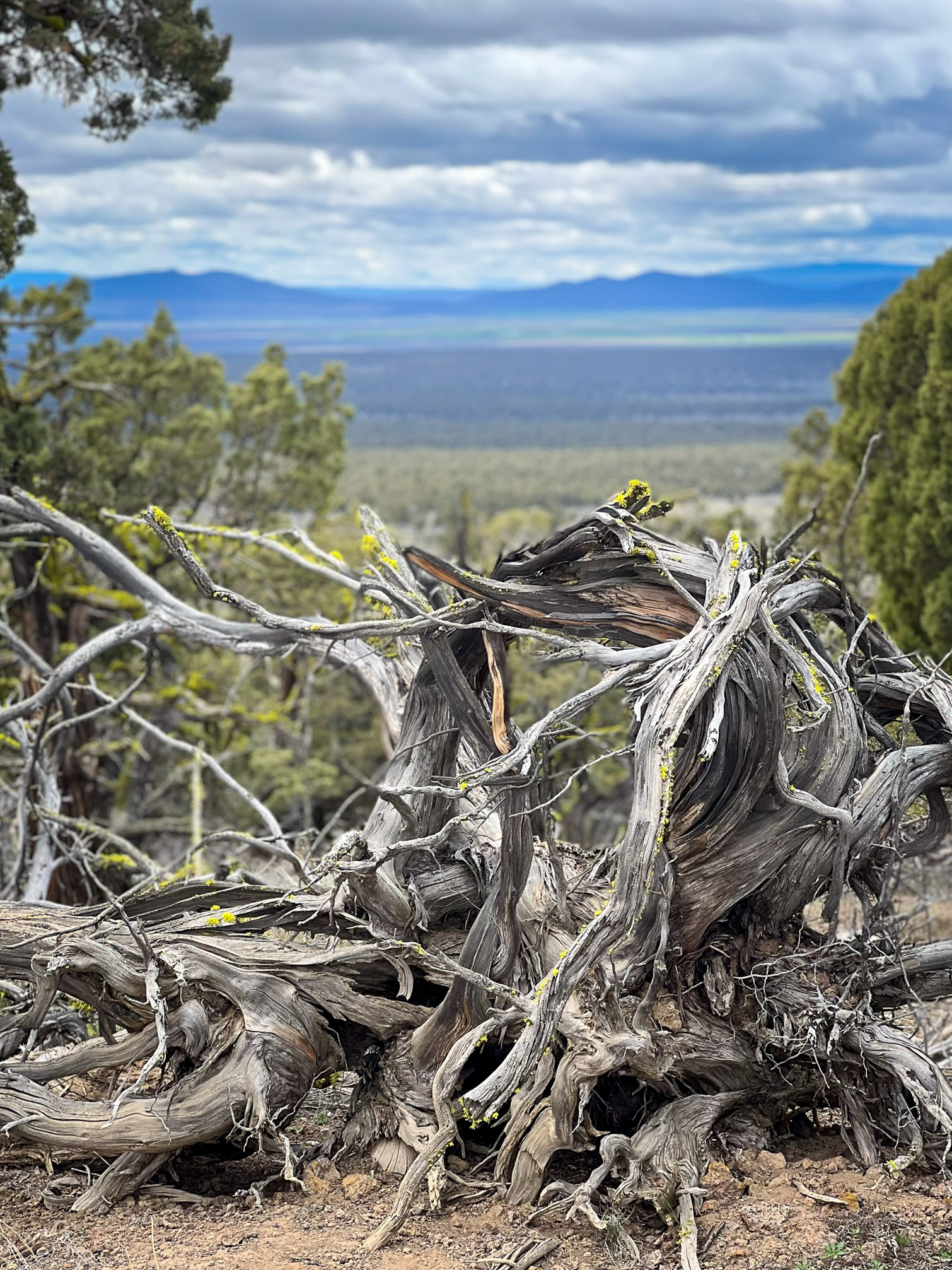
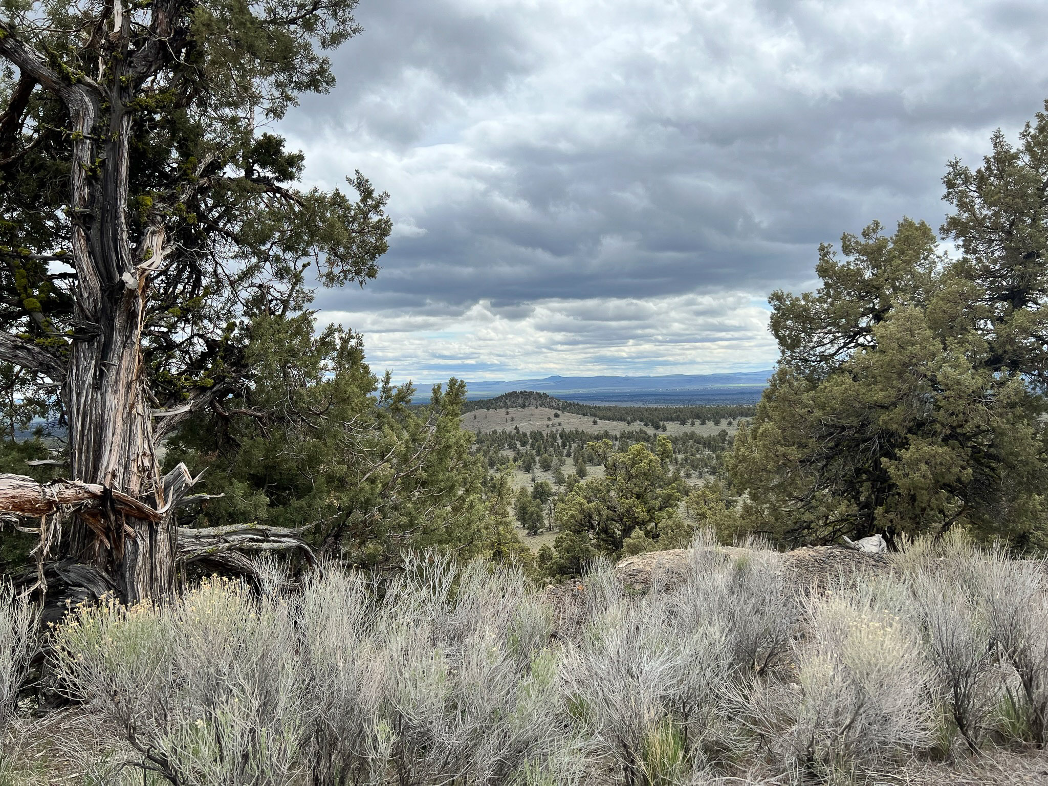
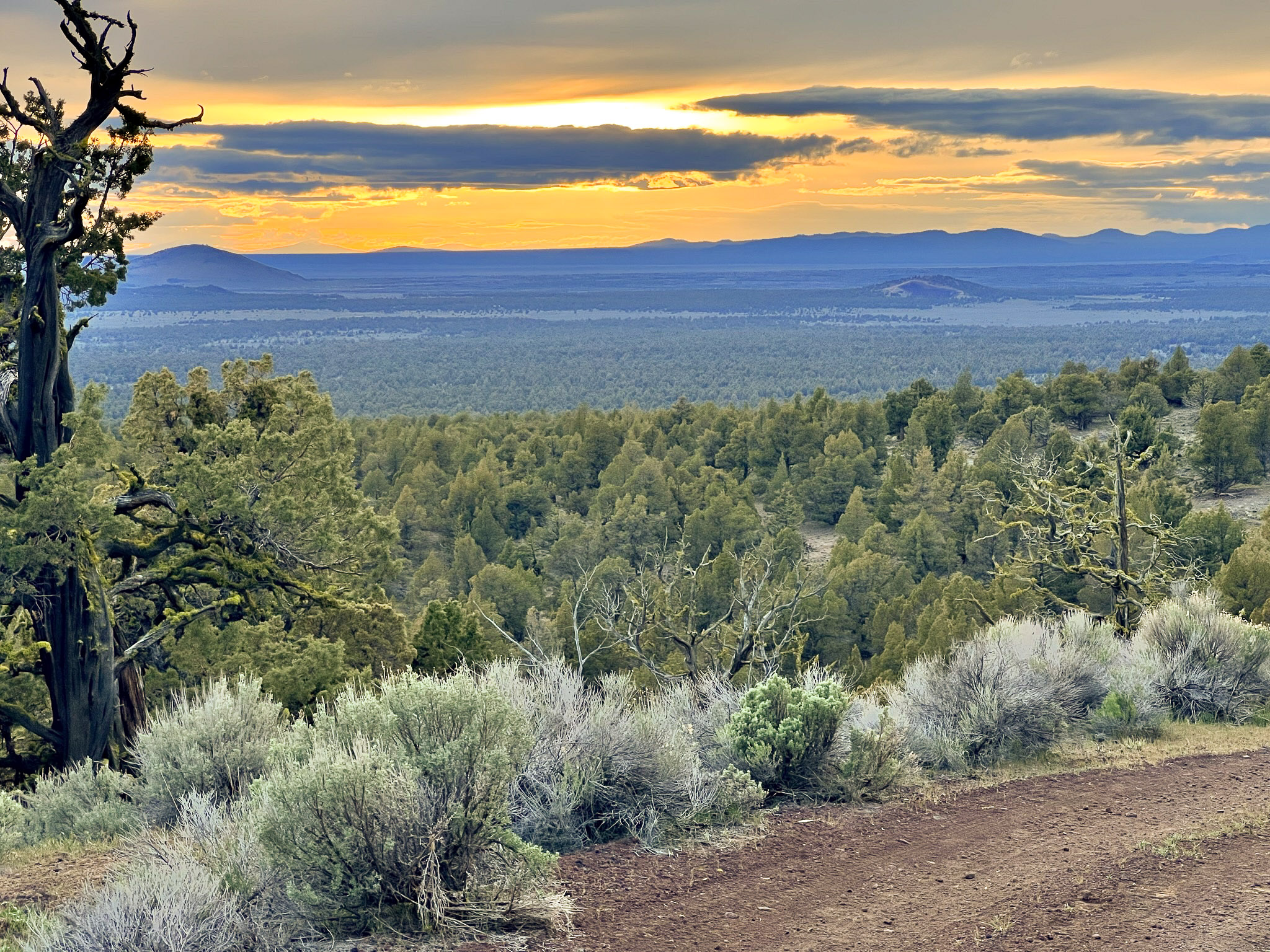
Central Oregon
Oregon is proud of their remote wilderness areas. A wide swath of this area is known as the Oregon Outback, and for good reason. It's very primitive and undeveloped with a great distances between services and filling stations. You must be prepared for any condition.

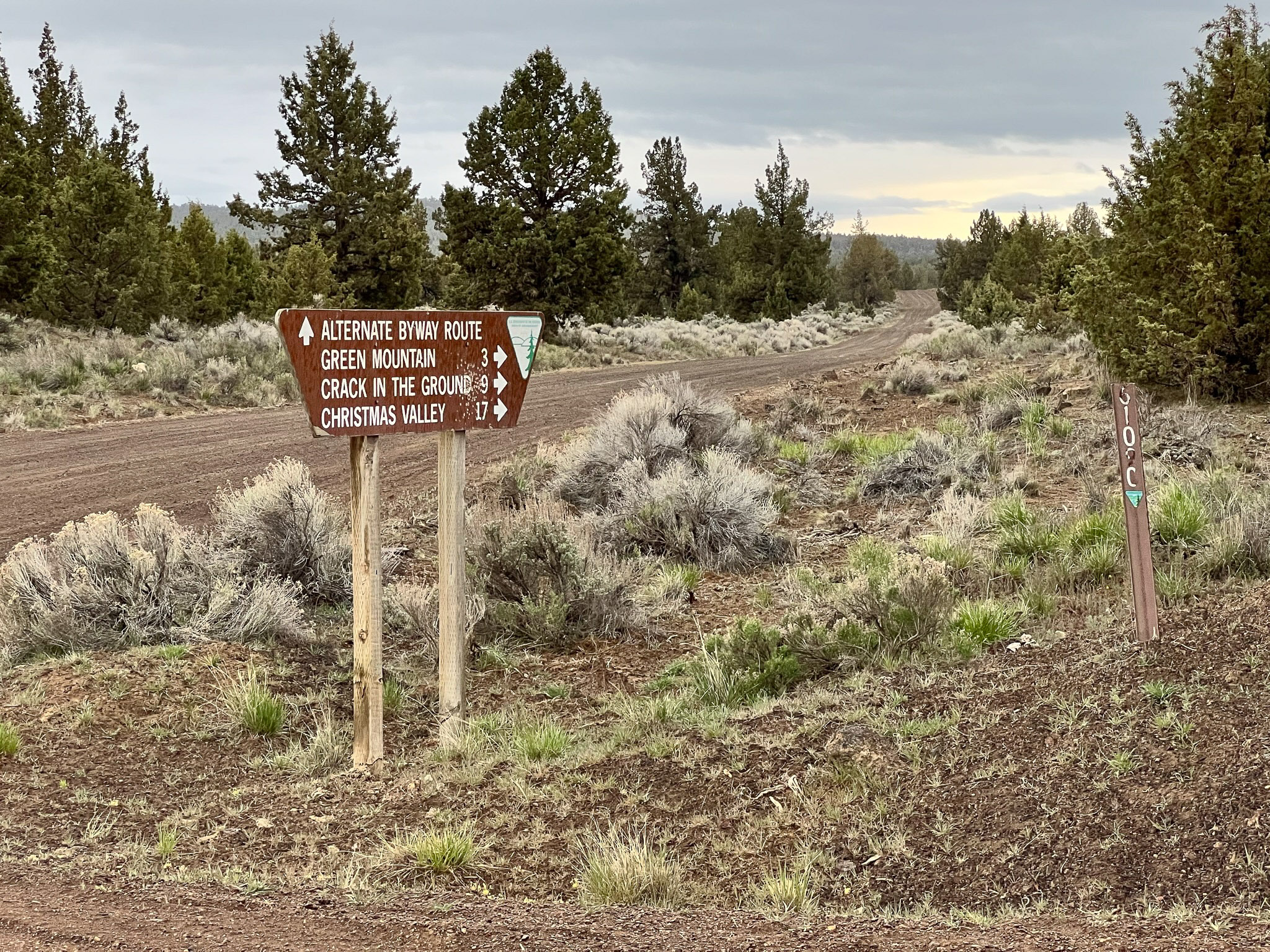
The unpaved road from Christmas Valley is wide and is widely known for its horrible washboards. Most of the road is not nearly as comfortable as it looks in this one spot.
Getting There
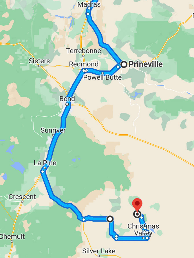
My route from Seattle to Central Oregon went from Seattle, over Snoqualmie Pass, then south from Ellensburg through Yakima and Goldendale. The scenic route adds about 30 minutes compared to driving through Portland but is more enjoyable than super-slab interstate highways.
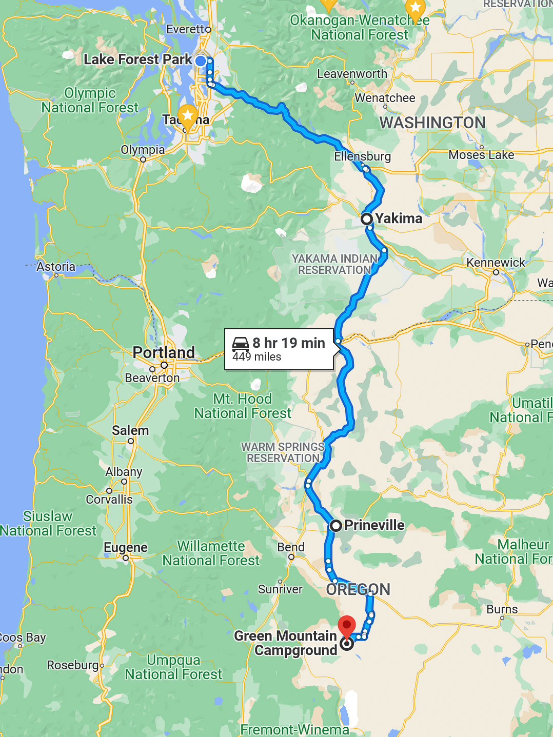
This trip was expected to take 8½ -hour driving time. After filling my tank in Prineville, the most efficient approach is to go due south to enter the park's unpaved roads.
But no, my Garmin Overland navigator had a wildly different idea, and directed me in a gigantic semi-circle around the park to enter the wilderness area from the south side, adding 1.5 hours driving on bad roads.
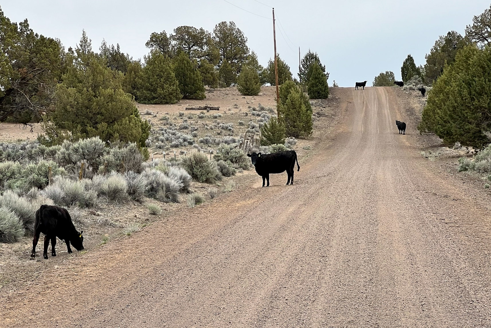
GPS navigation systems are poorly informed about unpaved roads. In primitive wilderness areas it can't distinguish between wide maintained roads and ranchers' pasture trails. This time, Garmin's "most direct route" included the dead-end private driveway to the Morrison Ranch, and a herd of black cows clamoring for dinner, and a dwindling ATV trail through soft sandy scrubland. Thankfully, a rancher happened by in his pickup truck and gave me directions.
Next time, I'll wrangle Garmin into better routing by adding more waypoints. The extra delay was annoying and I ended up arriving at the campsite at sunset. I rehydrated something elegant for dinner and went to bed, delaying my set-up to the morning.
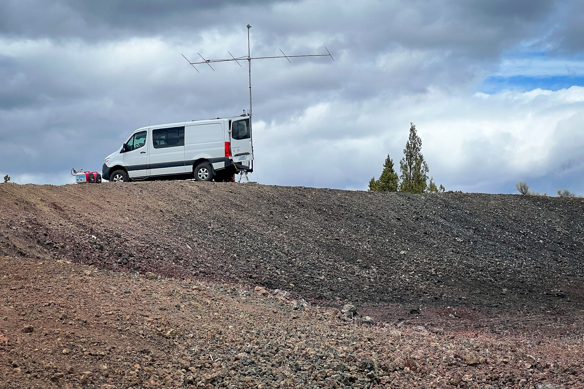
Green Mountain CN93pj
Having survived the route so far, it was pure pleasure to find such a nice public park at the top of Green Mountain.

Upon achieving the summit, the campground itself is pristine and clean. All campsites have a view and are near a good pit toilet.
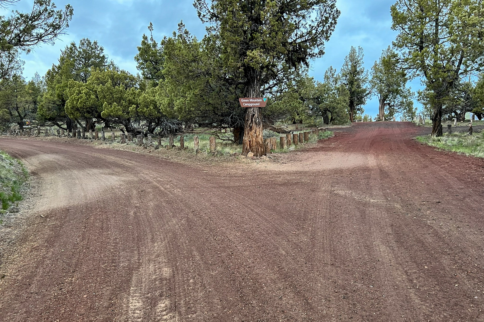
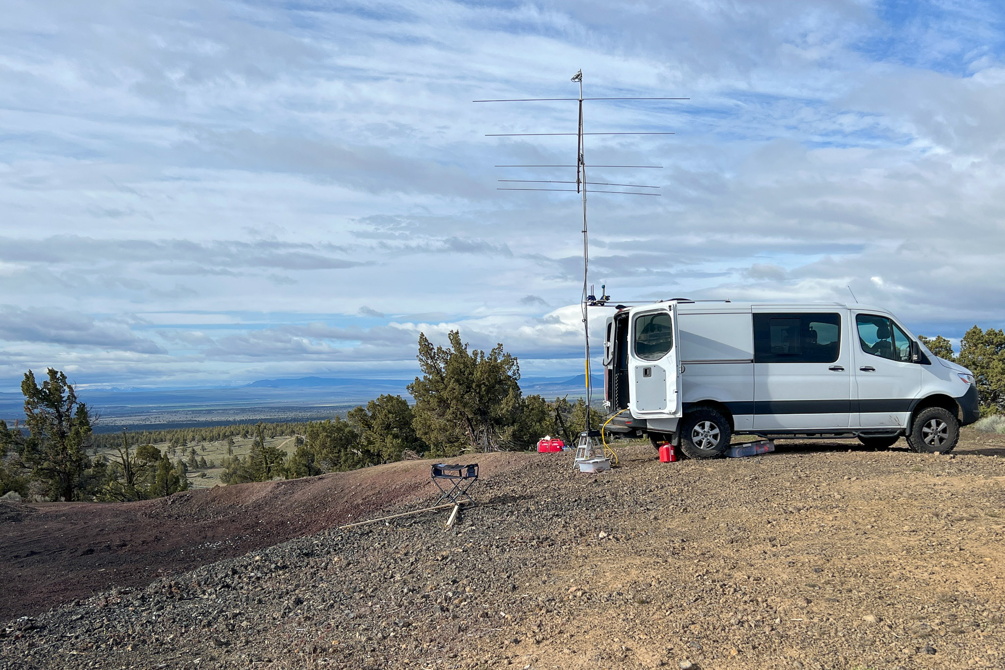
However, I did not stay at the campsite itself. Instead, I parked at the gravel pit about one-quarter mile east of the campground. This offers a better horizon eastward toward Mike Zulu in Kansas.
Over the years, I've often seen gravel pits situated at the top of hills, I wonder why these eyesores get the viewpoints so often.
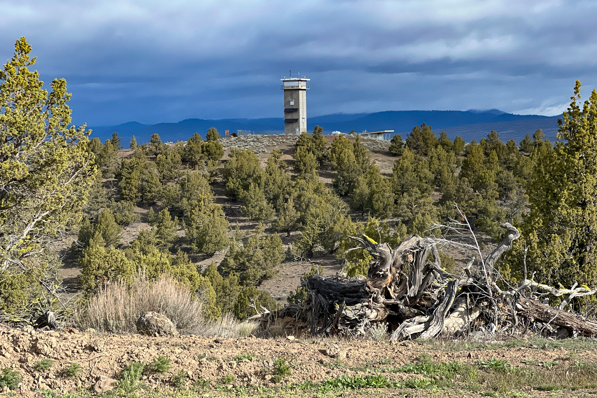
Looking west from the gravel pit we can see the campground nestled into all those trees below a very modern lookout tower. The awning that looks like an interpretive center is not; it's locked away as part of the tower compound. Nothing to see here, move along.
From the campground looking east, visitors can easily see me in profile on the ridge; I wonder what they thought. While roving in the West, folks usually ask me if I'm tracking bears. When traveling in the Mid-West, people usually assume I'm a storm chaser. In Oregon, they ask if I've found aliens.

The views are spectacular at this site at 5,200 feet elevation. The horizon is slightly negative in most directions.
Setup
It seems useful to show how some of the radio gear is set up.
When picking a location, my goal is to position the antenna within one wavelength of a drop-off in the desired direction. This reduces ground reflections and results in a lower take-off angle. This, in turn, improves meteor scatter and E-skip distances. However, it also reduces "ground gain" that would normally enhances EME performance. Anyway, this means I always back up my van close to the edge.
A simple tripod holds my mast during antenna assembly. A small string at the bottom holds the pieces at the right distances. Note the quick-disconnect mounting plates for no-tool assembly.

There's a pivot in the base of the trailer hitch antenna mount allowing the mast to be assembled at an angle to the side, instead of straight back down into the drop-off.
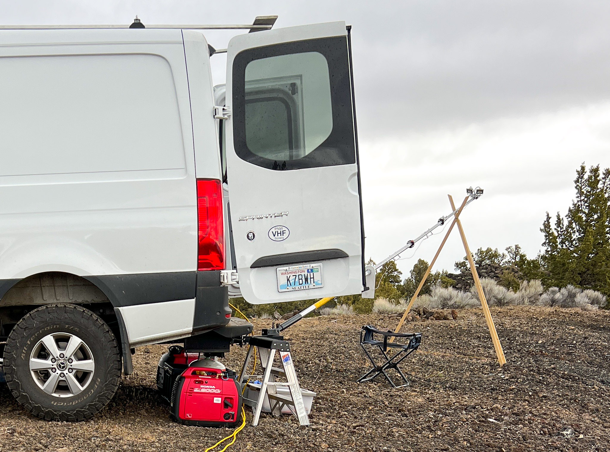
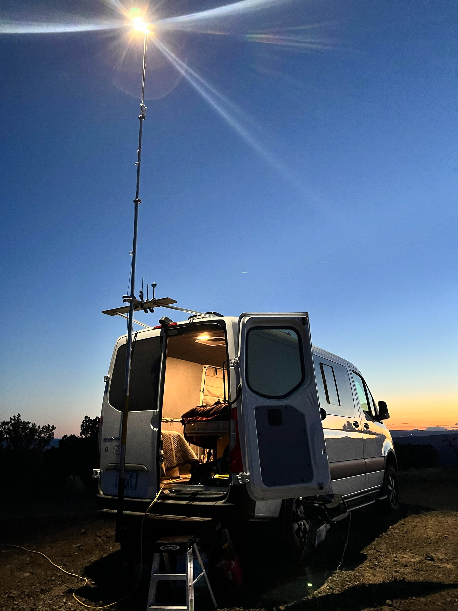
A porch light on top of the mast is a pair of 24v LED floodlights that is powered with 13.8v; they are plenty bright at half-voltage. By placing it high up, the lights don't cause glare or attract bugs into my space. In this picture, I've dismounted the antenna because it's Sunday night and I'll finish breaking camp in the morning. I don't like leaving the sail up overnight regardles.
The M2 6m5xhp is not usually a rover antenna. However, the boom sections stack neatly into 5-foot sections and nest together into a nice portable package. I cut and drilled a two-by-four to clamp the mast sections together for easier carrying and travel.
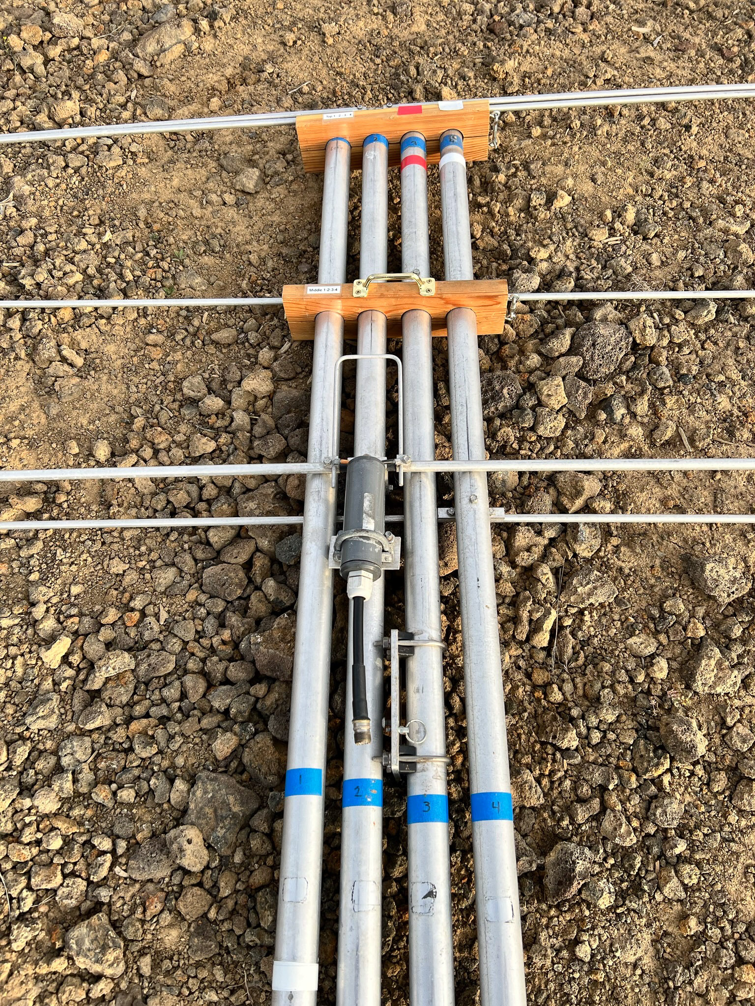
The compass rose is printed and taped onto a lid. During setup, this is aligned first with a smartphone compass and then by the sun. Magnetic compasses are affected by the vehicle's steel and are unreliable. I get the sun's position from WSJT's astronomical data readout.

Operating
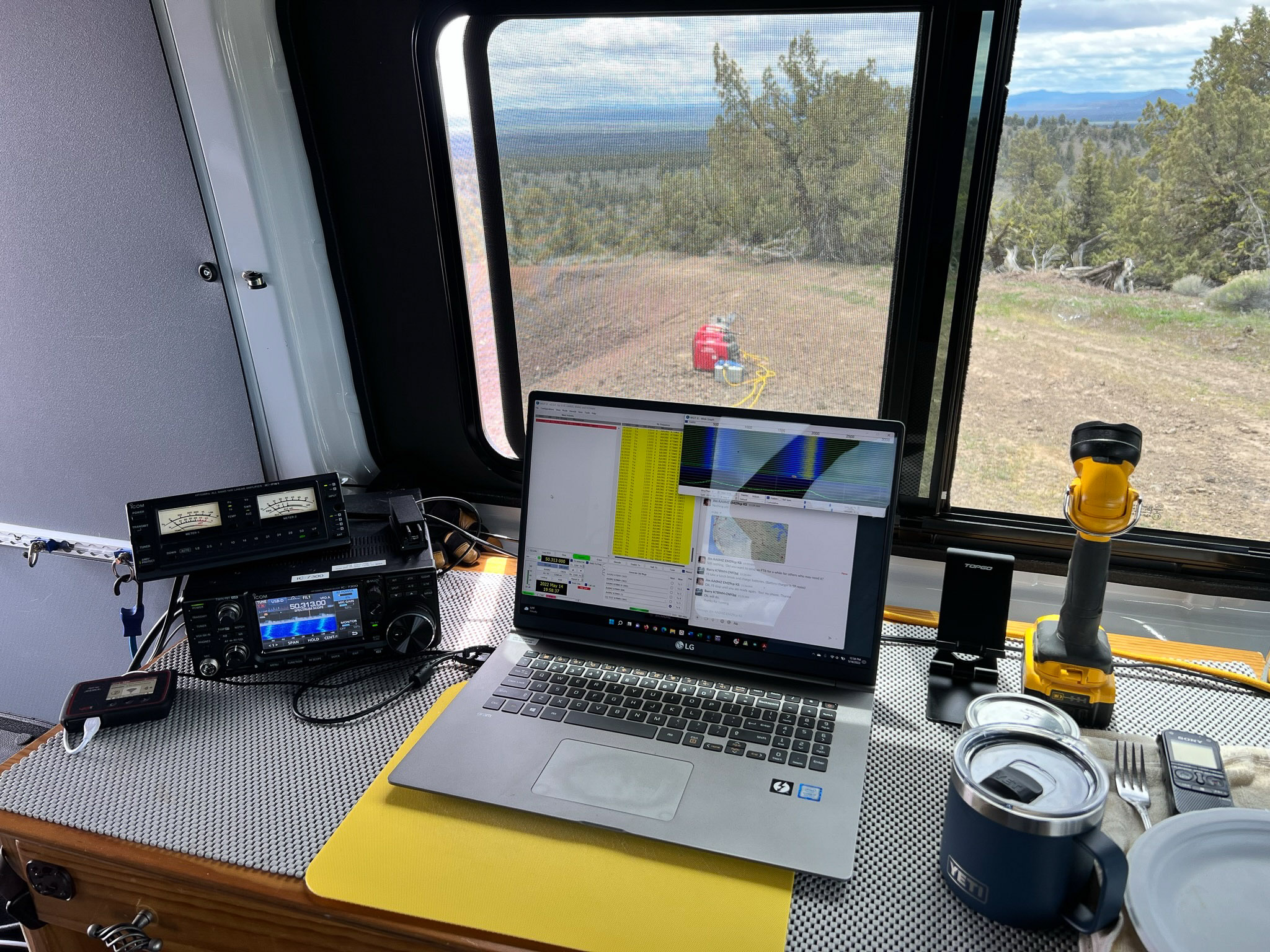
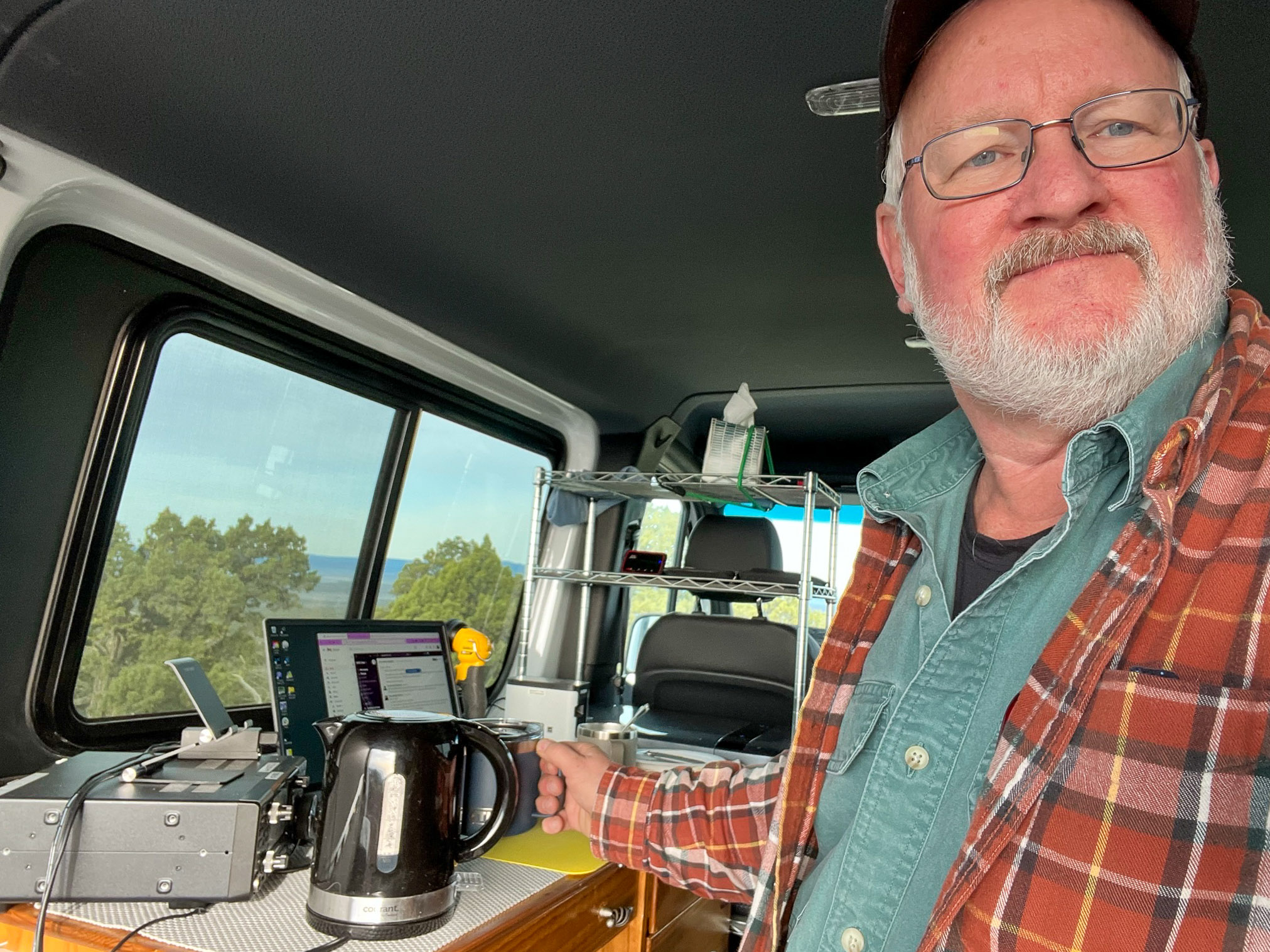
Here's the operating position inside the rover van. The key resources are, of course, the coffee pot in the foreground and the 12v fridge in the background. The layout is designed to provide a walkway from the desk to the back doors, where I can turn the antenna without stepping out into dirt or mud. I wear warm comfy bunny slippers on the cushioned floor.
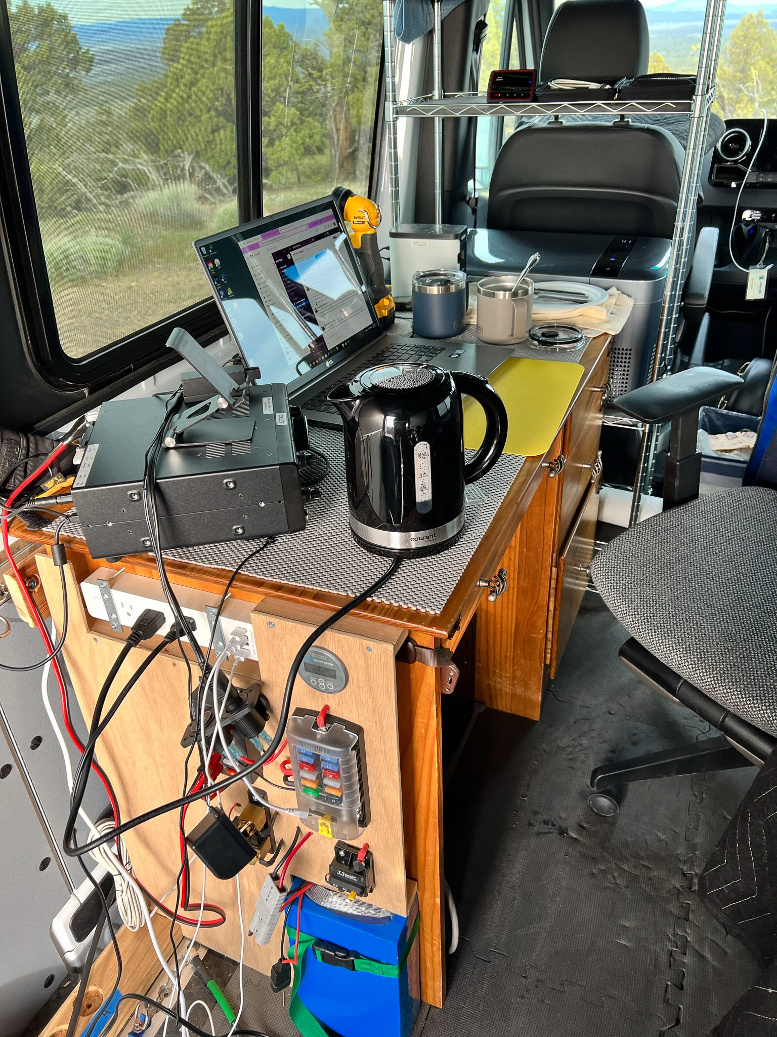
The IC-7300 on the left carries the Icom PW-1 amplifier's remote-control head on top. Next to the radio is a WiFi hotspot on the charger. At this gravel pit, Verizon had 2-3 bars of signal and I used the internet constantly for PSK Reporter and Slack chat. Over at the campsite nearby, there was 1 bar or less and the internet was practically unusable.
Final FFMA Contact for AA0MZ
On Saturday morning, I worked meteor scatter around the Pacific NW up to 900 miles in every direction. But I didn't get the direction or distance needed to reach Jim AA0MZ about 1330 miles away in Kansas. We spent hours of blind calling toward each other. To our mutual disappointment, I decoded only one sequence from Mike Zulu, and he never heard me.
Jim has performed miracles with his modest station, working 487 grids with 100 watts and a log-periodic antenna on an 18-foot mast. We have been disappointed with but not surprised at the difficulty in completing this contact. He has demonstrated what can be accomplished with perseverance!
Saturday afternoon, I made FT8 contacts around the Pacific NW out to about 900 miles again, but no further, as if all signals were blocked beyond Denver. Mike Zulu and I spent another hour or two focused on working each other and again were stymied. Again, I decoded only one sequence and Jim none at all.
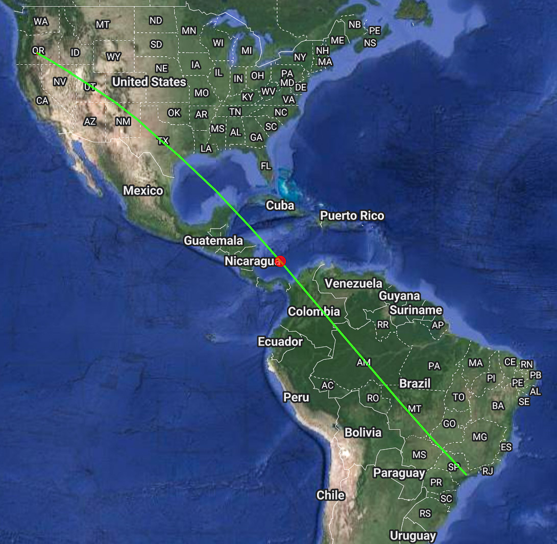
From time to time, I heard PY2XB in grid GG66 on the southern coast of Brazil over 6,570 miles away. Now, the chance to work TEP (trans equatorial propagation) was a possible prize not to be missed!
So, I turned up my power output as far as I could. The outcome wasn't nearly as fun as hoped. I turned it up too far. The "power limit" announced itself with arcing sounds, a big bang, and a puff of acrid smoke.
This was a dreadful setback. I was limited to 100w output for the rest of the trip. Further, my IC-7300 can only run from my LiFePo battery and not from the generator. And the battery could not be charged at the same time as it was being used because the charger generated massive RFI. The remainder of the weekend operated in a duty cycle of about 2 hours of usage and 2 hours of recharge. I planned my meals and rest breaks around the charging cycles.
Sunday was another day of lousy propagation without enhancement. The PSK Reporter maps showed the East Coast in furious E-skip conditions, while the West Coast had zero propagation eastward past Denver. How frustrating. But we had some digital tricks available. Jim and I tried the super sensitive mode of Q65-30A for almost two hours. I decoded one sequence at -35 dB (!), and Jim had no decodes at all. So, we tried the even-more-sensitive modes of Q65-120A and -120E. No luck. No decodes.
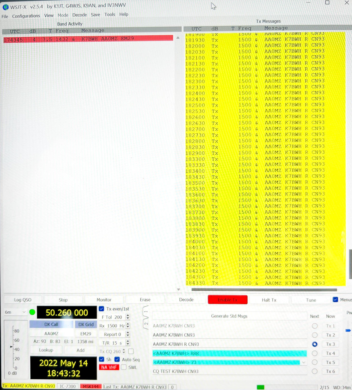
At 0200z (7 pm Pacific) our luck improved. The E-clouds finally moved, and E-skip appeared for the first time this weekend. The first station I heard was Francis KV5W, a well-known grid chaser, and I began an FT8 contact with him. Then I heard AA0MZ too, but I might as well finish with Francis first, right? Wrong! I heard AA0MZ for only one sequence and our path disappeared. Was the skip all done? You can imagine me kicking himself for not working "Mike Zulu" right away and dumping Francis. At the moment, we desperately feared the band-opening was only one contact long.
Thankfully, fifteen minutes later, after much recrimination via text messages with Jim, we easily worked each other on FT8: both of us with only 100-watts. This finished Jim's long chase for all 488 grids. A new FFMA winner is born, the first such award in 2022 that we know of.
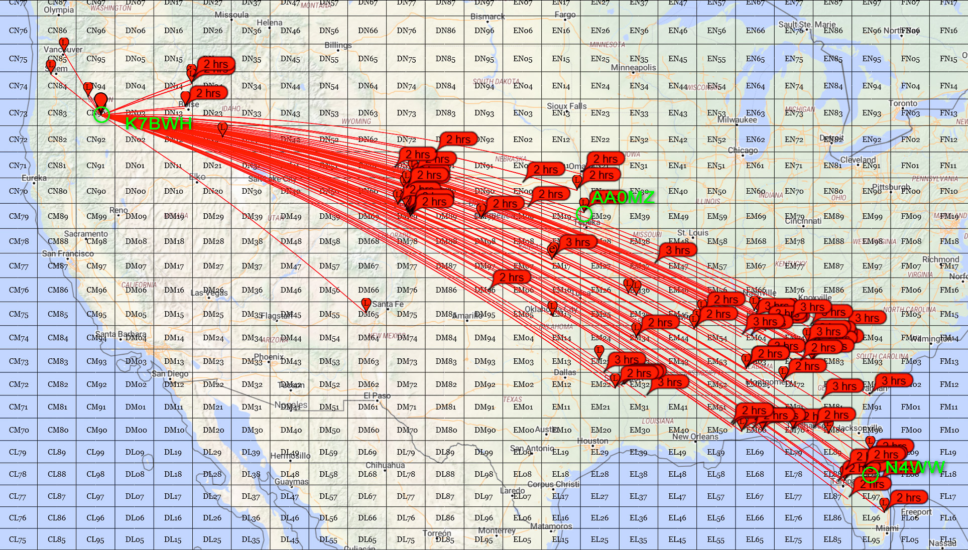
I went on to work KV5W, W5VY, N4WW, and a dozen more lucky grid chasers for 45 minutes until the band suddenly died again. All with only 100 watts output power. My apologies to those I couldn't work, as I'm sure many were calling me in this rare grid square.
The skip was extraordinarily narrow, in the sense of a very slender track from CN93 to Florida EL98 some 2500 miles away, and many points along this line. The screen shot below from PSK Reporter shows the thin skip path across the country.
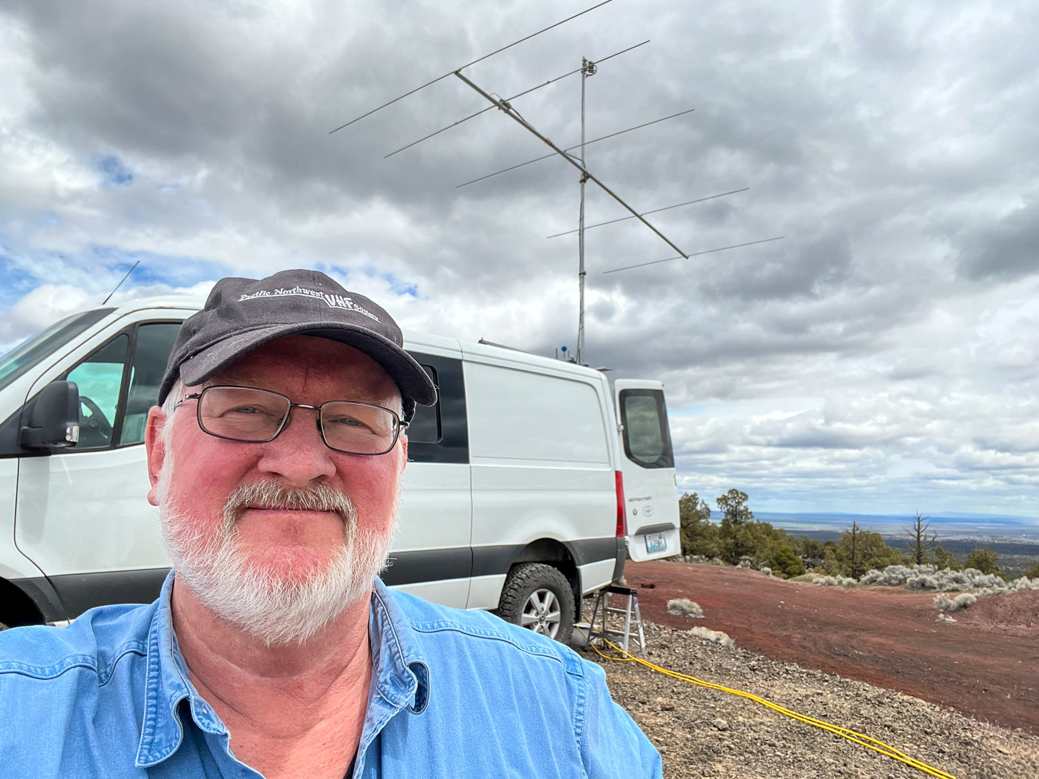
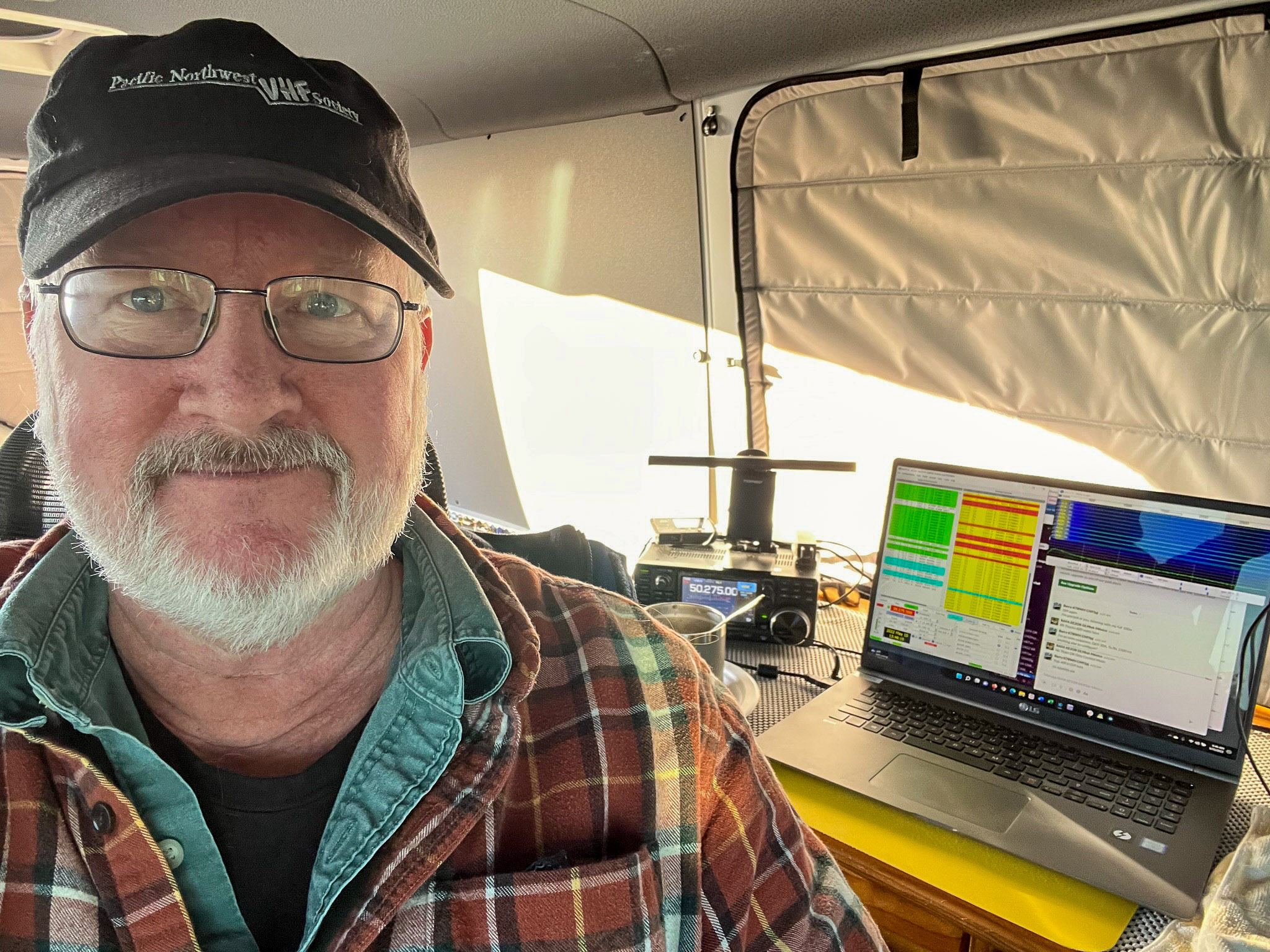
Here's the successful operator at sunset, at the end of two trips to CN93, each with two long days of trying to work Jim AA0MZ "Mike Zulu".
Trip Results for Only May 2022
For this trip alone in May:
- Trip time 4 days (Friday morning through Monday evening)
- Total on-the-air time: 25 ¾ hours (Sat 7:30 am - 8:30pm, Sun 7 am - 7:45pm)
- Total 59 contacts in 39 grids
- Burned 47.865 gallons of diesel and averaged 1.2 QSO/gal
- Farthest QSOs were to WB2SNN in EL96 (2504 miles) and N4WW in EL98 (2420 miles)
- For the first time, I killed up my longtime friend and traveling companion PW-1
- I've already acquired a replacement SSPA. With this and fuel, total trip cost was "only" $1,286
Feb + May Results
Considering both Feb and May trips to CN93 together:
- Distance driven: 879 miles + 905 miles = 1,784 miles
- Total fuel: 50 gal + 47.9 gal = 97.9 gallons diesel
- Total fuel cost: $270 + $271 = $541 fuel
- Amplifier replacement: 0 + $1,050 SSPA = $1,050
- Total fuel + amplifier: $339.81 + $1,286 = $1,625
- Total time on the air: 22 hours + 26 hours = 48 hours
- Total contacts: 14 qso + 59 qso = 73 QSOs
- Total QSO rate: 73 qso / 48 hr = 1.52 QSO/hour on the air
- Cost per contact: $1,625 / 73 qso = $22.26 / QSO
- Completing Jim's final contact for FFMA: priceless
Thanks everyone for following along. Congratulations to Jim AA0MZ!
Barry K7BWH
| < Previous | Page 4 of 34 | Next > |
©1998-2024 Barry Hansen