Rover Location Database
Grid Square CN71

Grid Square DN01
11 locations - Catnip Reservior - Soldier Meadows - Black Rock - DN00-DN01 Bottle Creek - Orovada - Yellow Peak - Virgin Valley - Bog Hot Springs - Hwy 299 - Denio Junction - Fox Mtn
Potential VHF rover sites in grid DN01.
This section helps plan an E-W grid trip through CN71 - DN11.
DN01 dimensions are 103.6 by 69.2 miles.
Explore this grid in Google Earth or equivalent:
Catnip Reservior, DN01gv49
| 41.912932, -119.460571 |

Todd KH2TJ has operated from Catnip Resv., up in the Sheldon National Wildlife Refuge.
Not too bad of a place if you don't feel like making the drive up Yellow Peak. Primitive campground. Isolated, no noise. Not as high as Yellow Peak though. Image c/o Google Maps.
Soldier Meadows, DN01ji36
| 41.360547, -119.222793 |
Todd KH2TJ recommends Soldier Meadows Campground. It's easy to reach, has a nice cabin and vault toilets and, added bonus, hot springs not too far away. If the cabin is occupied, then the campground at the hot springs is not bad. Note the surrounding hills to the north may hinder getting a signal out that direction.
Black Rock, DN01ma04
| 41.020040, -118.998510 |
Todd KH2TJ says: For DN01, I've played around up above Black Rock Pt area but this is extremely isolated and 4WD and high-clearance vechicles are really good to have. This site sits up above Burnt Rock Peak and has a couple of nice hidden playas above Black Rock Hot Springs for some isolated camping/boondocking.
You might also consider one of the higher elevations with trail in the "Black Rock Desert - High Rock Canyon Emigrant Trails" area. In fact, the large flat playa (alkali flats) down below is another candidate for camping or operating.
This is not far from the DN00-01 grid line in Casey Springs at 41.000, -119.01487.
Todd's done quite a bit of HF operations out in that area, such as Seven Troughs Highpoint. There lots of "hidden" cabins and old ghost towns in those areas.
DN00-DN01 Bottle Creek, DN01ta30
| 41.000000, -118.389583 |
Orovada, DN01xr38
| 41.743361, -118.057639 |
This is alongside dirt road with meadows and easy to setup. There is unlimited space and you are pretty high against Santa Rosa ranger, which is more to east which matters for MSK season
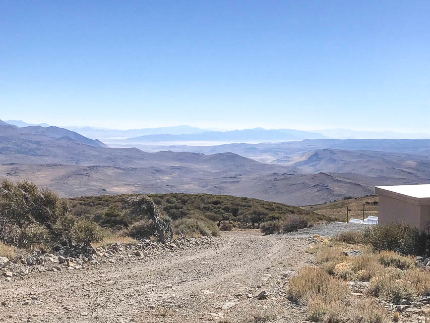
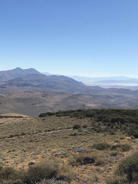
Yellow Peak, DN01eu50
| 41.836417, -119.622556 |
Yellow Peak is a fire lookout tower (unstaffed) in the Sheldon National Antelope Refuge.
A very good location, including some cellphone tower access, very RF quiet (compared to Fox mountain which was very noisy).
Virgin Valley, DN01lu94
| 41.852431, -119.002083 |
Virgin Valley Campground is a free developed campground with hot springs and a shower.
Bog Hot Springs, DN01ow31
| 41.921840, -118.800683 |
If you want a hot springs with more privacy and warmer water en mass, go here.
Hwy 299, DN01an03
| 41.556076, -120.000000 |
The CN91-DN01 grid line crosses CA Hwy 299 about 9.3 miles east of Cedarville CA, where there's a wide spot that lets you park well away from the highway. This is a wide-open plain a good distance from the mountains on both sides.
The grid line is a few hundred yards west of the border between California and Nevada, since the state border is not exactly on longitude 120.0. The road becomes unpaved as it enters Nevada.
Breakfast outstanding at Bakery in little town of Cedarville, CA.
Driving directions: From Cedarville, drive east on CA-299 about 9.3 miles, crossing over Middle Alkali Lake until you reach the state line.
Denio Junction, DN01qw48
| 41.952231, -118.626903 |
Denio Junction is the intersection of 140 and 292.
If you need supplies or a motel, Denio Junction (not Denio!) has gas, a 6-room motel, and a bar and grill. The grill is open 8am to 6pm, the bar till 9pm, and they're on Facebook.
Alternatively, a little north of here is Fields, OR (DN02), 26 miles north of Denio Jct. Fields has a 1-pump gas station, a general store (and pretty good milkshakes), a small cafe/kitchen, and a 2-room motel.
Fox Mtn, DN01fa35
| 41.024425, -119.558218 |
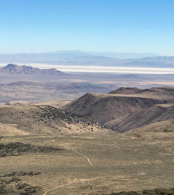

Petr AG6EE: Don't go here. The GSM tower is hanging low sending all its RF into your antenna.
Al W7KHD: Fox Mtn is SE of Duck Lake Valley, NV. Has a good 360 take off, maybe because of the lack of any other mountains that are taller or close. There are communications towers up there, which causes problems on the air.
Mike KB7ME: There's actually a decent operating spot below the summit which gets away from noise Petr mentions. Try DN01fa50ta on the DN00-DN01 grid line, two miles away. Photos above are from an ATV trip a while back, rockhounding with XYL.
Driving directions: Old Camp Canyon Rd is normally in pretty good shape.
Restrictions: The wind blows hard up there.
| < Previous | Page 4 of 5 | Next > |
©1998-2026 Barry Hansen