
Rover Location Database
British Columbia Rover Locations
- BC Map
- Select Grid
- CN69 Vancouver
- CN78 Vancouver
- CN79 Vancouver
- CN88 Victoria
- CN89 Vancouver
- CN99
- CN50 Vancouver
- CN60 Vancouver
- CN70 Vancouver
- DN09
- DN19
- DN29
- DO20
- Add a Place
Grid Square CN78
6 locations - Bahokus Peak - North Point - Sekiu Airport - Sekiu - Ucuelet - Minute Creek
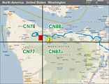
Potential VHF rover sites in Washington and BC grid CN78.
CN78 dimensions are 91.6 by 69.2 miles.
Explore this grid in Google Earth or equivalent:
Bahokus Peak, CN78pi89
| 48.372100, -124.675900 |
This is an old Air Force site with some local government radio antennas and a weather radar site. There is a wide place to park off the main road at a fork leading to one of the sites. There is no place to camp, but great place to stop and setup. I noticed no apparent receive interference problems from the mountaintop electronics, although VE7DXG could probably be heard on a Heathkit dummy load from that location.
There are trees everywhere on the hilltop which would make microwave operation difficult if not impossible above 1296 MHz. On the way up there is a spot with good exposure East to Southeast.
Driving directions: Look for Makah Air Force Station. Follow SR 112 to end of pavement, turn left, then drive approximately 1 mile to a hard right turn that takes you back up the hill to the top. The top is about 3 miles inland from the most northwestern point on the continental US. This gives you a nearly unobstructed look (except for trees) to the South, so it is a great place for coastal tropo.
SR 112 also has some places along the Strait of Juan De Fuca on the way to Neah Bay from Sekiu (Hello CQ from Sekiu) where vertical rock faces are on the West side of the road, and pulloffs on the East side of the road. These passive reflectors are good for about 6-9dB of signal enhancement (at least to K7RAT) while roving and can make for a few more points while driving up to the hill.
North Point, CN78xc10
| 48.084444, -124.072466 |
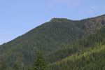
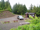
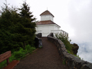
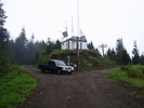
This a fire lookout site that has been converted to a small park/viewpoint, complete with an outhouse. If the weather is clear you can see it from Highway 101.
Look to the north when you are in the speedometer test area. The road up is well maintained, and could be driven in a passenger car if you are careful. There are numerous ditches cut across the road for drainage, but they don't present a problem if you take it slow. The path to the north is blocked by a ridge. The road continues to a microwave site which is on higher ground but gated off.
Driving directions: Take Highway 101 west from Port Angeles.
After you pass Lake Crescent, you'll eventually cross two bridges.
Turn right (North) on West Snider Road and cross the bridge.
Go 0.4 mile and then left at sign "North Point Lookout".
Go up FR 3040. It took me an hour from the highway to the lookout.
Sekiu Airport, CN78ug34
| 48.267368, -124.307045 |
Sekiu, CN78ug32
| 48.261070, -124.306161 |
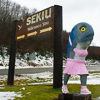

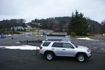
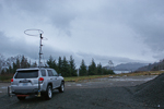


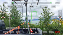
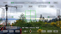
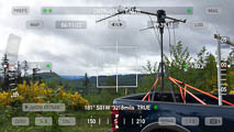
Every ham should have a chance to call CQ from a spot like this that can generate such mind-boggling confusion: "CQ CQ, CQ from Sekiu, CQ to Sekiu, and CQ everywhere else."
We arranged our schedule to be in this remote lowland spot during the regular Sunday morning weak-signal net, to give us better access to the more capable 2-meter stations. It was a good thing we did, too. It was difficult to make any contacts with people in Seattle because the Olympic mountains blocked our signal. Finally, we found that if everyone points at Mt Baker to the north, we could make a few contacts into Puget Sound.
Ucuelet, CN78fw51
| 48.924387, -125.538342 |
At the end of the Ucuelet Peninsula is a Coast Guard Radio Station and parking areas for hikers to the beach.
In 2003, there were low scrub trees obscuring a clear SE view. This location is decent for 2M and 432 though to south Puget Sound and bigger Seattle/Woodinville stations further north. Washington and Oregon Coast is good.
Mike K7MDL parked at the access gate to the transmitter towers just north of the Coast Guard station buildings which have beach access by foot. Allow 2.5 hours to get back to the Nanaimo ferry from here. It is 30 minutes to Radar Hill in CN79 just North.
Minute Creek, CN78um23
| 48.513010, -124.315422 |
Minute Creek overlooks the ocean at your feet. Very good shot to the South over the Olympics. Can work CN85 with ease from there. There are strange reflections toward CN87, but signals are quite strong even on 432. In 2002, we needed a decent 2 wheel drive pickup to drive the road. There are other spots on the highway between Jordan River and Port Renfrew that have good shots to the South, this one just seems to be the highest. I worked KC7VNA/DN06 on 432 from here.
Driving directions:
About 5 km East of Port Renfrew on the highway from Victoria
to Port Renfrew, signs mark "Minute Creek" and "Minute Creek Forest
Service Road".
Take the Forest Service Road North, up the hill.
Keep left as it forks after a 100m or so.
Go another km or so, and just as the road goes into the forest,
there's a switchback, with very nice views of the Straight of Juan
de Fuca.
There is room to park as it was a landing for logging operations.
| < Previous | Page 4 of 16 | Next > |
©1998-2026 Barry Hansen