Rover Location Database
British Columbia Rover Locations
- BC Map
- Select Grid
- CN69 Vancouver
- CN78 Vancouver
- CN79 Vancouver
- CN88 Victoria
- CN89 Vancouver
- CN99
- CN50 Vancouver
- CN60 Vancouver
- CN70 Vancouver
- DN09
- DN19
- DN29
- DO20
- Add a Place
Grid Square CN89
2 locations - Malaspina College - Cypress Lookout
Potential VHF rover sites in BC grid CN89.
CN89 dimensions are 89.8 by 69.2 miles.
Explore this grid in Google Earth or equivalent:
Malaspina College, CN89ad37
| 49.157583, -123.973071 |
Malaspina College (now Vancouver Island University, I think) has a local high spot with easy access. Modern scouting is needed.
Good shot to CN89, CN88, CN87. VE7QV lives on the top of the hill by the microwave tower, but there is no room to park by the tower. About 500' ASL. I usually work N7AU/DN07 from here with ease.
Driving directions:
Paved road all the way.
Take the Island Highway (also called Nanaimo Parkway, or Nanaimo Bypass).
There is a traffic light at Second Street, by Malaspina College.
Turn West on Second Street and after about 200m, there is a large
clearing on the right.
Park under the power lines, overlooking the college buildings.
Cypress Lookout, CN89ji84
| 49.352969, -123.178084 |


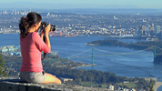
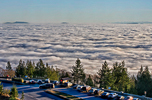
Cypress Mountain Lookout is a good parking area overlooking West Vancouver BC with open skies W-S-E. This road continues futher uphill to ski areas and the Cypress Provincial Park.
| < Previous | Page 7 of 16 | Next > |
©1998-2026 Barry Hansen