Rover Location Database
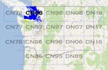
Washington Rover Locations
- WA Map
- WA List
- Select Grid
- WA from CN87
- Rare WA Grids
- WA Counties
- CN76 Long Beach
- CN77 Forks
- CN78 Sekiu
- CN85 Portland
- CN86 Centralia
- CN87 Seattle
- CN88 Belling'm
- CN95 The Dalles
- CN96 Yakima
- CN97 Mt Rainier
- CN98 Mt Baker
- DN05 Pendleton
- DN06 Tri-Cities
- DN07 Moses Lk
- DN08 Okanogan
- DN16 Pullman
- DN17 Spokane
- DN18 Colville
- Add a Place
Grid Square CN88
14 locations - Lyman Hill - Middle Chuckanut - Mt Erie - Mt Anderson - Little Mtn - I-5 Smokey Point - Lake Stevens HS - Baynes Peak - Mt Prevost - Bear Mtn Viewpoint - Mt Benton - Malahat Summit - Mt Tolmie - Island View Beach
Potential VHF rover sites in grid CN88.
CN88 dimensions are 91.6 by 69.2 miles.
Explore this grid in Google Earth or equivalent:
Lyman Hill, CN88wo20
| 48.585337, -122.147790 |
Lyman Hill is a high point in the Northern State Recreation Area an hour or two north of Seattle.
Don't rely on Garmin or Google navigation, neither one worked for me in January 2022. Garmin was wildly wrong and there was no road at all where it went. Google could not find a route.
The peak was logged off in the 1970s and trees are likely to be full grown since then. One of the forest road names suggest that it's owned by a pulp/paper company.
Restrictions: Don't rely on Garmin or Google navigation, neither one worked for me in January 2022.
Middle Chuckanut, CN88sp46
| 48.653977, -122.464879 |
Getting there is a real treat. Chuckanut Drive is the most scenic road in the Bellingham area. Narrow, winding 2-lane road with a rocky cliff looming overhead encroaching the roadway on one side, and a spectacular drop-off to ocean views on the other. Take your time, enjoy the drive.
Gated off after 20-minute crawl up the forest road at the turnoff to Fragrance Lake trail. I was unable to drive to the final parking area. If you can get there, it provides a nice shelf with open propagation in all directions except north.
Middle Chuckanut is in Larrabee State Park, between Frangrance Lake and Lost Lake.
Driving directions: From the turn-off to Hiline Drive, expect 20 minutes to the gate.
4wd is recommended for mud and slope in the first 1/4 mile.
Restrictions: Chuckanut Drive is not for the claustrophic (space), acrophobic (height),
vehophobic (driving), or thanatophobic (dying).
Larrabee Park has no camping, no overnight.
Mt Erie, CN88qk49
| 48.454193, -122.625230 |
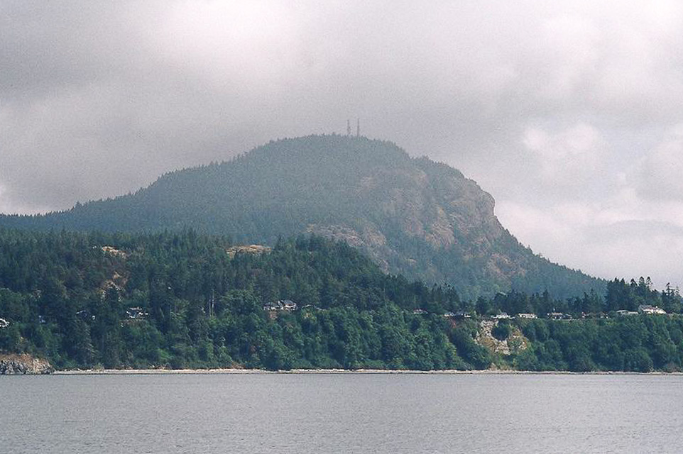
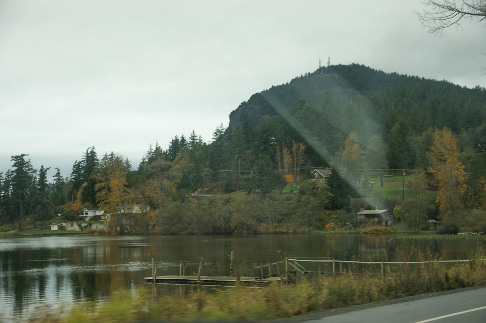
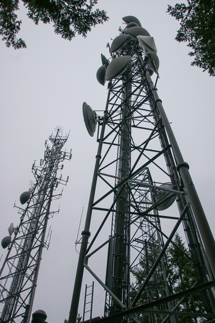
Mount Erie is the highest point on Fidalgo Island, at 1,273 feet. (See wikipedia.) Mount Baker is 43 miles to the northeast and can easily be seen from Mount Erie. On a clear day, Mount Rainier can be seen in the southeast, approximately 117 miles distant. Mount Erie is an Anacortes City Park and the summit is accessible via a single-lane, paved road from the base.
The hilltop hosts three large towers with a number of commercial and Coast Guard VHF+ transmitters, and the parking lot is surrounded by trees. It might not be good for really weak signal or microwave work, but Barry had no interference on 144 MHz unless he pointed directly north at the towers.
Driving directions: From I-5 take Exit 230 for WA-20 toward Anacortes
- Drive about 12 miles
- Turn left at a light onto WA-20 south
- Drive 1.8 miles
- Turn right onto Cambell Lake Rd
- Look for a quaint "Lake Erie Grocery" and keep right at the fork
- Drive 1.4 miles
- Slight right onto Ray Auld Dr with signpost "Mt Erie Viewpoint"
- Follow one-lane paved road 1.6 miles to top
Restrictions: One-lane road has lots of large overhanging tree branches
- Good clearance for sedans and SUVs but will snag tall antennas
- Road is not maintained for winter travel
- No restroom facilities on top
- Various signs announce "open 7am to 10pm" and "open 6am to 10pm" and "open 5am to 10pm".
Barry was there at 7am on Sunday and thinks they never close the gate, but who knows.
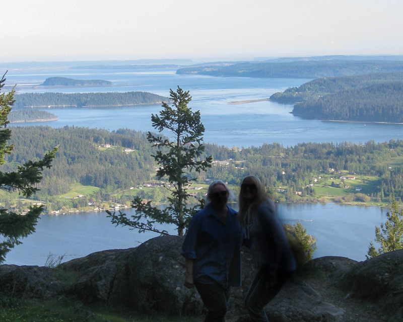
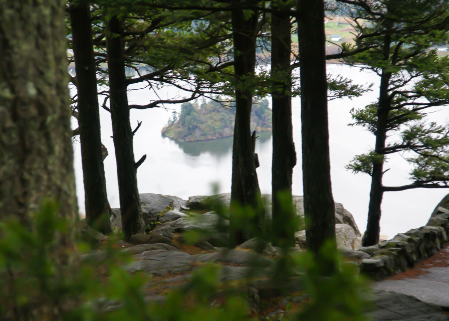
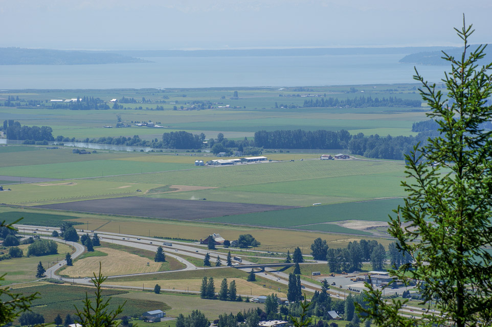
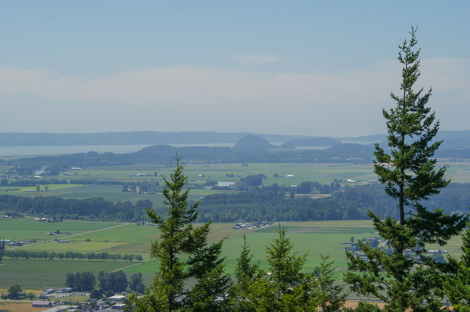
Mt Anderson, CN88up90
| 48.628333, -122.256667 |
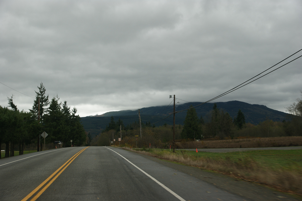
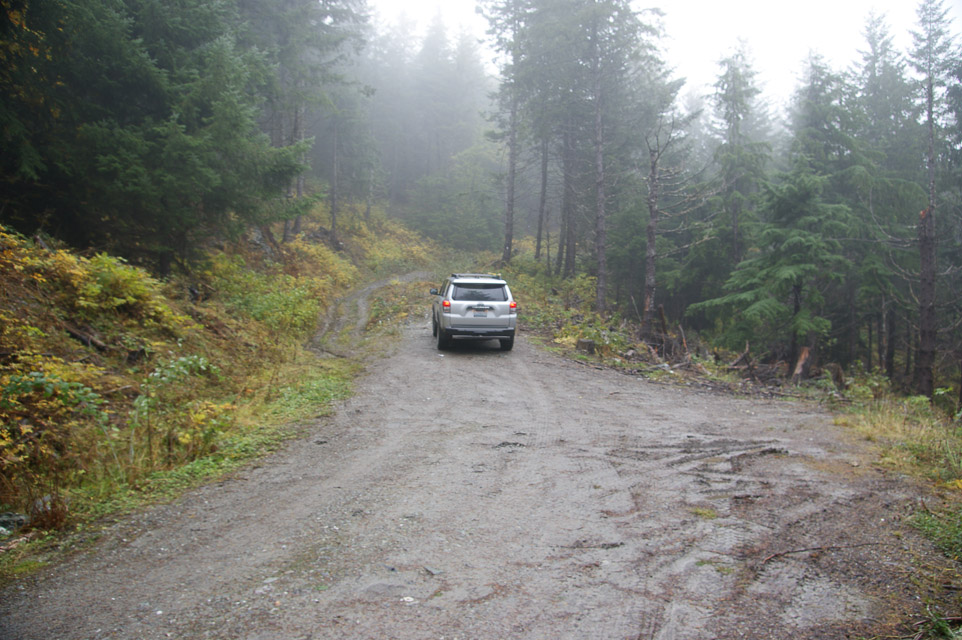
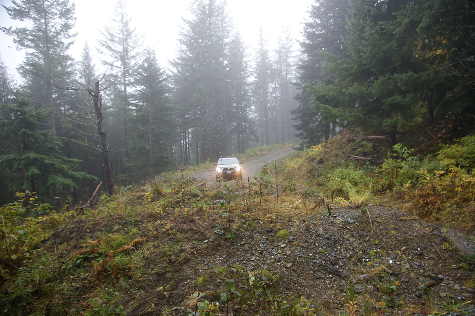
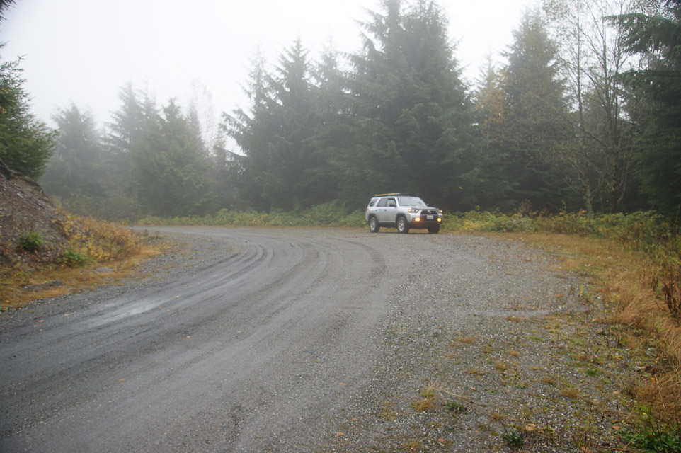
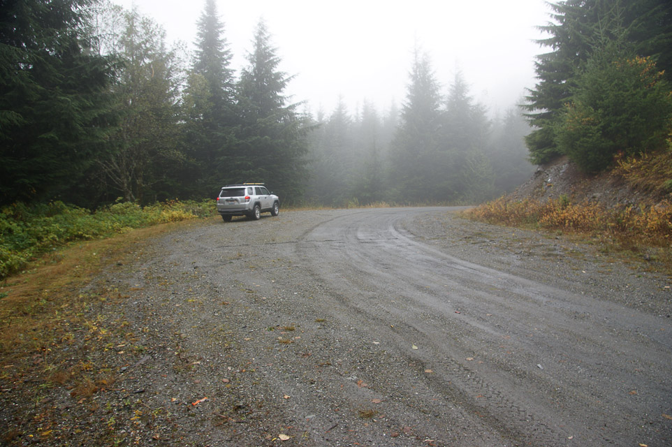
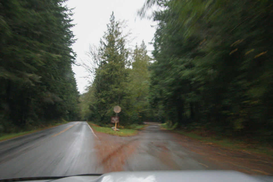
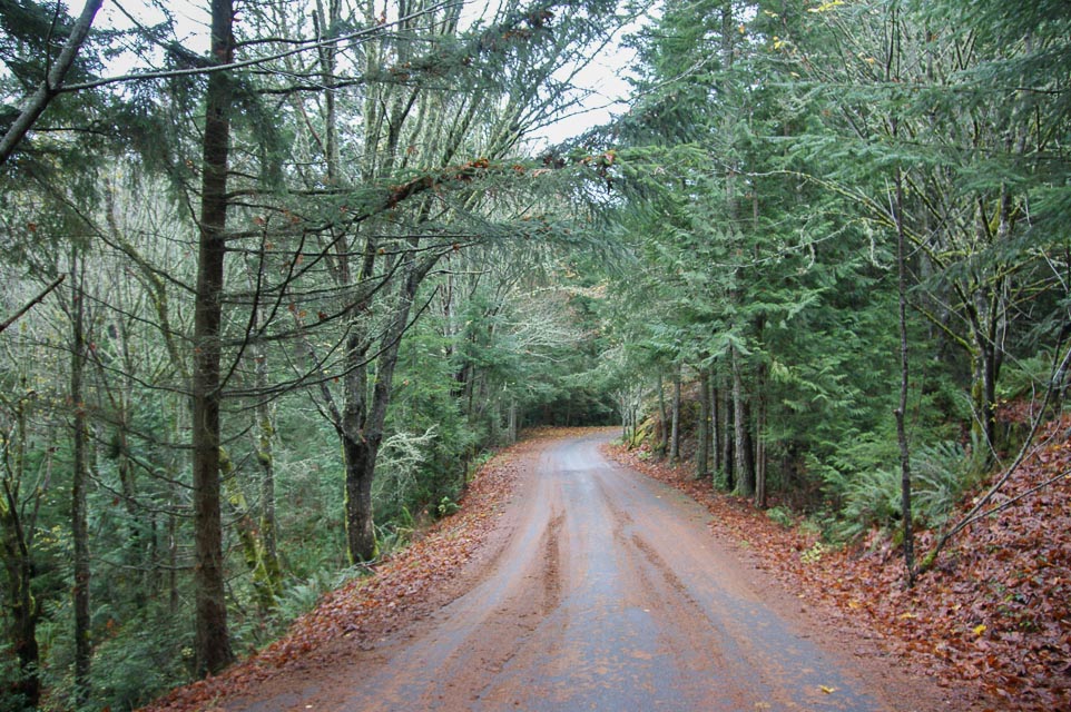
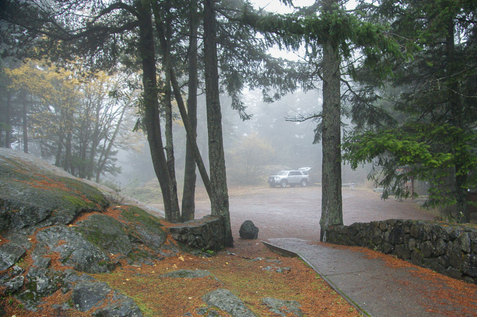
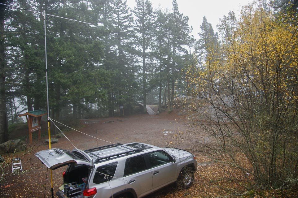
Mountaintop location north of Sedro Wooley. Between Hwy 9 and I-5 Northwest of Lyman Hill.
You can't drive all the way to the top but there are a couple good turnouts in the last half mile to park and operate. I like this wide area on a sweeping curve at CN88up90 at 3,007' altitude for its southern exposure, shown in last two images above.
Driving directions:
Access is via Old Hwy 99 1-1/2 miles south of Alger.
- From I-5 northbound take Exit 236 "Bow Hill Road", drive east 0.7 mi
- Turn left onto old Hwy 99, drive north 2.6 mi
- Turn right onto Parson Creek Rd, drive east 1 mi
- Turn left onto Skaarup Road, drive north 0.2 mi
- Continue straight where the road name changes to Alger Mt Rd Pvt
- Road changes to dirt "open" access road
- Drive 8 miles up mountain to the end; road ends within 300-400 ft from the top
Restrictions:
- Discover Pass required.
- On Nov 4, 2012, the road is maintained in good condition.
- The final section of road has been blocked with bunkers.
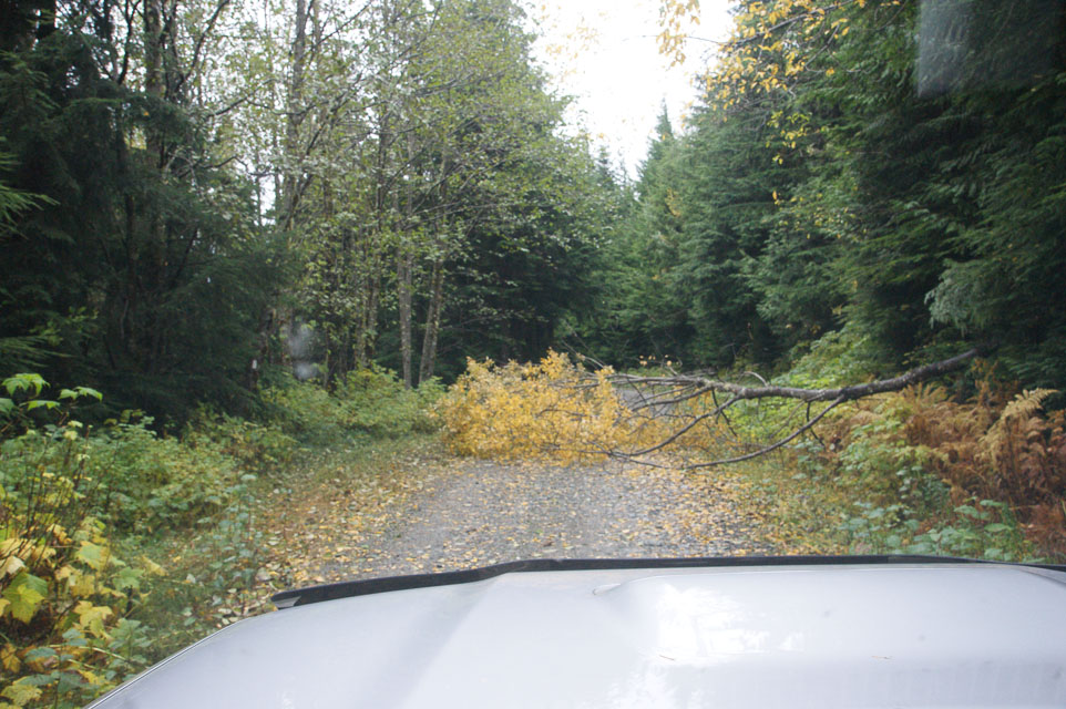
- In winter conditions be prepared. On Nov 4, the road was soft from
rain, and trees can fall anytime.
- On Jan 16, 2022, it was gated off at the bottom and signposted
"no motor vehicles" for the winter.
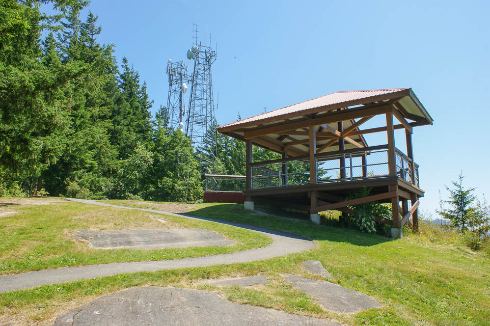
Little Mtn, CN88uj25
| 48.397200, -122.309200 |
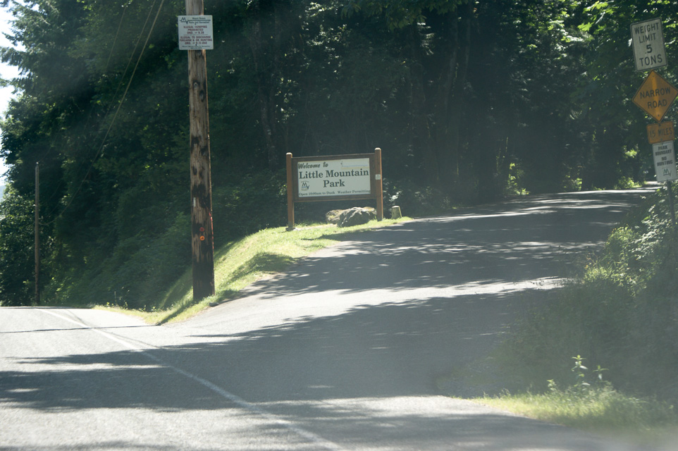
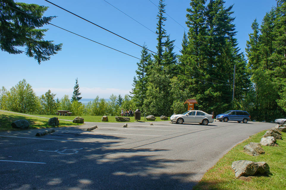

This site is a jewel of a public park at a scenic overlook on top of a small mountain. It is about ten minutes off I-5 on paved roads.
The best exposure is to the south and southwest. There is a sloping parking lot. Be careful of overhead power lines. There are restrooms and an observation deck with spectacular views.
N4SL and WB7FJG set up a portable station up through 432 in front of the observation deck during the June 2001 contest and reported excellent results.
K7BWH visited in July 2012 and January 2022, and worked 1296 on an HT all around a considerable line-of-sight distance.
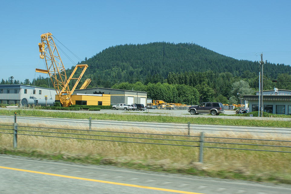
Driving directions: Northbound on I-5 take exit 225, south of Mt Vernon and just past a heavy crane display.
- Turn right (east) from the exit ramp onto Cedardale Road and immediately turn left (north).
- Go about 0.5 miles to Blackburn and turn right.
- Go east on Blackburn 1.1 miles and turn right onto Little Mt Road.
- Go up hill 0.3 miles and watch for "Little Mountain Park" sign on right. Turn at the sign.
- Proceed 1.3 miles on narrow paved road to the parking lot at the peak.
- Note: Most GPS devices think the road ends at the bottom gate.
Restrictions:
Park hours are 10 a.m. to dusk.
This is a popular local attraction, so expect lots of traffic.
Do not bring extended-length vehicle; a 144" wheelbase Sprinter van is
almost too big to fit into a parking space.
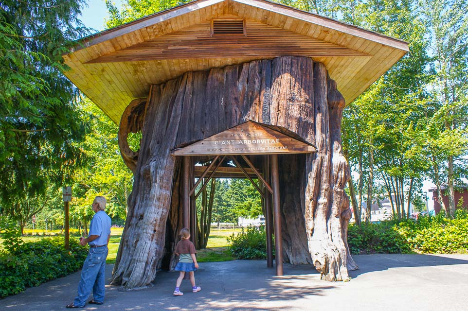
I-5 Smokey Point, CN88ve70
| 48.169570, -122.188900 |
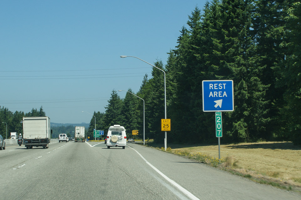
This is a rest stop on I-5 northbound north of Everett. It is on slightly high ground, and offers OK paths in all directions. Lynn N7CFO has used it for quick VHF and UHF operation with good success.
A famous and historic Western Red Cedar stump is on display, as evidence of the giant trees which once forested the area. Over 20 feet in diameter and 200 feet tall, the tree is believed to have been more than 1,000 years old. It's large enough to drive a car through.
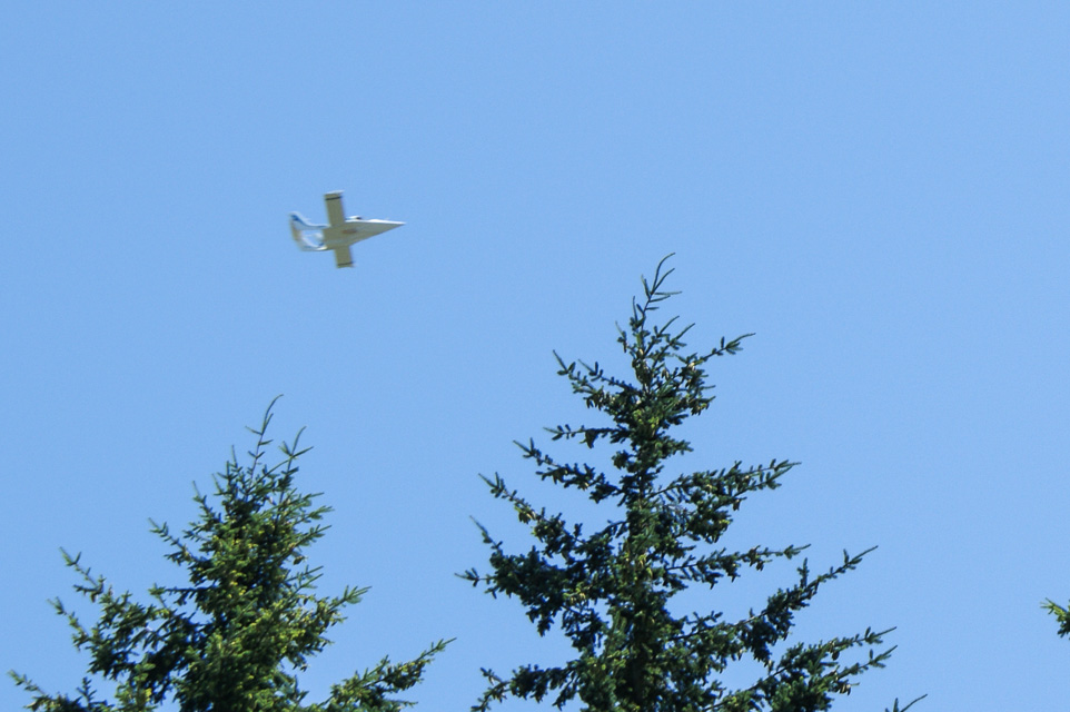
Keep an eye on the sky. This is close to the Arlington Airport and you may see unusual experimental aircraft overhead.
Driving directions: On northbound I-5 milepost 207, a mile past where the speed limit changes to 70, take exit into rest stop.
You have three choices as you enter the fork into Smokey Point:
- Left for RVs (recommended) will give you extra space from passersby and the trees
- Middle for commercial trucks
- Right for passenger cars
Restrictions: Signs are posted to limit your stay to 8 hours.
Lake Stevens HS, CN88xa05
| 48.022000, -122.078333 |
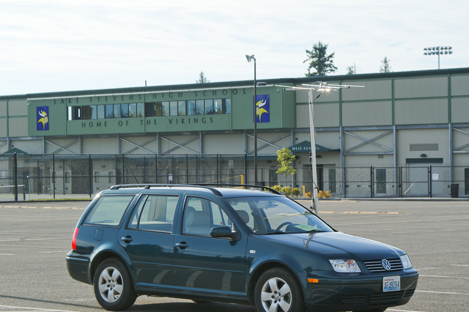
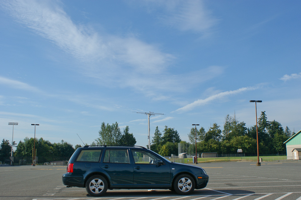
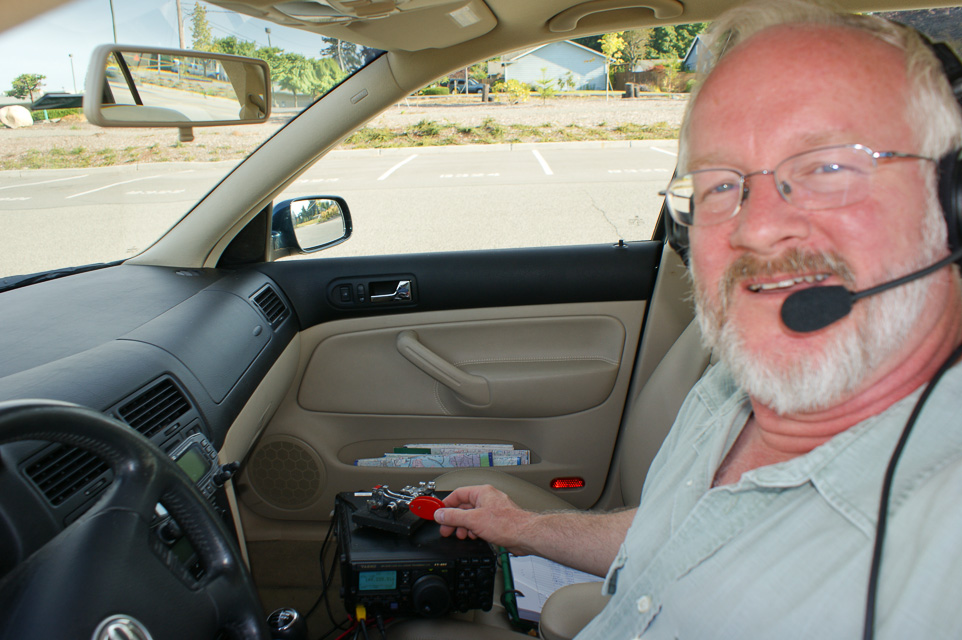
Lake Stevens High School is built on the top of a hill just north of a nice recreational lake. The large school parking area provides open view in all directions, especially south. Includes a porta-potty.
For the first time I made contacts in Portland and other Oregon cities.
Baynes Peak, CN88ft72
| 48.801890, -123.517530 |
Baynes Peak has a lookout tower in the Mt Maxwell Provincial park on Saltspring Island. The top is accessible by road.
Mt Prevost, CN88ct89
| 48.832511, -123.765660 |
Mt Prevost is a must-see if you are vacationing on Vancouver Island - the wife and kids will love it. There is a white cairn on the top which is clearly visible from the highway on sunny days. Often accessible even in the winter, or one can just drive to the first switchback and operate from there. Lots of tourists and local kids partying. Gravel road, but even a BMW can make it.
Driving directions:
- North on the TCH from Victoria. You can see the double summit from the town of Mill Bay, as you approach Duncan on the TCH.
- Go through Duncan. Just North of town turn left to Hwy 18 towards Lake Cowichan at the Esso Gas Station.
- Go West about 1 km, just after the railroad tracks turn right (North) to Somenos Road. After about 500m turn left to Mt. Prevost Road. There is a sign that says "Mt. Prevost Memorial Park, 7.1 km". It will turn into a gravel road at the Municipal Gate. Gate is rarely closed, only in summer high-fire-danger season.
- Follow climbing road. After about 2km there is a switchback with a beautiful view. Elevation about 1000'. Keep going.
- After about another 2km, just past a little gravel quarry there is Satellite Road. It is marked by a sign on a tree, easy to miss. Road goes on the boundary of a clear cut and climbs quite steeply.
- Follow Satellite Road for about another 2km as it winds through the forest. You'll get to a clearing covered with black shale/sand. Can't miss it. It's just under the summit. There are a few trees, but I think K7CW/VE7 worked into Tacoma on 1296 from there.
- The summit is not accessible from this location, but if you do not take the right turn onto Satellite Road and follow Mt. Prevost Road instead, it will take you to the summit. The road ends between the twin summits, you have to hike to the top. From the summit parking lot there is too much rock in the way, so I don't recommend operating from there. But if you take the 2 minute hike to either summit the view is breathtaking.
Bear Mtn Viewpoint, CN88fl60
| 48.459989, -123.529438 |
Mt Benton, CN88bv86
| 48.902119, -123.847026 |
This is the VE7DXG Contest QTH, who uses it as the BEST location on Vancouver Island, covering most of Washington state and beyond. It is located 1.5 hours from Nanaimo Ferry and is gated at the bottom. Members of the Cowichan Valley Amateur Radio Club have permission to pass through the gate and also have keys.
Driving directions:
- Turn West from the Trans Canada Highway in Chemainus at the Shell gas station onto "McMillen-Blodel Hauling Road" at the traffic lights. Follow gravel road about 500m to four-way stop. Go straight about 100m, to the gate.
- The gate is manned year-round and locked overnight. The local radio club has keys. If you just want to stay for the day tell the gatekeeper that you are going to the "Repeater" and you don't even have to pay the toonie ($2) to get in. Just make sure you are out by closing time (6PM in winter, 9PM in summer). The repeater on top is on 146.680 and 442.600.
- After the gate, follow the Copper Canyon Main (also called Chemainus River Road) to the missing 10 mile marker. (Don't worry, 6,8 and 9 miles are marked. The 10 mile signs fell down a few years ago.) Very nice and wide gravel road.
- 10-Mile Road (also called "12 mile" for unknown reasons) is right after a very prominent bridge, can't miss it. Turn right (the only way) to 10-Mile Road and follow it.
- It's a long drive, after about 15 minutes you cross another bridge.
- Keep going and after about another 15 minutes on the plateau the road turns sandy and makes a fairly sharp right turn. There is a very rocky road going to the left to Hollyoak Lake, that was marked by bunches of flagging tape in 2003.
- After about 500m you will see the tower and a white building on the summit. Just keep going towards it. Cross the earthen dam and keep going straight. You can get this far with 2 wheel drive.
- Put it in 4 low and follow the road to the summit. Very rough road. There are usually people around that can guide you to Hollyoak Lake. The site overlooks the lake.
Malahat Summit, CN88fn46
| 48.567502, -123.547030 |
Malahat Summit Viewpoint, also known as Split Rock viewpoint, is a popular scenic overlook along the Trans Canada Highway (TCH), 20km North of Victoria. Popular lookout spot. Restrooms, big parking lot.
This is the highest point of the TCH on Vancouver Island. I used to go there when I had no VHF at the home station to work aurora in winter. Good shot to CN89, 88, 87, even CN85. I worked WA7GSK/DN13 on 2m from there. The only drawback is the large number of tourists.
Driving directions:
Accessible year round, can't miss the big signs on the highway.
Mt Tolmie, CN88ik09
| 48.456409, -123.325213 |
Mt Tolmie Park is a local drive-up in Victoria for a quick stop and slight rise in the big city of Victoria. No toilet.
Island View Beach, CN88hn58
| 48.576448, -123.368723 |
Island View Beach Regional Park. operates seasonally from the Victoria Day long weekend in May to the Thanksgiving Day long weekend in October. On a clear day you can see Mt Baker and the Twin Sisters peaks.
The campground has 18 beach front RV sites, 5 treed tent trailer sites and 24 treed tent sites. The CRD's website allows you to reserve and pay for a campsite. Reservations can only be made up to 30 days in advance. You can login or create a CRD account here.
Rovers might find advice from the Nanaimo Amateur Radio Association, VE7NA.
| < Previous | Page 13 of 25 | Next > |
©1998-2026 Barry Hansen