
Rover Location Database
Washington Rover Locations
- WA Map
- WA List
- Select Grid
- WA from CN87
- Rare WA Grids
- WA Counties
- CN76 Long Beach
- CN77 Forks
- CN78 Sekiu
- CN85 Portland
- CN86 Centralia
- CN87 Seattle
- CN88 Belling'm
- CN95 The Dalles
- CN96 Yakima
- CN97 Mt Rainier
- CN98 Mt Baker
- DN05 Pendleton
- DN06 Tri-Cities
- DN07 Moses Lk
- DN08 Okanogan
- DN16 Pullman
- DN17 Spokane
- DN18 Colville
- Add a Place
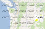
Grid Square DN16
24 locations - McMillan Spring Bluff - Robinette Mtn - Umatilla NF - DN15-16 - Stentz Creek - Field Springs SP - Jerita Road - Lewis Peak - Pullman Cemetery - Kamiak Butte - Big Butte - Endicott Ridge - Moscow Mtn - Hamilton Hill - Table Rock - Random Palouse Hill - Ladow Butte - Teal Camp - Clearwater Lookout - Alder Thicket - Pullman HS - Pullman HS - Cottonwood Butte - Clarkia
Potential VHF rover sites in Washington and Idaho grid DN16.
DN16 dimensions are 95.2 by 69.2 miles.
Explore this grid in Google Earth or equivalent:
McMillan Spring Bluff, DN16ic85
| 46.106337, -117.263803 |
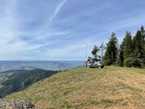
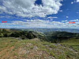
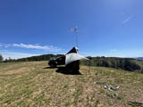
McMillan Spring Bluff is on the eastern edge of the Umatilla National Fores very near the Washington-Idaho border. This is a high point with open horizon, few trees and good privacy. I did not see anyone the entire 4-day visit.
There are a few established camp sites here though they looked unused for quite awhile. The ground is rocky and reasonably level.
The horizon is open from east through south-west. Other directions are acceptable as well with a couple of buttes to the NE posing a bit of an obstacle. The ledge drops approx 2,000 ft into the beautiful valley below. I was able to park the antenna within 10 ft or so of the drop with no issues. One thing to be aware of; while I was there the prevailing wind was from the valley (SE to NW) and was ferocious.
If your inclined to explore, the map indicates several other potential sites, including official NF campgrounds a little further down the road.
Driving directions: Follow West Mountain Road out of Anatone WA to the National Forest boundry. Stay on Forest Road 4304 for approximately 1 mile then left on the site access turn off. It's an easy drive down the NF gravel road to the turn off, then 100 yards up a rocky track to a large, flat location along the steep ridge.
Restrictions: Washington State Parks pass is required.
A high clearance vehicle is recommended for the final short drive up to the site.
Robinette Mtn, DN16ad78
| 46.158391, -117.936530 |
James K7KQA used this spot to work Jim KO9A, providing him the last QSO needed for FFMA. Watch the YouTube video KO9A FFMA DN16 - K7KQA after the event.
Restrictions: This is private land. Get permission from the landowner.
Umatilla NF, DN16cf63
| 46.222800, -117.781200 |
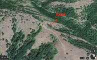
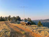
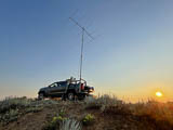
Ed N7PHY: This trip was activate rare grid square DN16 for 6 meter FFMA grid chasers. My plan was to drive, setup, and operate on Friday, July 9th, 2021 with the option to stay overnight and work meteor scatter in the morning before returning home.
The drive to the national forest entrance outside Dayton WA is about 5.5 hours from home in Edmonds. I had scoped out a very promising operating position at 4600 ft elevation, just a mile inside the forest boundary. However, I found the forest closed due to wild fires and fire fighting activities. With time wasting I scrambled to find an alternate location, settling on a side road into the forest used for 4x4/motorcycle riding (I think). It was a compromise but the easterly view was acceptable.
My rover setup is mostly self-contained or attached to my truck so setup doesn't take too long. About 45 minutes to be on the air.
I parked the truck within 3 feet of the easterly downward slope to the valley below at an elevation was 4407 ft. Everything poised for decent run on 6 meters.
Operation started around 1:30 pm and I was surprised to hear... nothing. A quick check of the equipment didn't reveal anything. Thankfully, Barry K7BWH was online with the VHF group and reported we hadn't much band opening yet. Nevertheless, I started calling on FT8 at 50.313 and began picking up stations at single hop distance. Several hours later the band did open somewhat to the southeast and I was able to make a fair amount of contacts. Highlight might be the successful Q65 contacts. There's an example picture with K6UM who needed the grid. (note the settings, seem to be the preferred)
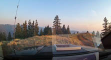
Finally, despite some infiltration of forest fire smoke I had decided to camp the night and work some meteor scatter in the morning before heading home. About an hour after darkness fell, the wind picked up and brought with it very dense, hot, ash laden smoke. I tried pulling the station cables and sealing up the truck but couldn't filter out enough of the smoke to breathe (or see) properly.
For reference, there's a photo out my front windshield showing increased smoke throughout the day.
Considering the worsening conditions and limited egress options I made the painful decision to pull out. Once out of the smoke zone, I drove on traffic-free highways arriving home around 5 am.
Total Contacts: 100 (91 in USA, 9 in Mexico)
Total Grids Contacted: 53
Total States/Provinces: 14
73, Ed N7PHY
DN15-16, DN16ga20
| 46.000000, -117.480208 |
This DN15-16 grid line is a great spot with horizon. Not an easy spot to get to by any means but WELL worth the gridline.
Driving directions: East from 129 is doable, best route in/out are via Troy, OR.
I liked South better then coming in from the east.
WAY too easy to get lost otherwise.
South was about 3 or 4 turns down to Troy where I got
directions to Elgin/Tollgate via more FS roads. (about 50 miles)
I passed Sprent Springs on my way up via NF40 before I got
turned around, it's one of the recent Rex additions to these pages,
a nice spot for a DN16 activation and easy access.
Restrictions: Best routes in/out are via Troy, OR.
FS roads north from this spot were awful; probably not passable until late July.
North from NF40 is a no go, East from 129 is doable, best was in/out via Troy.
Operate from the road itself; land on both sides is private property.
Stentz Creek, DN16ff05
| 46.231131, -117.580806 |
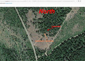
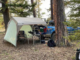
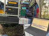
Stentz Creek is one of many possible high points in the wild scenic hills of the Umatilla National Forest which is in the Blue Mountains of southeast Washington and northeast Oregon.
This campsite is a roadside (not official) but established campsite encompassing more than an acre of space. Some nice big trees but also open field. Except for trees, it seemed we had 360 view (downward sloping ground in all directions).
Watch for wildlife. A highlight was a wild turkey wandering through our camp.
- Ed N7PHY
Driving directions: Turn south from Pomeroy onto Hwy 128 and go about 15 miles.
Road conditions are favorable. Maintained gravel road with a few potholes and wash board. Easily accomplished in a Subaru or other car with a bit of ground clearance.
Here's a dashcam video of driving through the forest from Pomeroy to campsite.
https://youtu.be/GBiDeJ1EifQ
It's 19 minutes (real time) from entrance to the camp site.
(I know, it's boring but shows road conditions in April 2021.)
Restrictions: This is far from civilization. Come prepared.
Field Springs SP, DN16jb88
| 46.075777, -117.175157 |
Fields Spring State Park is an 825-acre forested camping park in the Blue mountains of southeastern Washington. The park is open year round and is a 45-minute drive south of Lewiston-Clarkston. this spot looks to be easier to reach than places in the Umatilla Nat'l Forest and offers nice camping facilities.
There are some commercial antennas at the top of the peak.
Driving directions:
Fields Spring State Park
992 Park Road, Anatone, WA 99401
ph 509-256-3332
From Lewiston-Clarkston, drive south on Hwy 129 through Asotin, Theon and Anatone.
Restrictions: Discover Pass required
Jerita Road, DN16br56
| 46.735330, -117.871510 |
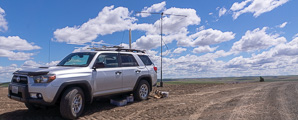
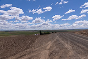
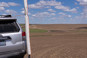
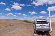
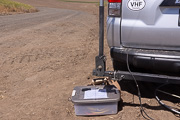
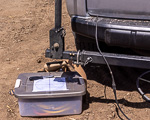
I'm looking for a spot in DN16 that is as close as possible to Seattle (CN87). There's not much out in the northwest corner of DN16; this might possibly qualify. The area is pretty flat and fully farmed wheatland and there're no peaks, parks, people or peppermint and such. This particular spot has a good horizon but I had trouble raising people in Seattle but then again my main contact back home was pointing the wrong way.
Restrictions: Find a spot by the side of the road.
Lewis Peak, DN16ab04
| 46.061581, -117.998241 |
Pretty much due east from Walla Walla in the Blue Moutains, right on the grid line of of DN06-DN16 and about six miles from the grid corner and the Oregon border. This would be an excellent stop while for circling DN06-DN16-DN05-DN15.
There are some antennas on this peak, including the Lewis Peak Repeater (146.96 MHz, -offset, PL100) maintained by Jeff AL1Q.
Pullman Cemetery, DN16jr90
| 46.709241, -117.172630 |
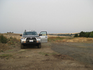
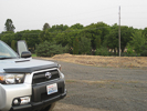
The cemetery is an isolated high spot on the south edge of Pullman, behind the Walmart center. It looks to be free of any radio towers or other noise sources. It should be good -- but it isn't. There was a severe 2m noise generator exactly in the direction of Seattle.
Restrictions: Open dawn to dusk.
Kamiak Butte, DN16ku18
| 46.870100, -117.153200 |
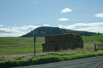
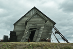
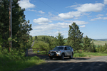
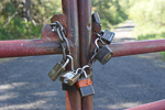
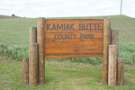
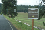
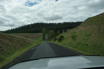
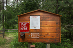
The peak of Kamiak Butte is only accessible with a key for one of the many padlocks on the gate. It has several radio installations along the west end of the ridge.
The State Park is lovely but parking and picnicking areas are far below the summit. You can hike up to the peak along nice trails in the forest, but only non-vehicle traffic is allowed up there.
Driving directions: On Hwy 27 about 3 miles south of Palouse WA (12 miles north of Pullman).
Restrictions: No vehicles on peak.
Big Butte, DN16jc07
| 46.115500, -117.249600 |

The lookout is used after lightning storms for fire detection. There is a gate on the road to the tower about 1/4 mile from the top which may be closed. There is absolutely no view from the ground due to trees.
Driving directions: From Pomeroy take Forest Road 40 to Road 43 to Road 4304 to Big Butte.
- This route stays high much of the way through the Umatilla National Forest, in the 5000-6200' range.
- It also passes by two Forest Service rental cabins, one at Clearwater Lookout and one at Wenatchee Guard Station.
- Contact the Pomeroy Ranger District regarding those. Big Butte is not available for rent.
Endicott Ridge, DN16ex02
| 46.968200, -117.660100 |
This is a better location than it looks with excellent exposure in all directions.
Driving directions: Southwest of Colfax on Highway 26, just before the fairgrounds turn north towards Endicott on Endicott road.
- Go 16 miles to Endicott.
- Go right on the Endicott-St. Johns Highway just before the school.
- Go one short block, then turn left on the Endicott-St. Johns Highway going north.
- Go 2.3 miles and turn left on Grove Road. This is a good gravel road winding up to a high knoll.
- Go to the top of the hill 4/10 of a mile from the main road.
- Just past of the top of the hill you can get to higher ground by pulling off the road onto a wheat field.
Moscow Mtn, DN16nt93
| 46.804613, -116.839557 |
August 2001 update, DE KF7CN: There used to be a fire watch tower up there long ago. K7TM did a short operation up there a year ago and found it to be a good location. I did field day in 1986 up there and we were only chased off the mountain by lightning twice that weekend! We were in a Nissan Xterra and still had to be very careful on some of the water bars near the top. The gates roads all close at 3 PM now. I didn't notice if the lookout location was gated or not. It didn't used to be. But then none of Moscow Mountain used to be gated.
The bluff has a great shot in all directions except directly at Spokane; the operating location is shielded by the peak. However, Spokane is less than 90 miles away and it does cause too much problems. Paths toward Seattle are slightly shielded but still workable.
Driving directions: Come in from the Troy, Idaho side of the hill past the old ski area.
Hamilton Hill, DN16is17
| 46.780260, -117.322000 |
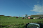
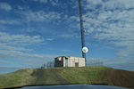
Cell phone tower 7 miles south of Colfax on Highway 195.
Good exposure in all directions. Line of sight to Steptoe Butte. The little knob of a hill is tiny and the driveway does not fully encircle the installation. The last 20 yeards was very steep with dropoffs. No room to turn around; you must back down. Lots of RF and it was radio noisy on 2m.
Driving directions: Seven miles south of Colfax, go right on Hamilton Hill Road for 1.25 miles.
- Go left on Bar Road 1/4 mile to cell site.
Table Rock, DN16ba07
| 46.030700, -117.910400 |
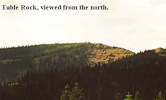
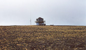
Forest Service Lookout about 19 miles east of Walla Walla, WA.
Broad, relatively flat and treeless summit. Clear shots in all directions except northeast. This is on the western edge of the Blue Mountains with nothing but rolling sagebrush hills and farmland toward the west. Probably a really good shot toward Portland down the Columbia from here.
Lookout is staffed in the summer, might want to check ahead with FS, the lookout on duty probably won't appreciate company for a whole weekend. I didn't take the road from Walla Walla. The route from the north via Dayton was full of potholes the last couple of miles.
Driving directions: Not clearly labeled on the map, it's 3/4 mile west of Squaw Peak.
Random Palouse Hill, DN16iw59
| 46.954167, -117.289000 |
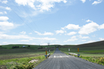
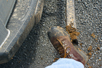
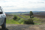
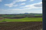
I stopped here on my way back from Steptoe Butte during the June 2012 VHF contest. There is nothing special about this spot except it's slightly above average terrain and easy to reach from main roads. I was short on time and needed to make a few contacts from DN16 to grab some multiplier points. Although Ladow Butte is a far better location, recent weather made all the farm access roads very muddy, and I didn't want to take chances.
In the first photo, my hilltop is seen in the distance just around the bend. In the second photo, I'm scraping tons of mud off my boots after being on the air.
A local farmer drove out on his ATV with his two dogs to see what I was doing. A nice, socialable guy with a Technician's license himself. I gave him my QSL card and encouraged him to get some gear and get on the air. He said I was parked on a county road and so nobody would complain about my using the spot.
Ladow Butte, DN16lx28
| 46.992115, -117.064336 |
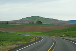
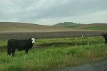
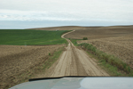
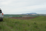
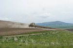
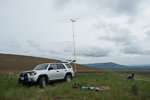
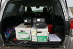
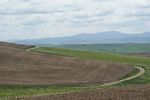
I scouted a hundred miles of dirt roads this weekend to find a good hilltop near Pullman. Ladow Butte is the best hilltop without hiking. Unfortunately there is no road to the top, but this level outcropping provides a very convenient and level place to pull aside. If there is rain or snow, do not attempt this soft dirt road. Two of the local farmers stopped by to find out what I was doing. This spot is far from Seattle; the Idaho border is but a mile away.
I made five contacts on 2-meters (CN79, CN85, CN87) and four contacts on 6-meters (CN87, DN13, DN17). This is remote! Signal strengths were very low. I was hoping to provide DN16 to more people; extra people joined the Sunday morning net trying to work me.
I like this location and it was successful, but there is probably a DN16 hilltop spot fifty miles closer with better propagation to Seattle and Portland.
Teal Camp, DN16fe15
| 46.188167, -117.573500 |
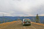
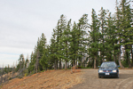
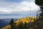
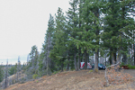
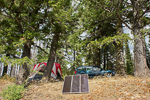
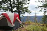
Teal Camp in the Umatilla National Forest is an excellent spot for hilltopping. It offers a bathroom, firepit, picnic tables, 12 campsites and excellent exposure. It's quiet, secluded, scenic and has good trees for dipoles. Most other campers will be hunters or ATV riders. Be sure to bring your Discover Pass for Washington Parks.
I spent two comfortable nights here in Sept 2011 during the Washington State QSO Party (aka Salmon Run). This is remote - Teal Camp has the least background noise on the radio of any place I've been. It requires an hour of dirt road travel south of Pomeroy.
Photos above: My dipole (G5RV) ran approximately parallel to the spit of land poking out toward the valley, for HF coverage E and SE. The 2-meter beam on a 20' mast is pointed NE toward Seattle.
Clearwater Lookout, DN16fe08
| 46.203105, -117.575068 |
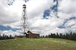
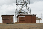
Lookout towers are often placed on the highest point around, always a good landmark for your searches. I noticed this lookout in Google Earth while skimming through the almost-unpopulated Garfield County. It looks good but Teal Campground one mile further along is a much better spot for camping and offers the same altitude, better trees, picnic tables and better views.
There might be a rental cabin available on site, see recreation.gov. There is an outhouse but no water or other services. Contact the Pomeroy Ranger District at 509-843-1891. As of 9-14-2011 the cabin is closed waiting for work completion on propane system.
Note this is an active spot during the fire season (summer and fall) and includes a helipad where workers rest and replenish. Stay out of their way; look for a separate clearing near arrival kiosk.
Alder Thicket, DN16fg12
| 46.258633, -117.567400 |
Garfield County is the least populous and most rare county for ham radio in Washington state, with only about 10 resident hams. As of 2000, the population is 2397, making it the least populous in the state. The county has only one city, Pomeroy. The county covers 712 square miles, some of which is the Umatilla National Forest, and is the 7th smallest county by area.
This would be a good spot to operate for the WA State QSO Contest in September.
This campground appears to be at a good height above average terrain near Huckleberry Butte, and is reachable by two-hour drive from Pullman.
Pullman HS, DN16jr89
| 46.746833, -117.181167 |
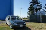
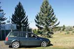
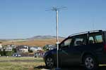
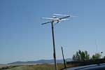
I've tried this spot a few times, and it's poor for radio work. The half-million gallons of water and the busy communication farm causes VHF and UHF noise.
But I'll keep trying spots in this area since I travel here frequently to see relatives, and DN16 is relatively rare.
Pullman HS, DN16jr88
| 46.743200, -117.180000 |

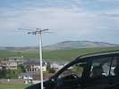
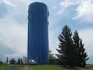

This was a great location for the CQ WW VHF contest on July 16-17, 2011. I parked on the north side of the water tower for good propogation into Spokane (60mi) and Tri-Cities (90mi). Then I parked on the southwest side of the tower for good path into Seattle (200mi)and Portland (300mi).
This was my first VHF contest and provided points and a grid to the people who stuck around on 2m. I have 50 watts 2m SSB and a 3el beam.
I had some nice contacts with K7HPT in two grids; wow he must have done a lot of driving, thanks! Great signal from Dale. I heard a few stations W7GLF, W7MEM, K7SMA, VE7DXG that didn't quite hear me but that was fun and exciting anyway.
I'm new to VHF and just getting equipped and didn't know what to expect. But I didn't really expect 2m to empty out after the first half hour. Did 2m go dead or did everyone abandon it after they thought they worked everyone else? I was disappointed after the first hour to be calling CQ for two more hours with no answer. I was hoping to get lots of Spokane contacts from what seemed like my favorable location 60 miles to their south. And hoping to get someone in the Tri-Cities but, no. It was nice to hear lots of activity when the contest started but then it seemed like nobody wanted to bother with the band. Is this typical? Just curious.
There was a flurry of 2m activity Sunday morning after the PNWVHF weak signal net. That was great fun and I doubled my score.
My hilltop had a water tower bristling with cellphone antennas. This was actually rather handy. In a fit of boredom I used my cellphone and ordered a 6m antenna from HRO for my next contest. I wish I'd planned ahead and borrowed one for this trip.
Operating time 3 hours Saturday and 2 hours Sunday, 2m only, 6 contacts, 5 grids, 60 points.
One nice thing about hilltopping is at least I'm parked in a lovely scenic location!
Cottonwood Butte, DN16sb46
| 46.068296, -116.464696 |
Clarkia, DN16ux79
| 46.999900, -116.269835 |
The city of Clarkia on Hwy 3 is very near the DN16-17 grid line, and makes a good starting point to find a hilltop for VHF operation. Also, this is only about 11 miles wst of the grid corner for DN16-17-26-27.
| < Previous | Page 22 of 25 | Next > |
©1998-2026 Barry Hansen