Rover Location Database
Washington Rover Locations
- WA Map
- WA List
- Select Grid
- WA from CN87
- Rare WA Grids
- WA Counties
- CN76 Long Beach
- CN77 Forks
- CN78 Sekiu
- CN85 Portland
- CN86 Centralia
- CN87 Seattle
- CN88 Belling'm
- CN95 The Dalles
- CN96 Yakima
- CN97 Mt Rainier
- CN98 Mt Baker
- DN05 Pendleton
- DN06 Tri-Cities
- DN07 Moses Lk
- DN08 Okanogan
- DN16 Pullman
- DN17 Spokane
- DN18 Colville
- Add a Place
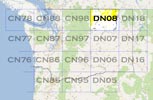
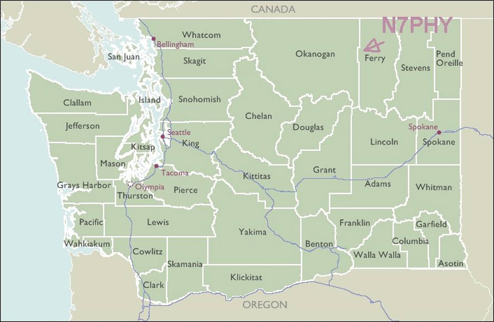
Grid Square DN08
22 locations - Bamber Creek Plateau - Graves Mtn - Storm King NW - Storm King Mtn - Buck Mtn - Loup Loup Ski Bowl - South Ridge - Starvation Mtn - Tunk Mtn - Sherman Pass - Gold Mtn Lookout - Funk Mtn - Goat Mtn - Omak Mtn - Monumental Mtn - Knowlton Knob - Moses Mtn - Parachute Meadows - Sherman Pass - Miller Mtn - Whitestone Ridge - Goat Mtn
Potential VHF rover sites in grid DN08.
DN08 dimensions are 91.6 by 69.2 miles.
Explore this grid in Google Earth or equivalent:
Bamber Creek Plateau, DN08ov50
| 48.877530, -118.785040 |


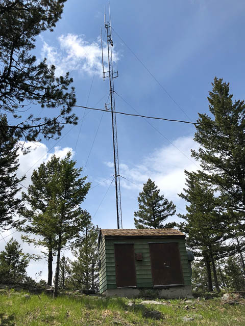
This is the former location of the Curlew Air Force Station in the Colville National Forest, an Air Force radar site operating from May 1950 until December 1960. The demolished buildings have left some large, level areas to setup with good horizon view from NE to South. Cell phone coverage is poor to non-existent.
Driving directions: Access is via gravel NF road 850 which is well maintained until the last 1/4 mile which is fairly rutted. High ground clearance is recommended.
Graves Mtn, DN08tp62
| 48.637153, -118.358681 |
Graves Mtn is an open flat spot with good horizon in all directions. This is BLM land and north of the Colville Indian Reservation.
Driving directions: Take Hwy 20, Sherman Pass Scenic Byway, to (48.61861, -118.3964)
Turn north onto unpaved Graves Mtn Rd.
Turn left at (48.617182, -118.385169) to continue on
Graves Mtn Rd which soon climbs upward.
Continue straight at the intersection at (48.639379, -118.381862)
even though it is the smaller less-travelled side.
Total about 6 miles / 25 minutes from turnoff from Hwy 20 Sherman
Pass Scenic Byway.
Storm King NW, DN08nr99
| 48.749560, -118.835231 |
Here's a spot right on the Ferry County - Okanogan County line, high up in the mountains. It might be a great spot for HF contests involving counties. Scouting is needed.
Restrictions: BLM land. Check on Indian reservation restrictions during the pandemic, and plan your route to avoid the reservation, if needed.
Storm King Mtn, DN08or56
| 48.733388, -118.788222 |
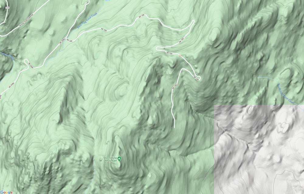
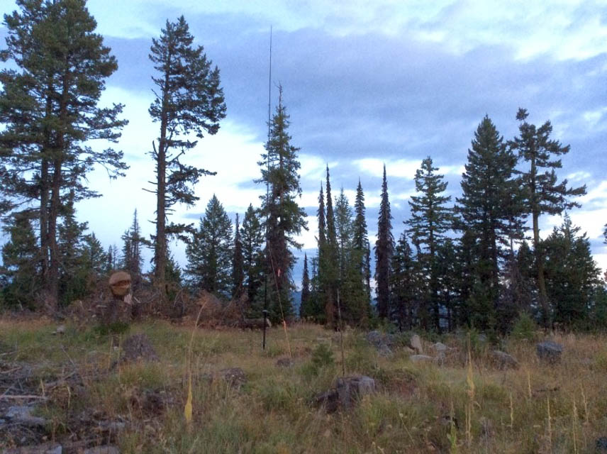
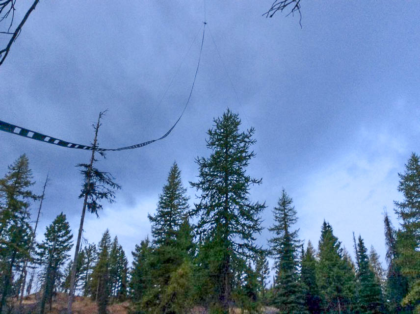
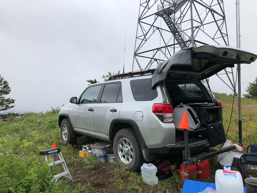
Ed N7PHY reports that Storm King Mountain is a near miss as a quality VHF location. There are small open views to the SE and NW but not the open horizon he was hoping for. He scouted out this nice location on the ridge but unfortunately the peak is inaccessible by vehicle, after hiking up there to be sure. But, there are a thousand other locations to investigate out there.
Buck Mtn, DN08ck14
| 48.436967, -119.824160 |
This summit appears to have some radio towers, so I anticipate some RF issues.
Scouting is needed.
.
Loup Loup Ski Bowl, DN08aj93
| 48.388637, -119.924367 |
A good place to scout: See if you can drive to the top of the chair lift at Loup Loup Ski Bowl.
Satellite photos show a radio tower a little above the lifts. A nice camping area below the ski resort is the Loup Loup Campground. First come, first served, $12/night, opens June 12, 2020, after Coronavirus.
Scouting is needed.
.
South Ridge, DN08bj09
| 48.415073, -119.911023 |
South Ridge is near Loup Loup Ski Bowl and more likely to be ungated than the ski resort. Need to scout a decent operating spot.
Scouting is needed.
.
Starvation Mtn, DN08am66
| 48.528200, -119.942500 |
A former military radar site, 12 miles NE of Twisp, WA.
Nice road all the way from Loup Loup Pass on Hwy 20. Views from the ground are limited but antennas atop towers would clear the obstructing scrubby trees. Nice open areas on top.
Shielded by Granite Mtn (7400') 3 miles southeast and by Old Baldy Mtn (7800') 5 miles north.
Scouting is needed.
.
Driving directions: Take FS 42 north to FS 4235 to summit
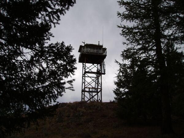
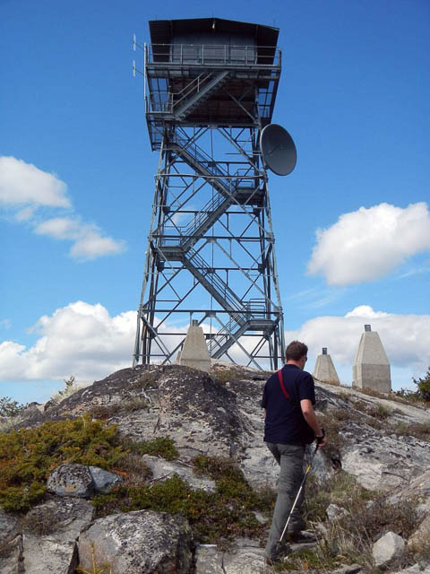
Tunk Mtn, DN08jn11
| 48.546000, -119.236200 |


This is a fire lookout northeast of Omak with fair exposure in most directions. Tunk Mtn is generally in the wilderness about midway between Omak and Republic, WA.
June 2018: Barry K7BWH visited while scouting DN08. He much prefers Gold Mtn lookout nearby which has no radios installed at all, better view of horizon, and a larger and flatter parking area.
June 2006: Mike K7MDL and Eric N7EPD operated from there in the 2006 June VHF contest and found it to be a great spot. Lots of good 6M action up there at the time with good exposure to the south.
June 2003: Lynn N7CFO visited to scope it out for the September VHF contest. He could drive the lookout, but concluded that a camping trailer could not get in. There is a lot of radio gear in the area, so RF could be a problem. There is a tent pad just downhill from the highest point.
Also in that area, Mike K7MDL recommends Mt. Kobau in DN09 just north on Hwy 97 after crossing the BC border at Osoyoos. Mt Kobau is at 6,000ft and offers good all around coverage with an easy drive up.
Driving directions: There are two ways to get into Tunk.
One way is via Riverside (follow the Delorme map, it is pretty easy).
The other way is via Tonasket which is longer, but the roads are a lot better.
- To go via Tonasket, take Highway 20 SE from Tonasket.
- At mile 13 turn right (south) on Aeneas Valley Road (paved).
- Go approximately 2 miles to 3010 road to 3015 road.
- At the intersection of 3015 road and 200 road, turn south on 200 road.
- This intersection is at the 4500' level.
- There is a steep pull for first 1/4 mile after the intersection, but it is not as bad as it looks.
- Take the upper fork through the gate.
Restrictions: Call the BIA (bureau of indian affairs) for road conditions and possible restrictions. Be wary of road washouts.
From a parked vehicle, South is blocked from 150 - 210 degrees.
No toilet. No really good place to park away from existing towers and repeaters.
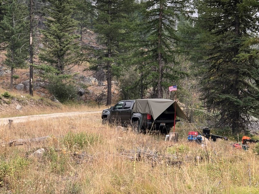
Sherman Pass, DN08so26
| 48.608611, -118.476857 |
Sherman Pass on Hwy 20 milepost 319.5 is the highest pass in the state of WA and it still is in DN08. There is a pulloff with a vault toilet and some flat spots for parking.
Like all mountain passes, some directions are blocked. The east side of the pass is open to the East Coast, good views to the South, points North and West you may have to move around a little.
Get the Sherman Pass road conditions, webcam and weather forecast here.
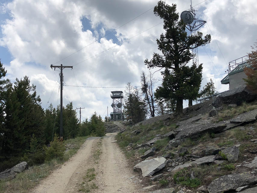
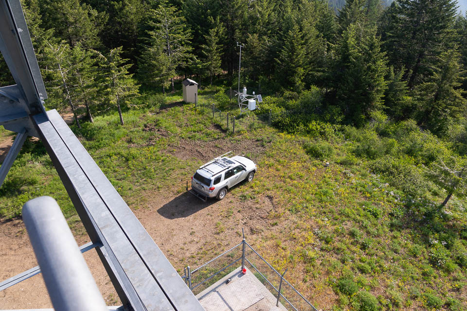
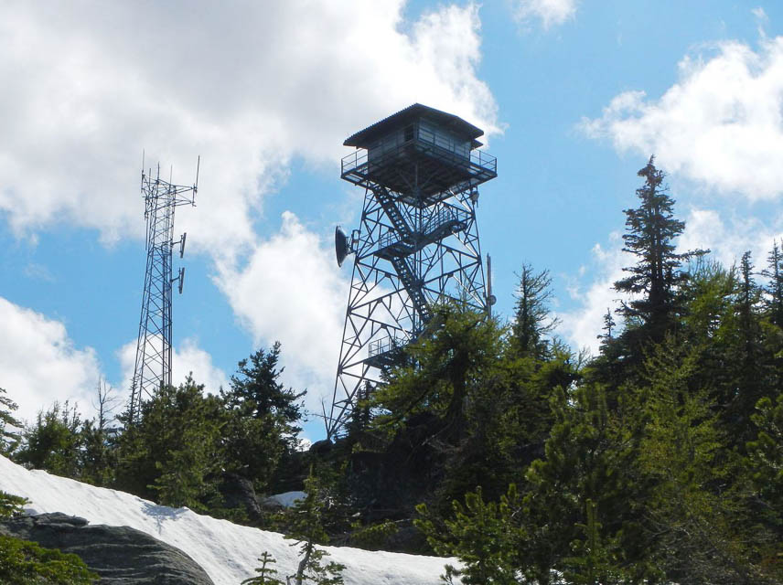
Gold Mtn Lookout, DN08se33
| 48.180734, -118.466845 |


This is a lookout tower in the Colville Indian Reservation. Generally speaking, it's a few miles SSW of Twin lakes on the map.
No cell or other radio towers nearby. Cellphone service is weak here.
The lookout was manned in the 1990s but apparently vacant in 2018.
Barry K7BWH and Rod WE7X operated here in the 2018 June VHF contest. There is not much level parking around the base of the tower but we fit two rovers on opposite sides of the lookout. There is a vault toilet.
Driving directions:
- From Hwy 2 (Bridge Creek Road) the turnoff to Hwy 53 (Wilmont Creek Road) is at 48.24627, -118.49373.
- Follow Wilmont Creek Road for 6.2 miles to the turnoff (48.182787, -118.465214) onto an unpaved access road.
- The access road to the lookout is fairly level since it runs a half mile along a ridge line from the turnoff.
- A sedan can handle this.
Restrictions: Call BIA (bureau of indian affairs) for road conditions and restrictions.
Funk Mtn, DN08do03
| 48.599700, -119.744800 |

Lookout 7 miles north of Conconully
This is a fire lookout with excellent exposure in all directions. It can (as of Sept 2003) be reached with a 2WD pickup truck. There is no radio gear or antennas at this site.
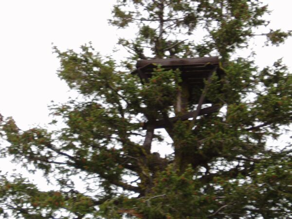
Lynn visited this site in 9/03 to scope it out for the September VHF contest. At that time the road was gated about 1/4 mile from the lookout. At that time the lookout was staffed, so I was able to get into the cab. The view was fantastic, and it would make a great operating location. There is plenty of room in the area at the base of the tower.
The tree platform is the "Old" lookout - per Teresa, the Ranger staffing the lookout, it dates back to the turn of the century. At that time the lookouts camped on top of the hill and periodically climbed the tree to look for fires.
Driving directions: Take Highway 38 NW out of Conconully and turn NE on 3810 road. It is easy to find.
Restrictions: Road is gated. Check to see if lookout is staffed to get access.
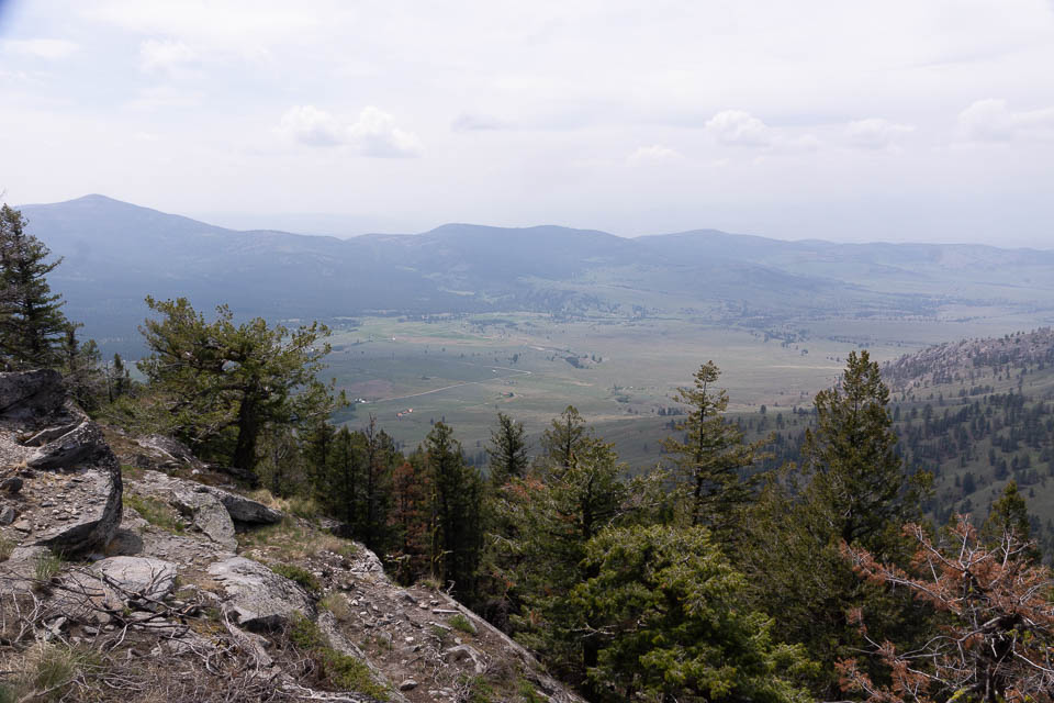
Goat Mtn, DN08aa13
| 48.014748, -119.985564 |

Ed KD7PY (prev. K7WIA) put DN08 on the air in the June 2005 VHF Contest from Goat Mountain. This spot has a clear shot from north through east to south.
He reported no interference from the big transmitter tower.
Driving directions: Goat Mtn is in the SW corner of DN08 on National Forest Road 8140. It's about 2 miles west of Alta Lake State Park and the city of Pateros.
Omak Mtn, DN08ik27
| 48.449132, -119.309028 |

See summitpost.org description.
Omak Mountain (5747 feet) is a broad peak on the east edge of the town of Omak. It is located inside the Colville Indian Reservation. The summit has several small buildings and a cell tower installation owned by Day Wireless. Near the wireless tower is a steel fire lookout tower built in 1986. This fire lookout is still used every summer to detect fires. The original lookout was built in 1935 and might still be present but not on the exact summit. A second lookout made of wood was built in 1968, but is no longer present. The remains of its support blocks can still be seen at the base of the current lookout.
Restrictions: Requires 4WD vehicle.
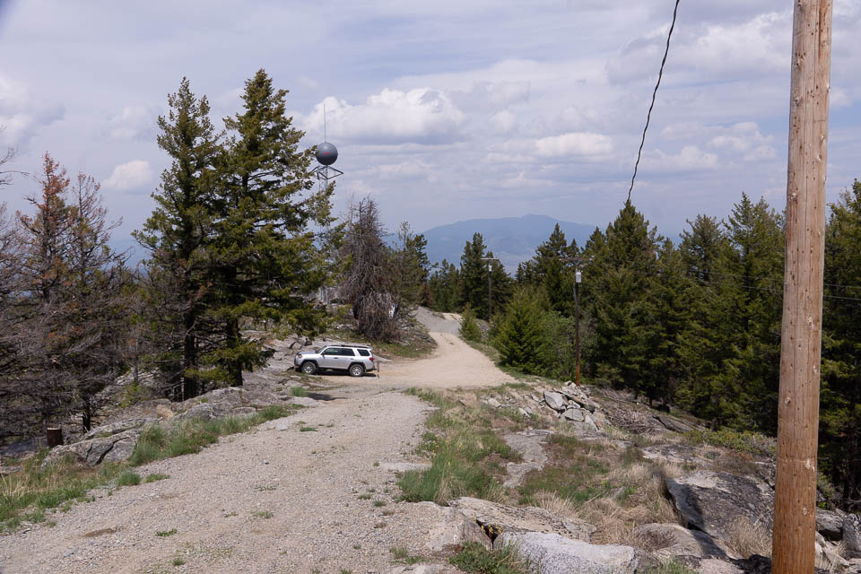
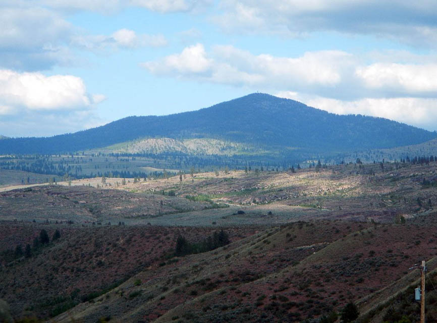
Monumental Mtn, DN08xl17
| 48.490823, -118.066731 |
An easy 45-minute drive peak southwest of Colville, in the northeast corner of DN08.
The last 100 yards to the top is gated (for communications towers), but there are several pullouts on the way up that are still about 5300 feet or higher.
Monumental is an easy drive in any vehicle. You could probably haul a trailer up for some contest operation. Randy's preference is to utilize one of the pullouts as an operating location, versus going all the way to the top (with a key). The interference from the site should be much less, at a reasonable distance from the radio towers.
Driving directions: From Colville take 395 south (from Spokane take 395 north)
- Turn west onto Orin-Rice Road
- Note Orin-Rice Road is smoother than the northern route of Gold Creek Road
- Turn right to stay on Orin-Rice Road
- Turn right onto Monumental Road
- Follow switchbacks to peak
- Find a pullout before the gate
Restrictions: Discover Pass is required.
Knowlton Knob, DN08bd19
| 48.164200, -119.901800 |

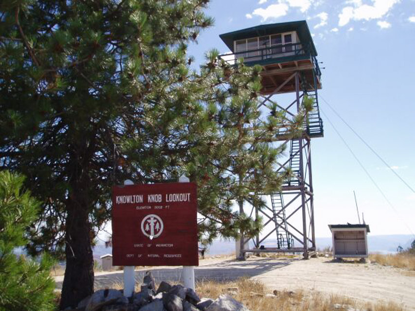

This is a DNR lookout, northwest of Brewster. The lookout is on DNR land, but it is surrounded by private land. Lynn operated the September VHF contest from the ridge just east of the lookout - he was unable to get the trailer up the final hill. I had several visitors while I was there, and they told me that the cattle rancher that owns the land surrounding the lookout often locks the gate on the road during hunting season.
The lookout is well maintained, and even has a pit toilet and a solar shower. There is a lot of room at the base of the tower for setting up equipment, tents, etc.
The route is well marked up from Brewster, right up until just before you reach the locked gate.
Driving directions: From Highway 97 in Brewster, go uphill at the Union 76 station, across from Brewster market place. The road is not marked.
- Cross the railroad tracks and go left at the power substation up Paradise Hill road.
- Go four miles to the end of the pavement.
- Go another two miles to a mailbox stand at the head of the T.
- Go right. Look for Knowlton LO signs. Go about four miles to the cattle pens.
- Look for a DNR sign. Go 200 yards, and then take another left.
- Go 1.8 miles to first Y, go left, then a half mile farther to second Y.
- Go right and then on up to the top.
- The road is passable with any pickup, and does not get steep until the hairpin switchback.
Restrictions:
7/21/2012 Update. Barry K7BWH visited this spot and confirmed it is gated off.
A lame substitute is along Benson Creek Road DN08BE27. But it's not worth the drive.
This is hilly terrain; there must be some good spots but I didn't find any.
8/2/2008 Update. Rex Kamstra visited the area and Gebbers Logging now has the access
road sealed off at the Benson Creek Road, which is the dirt road between Twisp and Brewster.
The gate has all kinds of threatening signs on it and it is locked.
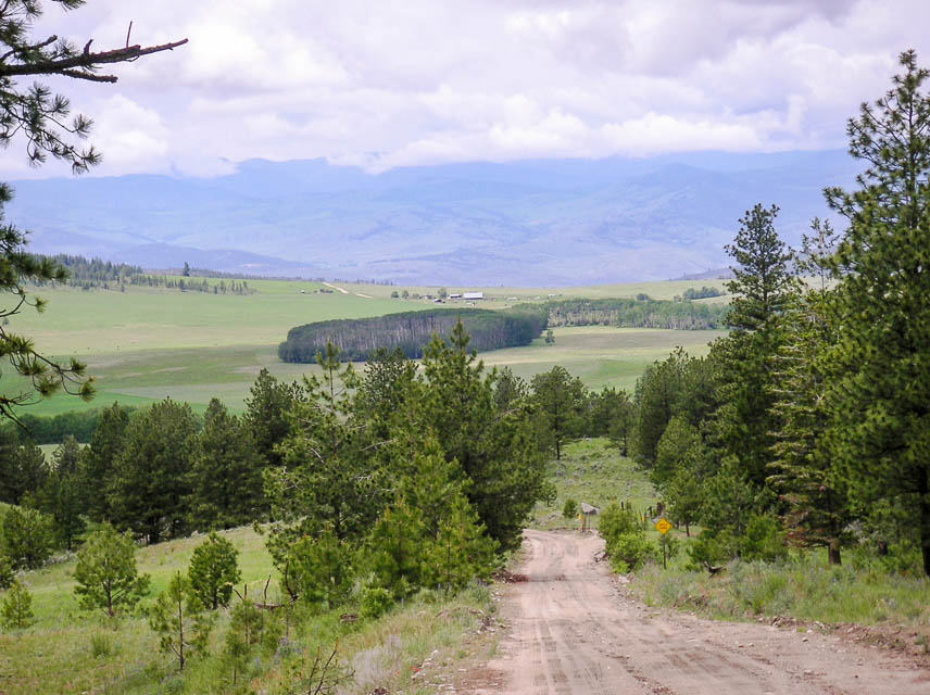
Moses Mtn, DN08li29
| 48.371500, -119.060300 |
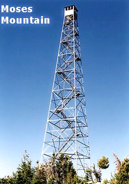
Mountaintop 21 miles east of Omak WA.
Rewarding operating site for those willing to punish your vehicle. Highest point on the Colville Indian Reservation. Abandoned 123' steel lookout tower on the summit (bottom stairs have been removed). Lots of scrubby trees scattered about. No neighboring peaks to interfere.
A few VHF repeaters onsite. Extremely wide-open views east to west toward the south, just miles and miles of flat ground on the horizon. Site is far enough away from the Cascades it should be relatively easy to get a signal over them.
Driving directions: Take Hwy 155 east of Omak to Moses Mountain Road.
- 4WD REQUIRED
- "Road" is really bad the last 1/3 of the way, frequent washed-out switchbacks and huge boulders
- Don't even think about towing anything behind you, you'll be lucky to get your rig up there alone
Restrictions: Four wheel drive really is required.
Parachute Meadows, DN08ar50
| 48.708400, -119.957700 |
High spot back in the brush, NE of Winthrop and west of Tonasket on Forest Road 38.
Lynn visited this site in 2005 while pulling a small 5th wheel trailer. You can get in two ways - from the Loomis/Toats Coulee area or by going north from Winthorp. Both roads are passable with a pickup truck, but are narrow in places. There are several unimproved campgrounds in the area. This area is probably busy during hunting season. Lynn camped near this location and had no trouble working into the Puget Sound area on 432 using a 12 element Yagi.
If you go to this area then you should not go alone - it is extremely isolated. Likewise, if you pull a trailer up these roads a scout car running ahead is a very good idea.
Sherman Pass, DN08so25
| 48.606670, -118.479800 |
Mountain pass about 15 miles east of Republic, WA and 35 miles west of Colville.
Parking is not allowed at the pass. The pass itself is wedged between the rocks. You can park in a small pullout on the west side of the pass on the north side of the road for westerly propagation, or in a big trailhead parking lot on the northeast side of the pass for easterly propagation. North and south probably won't be too good from here with mountains on either side 6800'-7100' high. About a mile to the east of the pass is the Sherman Pass Campground.
Miller Mtn, DN08ua00
| 48.001910, -118.329514 |
Whitestone Ridge and Miller Mountain are in the grid corner near Spokane and several other peaks such as Stensgar, Bare and Jumpoff Joe. This ridge spans the gridline and lends itself well to easily work from both DN08 and DN07. I sure hope it's driveable.
Whitestone Ridge, DN08ra85
| 48.021409, -118.508848 |
Whitestone Ridge and Miller Mountain are in the grid corner near Spokane and several other peaks such as Stensgar, Bare and Jumpoff Joe. This ridge spans the gridline and lends itself well to easily work from both DN08 and DN07. I sure hope it's driveable.
Goat Mtn, DN08aa13
| 48.014748, -119.985564 |
Ed KD7PY (prev. K7WIA) put DN08 on the air in the June 2005 VHF Contest from Goat Mountain. This spot has a clear shot from north through east to south.
He reported no interference from the big transmitter tower.
Driving directions: Goat Mtn is in the SW corner of DN08 on National Forest Road 8140. It's about 2 miles west of Alta Lake State Park and the city of Pateros.
| < Previous | Page 21 of 25 | Next > |
©1998-2026 Barry Hansen