Rover Location Database
Idaho Rover Locations
- Idaho Map
- Idaho List
- Select Grid
- DN44 Yellowstone
- DN43 Rexburg
- DN42 Soda Spr
- DN35 Salmon
- DN34 Lemhi
- DN33 Craters of the Moon
- DN32 Pocatello
- DN27 Flathead
- DN26 Clearwater
- DN25 Nez Perce
- DN24 Salmon
- DN23 Mtn Home
- DN22 Twin Falls
- DN18 Sandpoint
- DN17 Coeur d'Alene
- DN16 Moscow
- DN15 Wallowa
- DN14 McCall
- DN13 Boise
- DN12
- Add a Place
Grid Square DN26
2 locations - Lolo Pass - DN16-DN26 Grid Line
Potential VHF rover sites in grid DN26.
DN26 dimensions are 95.2 by 69.2 miles.
Explore this grid in Google Earth or equivalent:
Lolo Pass, DN26qp71
| 46.631470, -114.604990 |

Lolo Pass is 45 miles south of Missoula, MT. Take Hwy 93 south to Lolo, and turn onto Hwy 12 up to the pass.
Highway 12 from Lolo Pass to Lewiston-Clarkston is one of the most scenic and picturesque mountainous routes in the country. I've ridden this on motorcycle and thrilled to the sign "Curves 99 miles". Every turn highlights a new look at clear streams running over mossy rocks burbling down through narrow valleys framed by lush green forests. Allow time to stop and enjoy it.
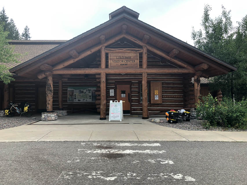
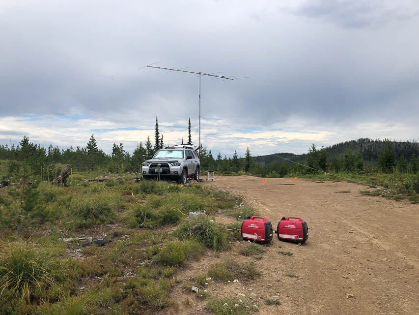
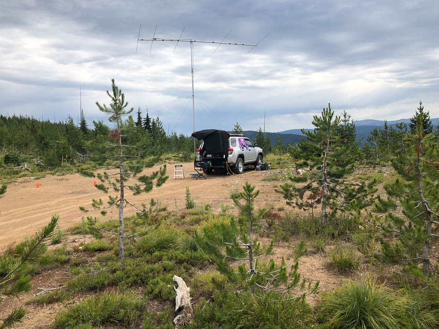
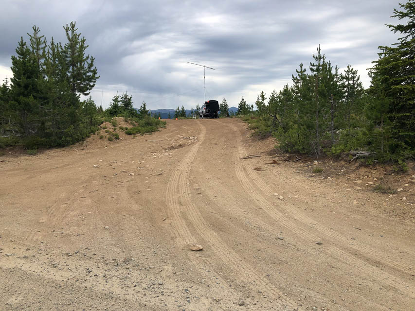
Lolo Pass Visitor Center at 5,225' offers a large parking lot for a quick stop for contacts. Better yet, take the unpaved road west from 100 yards north of the visitor center. It takes you up to the ridge line at 6,180' with open horizons in all directions.
Driving directions: Drive to Lolo Pass visitor center on Hwy 12.
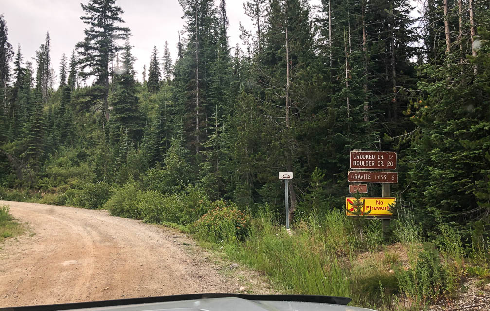
Find the unpaved road leading west, marked by brown sign "Crooked Cr 12"
and "Boulder Cr 20" and "Granite Pass 6" and "FS 595".
This road starts in the Lolo National Forest and travels through
the Nez Perce - Clearwater National Forests.
Restrictions: No cellphone, no internet, no APRS.
Highway 12 is a beautiful, smooth road but this is a very remote
national park area with no services for a hundred miles or more.
DN16-DN26 Grid Line, DN26ac05
| 46.107400, -116.000000 |
| < Previous | Page 12 of 24 | Next > |
©1998-2026 Barry Hansen