Rover Location Database
Idaho Rover Locations
- Idaho Map
- Idaho List
- Select Grid
- DN44 Yellowstone
- DN43 Rexburg
- DN42 Soda Spr
- DN35 Salmon
- DN34 Lemhi
- DN33 Craters of the Moon
- DN32 Pocatello
- DN27 Flathead
- DN26 Clearwater
- DN25 Nez Perce
- DN24 Salmon
- DN23 Mtn Home
- DN22 Twin Falls
- DN18 Sandpoint
- DN17 Coeur d'Alene
- DN16 Moscow
- DN15 Wallowa
- DN14 McCall
- DN13 Boise
- DN12
- Add a Place
Grid Square DN33
10 locations - Hwy 28 and 22 - North Bingham RV Park - Arco Hilltop - Arco Pullout - Howe Peak - Rose Ponds Park - Big Southern Butte - East Butte - Circular Butte - Stevens Peak
Potential VHF rover sites in grid DN33.
DN33 dimensions are 100.3 by 69.2 miles.
Explore this grid in Google Earth or equivalent:
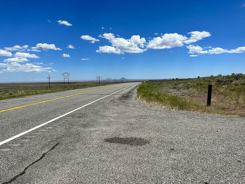
Hwy 28 and 22, DN33px27
| 43.987665, -112.729776 |
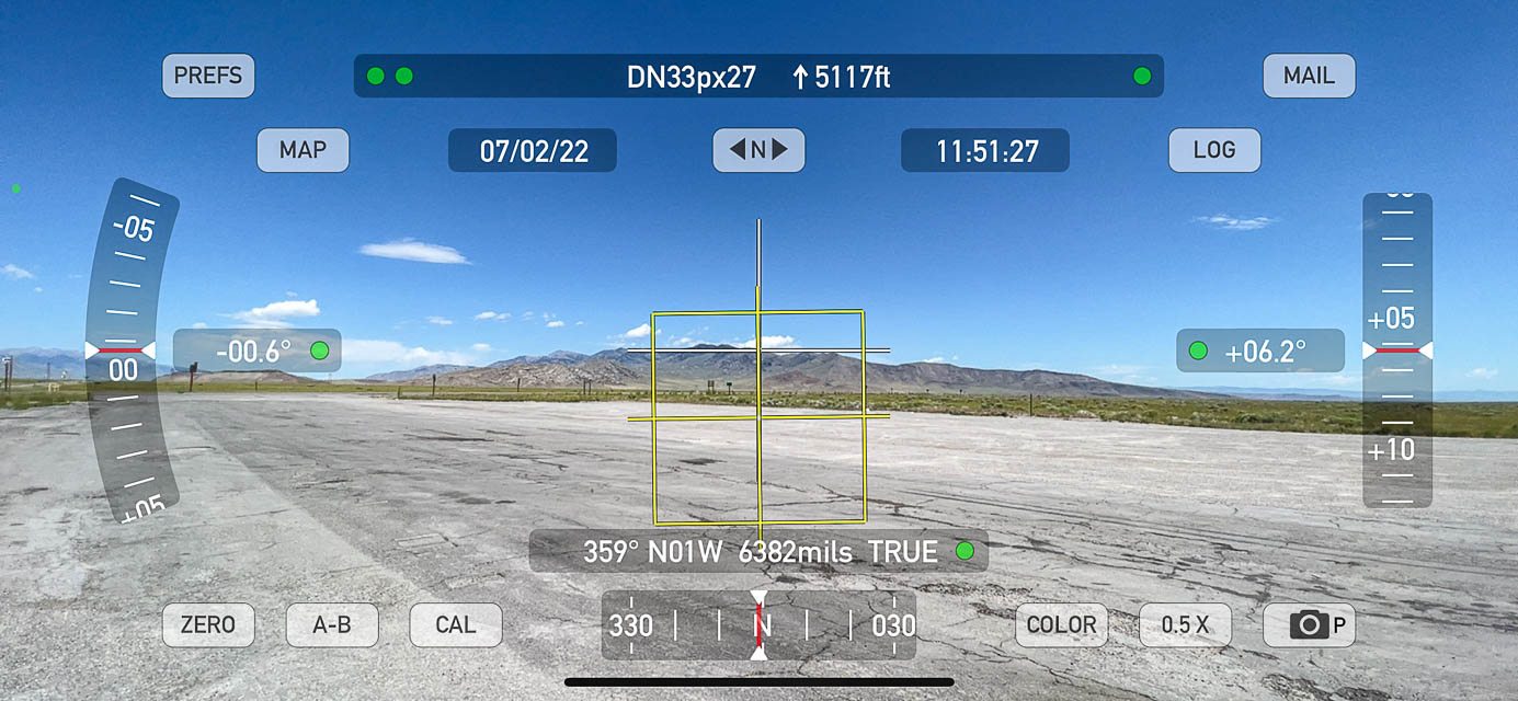
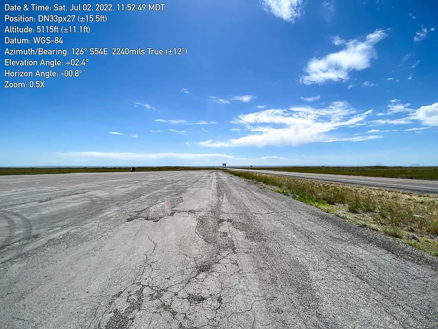
There's a very large apron alongside the intersection of Idaho Hwy 28 and 22, with a nearly-zero horizon to the east and south.
Restrictions: This is a busy and exposed area. No toilet.
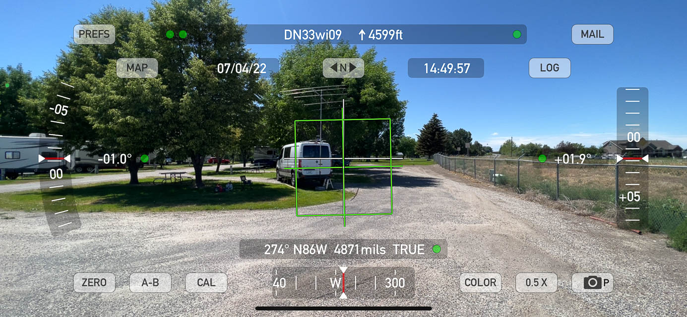
North Bingham RV Park, DN33wi09
| 43.374117, -112.163621 |
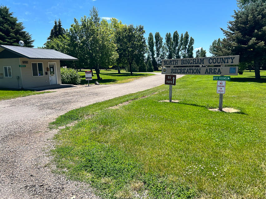


Sometimes we just want a pleasant place with showers to park under the trees for the night. This is a nice clean friendly RV park that's only a mile from Hwy 26, the main road through Shelley, ID.
Propagation on 6m was lousy and there was some background noise, but it was an easy stop and excellent respite from summer heat.
There is a good horizon, only 3-4 degrees in all directions, so it was simply a bad day of propagation.
Restrictions:
The RV plug-in pedestals have only 220v and not 110v. Be sure to bring an adapter if you need 110v, like me.
I had no problem with self-checkin when arriving without a reservation. Be sure to phone the number given and tell them you're a drive-in camper and your slot number.
Arco Hilltop, DN33ko23
| 43.599407, -113.144337 |
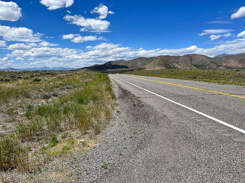
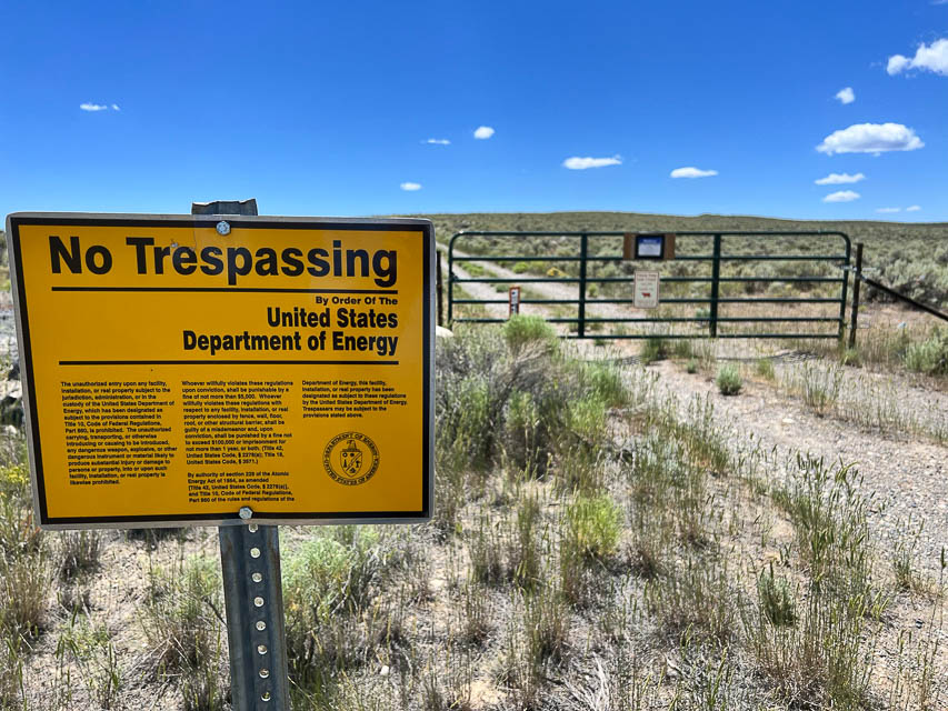
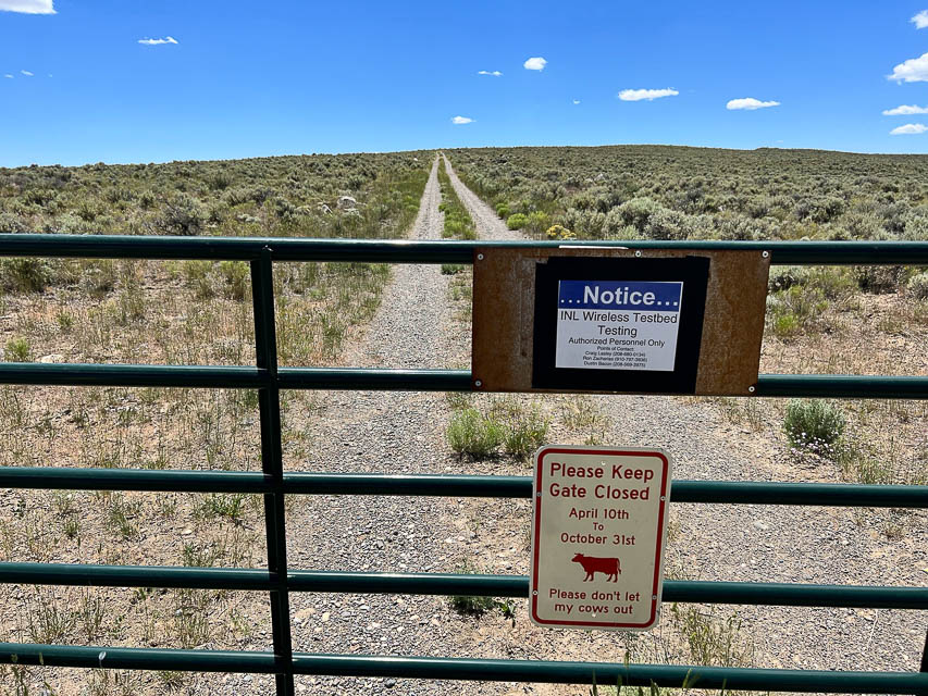
There's a moderate rise along US Hwy 26 on the plains between Arco and Atomic City. It makes a fair pullout for a quick stop along the road, and has a little better horizon than the pullout at DN33kr52.
The path to the hilltop is gated with several warning signs. Too bad, since the terrain looks good for VHF.
Arco Pullout, DN33ko52
| 43.592323, -113.124457 |
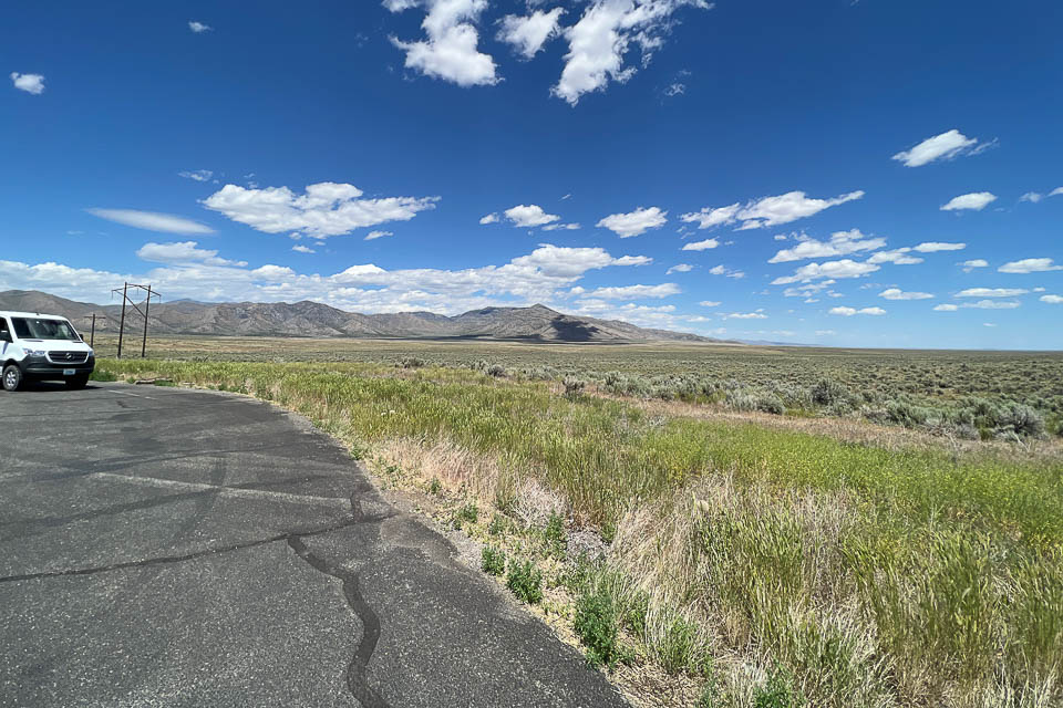
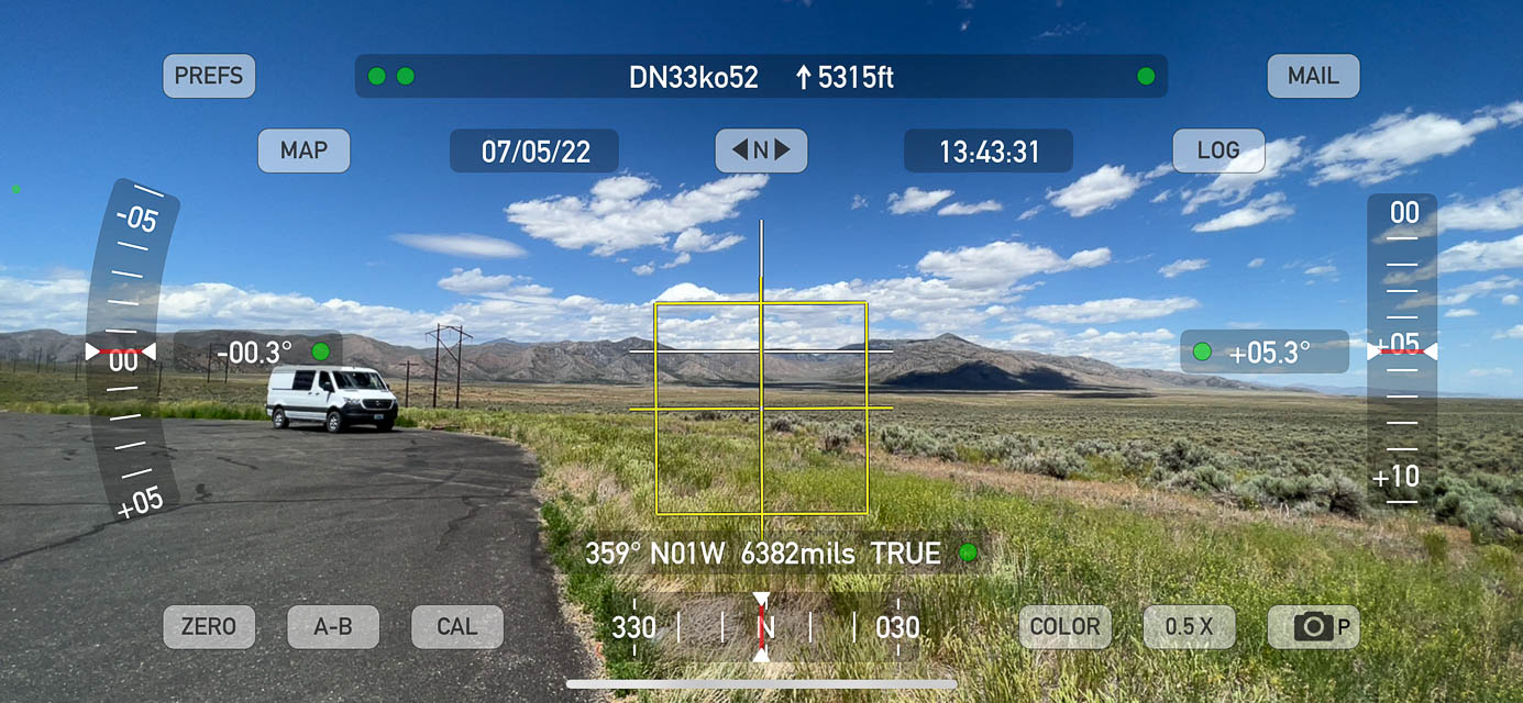
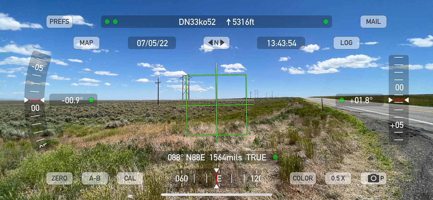

This is a paved wide spot along Hwy 26 on the plains between Arco and Atomic City. It makes the quickest possible pullout for a quick stop along the road. The horizon is +5 degrees in most directions and not as quite as good as the hilltop a half mile west at DN33ko23, but easier to reach.
Restrictions: Nothing here but parking. Actually, nothing anywhere for many miles.
Howe Peak, DN33kr71
| 43.713295, -113.100503 |
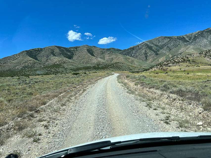
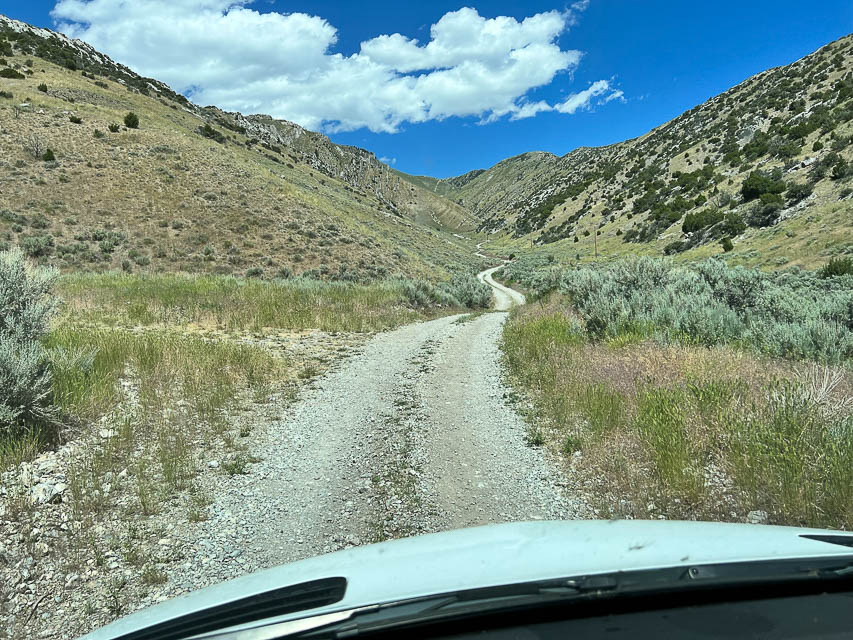
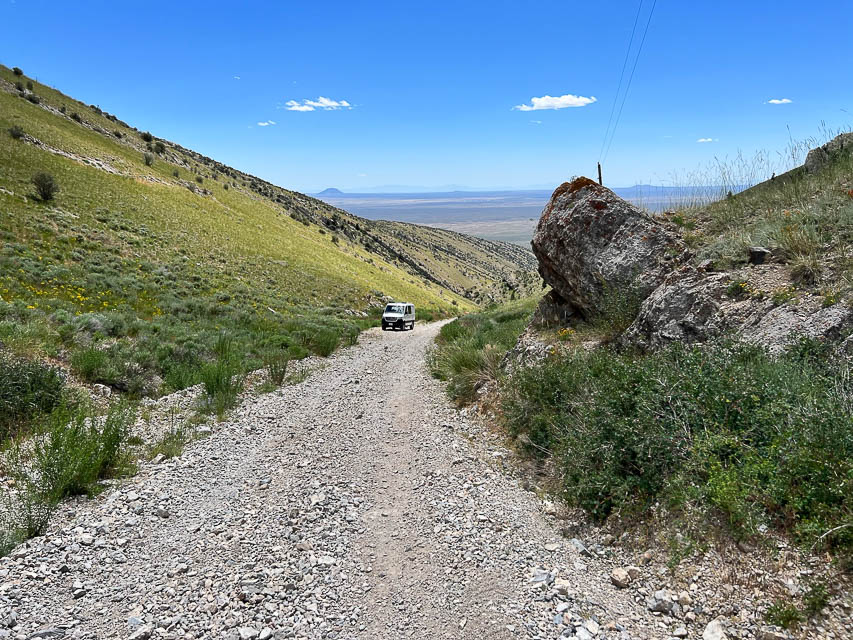
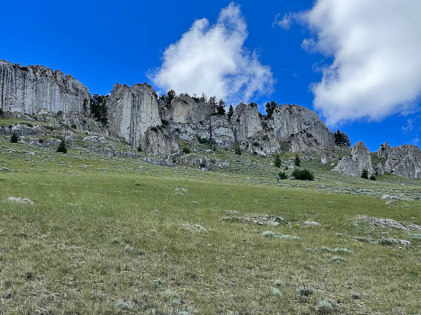
Don't go without 4x4, lockers and high clearance. The route from Hwy 33 (Road 557, aka Right Fork) starts out pleasant and then gets very steep with loose shale. There appears to be three unpaved roads converging on this peak; you should try the other routes.
The rock formations look like dinosaur fins poking straight up from the hillside. These are popular with rock climbers. A couple primitive campsites are available on the way up.
Rose Ponds Park, DN33uf18
| 43.245562, -112.318926 |
Rose Pond Park is right off the I-15 freeway between Pocatello and Idaho Falls.
This is a county-owned park along the Snake River with a 40-acre fishing lake. Open to the public, fishing, swimming, bike/walking path, dispersed camping. Free, no services. Their website is Bingham County Parks and Rec
You can park pretty far from the noisy highway if you want but cellphone service drops to almost nothing. Near the highway, Verizon clocks in at a consistent 24 mbps down/8 up. ATT varied, sometimes 3 down/1 up, other times shot up to 20 down/3 up. Received 40 over-the-air TV stations.
Driving directions: Traveling North on Highway 91, just outside of Blackfoot, turn left at the Oakridge Chevron, then turn right onto Rose Road and follow Rose Road out to the entrance just prior to going over the Interstate overpass.
Restrictions: No services. Five day max stay. Some rough roads but any size rig can access.
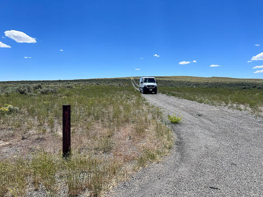
Big Southern Butte, DN33lj75
| 43.396120, -113.022619 |
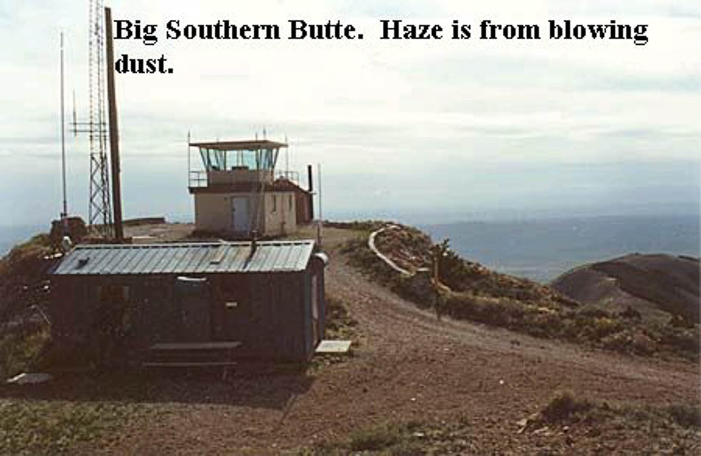
Big Southern is a good 2,000-3,500' above the surrounding sagelands with nothing of comparable height for miles. There are a few repeaters on the summit.
Check ahead with BLM on this. If there is a lookout on duty, they may not appreciate having company for a weekend.
Driving directions:
23 miles SE of Arco ID. In 2003, there was an opened gate at the base of the butte.
DeLorme maps aren't real accurate for this desolate part of Idaho. Access is via Taber Road 1 mile south of Atomic City, with a signed intersection pointing toward the butte. There are two ways to get to the top, but the best I found was staying to the south of the butte, and circling around the west side, dodging potholes the whole way. The road to the top doesn't show on the maps, but it comes up from the northwest side.
East Butte, DN33ql09
| 43.497630, -112.665105 |
This is a prime hilltop that's loaded with commercial radio towers, which is always a dead giveaway of its propagation value. Not sure if it has a good operating spot away from the existing antennas.
Driving directions: Hwy 20 between Arco and Idaho Falls.
Turn south onto Grant Road and follow it to the top.
Circular Butte, DN33qt39
| 43.831032, -112.635245 |
Easy access on dirt road from Hwy 33 near Terreton.
Stevens Peak, DN33ud42
| 43.136691, -112.294787 |
Satellite view seems to show a road up to Stevens Peak.
Driving directions: Drive to Blackfoot (home of the Idaho Potato Museum) and drive southeast on Cromwell Lane to the Equalizing Resevoir. Cross the Blackfoot River and continue straight on dirt roads, turning right to go south under the power lines.
| < Previous | Page 9 of 24 | Next > |
©1998-2026 Barry Hansen