Rover Location Database
Idaho Rover Locations
- Idaho Map
- Idaho List
- Select Grid
- DN44 Yellowstone
- DN43 Rexburg
- DN42 Soda Spr
- DN35 Salmon
- DN34 Lemhi
- DN33 Craters of the Moon
- DN32 Pocatello
- DN27 Flathead
- DN26 Clearwater
- DN25 Nez Perce
- DN24 Salmon
- DN23 Mtn Home
- DN22 Twin Falls
- DN18 Sandpoint
- DN17 Coeur d'Alene
- DN16 Moscow
- DN15 Wallowa
- DN14 McCall
- DN13 Boise
- DN12
- Add a Place
Grid Square DN43
4 locations - Swan Valley - Dalton Hill - Ninemile Knoll - White Owl Butte
Potential VHF rover sites in grid DN43.
DN43 dimensions are 100.3 by 69.2 miles.
Explore this grid in Google Earth or equivalent:
Swan Valley, DN43hk46
| 43.444685, -111.382602 |
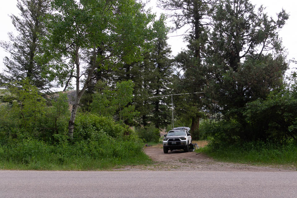
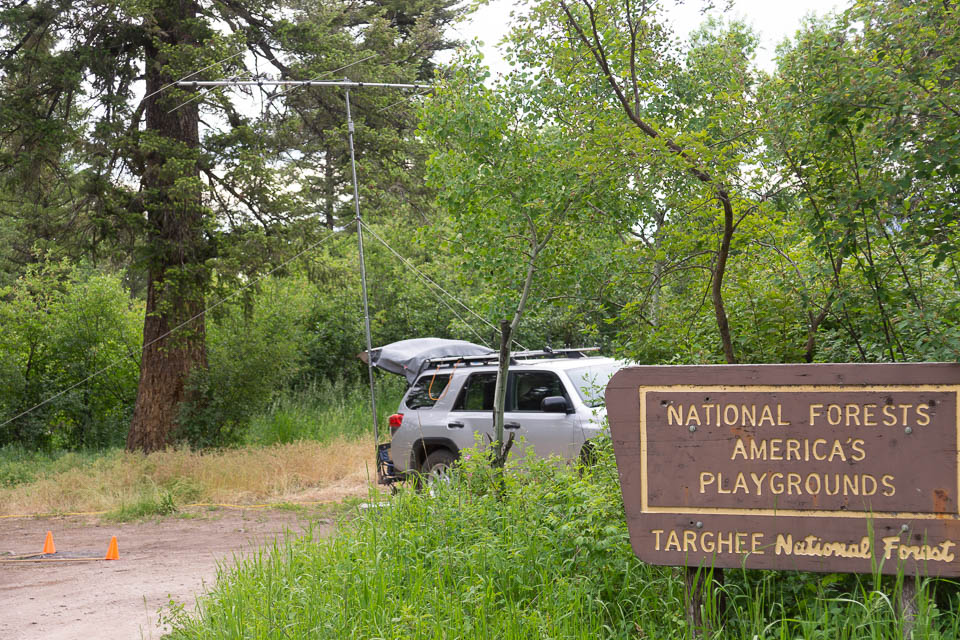

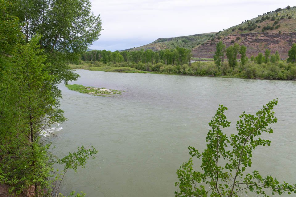
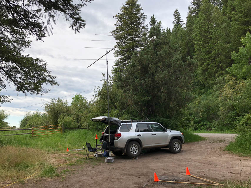
Swan Valley is a town along the Snake River below the big Palisades Dam. This operating spot is in National Park land directly along the river, down in somewhat of a slot canyon where it narrows near this spot. Steep hills on either side might restrict your possibilities but the canyon points NW-to-SE and gave me contacts from Portland to Seattle.
Try using meteor scatter here - it has a good chance of working much better than waiting for 6m skip.
Driving directions: Drive north from the city of Swan Valley on Hwy 26.
Turn left immediately after crossing the bridge at Fall Creek Road.
I took NF-058 and drove a mile to the Targhee National Forest sign on the left.
Also try Fall Creek Road a very short ways west from NF-058. It climbs up the ridge
to a tower and clearing.
Restrictions: This is a busy road; expect lots of traffic as this is the only road that gives access from the south side of the Snake River. The recreation area near the Palisades Dam attracts hunters, fishermen, ATV and horse trailers.
Dalton Hill, DN43fi05
| 43.356707, -111.576290 |
Kepps Crossing Road runs along the top of a good-looking ridge line. This spot is one possible turnout.
Driving directions: NF-077 also known as Skyline Rd, also known as Kepps Crossing Rd.
Drive to Idaho Falls which is on I-15.
Follow S Blvd to E Sunnyside Rd (1.6 mi)
Follow E Sunnyside Rd to Eagle Pass Rd (13.0 mi)
Drive to Kepps Crossing Rd / NF-077 (17.2 mi)
Ninemile Knoll, DN43aw35
| 43.940015, -111.969767 |
It's not much of a hill but looks like a wide open spot with no trees and easy drive far from the mountains, on the satellite view.
White Owl Butte, DN43fs23
| 43.763249, -111.560790 |
Satellite view suggests this is reasonably accessible from White Owl Road.
| < Previous | Page 5 of 24 | Next > |
©1998-2026 Barry Hansen