
Rover Location Database
United States Rover Locations
- Select Grid
- USA
- USA List
- BO Alaska
- BP Alaska
- CM California
- CN Pacific NW
- CO Canada
- DL Mexico
- DM Southwest
- DN Rockies
- DO Canada
- EL Texas Florida
- EM South
- EN Central
- EO Canada
- FM East Coast
- FN Northeast
- FO Canada
- Data Check
Grid Field DN
338 locations - Shotgun Ridge - McMillan Spring Bluff - Bamber Creek Plateau - Coffee Pot Ridge - Twin Lakes - Burke Lake - Beezley Hills Preserve - Booth Hill - Robinette Mtn - Umatilla NF - DN15-16 - Caliche - Stentz Creek - Graves Mtn - Storm King NW - Storm King Mtn - Buck Mtn - Loup Loup Ski Bowl - South Ridge - Starvation Mtn - Tunk Mtn - Sherman Pass - Gold Mtn Lookout - Funk Mtn - Goat Mtn - Omak Mtn - Field Springs SP - Jerita Road - Saddle Mtn Peak - Saddle Mtn Nike - Ritzville - Horse Heaven Hills - Lewis Peak - Pullman Cemetery - Bridge Creek - Peterson Ranch Road - Quincy Rest Stop - Monumental Mtn - Colville Mtn - Lamont Microwave - Kamiak Butte - Big Butte - Endicott Ridge - Moscow Mtn - Hamilton Hill - Table Rock - Knowlton Knob - Moses Mtn - Parachute Meadows - Sherman Pass - I-90 Winchester Wasteway - Calloway Road - Wild Horse Overlook - I-90 Vantage Viewpoint - Sentinel Ridge - Jump Off Joe Butte - Beverly-Burke - Random Palouse Hill - Stensgar Mtn - Monument Hill - Frenchman Hills - Frenchman Hills - Mt Spokane - Miller Mtn - Stensgar Mtn - Near Miller Mtn - Miller Mtn - Whitestone Ridge - Whitestone Ridge - Boyer Mtn - Jumpoff Joe - Bare Mtn - Ladow Butte - Golgotha Butte - Deer Mtn - Old Dominion Mtn - Teal Camp - Clearwater Lookout - Alder Thicket - I-90 Exit 206 - Ritzville - I-90 Sprague Rest Area - Pullman HS - Steptoe Butte - Steptoe Butte - Nine Canyon Road - Pullman HS - Goat Mtn - Umatilla NWR - Cold Springs - Morgan Lake - Akers Butte - Catnip Reservior - Soldier Meadows - UPRR Comm Site - Black Rock - DN01-02 Line - Sled Springs - Weigh Station - Roberts Butte - Bone Springs - North Powder PR - Spanish Peak - Elkhorn Summit - Baker Valley Overlook - Rock Springs Campground - Hart Mtn Refuge - Hot Springs Campground - Ukiah Ridge - Skyview Cemetery - Bacon Ridge - Steens Hwy - Gravel Pit 1 - Rock Quarry - Hwy 95 Gravel Pit - Cow Lakes - Danner Water Tank - Antelope Reservoir - Pharmacy Hill - Gravel Pit 2 - Fifteenmile Reservoir - Hwy 95 Hill - North Blue Mtn - Iron Mtn Rd - Iron Mtn Road - Upper Dam West - Thomas Creek Ridge - Purser Ridge - Juniper Ridge - Juniper Ridge 2 - Grahams Hill - Red Hill - Red Hills - Sand Hills - Calamity Butte - Riddle Mtn - Little Lookout Mtn - Salt Creek Sno-Park - Fish Lake - Steens Rim - Flagstaff Butte - Haskin Butte - Sheep Rock - Kuhn Ridge - Table Mtn - Deadhorse Butte - Cactus Mtn - Grassy Knoll - Hat Point - Sacajawea Spring Camp - Harl Butte - Miller Butte - Skyline Road - Bald Mtn - Dooley Mtn - Big Lookout - Mountain Lookout Road - Meadow Brook Summit - Steens Mountain - Battle Mtn - Pendleton - Juniper Mountain - King Mtn Lookout - Snow Mtn Lookout - Upper Dugout Creek - Thumbtack Resevoir - Cottonwood Mtn - Poison Springs Bluff - Tub Mtn - Dixie Butte - Fall Mountain - Ritter Butte - Table Rock Lookout - Mt Emily - Indian Rock - Emigrant Hill - High Ridge Lookout - White Pine Trough - War Eagle Mtn - Mt Baldy - Hwy 28 and 22 - Lemhi Pass West Viewpoint - Lemhi Pass - Leadore City Park - Birch Creek - Anderson Canyon - North Bingham RV Park - Riverside Campground - DN23-DN24 Line - Arco Hilltop - Arco Pullout - Howe Peak - Rose Ponds Park - Poison Creek Campground - Notch Butte Lookout - Big Southern Butte - Thorn Creek Lookout - Deadwood Lookout - Cottonwood Butte - Black Mtn - Galena Pass - DN21-22 Jackpot - Park Creek - Challis RV Park - McKim Creek - Clover Mtn - Williams Lake - Sula Peak - Woods Creek Pass - Hell's Half Acre - Bare Cone Lookout - Lolo Pass - Lookout Pass - Sunset Peak - China Hat - Blackfoot Reservoir - American Falls Reservoir - Coldwater Hill - Cotterell Rest Area - Bliss Rest Area - Jerome Rest Area - CJ Strike Park - Sunset Mtn Lookout - Mores Creek Summit - Gooding Gravel Pit - Blacks Creek Rest Area - Soda Point - Baldy Mtn - Cow Camp Rd - Threemile Knoll - Windy Point - Hawley Mtn - Danskin Lookout - Trinity Mtn - Bell Mtn - East Butte - Circular Butte - Swan Valley - Dalton Hill - Ninemile Knoll - White Owl Butte - Bennett Mtn South - Sid Butte - Shale Butte - Stevens Peak - Gedney Butte - Pence Butte - Sugar Loaf - Cherry Springs Rd - Dave's Pass - Graham Peak - Horse Butte Rest Area - North Chapin Mtn - Sand Gulch - Canyon Bluff - Samaria Mtns - Lake Walcott SP - Twin Peaks - Sturgill Peak - Hawley Mtn - Hawley Mtn - Sheep Trail Campground - Clarkia - Clarkia - Squaw Butte - Cold Springs - Stanley Estates - Cranbrook Visitor Center - Pulloff 1 - Pulloff 2 - Pulloff 3 - Pulloff 4 - Pulloff 5 - Mt Kobau - Creston Hillside - AW Root Beer - Wolf S3 - DN11-21 Mountain City - DN11-21 Ridge - DN00-DN01 Bottle Creek - Llewellyn Johns Park - Mountain Shadows RV Park - University Mtn - Blue Lake - Goshute Ridge - Coyote Cove - Grindstone Mtn - Ridge Road - Gravel Hill Ridge - Spruce Mtn - Nelson Reservoir - Kremlin Campground - Bootlegger Campground - Fremont Lake Campground - Hershey - Logan Pass - Webb Mtn - Fort Peck RV Park - Big Gumbo - Saddle Butte - Fort Buford DN77-87 - Snowden Bridge - Medicine Lake - Brockton Hilltop - Jack's Spot - Stateline Cove - Theodore Roosevelt Ranch - Lost Trail Ski Area - DN25-35 Line - Orovada - Yellow Peak - Virgin Valley - Bog Hot Springs - Paradise Hill - Hwy 140 Grid Line - DN01-DN11 Grid Line - Water Pipe Ridge - Hwy 226 - Hwy 299 - Arod Lakes - Smoke Ridge - Looking Glass Hill - Mt Lewis - Dead Boat Mtn - Black Rock - Denio Junction - Fox Mtn - Ragged Top Rd - Road 436 - Castle Garden - Fort Peck - Chief Joseph Pass - Sula Peak Lookout - Morell Lookout - DN55-56-65-66 - Sunset Mtn - Point Six - Hwy 20
Potential VHF rover sites in grid DN.
DN dimensions are 1154.9 by 1623.5 miles.
Shotgun Ridge, DN06ad21
| 46.132252, -119.978724 |
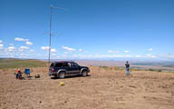
This is a nice spot on township road south of Mabton, WA. Great views of the horizon in nearly all directions. Good path into the Tri-Cities and Hermiston.
We've taken to calling it "shotgun ridge" because during our visit a very nice gentlemen with very large guns was blasting away for target practice.
Driving directions:
From I-82 in Prosser, find your way to Hwy 221 and Horse Heaven Vista.
Continue straight south, turning south onto Beit James Rd
Turn west onto Sellards Rd
Turn west again onto McKinley Springs Rd which becomes township Rd
Look for the gravel pit.
McMillan Spring Bluff, DN16ic85
| 46.106337, -117.263803 |
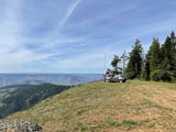
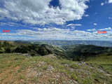
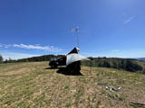
McMillan Spring Bluff is on the eastern edge of the Umatilla National Fores very near the Washington-Idaho border. This is a high point with open horizon, few trees and good privacy. I did not see anyone the entire 4-day visit.
There are a few established camp sites here though they looked unused for quite awhile. The ground is rocky and reasonably level.
The horizon is open from east through south-west. Other directions are acceptable as well with a couple of buttes to the NE posing a bit of an obstacle. The ledge drops approx 2,000 ft into the beautiful valley below. I was able to park the antenna within 10 ft or so of the drop with no issues. One thing to be aware of; while I was there the prevailing wind was from the valley (SE to NW) and was ferocious.
If your inclined to explore, the map indicates several other potential sites, including official NF campgrounds a little further down the road.
Driving directions: Follow West Mountain Road out of Anatone WA to the National Forest boundry. Stay on Forest Road 4304 for approximately 1 mile then left on the site access turn off. It's an easy drive down the NF gravel road to the turn off, then 100 yards up a rocky track to a large, flat location along the steep ridge.
Restrictions: Washington State Parks pass is required.
A high clearance vehicle is recommended for the final short drive up to the site.
Bamber Creek Plateau, DN08ov50
| 48.877530, -118.785040 |
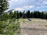
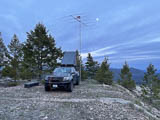
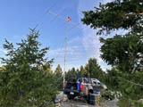
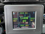
This is the former location of the Curlew Air Force Station in the Colville National Forest, an Air Force radar site operating from May 1950 until December 1960. The demolished buildings have left some large, level areas to setup with good horizon view from NE to South. Cell phone coverage is poor to non-existent.
Driving directions: Access is via gravel NF road 850 which is well maintained until the last 1/4 mile which is fairly rutted. High ground clearance is recommended.
Coffee Pot Ridge, DN07rm56
| 47.527825, -118.537846 |
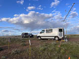
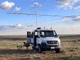
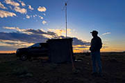
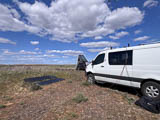
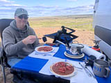

Ed N7PHY and Barry K7BWH visited Coffee Pot Ridge for a shakedown cruise in April 2025.
Read the after-action report here.
Twin Lakes, DN07rm78
| 47.533923, -118.520440 |
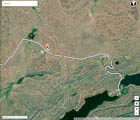
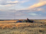

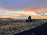
Ed N7PHY visited Twin Lakes Recreation Area for the WA State QSO Party in Sept 2021.
It's open scab-land full of rocks, sage brush, and not much else. We picked a spot that was a compromise between max elevation and walking distance to the vault toilet at the lake that still had great views of the horizon in most directions.
The weather was everything from sunshine to howling wind (~35 mph gusts) and horizontal rain. We normally setup outside under a canopy but had to pull the radio gear into the truck when it got too wild to operate outside. We even disassembled some of the camp to prevent it from blowing away. Did I mention there are no trees nor windbreak?
Restrictions: Tie things down. Tie everything down.
Burke Lake, DN07ad82
| 47.137454, -119.931762 |
Beezley Hills Preserve, DN07ch46
| 47.317267, -119.796005 |
Booth Hill, DN17dn22
| 47.551917, -117.726674 |
Booth Hill is not super tall, but easy access as you come into town by Medical Lake to the west of Spokane. You can park next to the FAA tower. It looks like some sort of old car scrap yard.
Also identified as SOTA peak W7W/WE-035.
Robinette Mtn, DN16ad78
| 46.158391, -117.936530 |
James K7KQA used this spot to work Jim KO9A, providing him the last QSO needed for FFMA. Watch the YouTube video KO9A FFMA DN16 - K7KQA after the event.
Restrictions: This is private land. Get permission from the landowner.
Umatilla NF, DN16cf63
| 46.222800, -117.781200 |
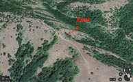
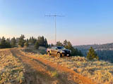
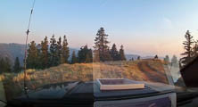
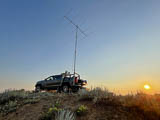
Ed N7PHY: This trip was activate rare grid square DN16 for 6 meter FFMA grid chasers. My plan was to drive, setup, and operate on Friday, July 9th, 2021 with the option to stay overnight and work meteor scatter in the morning before returning home.
The drive to the national forest entrance outside Dayton WA is about 5.5 hours from home in Edmonds. I had scoped out a very promising operating position at 4600 ft elevation, just a mile inside the forest boundary. However, I found the forest closed due to wild fires and fire fighting activities. With time wasting I scrambled to find an alternate location, settling on a side road into the forest used for 4x4/motorcycle riding (I think). It was a compromise but the easterly view was acceptable.
My rover setup is mostly self-contained or attached to my truck so setup doesn't take too long. About 45 minutes to be on the air.
I parked the truck within 3 feet of the easterly downward slope to the valley below at an elevation was 4407 ft. Everything poised for decent run on 6 meters.
Operation started around 1:30 pm and I was surprised to hear... nothing. A quick check of the equipment didn't reveal anything. Thankfully, Barry K7BWH was online with the VHF group and reported we hadn't much band opening yet. Nevertheless, I started calling on FT8 at 50.313 and began picking up stations at single hop distance. Several hours later the band did open somewhat to the southeast and I was able to make a fair amount of contacts. Highlight might be the successful Q65 contacts. There's an example picture with K6UM who needed the grid. (note the settings, seem to be the preferred)
Finally, despite some infiltration of forest fire smoke I had decided to camp the night and work some meteor scatter in the morning before heading home. About an hour after darkness fell, the wind picked up and brought with it very dense, hot, ash laden smoke. I tried pulling the station cables and sealing up the truck but couldn't filter out enough of the smoke to breathe (or see) properly.
For reference, there's a photo out my front windshield showing increased smoke throughout the day.
Considering the worsening conditions and limited egress options I made the painful decision to pull out. Once out of the smoke zone, I drove on traffic-free highways arriving home around 5 am.
Total Contacts: 100 (91 in USA, 9 in Mexico)
Total Grids Contacted: 53
Total States/Provinces: 14
73, Ed N7PHY
DN15-16, DN16ga20
| 46.000000, -117.480208 |
This DN15-16 grid line is a great spot with horizon. Not an easy spot to get to by any means but WELL worth the gridline.
Driving directions: East from 129 is doable, best route in/out are via Troy, OR.
I liked South better then coming in from the east.
WAY too easy to get lost otherwise.
South was about 3 or 4 turns down to Troy where I got
directions to Elgin/Tollgate via more FS roads. (about 50 miles)
I passed Sprent Springs on my way up via NF40 before I got
turned around, it's one of the recent Rex additions to these pages,
a nice spot for a DN16 activation and easy access.
Restrictions: Best routes in/out are via Troy, OR.
FS roads north from this spot were awful; probably not passable until late July.
North from NF40 is a no go, East from 129 is doable, best was in/out via Troy.
Operate from the road itself; land on both sides is private property.
Caliche, DN07aa88
| 47.033854, -119.928472 |
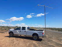
Caliche Lake is right along I-90 in the SW corner of DN07, an easy stop near the Columbia River.
Stentz Creek, DN16ff05
| 46.231131, -117.580806 |
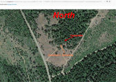
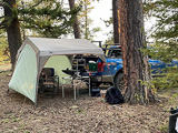
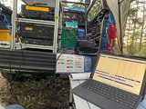
Stentz Creek is one of many possible high points in the wild scenic hills of the Umatilla National Forest which is in the Blue Mountains of southeast Washington and northeast Oregon.
This campsite is a roadside (not official) but established campsite encompassing more than an acre of space. Some nice big trees but also open field. Except for trees, it seemed we had 360 view (downward sloping ground in all directions).
Watch for wildlife. A highlight was a wild turkey wandering through our camp.
- Ed N7PHY
Driving directions: Turn south from Pomeroy onto Hwy 128 and go about 15 miles.
Road conditions are favorable. Maintained gravel road with a few potholes and wash board. Easily accomplished in a Subaru or other car with a bit of ground clearance.
Here's a dashcam video of driving through the forest from Pomeroy to campsite.
https://youtu.be/GBiDeJ1EifQ
It's 19 minutes (real time) from entrance to the camp site.
(I know, it's boring but shows road conditions in April 2021.)
Restrictions: This is far from civilization. Come prepared.
Graves Mtn, DN08tp62
| 48.637153, -118.358681 |
Graves Mtn is an open flat spot with good horizon in all directions. This is BLM land and north of the Colville Indian Reservation.
Driving directions: Take Hwy 20, Sherman Pass Scenic Byway, to (48.61861, -118.3964)
Turn north onto unpaved Graves Mtn Rd.
Turn left at (48.617182, -118.385169) to continue on
Graves Mtn Rd which soon climbs upward.
Continue straight at the intersection at (48.639379, -118.381862)
even though it is the smaller less-travelled side.
Total about 6 miles / 25 minutes from turnoff from Hwy 20 Sherman
Pass Scenic Byway.
Storm King NW, DN08nr99
| 48.749560, -118.835231 |
Here's a spot right on the Ferry County - Okanogan County line, high up in the mountains. It might be a great spot for HF contests involving counties. Scouting is needed.
Restrictions: BLM land. Check on Indian reservation restrictions during the pandemic, and plan your route to avoid the reservation, if needed.
Storm King Mtn, DN08or56
| 48.733388, -118.788222 |
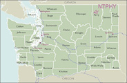
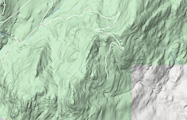
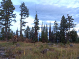
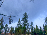
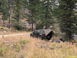
Ed N7PHY reports that Storm King Mountain is a near miss as a quality VHF location. There are small open views to the SE and NW but not the open horizon he was hoping for. He scouted out this nice location on the ridge but unfortunately the peak is inaccessible by vehicle, after hiking up there to be sure. But, there are a thousand other locations to investigate out there.
Buck Mtn, DN08ck14
| 48.436967, -119.824160 |
This summit appears to have some radio towers, so I anticipate some RF issues.
Scouting is needed.
.
Loup Loup Ski Bowl, DN08aj93
| 48.388637, -119.924367 |
A good place to scout: See if you can drive to the top of the chair lift at Loup Loup Ski Bowl.
Satellite photos show a radio tower a little above the lifts. A nice camping area below the ski resort is the Loup Loup Campground. First come, first served, $12/night, opens June 12, 2020, after Coronavirus.
Scouting is needed.
.
South Ridge, DN08bj09
| 48.415073, -119.911023 |
South Ridge is near Loup Loup Ski Bowl and more likely to be ungated than the ski resort. Need to scout a decent operating spot.
Scouting is needed.
.
Starvation Mtn, DN08am66
| 48.528200, -119.942500 |
A former military radar site, 12 miles NE of Twisp, WA.
Nice road all the way from Loup Loup Pass on Hwy 20. Views from the ground are limited but antennas atop towers would clear the obstructing scrubby trees. Nice open areas on top.
Shielded by Granite Mtn (7400') 3 miles southeast and by Old Baldy Mtn (7800') 5 miles north.
Scouting is needed.
.
Driving directions: Take FS 42 north to FS 4235 to summit
Tunk Mtn, DN08jn11
| 48.546000, -119.236200 |
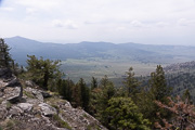
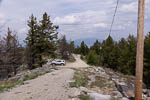


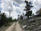
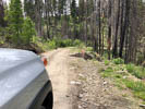
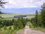
This is a fire lookout northeast of Omak with fair exposure in most directions. Tunk Mtn is generally in the wilderness about midway between Omak and Republic, WA.
June 2018: Barry K7BWH visited while scouting DN08. He much prefers Gold Mtn lookout nearby which has no radios installed at all, better view of horizon, and a larger and flatter parking area.
June 2006: Mike K7MDL and Eric N7EPD operated from there in the 2006 June VHF contest and found it to be a great spot. Lots of good 6M action up there at the time with good exposure to the south.
June 2003: Lynn N7CFO visited to scope it out for the September VHF contest. He could drive the lookout, but concluded that a camping trailer could not get in. There is a lot of radio gear in the area, so RF could be a problem. There is a tent pad just downhill from the highest point.
Also in that area, Mike K7MDL recommends Mt. Kobau in DN09 just north on Hwy 97 after crossing the BC border at Osoyoos. Mt Kobau is at 6,000ft and offers good all around coverage with an easy drive up.
Driving directions: There are two ways to get into Tunk.
One way is via Riverside (follow the Delorme map, it is pretty easy).
The other way is via Tonasket which is longer, but the roads are a lot better.
- To go via Tonasket, take Highway 20 SE from Tonasket.
- At mile 13 turn right (south) on Aeneas Valley Road (paved).
- Go approximately 2 miles to 3010 road to 3015 road.
- At the intersection of 3015 road and 200 road, turn south on 200 road.
- This intersection is at the 4500' level.
- There is a steep pull for first 1/4 mile after the intersection, but it is not as bad as it looks.
- Take the upper fork through the gate.
Restrictions: Call the BIA (bureau of indian affairs) for road conditions and possible restrictions. Be wary of road washouts.
From a parked vehicle, South is blocked from 150 - 210 degrees.
No toilet. No really good place to park away from existing towers and repeaters.
Sherman Pass, DN08so26
| 48.608611, -118.476857 |
Sherman Pass on Hwy 20 milepost 319.5 is the highest pass in the state of WA and it still is in DN08. There is a pulloff with a vault toilet and some flat spots for parking.
Like all mountain passes, some directions are blocked. The east side of the pass is open to the East Coast, good views to the South, points North and West you may have to move around a little.
Get the Sherman Pass road conditions, webcam and weather forecast here.
Gold Mtn Lookout, DN08se33
| 48.180734, -118.466845 |
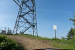
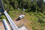

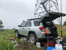
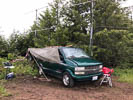
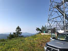
This is a lookout tower in the Colville Indian Reservation. Generally speaking, it's a few miles SSW of Twin lakes on the map.
No cell or other radio towers nearby. Cellphone service is weak here.
The lookout was manned in the 1990s but apparently vacant in 2018.
Barry K7BWH and Rod WE7X operated here in the 2018 June VHF contest. There is not much level parking around the base of the tower but we fit two rovers on opposite sides of the lookout. There is a vault toilet.
Driving directions:
- From Hwy 2 (Bridge Creek Road) the turnoff to Hwy 53 (Wilmont Creek Road) is at 48.24627, -118.49373.
- Follow Wilmont Creek Road for 6.2 miles to the turnoff (48.182787, -118.465214) onto an unpaved access road.
- The access road to the lookout is fairly level since it runs a half mile along a ridge line from the turnoff.
- A sedan can handle this.
Restrictions: Call BIA (bureau of indian affairs) for road conditions and restrictions.
Funk Mtn, DN08do03
| 48.599700, -119.744800 |
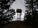
Lookout 7 miles north of Conconully
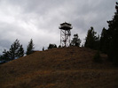
This is a fire lookout with excellent exposure in all directions. It can (as of Sept 2003) be reached with a 2WD pickup truck. There is no radio gear or antennas at this site.
Lynn visited this site in 9/03 to scope it out for the September VHF contest. At that time the road was gated about 1/4 mile from the lookout. At that time the lookout was staffed, so I was able to get into the cab. The view was fantastic, and it would make a great operating location. There is plenty of room in the area at the base of the tower.
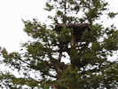
The tree platform is the "Old" lookout - per Teresa, the Ranger staffing the lookout, it dates back to the turn of the century. At that time the lookouts camped on top of the hill and periodically climbed the tree to look for fires.
Driving directions: Take Highway 38 NW out of Conconully and turn NE on 3810 road. It is easy to find.
Restrictions: Road is gated. Check to see if lookout is staffed to get access.
Goat Mtn, DN08aa13
| 48.014748, -119.985564 |
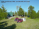
Ed KD7PY (prev. K7WIA) put DN08 on the air in the June 2005 VHF Contest from Goat Mountain. This spot has a clear shot from north through east to south.
He reported no interference from the big transmitter tower.
Driving directions: Goat Mtn is in the SW corner of DN08 on National Forest Road 8140. It's about 2 miles west of Alta Lake State Park and the city of Pateros.
Omak Mtn, DN08ik27
| 48.449132, -119.309028 |
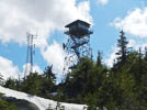


See summitpost.org description.
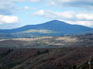
Omak Mountain (5747 feet) is a broad peak on the east edge of the town of Omak. It is located inside the Colville Indian Reservation. The summit has several small buildings and a cell tower installation owned by Day Wireless. Near the wireless tower is a steel fire lookout tower built in 1986. This fire lookout is still used every summer to detect fires. The original lookout was built in 1935 and might still be present but not on the exact summit. A second lookout made of wood was built in 1968, but is no longer present. The remains of its support blocks can still be seen at the base of the current lookout.
Restrictions: Requires 4WD vehicle.
Field Springs SP, DN16jb88
| 46.075777, -117.175157 |
Fields Spring State Park is an 825-acre forested camping park in the Blue mountains of southeastern Washington. The park is open year round and is a 45-minute drive south of Lewiston-Clarkston. this spot looks to be easier to reach than places in the Umatilla Nat'l Forest and offers nice camping facilities.
There are some commercial antennas at the top of the peak.
Driving directions:
Fields Spring State Park
992 Park Road, Anatone, WA 99401
ph 509-256-3332
From Lewiston-Clarkston, drive south on Hwy 129 through Asotin, Theon and Anatone.
Restrictions: Discover Pass required
Jerita Road, DN16br56
| 46.735330, -117.871510 |
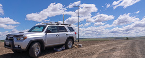
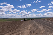
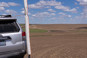
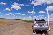
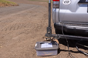
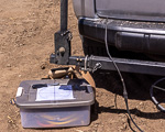
I'm looking for a spot in DN16 that is as close as possible to Seattle (CN87). There's not much out in the northwest corner of DN16; this might possibly qualify. The area is pretty flat and fully farmed wheatland and there're no peaks, parks, people or peppermint and such. This particular spot has a good horizon but I had trouble raising people in Seattle but then again my main contact back home was pointing the wrong way.
Restrictions: Find a spot by the side of the road.
Saddle Mtn Peak, DN06ft33
| 46.806522, -119.558217 |
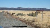
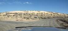
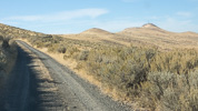
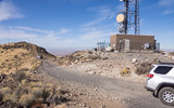
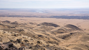
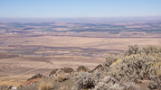
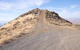
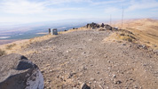
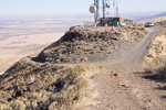
At the peak of Saddle Mountain is a short drive up a steep rise, offering an ideal VHF operating location. The ground drops away steeply in all directions. There are commercial towers a short distance away.
Driving directions:
Use Hwy 24 for an easy drive on 5 miles of mostly-paved roads. Turn left at the "tee" with the sign "Saddle Mtn Overlook" for a narrow dirt road to the peak, or turn right for the nearby DN06gt paved parking.
Hwy 24 comes up from the south side Saddle Mtn range; there is no access from the north, in spite of what Google Maps or GPS routing software might tell you. I explored it thoroughly from Corfu and around the Lower Crab Creek, and it would require a gate key and permission from the company that owns intervening land.
Restrictions: Popular with hunters.
Saddle Mtn Nike, DN06gt60
| 46.792457, -119.448901 |

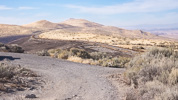
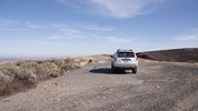
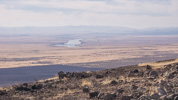
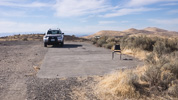
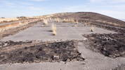
This is a decomissioned Nike missile site with paved road access and a large flat concrete parking apron. The altitude is lower than the DN06gt peak by about 700' but the driving access and camping is much easier.
Driving directions:
Use Hwy 24 for an easy drive on the last 5 miles of mostly-paved roads. Turn right at the sign "Saddle Mtn Overlook, 1 mile" for the Nike site, or left for a narrow dirt road to the peak. Hwy 24 is on the south side Saddle Mtn range; it is not possible to approach from the north side (Othello, Royal City) unless you have a gate key and permission from the company that owns intervening land.
Restrictions: No services. Popular with sightseers.
Ritzville, DN06qx09
| 46.999990, -118.661550 |

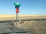
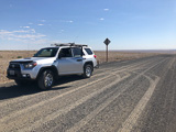
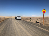
The DN06-DN07 grid line conveniently lies upon this road and local high spot in Eastern Washington, south of Moses Lake and Ritzville. You might be able to find a way to activate both grids from the edge of the road.
Driving directions: Take Hwy 21 from Ritzville to Lind.
Turn off at the unpaved Roloff Rd and Hwy 21 intersection.
Watch your GPS for the exact 47 degrees grid line.
Restrictions: Stay off private land and fields.
Horse Heaven Hills, DN06fg50
| 46.252123, -119.536325 |
McBee Road takes you high above the Yakima/Richland valley. From the I-82 freeway far below you can see the slash cut into the slopes above. It seems like it would be easy to reach as a stop along the way.
Driving directions: From I-82 near the Tri-Cities, take Exit 96.
Drive south on Webber Canyon Road.
Turn right onto N McBee Road.
Drive 4.0 miles, keep right at the top.
Lewis Peak, DN16ab04
| 46.061581, -117.998241 |
Pretty much due east from Walla Walla in the Blue Moutains, right on the grid line of of DN06-DN16 and about six miles from the grid corner and the Oregon border. This would be an excellent stop while for circling DN06-DN16-DN05-DN15.
There are some antennas on this peak, including the Lewis Peak Repeater (146.96 MHz, -offset, PL100) maintained by Jeff AL1Q.
Pullman Cemetery, DN16jr90
| 46.709241, -117.172630 |
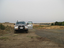
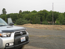
The cemetery is an isolated high spot on the south edge of Pullman, behind the Walmart center. It looks to be free of any radio towers or other noise sources. It should be good -- but it isn't. There was a severe 2m noise generator exactly in the direction of Seattle.
Restrictions: Open dawn to dusk.
Bridge Creek, DN04lx99
| 44.999990, -119.004273 |
Peterson Ranch Road, DN05aw55
| 45.938333, -119.950333 |
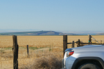
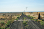
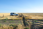
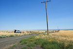
This is a high point among the wheat fields with no obstructions in any direction. There is nothing around taller than a stalk of wheat or fence post. Good paths to W6 and VE7, Midwest, Oregon, all directions.
This spot is radio-quiet with little background noise. However, some arcing noise on 2m gradually built up over the day as temperatures rose to 95F. It can get windy.
This is a nice, quiet location in the northwest corner of DN05. You can see Golgotha Butte DN05au (closed) about 5 miles away toward the southeast. This area has miles of beautiful vineyards and supports many well-known labels: Chateau St Michelle, Mercer, Columbia Crest, etc.
Driving directions: From Hwy 14 along the river, turn north on Alderdale Road.
- Drive past Golgotha Butte a few miles
- Turn left (west) onto Petersen Road
- Drive 1.9 miles to a fence intersection and cattle crossing grate
Restrictions: The fields are signposted "no tresspassing" but this wide turnout on top of the hill has ample space.
Quincy Rest Stop, DN07af55
| 47.232392, -119.956090 |
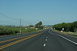
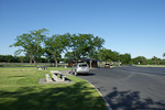
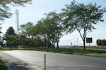
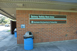
This is a delightful little rest stop on top of a rise above the Columbia River as you drive between Wenatchee and Quincy on Highway 28.
Located in the northwest corner of DN07, this might be a good place for circling the corner. You know it must be good for something with a cellphone tower so near by.
Restrictions: Signpost to limit your stay to 8 hours, no tents, no camps.
It sounds like a great place to spend the night in a car.
Monumental Mtn, DN08xl17
| 48.490823, -118.066731 |
An easy 45-minute drive peak southwest of Colville, in the northeast corner of DN08.
The last 100 yards to the top is gated (for communications towers), but there are several pullouts on the way up that are still about 5300 feet or higher.
Monumental is an easy drive in any vehicle. You could probably haul a trailer up for some contest operation. Randy's preference is to utilize one of the pullouts as an operating location, versus going all the way to the top (with a key). The interference from the site should be much less, at a reasonable distance from the radio towers.
Driving directions: From Colville take 395 south (from Spokane take 395 north)
- Turn west onto Orin-Rice Road
- Note Orin-Rice Road is smoother than the northern route of Gold Creek Road
- Turn right to stay on Orin-Rice Road
- Turn right onto Monumental Road
- Follow switchbacks to peak
- Find a pullout before the gate
Restrictions: Discover Pass is required.
Colville Mtn, DN18bn27
| 48.573700, -117.897200 |
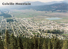
One mile north of Colville, WA.
Site is shielded toward western Washington by higher mountains to the southwest. Might be good toward the northwest into B.C. though.
Colville Mt is only about 3200' high. Also see a better location nearby, DN08 Monumental Mt at 5300'.
Driving directions: Follow Main Street uphill north out of town, up the west side of the mountain
- When the rise tops out, turn right uphill on the narrow dirt road
- Follow switchbacks up the southwest face of the mountain
- You can access the giant letter "C" and cross visible from town that's on the upper south slope
- From here you get a clear shot south down the valley toward Spokane
- The road continues up to the summit where there's a cluster of radio towers
Lamont Microwave, DN17be25
| 47.188083, -117.897167 |
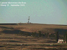
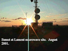
Microwave tower site southeast of the town of Lamont on Highway 23. Turnoff from I-90 at Sprague.
It is easy to get to from hiway 23 and offers good exposure in all directions. There is a large microwave installation there, but it is easy to move around to get the path you want. RF does not seem to be a problem.
June 12, 2002 update! KF7CN attempted to get to this site during the June VHF contest and found that they had installed a gate about 100 yards from the top.
Driving directions: Go to Lamont on Highway 23.
- Turn east on 9th street.
- After 1/4 mile the road turns to gravel.
- Look for the towers.
Kamiak Butte, DN16ku18
| 46.870100, -117.153200 |
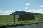
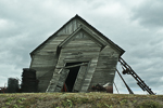
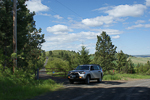
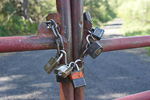
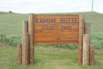
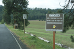
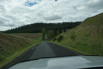
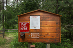
The peak of Kamiak Butte is only accessible with a key for one of the many padlocks on the gate. It has several radio installations along the west end of the ridge.
The State Park is lovely but parking and picnicking areas are far below the summit. You can hike up to the peak along nice trails in the forest, but only non-vehicle traffic is allowed up there.
Driving directions: On Hwy 27 about 3 miles south of Palouse WA (12 miles north of Pullman).
Restrictions: No vehicles on peak.
Big Butte, DN16jc07
| 46.115500, -117.249600 |

The lookout is used after lightning storms for fire detection. There is a gate on the road to the tower about 1/4 mile from the top which may be closed. There is absolutely no view from the ground due to trees.
Driving directions: From Pomeroy take Forest Road 40 to Road 43 to Road 4304 to Big Butte.
- This route stays high much of the way through the Umatilla National Forest, in the 5000-6200' range.
- It also passes by two Forest Service rental cabins, one at Clearwater Lookout and one at Wenatchee Guard Station.
- Contact the Pomeroy Ranger District regarding those. Big Butte is not available for rent.
Endicott Ridge, DN16ex02
| 46.968200, -117.660100 |
This is a better location than it looks with excellent exposure in all directions.
Driving directions: Southwest of Colfax on Highway 26, just before the fairgrounds turn north towards Endicott on Endicott road.
- Go 16 miles to Endicott.
- Go right on the Endicott-St. Johns Highway just before the school.
- Go one short block, then turn left on the Endicott-St. Johns Highway going north.
- Go 2.3 miles and turn left on Grove Road. This is a good gravel road winding up to a high knoll.
- Go to the top of the hill 4/10 of a mile from the main road.
- Just past of the top of the hill you can get to higher ground by pulling off the road onto a wheat field.
Moscow Mtn, DN16nt93
| 46.804613, -116.839557 |
August 2001 update, DE KF7CN: There used to be a fire watch tower up there long ago. K7TM did a short operation up there a year ago and found it to be a good location. I did field day in 1986 up there and we were only chased off the mountain by lightning twice that weekend! We were in a Nissan Xterra and still had to be very careful on some of the water bars near the top. The gates roads all close at 3 PM now. I didn't notice if the lookout location was gated or not. It didn't used to be. But then none of Moscow Mountain used to be gated.
The bluff has a great shot in all directions except directly at Spokane; the operating location is shielded by the peak. However, Spokane is less than 90 miles away and it does cause too much problems. Paths toward Seattle are slightly shielded but still workable.
Driving directions: Come in from the Troy, Idaho side of the hill past the old ski area.
Hamilton Hill, DN16is17
| 46.780260, -117.322000 |
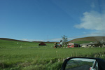
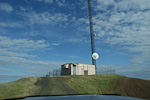
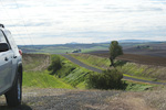
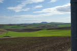
Cell phone tower 7 miles south of Colfax on Highway 195.
Good exposure in all directions. Line of sight to Steptoe Butte. The little knob of a hill is tiny and the driveway does not fully encircle the installation. The last 20 yeards was very steep with dropoffs. No room to turn around; you must back down. Lots of RF and it was radio noisy on 2m.
Driving directions: Seven miles south of Colfax, go right on Hamilton Hill Road for 1.25 miles.
- Go left on Bar Road 1/4 mile to cell site.
Table Rock, DN16ba07
| 46.030700, -117.910400 |
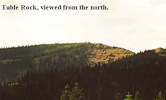
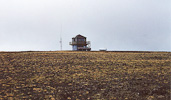
Forest Service Lookout about 19 miles east of Walla Walla, WA.
Broad, relatively flat and treeless summit. Clear shots in all directions except northeast. This is on the western edge of the Blue Mountains with nothing but rolling sagebrush hills and farmland toward the west. Probably a really good shot toward Portland down the Columbia from here.
Lookout is staffed in the summer, might want to check ahead with FS, the lookout on duty probably won't appreciate company for a whole weekend. I didn't take the road from Walla Walla. The route from the north via Dayton was full of potholes the last couple of miles.
Driving directions: Not clearly labeled on the map, it's 3/4 mile west of Squaw Peak.
Knowlton Knob, DN08bd19
| 48.164200, -119.901800 |
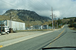
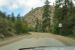
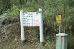
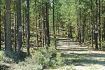
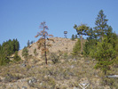
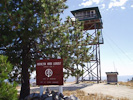
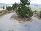
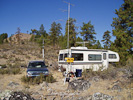
This is a DNR lookout, northwest of Brewster. The lookout is on DNR land, but it is surrounded by private land. Lynn operated the September VHF contest from the ridge just east of the lookout - he was unable to get the trailer up the final hill. I had several visitors while I was there, and they told me that the cattle rancher that owns the land surrounding the lookout often locks the gate on the road during hunting season.
The lookout is well maintained, and even has a pit toilet and a solar shower. There is a lot of room at the base of the tower for setting up equipment, tents, etc.
The route is well marked up from Brewster, right up until just before you reach the locked gate.
Driving directions: From Highway 97 in Brewster, go uphill at the Union 76 station, across from Brewster market place. The road is not marked.
- Cross the railroad tracks and go left at the power substation up Paradise Hill road.
- Go four miles to the end of the pavement.
- Go another two miles to a mailbox stand at the head of the T.
- Go right. Look for Knowlton LO signs. Go about four miles to the cattle pens.
- Look for a DNR sign. Go 200 yards, and then take another left.
- Go 1.8 miles to first Y, go left, then a half mile farther to second Y.
- Go right and then on up to the top.
- The road is passable with any pickup, and does not get steep until the hairpin switchback.
Restrictions:
7/21/2012 Update. Barry K7BWH visited this spot and confirmed it is gated off.
A lame substitute is along Benson Creek Road DN08BE27. But it's not worth the drive.
This is hilly terrain; there must be some good spots but I didn't find any.
8/2/2008 Update. Rex Kamstra visited the area and Gebbers Logging now has the access
road sealed off at the Benson Creek Road, which is the dirt road between Twisp and Brewster.
The gate has all kinds of threatening signs on it and it is locked.
Moses Mtn, DN08li29
| 48.371500, -119.060300 |

Mountaintop 21 miles east of Omak WA.
Rewarding operating site for those willing to punish your vehicle. Highest point on the Colville Indian Reservation. Abandoned 123' steel lookout tower on the summit (bottom stairs have been removed). Lots of scrubby trees scattered about. No neighboring peaks to interfere.
A few VHF repeaters onsite. Extremely wide-open views east to west toward the south, just miles and miles of flat ground on the horizon. Site is far enough away from the Cascades it should be relatively easy to get a signal over them.
Driving directions: Take Hwy 155 east of Omak to Moses Mountain Road.
- 4WD REQUIRED
- "Road" is really bad the last 1/3 of the way, frequent washed-out switchbacks and huge boulders
- Don't even think about towing anything behind you, you'll be lucky to get your rig up there alone
Restrictions: Four wheel drive really is required.
Parachute Meadows, DN08ar50
| 48.708400, -119.957700 |
High spot back in the brush, NE of Winthrop and west of Tonasket on Forest Road 38.
Lynn visited this site in 2005 while pulling a small 5th wheel trailer. You can get in two ways - from the Loomis/Toats Coulee area or by going north from Winthorp. Both roads are passable with a pickup truck, but are narrow in places. There are several unimproved campgrounds in the area. This area is probably busy during hunting season. Lynn camped near this location and had no trouble working into the Puget Sound area on 432 using a 12 element Yagi.
If you go to this area then you should not go alone - it is extremely isolated. Likewise, if you pull a trailer up these roads a scout car running ahead is a very good idea.
Sherman Pass, DN08so25
| 48.606670, -118.479800 |
Mountain pass about 15 miles east of Republic, WA and 35 miles west of Colville.
Parking is not allowed at the pass. The pass itself is wedged between the rocks. You can park in a small pullout on the west side of the pass on the north side of the road for westerly propagation, or in a big trailhead parking lot on the northeast side of the pass for easterly propagation. North and south probably won't be too good from here with mountains on either side 6800'-7100' high. About a mile to the east of the pass is the Sherman Pass Campground.
I-90 Winchester Wasteway, DN07ec44
| 47.103380, -119.627510 |
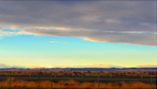
"Winchester Wasteway" - isn't that a lovely name for a rest stop?
I-90 rest stop at milepost 161 is open both eastbound and westbound, about 30 miles west of Moses Lake.
Unobstructed paths in all directions. Westbound rest area is one half mile east of eastbound rest stop and is on slightly higher ground.
Calloway Road, DN06ux46
| 46.987290, -118.293200 |
High ground in the boonies, southeast of Ritzville. Good rover stop.
Driving directions: From the Ritzville-Benge Road going north towards I-90:
- Turn right on Calloway Road
- Go about a mile to the top of the hill
- The high ground is near a farmhouse on the left
Wild Horse Overlook, DN06ax41
| 46.964160, -119.964200 |
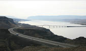
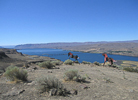
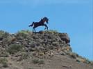
I-90 (eastbound) roadside viewpoint overlooking the Columbia River at mile 140. There is another viewpoint accessible from the westbound lanes. This location has excellent exposure to the west, north and south, but the path to the east is blocked by a ridge.
These viewpoints are a bit lower than DN06 Frenchman Hills, but they offer extremely quick access to nice places to pull off.
I-90 Vantage Viewpoint, DN06ax33
| 46.973400, -119.970100 |
I-90 (westbound) roadside viewpoint overlooking the Columbia River at mile 140. There is another viewpoint (Wild Horse Overlook) accessible from the eastbound lanes. This location has excellent exposure to the west, north and south, but the path to the east is blocked by a ridge.
These viewpoints are a bit lower than DN06 Frenchman Hills, but they offer extremely quick access to nice places to pull off.
Sentinel Ridge, DN06bt45
| 46.816500, -119.881500 |
Repeater site southeast of Vantage. DeLorme Topo map says you can see Mt. Rainier from there.
Driving directions: On the East side of the Columbia river on I-90 turn south onto Hwy 26
- Then take Hwy 243 south again.
- Travel approximately 13 miles and take the turn to Mattawa on the left.
- Watch your speed - it's 25 in town.
- Just outside of town (East) turn Left (North) onto Rd R.
- Stay on Rd R and when you cross the canal keep to the left of the fence
- Stay on this road until you get to the top where all the microwave sites are.
- You should find enough room to get away for any thing that will cause RFI
- Caution: when cresting the ridge, take it slow and take a look.
THE OTHER SIDE MAY NOT HAVE A ROAD UNTIL YOU HIT THE BOTTOM - straight down.
Jump Off Joe Butte, DN06kc44
| 46.103471, -119.130249 |
Easily accesible butte. Numerous radio towers in the area. Excellent exposure in all directions.
Driving directions: Best to look at a local map for this one.
- Get to Owens Road, south of Kennewick and go south.
- Go east on Jump Off Joe Road.
Beverly-Burke, DN07aa70
| 47.000000, -119.941145 |
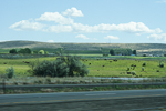
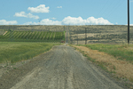
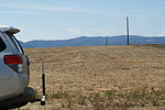
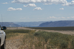
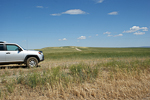
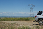
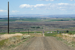
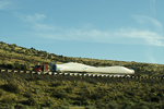
Beverly-Burke road is just off the I-90 freeway near Vantage and the Columbia River near the congruence of four grid squares. This nice hilltop offers both DN07 and DN06 together.
Note that DN06 Frenchman Hills is slightly higher and about a mile to the east. It might have better takeoff angles but following the roads to reach it will adds another fifteen minutes each way. I made a scouting trip and like this Beverly-Burke spot better.
On my way home westbound on I-90, on the long climb up to Ryegrass, it was interesting to see the giant blades from a wind turbine on a very long truck.
Random Palouse Hill, DN16iw59
| 46.954167, -117.289000 |
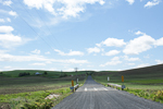
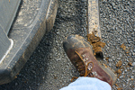
I stopped here on my way back from Steptoe Butte during the June 2012 VHF contest. There is nothing special about this spot except it's slightly above average terrain and easy to reach from main roads. I was short on time and needed to make a few contacts from DN16 to grab some multiplier points. Although Ladow Butte is a far better location, recent weather made all the farm access roads very muddy, and I didn't want to take chances.
In the first photo, my hilltop is seen in the distance just around the bend. In the second photo, I'm scraping tons of mud off my boots after being on the air.
A local farmer drove out on his ATV with his two dogs to see what I was doing. A nice, socialable guy with a Technician's license himself. I gave him my QSL card and encouraged him to get some gear and get on the air. He said I was parked on a county road and so nobody would complain about my using the spot.
Stensgar Mtn, DN18ae13
| 48.179537, -117.988465 |
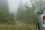
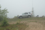
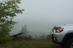
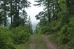
After ascending Stensgar Mtn on Locke Road (a very bad choice) I managed to turn around and return just far enough to return to DN08. The peak of Stensgar Mtn is in DN18. But I found a flat spot near a switchback which provided enough room to get on the air and activate the grid for contest points. This is halfway down the mountain and only offered access to local and Spokane stations.
Monument Hill, DN07ch36
| 47.319931, -119.800792 |
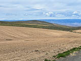
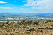
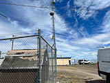
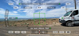
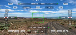
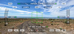
Looks like a good spot on top of the big ridge north of Quincy. However there are lots of radio towers and no good place to pull off the road.
Good paths to east and south and west. The summit compound is gated.
Easy drive up on good roads.
Driving directions: At the east end of Quincy go north on 9th Avenue SE
- It starts out going northeast then quickly goes due north
- Stay on the road which turns into P NW road
- One mile off highway 28 you will cross 11 NW Road
- Continue on another 5.1 miles to an intersection
- Stay to the right and continue on (you are going northeast)
- The road name changes to Monument Road
- Go another .5 miles (east) to another junction and continue on (don't go right)
- Go .4 miles to a road on the north side (your left) and turn north
- The top is just 1/10 mile off the road
Frenchman Hills, DN06bx18
| 46.993382, -119.901631 |
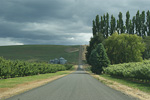
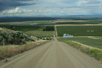
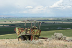
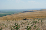
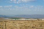
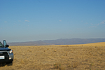
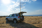
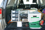
This hilltop in farmland is about 15 minutes from I-5. It offers a local high point along the north edge of DN06. Strongly advised to use 4WD for the last bit along a wheat field.
Propagation into the Seattle area is generally very good, but some stations don't have eastward paths from their home location. Propagation into Portland was okay on 6m but very bad on 2m.
Note that DN07 is nearby but you have to loop around to DN07 Beverly-Burke a mile west to stay on a hilltop. The nearest entry to DN07 from here would be on Road R, which would be at the bottom of this big hill.
I've always wondered why everyone says to be bring toilet paper. On this trip, I finally found out what it's good for: just the right size to prop up my gear. (See photo.)
Driving directions: From I-5 drive 7 miles east from Vantage and take exit 143 for Silica Road.
- Turn right onto Road U (what an original name).
- Turn left onto Road 5 (see? brilliant name).
- Take the first right onto Road 5.5 / Road T.
- Turn right onto Road S
- Drive to top of hill, at the ancient combine turn right into the field
- Drive along the edge of the field to the top
Note: This could be reached from the south via Highway 26, but the road
is a poor dirt track and would be impassable in rain or snow.
Frenchman Hills, DN07ba10
| 47.000100, -119.903100 |

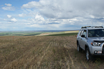


The DN07 side of the DN06-DN07 grid line through Frenchman Hills is down in the valley. I couldn't find a good open spot nearby; the big hill on the south will block most paths to Puget Sound.
I think it will be much better to work from DN07 Beverly-Burke a mile
toward the west.
See also the high spot at DN06 Frenchman Hills nearby.
Mt Spokane, DN17kw61
| 47.921200, -117.114100 |
This is a popular ski area northeast of Spokane. The locals report that Mt Spokane summit is driveable in the summer with pavement to the top. It has gates but they are generally open. On the way up to the peak, you will pass Beauty Mountain (5206') and Bald Knob (5108').
Driving directions: Highway 2 north from Spokane
- Turn right onto WA-206 East (Mt Spokane Park Drive)
- Take left onto N Summit Road
Miller Mtn, DN08ua00
| 48.001910, -118.329514 |
Whitestone Ridge and Miller Mountain are in the grid corner near Spokane and several other peaks such as Stensgar, Bare and Jumpoff Joe. This ridge spans the gridline and lends itself well to easily work from both DN08 and DN07. I sure hope it's driveable.
Stensgar Mtn, DN18ae13
| 48.181196, -117.988701 |
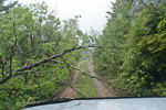
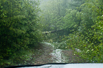
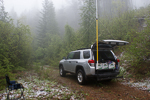
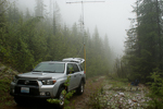
Stensgar Mtn is a driveable high point in the lower corner of DN18, near Spokane, and with this much altitude should have good propogation in every direction.
Be sure to take the gravel Red Marble Road approaching from the north; I talked to locals on the air that said the road is much better and is used regularly to service the radio towers.
I drove this during the 2012 June VHF contest but didn't reach the summit because Locke Road on the west side is overgrown and not maintained. It's drivable with good 4wd but bring a chain saw.
These pictures are not at the top. I'm about 1200' below the summit but could not continue. However I had just crossed into DN18 and so could activate the grid successfully from here.
Near Miller Mtn, DN07ux16
| 47.986173, -118.319900 |
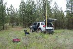
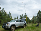
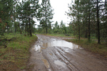
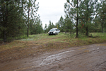
I tried to reach Miller Mountain but took a wrong turn, and ended up a mile south from the peak. The roads were extremely muddy and slippery and I didn't want to chance getting stuck. This was good enough to activate DN07 and make some points in the June 2012 VHF contest, but it would be much better to actually reach the actual peak in DN08.
Note: From Hwy 25, turn onto "BIA Hwy 68". The name soon changes to "Miller Mountain Road". At a fork, turn right onto "BIA Hwy 68" again, even though it looks smaller and less travelled. The name soon changes back to "Miller Mountain Road". A local resident uses an ATV to reach the peak, which offers another 800 vertical feet and terrific view in all directions. These residents prefer that you do not park on the road I had taken since it's all private property, although no signposts say so.
Miller Mtn, DN07ux19
| 47.997733, -118.322754 |
Whitestone Ridge and Miller Mountain are in the grid corner near Spokane and several other peaks such as Stensgar, Bare and Jumpoff Joe. This ridge spans the gridline and lends itself well to easily work from both DN08 and DN07. I sure hope it's driveable.
Whitestone Ridge, DN08ra85
| 48.021409, -118.508848 |
Whitestone Ridge and Miller Mountain are in the grid corner near Spokane and several other peaks such as Stensgar, Bare and Jumpoff Joe. This ridge spans the gridline and lends itself well to easily work from both DN08 and DN07. I sure hope it's driveable.
Whitestone Ridge, DN07rx98
| 47.995321, -118.506260 |
Whitestone Ridge and Miller Mountain are in the grid corner near Spokane and several other peaks such as Stensgar, Bare and Jumpoff Joe. This ridge spans the gridline and lends itself well to easily work from both DN07 and DN08. I sure hope it's driveable.
Boyer Mtn, DN18ge77
| 48.196596, -117.434262 |
Jumpoff Joe, DN18dc97
| 48.114410, -117.671181 |
Jumpoff Joe Mtn is a possible destination in DN18, north of Spokane. May or may not be driveable.
Bare Mtn, DN18ic80
| 48.087311, -117.259269 |
Bare Mtn (aka Bald Mtn) is a possible destination in DN18, north of Spokane, quite near Jumpoff Joe Mtn. May or may not be driveable.
Ladow Butte, DN16lx28
| 46.992115, -117.064336 |
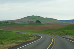
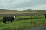
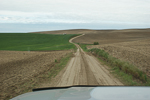
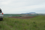
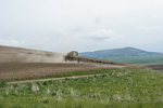
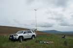
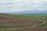
I scouted a hundred miles of dirt roads this weekend to find a good hilltop near Pullman. Ladow Butte is the best hilltop without hiking. Unfortunately there is no road to the top, but this level outcropping provides a very convenient and level place to pull aside. If there is rain or snow, do not attempt this soft dirt road. Two of the local farmers stopped by to find out what I was doing. This spot is far from Seattle; the Idaho border is but a mile away.
I made five contacts on 2-meters (CN79, CN85, CN87) and four contacts on 6-meters (CN87, DN13, DN17). This is remote! Signal strengths were very low. I was hoping to provide DN16 to more people; extra people joined the Sunday morning net trying to work me.
I like this location and it was successful, but there is probably a DN16 hilltop spot fifty miles closer with better propagation to Seattle and Portland.
Golgotha Butte, DN05au95
| 45.855690, -119.918070 |
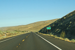
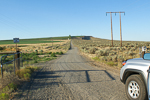
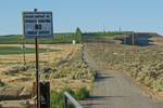
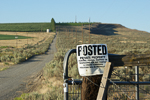
DN05 has just a thin sliver of its northwest corner in the state of Washington. A high point is Golgotha butte with a 360 degree view. It's located south of Yakima, about 1.5 miles north of the Columbia River via a very straight, but somewhat rough, gravel road. Best alternative is Petersen Road DN05aw, about five miles north. Also look at nearby Crow Butte, although satellite photos suggest that the access road is gated.
Restrictions: July 2012: Gated closed. Signpost said no public access for any purpose. This hilltop is fully developed by a winery and is closed to the public.
Deer Mtn, DN07av10
| 47.875742, -119.985087 |
There is a thin sliver of Chelan County (a rare county) in DN07. And it happens to contain a broad ridge with sparse trees and a country road. This might be a good place to operate an HF contest (such as the 7th Call Area QSO Party on the first Saturday in May) and also operate a VHF station (every Sunday). I don't see a good campground nearby, but still...
Old Dominion Mtn, DN18dn09
| 48.581390, -117.747960 |
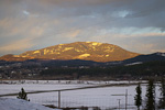
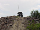
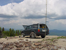
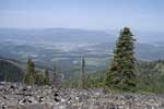
Here's an interesting spot with good elevation in the mountains north of Spokane DN18. A neat picture of K7MDL in the June 2005 VHF Contest looks like fun!
Old Dominion is the 95th most prominent peak in Washington, located seven miles east of Colville. This is said to be accessible with regular passenger sedans here. However, a mountain hiking site suggests using a 4x4 vehicle.
Update July 2012. 4WD is required. The USFS no longer maintains a radio site up there, so road maintenance has been virtually non-existent.
Driving directions: See more maps here.
- Start at the east end of Colville on Hwy 20
- Take the Colville-Aladdin road north
- Turn right on Northport Road
- Follow Northport Road to Threeforks
- Turn right onto the S Fork Mill Creek Road
- In a few miles, look for a wide Forest Road on the south side, possibly number 9411.
Teal Camp, DN16fe15
| 46.188167, -117.573500 |
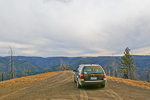
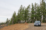
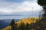
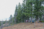
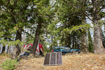
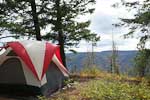
Teal Camp in the Umatilla National Forest is an excellent spot for hilltopping. It offers a bathroom, firepit, picnic tables, 12 campsites and excellent exposure. It's quiet, secluded, scenic and has good trees for dipoles. Most other campers will be hunters or ATV riders. Be sure to bring your Discover Pass for Washington Parks.
I spent two comfortable nights here in Sept 2011 during the Washington State QSO Party (aka Salmon Run). This is remote - Teal Camp has the least background noise on the radio of any place I've been. It requires an hour of dirt road travel south of Pomeroy.
Photos above: My dipole (G5RV) ran approximately parallel to the spit of land poking out toward the valley, for HF coverage E and SE. The 2-meter beam on a 20' mast is pointed NE toward Seattle.
Clearwater Lookout, DN16fe08
| 46.203105, -117.575068 |
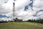
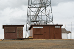
Lookout towers are often placed on the highest point around, always a good landmark for your searches. I noticed this lookout in Google Earth while skimming through the almost-unpopulated Garfield County. It looks good but Teal Campground one mile further along is a much better spot for camping and offers the same altitude, better trees, picnic tables and better views.
There might be a rental cabin available on site, see recreation.gov. There is an outhouse but no water or other services. Contact the Pomeroy Ranger District at 509-843-1891. As of 9-14-2011 the cabin is closed waiting for work completion on propane system.
Note this is an active spot during the fire season (summer and fall) and includes a helipad where workers rest and replenish. Stay out of their way; look for a separate clearing near arrival kiosk.
Alder Thicket, DN16fg12
| 46.258633, -117.567400 |
Garfield County is the least populous and most rare county for ham radio in Washington state, with only about 10 resident hams. As of 2000, the population is 2397, making it the least populous in the state. The county has only one city, Pomeroy. The county covers 712 square miles, some of which is the Umatilla National Forest, and is the 7th smallest county by area.
This would be a good spot to operate for the WA State QSO Contest in September.
This campground appears to be at a good height above average terrain near Huckleberry Butte, and is reachable by two-hour drive from Pullman.
I-90 Exit 206, DN07pc73
| 47.096833, -118.686500 |
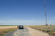
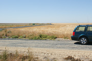
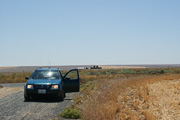
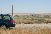
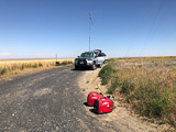
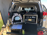
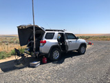
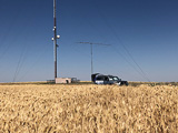
This location is among the taller of the rolling hills east of Moses Lake. There is easy access from I-90 (seen in the distance) and good parking from Koch Road on the north side of the freeway. Take Exit 206 and follow signs to "Mennonite Church" uphill on frontage road.
Excellent view in all directions, no trees or power lines, good height above average terrain. There is good cellphone access from nearby tower. This is my favorite site in DN07.
Restrictions: Respect the farmer's field and private property.
Ritzville, DN07tc61
| 47.090333, -118.365333 |
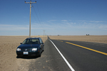
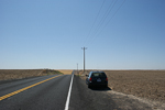
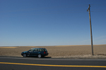
This small peak among the rolling wheat fields of eastern Washington offers good views in all directions with zero trees and blockage. This might be the spot that K7HPT used in the 2011 UHF contest where he worked me on Steptoe Butte and Gabor in BC.
Drive on I-90 to Ritzville turn-off exit 220 and turn south for about a mile. You can work from a wide spot along WA-261, or there is a ellphone tower nearby on a slightly higher hill that might make a good operating location. However, better yet is DN07pc a few miles west.
I-90 Sprague Rest Area, DN07xh60
| 47.294167, -118.032667 |
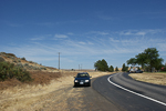
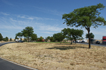
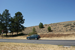
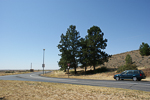
The I-90 westbound rest stop near Sprague in eastern Washington is centrally located between Spokane and Seattle. It has a good view south, east and southwest. However, a nearby hill blocks your view to north and west. Be sure to park in the trucker's area for a slightly better view.
This is probably a poor radio location; a slightly better choice is probably the Eastbound rest area. It's farther from the hill and you can use "car" parking.
Pullman HS, DN16jr89
| 46.746833, -117.181167 |
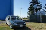
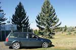
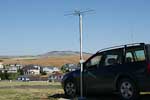
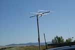
I've tried this spot a few times, and it's poor for radio work. The half-million gallons of water and the busy communication farm causes VHF and UHF noise.
But I'll keep trying spots in this area since I travel here frequently to see relatives, and DN16 is relatively rare.
Steptoe Butte, DN17ia47
| 47.032167, -117.296500 |
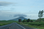
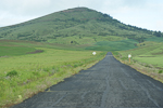
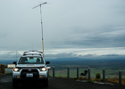
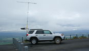
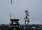
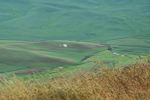
This site is on an 1100' butte NE of the town of Steptoe on state highway 195, south of Spokane. The average terrain is about 2000' and you can see 200 miles on a clear day. There are no gates on this location.
There was a small hotel located in Steptoe that also has an RV park behind it. As of 8/2001, their rates are $35 for a single, and $39 for a double (two double beds). A full RV hookup, complete with cable TV costs $15, and $18 for a pull through site. (Wheel Inn, Inc. P.O. Box 18, Steptoe, WA 99174. (509)397-9195. 1-(888)397-3195. hartleys@colfax.com)
This is an ideal location to start or end a rover operation. You CANNOT BELIEVE the shot in all directions from the top of the butte. There are no obstructions other than some microwave towers that are easy to work around. The RF levels are low and cause no problems. Expect a lot of traffic - people drive up there just to see the view. Per the signs at the top of the butte, some looney built a hotel on top of the butte back around 1900. It gives a guy fantasies about running a mountaintop operation - complete with room service!
Steptoe Butte, DN17ia47
| 47.032167, -117.296500 |
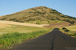
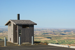
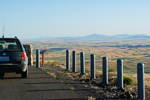
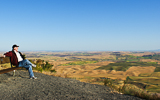
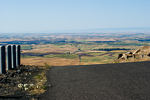
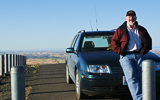
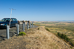
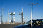
Steptoe Butte is an isolated cone with excellent views in all directions. It is wonderful operating location and a favorite of many. (And it's not just the bathroom-with-a-view!) See also KF7CN on Steptoe Butte for the September 2004 VHF Contest.
Easy radio access to Spokane and much of eastern Washington. DN17ia is near the southern edge of the same grid as Spokane, so it's not rare, but you can make up for it with the number of contacts.
This location requires a Discover Pass from the state. Buy it before you go, because it did not offer a signup box anywhere in the park.
Nine Canyon Road, DN06ka69
| 46.038167, -119.113333 |
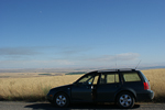
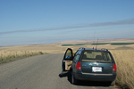
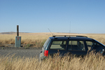
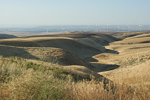
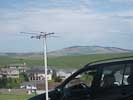
This lofty location above Kennewick and the Tri-Cities should have good radio propagation in all directions. However, no UHF contacts were made during the contest. I made a 144 MHz simplex contact with N7NKT in Hermiston, OR, so maybe that's a better direction from this spot.
I don't know if the line-of-sight was bad or if there was just nobody on the air. Next time, I will try another nearby spot a bit closer to the city, somewhere around the Jump-Off Joe peak.
Pullman HS, DN16jr88
| 46.743200, -117.180000 |

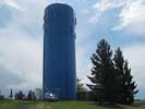

This was a great location for the CQ WW VHF contest on July 16-17, 2011. I parked on the north side of the water tower for good propogation into Spokane (60mi) and Tri-Cities (90mi). Then I parked on the southwest side of the tower for good path into Seattle (200mi)and Portland (300mi).
This was my first VHF contest and provided points and a grid to the people who stuck around on 2m. I have 50 watts 2m SSB and a 3el beam.
I had some nice contacts with K7HPT in two grids; wow he must have done a lot of driving, thanks! Great signal from Dale. I heard a few stations W7GLF, W7MEM, K7SMA, VE7DXG that didn't quite hear me but that was fun and exciting anyway.
I'm new to VHF and just getting equipped and didn't know what to expect. But I didn't really expect 2m to empty out after the first half hour. Did 2m go dead or did everyone abandon it after they thought they worked everyone else? I was disappointed after the first hour to be calling CQ for two more hours with no answer. I was hoping to get lots of Spokane contacts from what seemed like my favorable location 60 miles to their south. And hoping to get someone in the Tri-Cities but, no. It was nice to hear lots of activity when the contest started but then it seemed like nobody wanted to bother with the band. Is this typical? Just curious.
There was a flurry of 2m activity Sunday morning after the PNWVHF weak signal net. That was great fun and I doubled my score.
My hilltop had a water tower bristling with cellphone antennas. This was actually rather handy. In a fit of boredom I used my cellphone and ordered a 6m antenna from HRO for my next contest. I wish I'd planned ahead and borrowed one for this trip.
Operating time 3 hours Saturday and 2 hours Sunday, 2m only, 6 contacts, 5 grids, 60 points.
One nice thing about hilltopping is at least I'm parked in a lovely scenic location!
Goat Mtn, DN08aa13
| 48.014748, -119.985564 |

Ed KD7PY (prev. K7WIA) put DN08 on the air in the June 2005 VHF Contest from Goat Mountain. This spot has a clear shot from north through east to south.
He reported no interference from the big transmitter tower.
Driving directions: Goat Mtn is in the SW corner of DN08 on National Forest Road 8140. It's about 2 miles west of Alta Lake State Park and the city of Pateros.
Umatilla NWR, DN05fv24
| 45.893496, -119.559877 |
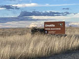
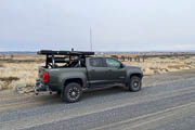
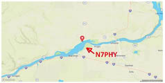
Umatilla National Wildlife Refuge is a clean quiet place to park with good horizon in all directions. See also Fish & Wildlife Service website.
Driving directions: The main entrance, located on the McCormack Unit, is 10 miles south of I-84 at the end of Paterson Ferry Road.
Restrictions: Parking is allowed in designated parking areas only.
The refuge is open from sunrise to sunset. No overnight camping.
Cold Springs, DN05ku15
| 45.855340, -119.156640 |
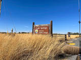
Cold Springs Wildlife Refuge is POTA K-0499. This mostly a grassland surrounding a small lake six miles (15 minutes) east of Hermiston, OR. Except for some trees surrounding the lake, the horizon is good in most directions.
See also the Cold Springs National Wildlife Refuge website by the US Fish & Wildlife Service.
Driving directions: The drive to the park is a simple gravel road, nothing difficult.
Restrictions: Day use only.
Morgan Lake, DN05wh32
| 45.302332, -118.137613 |


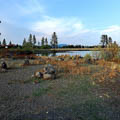

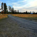
Morgan Lake is a free dispersed campground area around a 60-acre surface area lake that was a former gravel pit, re-purposed for recreation and stocked for fishing. It's managed by the city of LaGrande, Oregon.
Eight camping spots on the lakefront with a handful of more pullouts. Some have full sun, some are shaded. All have covered picnic tables with fire ring. Usually has a burn ban. 55-gallon trash cans spreadout through the area. No toilets, water, or other services.
Access was interesting. This area is basically on top of the mountain (4,200' amsl) and the road was steep. Signs at the base warn of steep/narrow roads and one said 17% grade. Road had the requisite washboard and potholes and really was very steep in parts. Road is hard packed gravel in 2021 and is in pretty good shape. Some reviews said 4wd is needed, but several big RVs are up there.
Verizon cellphone is pretty weak and very spotty. ATT is only slightly better.
Restrictions:
Last day open is Oct. 31.
Free camping is limited to 3-day stay.
Camp gates locked at 10pm and open at 6am.
Boats allowed but no gas or electric motors.
Akers Butte, DN15fr11
| 45.714267, -117.572264 |
Catnip Reservior, DN01gv49
| 41.912932, -119.460571 |

Todd KH2TJ has operated from Catnip Resv., up in the Sheldon National Wildlife Refuge.
Not too bad of a place if you don't feel like making the drive up Yellow Peak. Primitive campground. Isolated, no noise. Not as high as Yellow Peak though. Image c/o Google Maps.
Soldier Meadows, DN01ji36
| 41.360547, -119.222793 |
Todd KH2TJ recommends Soldier Meadows Campground. It's easy to reach, has a nice cabin and vault toilets and, added bonus, hot springs not too far away. If the cabin is occupied, then the campground at the hot springs is not bad. Note the surrounding hills to the north may hinder getting a signal out that direction.
UPRR Comm Site, DN00cf42
| 40.218642, -119.791947 |
Todd KH2TJ says: For DN00 - I go up to the UPRR Solar Powered Communications Site which overlooks Sand Pass and Smoke Creek. The radio towers are owned by Union Pacific railroad.
This site is the closest hilltop I could find coming in from the Flannigan, CA, side. It's close enough for me to drive up from my home in Portola, CA CM99.
This is on BLM land and is not part of the Indian Reservation.
Driving directions: Take Surprise Valley Rd to the turnoff at 40.20444, -119.81415. Take this unpaved road north around the sand/gravel pit and continue uphill.
Restrictions: Depending on weather, wet conditions may require 4WD.
Black Rock, DN01ma04
| 41.020040, -118.998510 |
Todd KH2TJ says: For DN01, I've played around up above Black Rock Pt area but this is extremely isolated and 4WD and high-clearance vechicles are really good to have. This site sits up above Burnt Rock Peak and has a couple of nice hidden playas above Black Rock Hot Springs for some isolated camping/boondocking.
You might also consider one of the higher elevations with trail in the "Black Rock Desert - High Rock Canyon Emigrant Trails" area. In fact, the large flat playa (alkali flats) down below is another candidate for camping or operating.
This is not far from the DN00-01 grid line in Casey Springs at 41.000, -119.01487.
Todd's done quite a bit of HF operations out in that area, such as Seven Troughs Highpoint. There lots of "hidden" cabins and old ghost towns in those areas.
DN01-02 Line, DN02va20
| 42.000000, -118.231779 |
Sled Springs, DN15ir85
| 45.730240, -117.265277 |
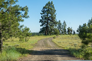
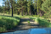
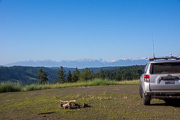
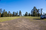
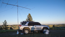
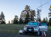
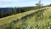
An easy stop along the Enterprise - Lewiston Hwy 3. The drive north from Sled Springs is a beautiful trip through mountains on good roads. One of my favorite VHF rover locations in the state of Oregon.
This is a large flat clearing only short distance (half mile?) off the main highway, which runs for several miles along this ridge. There’s probably several other similar good campsites out there if this one is crowded.
Also note that 7.5 miles north is Joseph Canyon Viewpoint (45.83499, -117.263867) with parking and a vault toilet.
You can park on the edge of a giant drop off for good low-angle take off in N-E-S directions, and no major hills to the West. If you move away from the vehicle using a HT, and make four contacts, you can count two points for Summits on the Air! It may not be high enough for you, but it is very accessable with lots of room for camping, antennas, all sorts of things.
SOTA info: W7O/NE-240 - 4940, 1506m / 4941ft, 2 SOTA points
Driving directions: Take Lewiston - Enterprise Hwy 3.
Look for unmarked turnoff at 45.73653, -117.273069 to the east
Follow winding unpaved road through sparse forest about 1/2 mile
Weigh Station, DN15iq60
| 45.670020, -117.276810 |
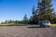
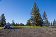
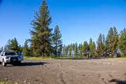
"Weigh Station" is a quick open gravel pull-off from the Enterprise-Lewiston Hwy 3, so named from the signposts. However, no equipment of any sort seen when I travelled through in 2015.
This is one of many possible places to operate (or to duck into the national forest to a nearby drop-off) along Hwy 3, which runs for several miles along the top of a ridge.
Roberts Butte, DN15jp43
| 45.641200, -117.209890 |
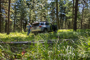
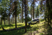
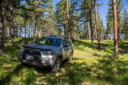
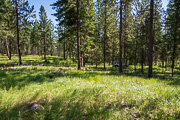
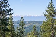
Roberts Butte seemed like a good spot on paper, but I ran out of trail long before I reached good operating spot.
Bone Springs, DN15av60
| 45.877625, -117.946697 |
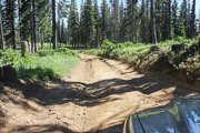
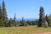
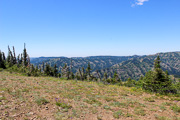
At 5880', Bone Springs was home to a fire lookout tower until the 1980s. On a (rare) clear day Hood, Adams, and Rainier are visible. Western Oregon and Western Washington can be worked from here. The Seven Devils in Idaho can also be seen toward the east. The Boise area seemed to be difficult to reach, likely due to the Eagle Cap Range blocking to the southeast. Cell coverage is okay.
Driving directions: The site can be reached from the north or south, but the best approach is from the south via FSR 64 from Tollgate, passing by Jubilee Lake. The last 3/4 mile of road is heavily rutted in places and snowdrifts can linger on this section well into June. Once you reach the top via a short spur road, you'll find a large flat summit with plenty of parking.
North Powder PR, DN15aa85
| 45.023659, -117.927913 |
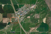
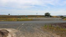
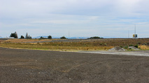
North Powder Park & Ride is a quick off/on at I-84 Exit 285 sometimes used by truck drivers as a rest spot. The Park & Ride is a large, flat gravel parking lot with a good horizon in all directions. It's a great spot to quickly set up and activate DN15 on your way along the Interstate highway. Being this is rural Eastern Oregon there aren't many VHF locals to work. Cell coverage is excellent.
Spanish Peak, DN04cj67
| 44.407149, -119.775539 |
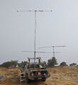
At 6400' and an unobstructed 360-degree summit and few trees, Spanish Peak is an excellent VHF site. 50 MHz conditions out to 300 miles seemed better than other places in DN04. Tim AL1VE could receive FT8 stations, throughout the contest period, westward from San Francisco to Seattle and across the north over to southern Idaho.
Road access was fairly easy, but portions were a bumpy and Tim certainly wouldn't advise trying the last five miles in wet conditions.
Elkhorn Summit, DN04vx03
| 44.974537, -118.249054 |
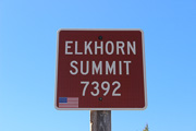
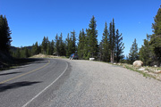
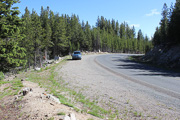
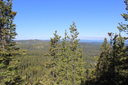
At 7392', Elkhorn Summit along the Elkhorn Scenic Drive is the second-highest paved road in Oregon. There is a large wide spot for parking at the summit.
Propagation will mainly be north to south toward the west, although some easterly propagation is possible. Western Oregon and Western Washington can easily be worked from here.
The Scenic Drive is not maintained for winter travel past the Snow Park a mile down the road to the east. The Forest Service typically will not plow the route open until the 3rd or 4th week of June, so don't plan on operating the June VHF contest from here. A less ideal substitute is to operate from the Snow Park which is about 200' lower in elevation.
Cellphone coverage is minimal to non-existent.
Baker Valley Overlook, DN04wx34
| 44.975475, -118.138981 |
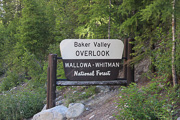
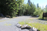
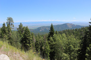
The Baker Valley Overlook is located along the popular Elkhorn Scenic Byway at 5550' northwest of Haines, Oregon. There is a campsite next to the overlook.
Main propagation will be from north to south toward the east. This can be a busy location, especially on summer weekends, with folks stopping to take in the view.
Cellphone coverage is excellent.
Rock Springs Campground, DN03nx99
| 43.999990, -118.839283 |
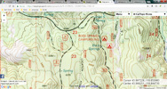
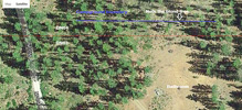
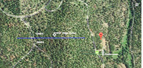
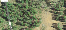
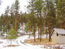

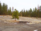

Rock Springs Campground spans the DN03-DN04 grid line, which runs across the north end of the campground. You can operate from a campsite and hand out two of the most rare grid squares. It's desirable to park exactly on the DN03/04 grid line – this is good for grid chasers which get both grids in one QSO. (Note that ARRL contest rules insist on moving and handing out one grid at a time.)
The campground itself is slightly below mild hills toward both east and west. Click here for topo map. The adjacent forestry road NF-28 provides relatively easy access near the high point on the ridge west of the campground (marked in the image as "VHF High Point"). The peak of the ridge might be possible by a drive in the woods. It's a gentle slope and it's only 200 yards off the road to get to the high point. The trees on top of the ridge are about 30-35 ft tall.
Hart Mtn Refuge, DN02en11
| 42.549042, -119.654671 |
At the intersection of Hart Mountain Rd and Frenchglen Rd is the offices and parking area for Hart Mountain National Antelope Refuge. This is the place to talk to rangers about local conditions.
Restrictions: No camping facilities(?) at this office area.
Hot Springs Campground, DN02dm70
| 42.501932, -119.689886 |
There is a hot spring and a nice but primitive campground. It hase an outbuilding with a vault toilet.
This is in a valley with a 7,200' ridge to the west and a 6,800' peak to the east. Might be good for HF and moonbounce but not much clear horizon for VHF.
Ukiah Ridge, DN05mh22
| 45.301910, -118.979514 |
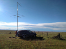
Here is a DN05 operating location with easy access just north of Ukiah, roughly DN05mh22. Bear Creek Road runs along a ridge by Highway 395 (Pendleton-John Day Hwy) with a good open view of the horizon in all directions. There is no significant vegetation and a variety of operating locations.
We were running 5 elements on 2m. We had a good signal path to Cesar N7BUS on Mt Walker (47.7756, -122.9137)to the north in the June VHF 2017 contest. --Ward KD1RX
Skyview Cemetery, DN05on48
| 45.578878, -118.796357 |
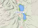
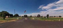
Skyview Memorial Park looks like a promising spot on a high bluff along Hwy 395 just south of Pendleton.
Bacon Ridge, DN03aa50
| 43.000010, -119.952410 |
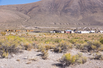
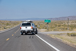
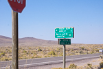
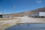
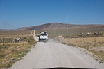
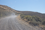
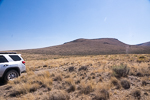
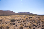
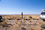
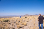
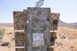
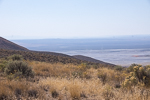
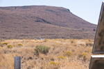
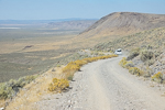
Bacon Ridge is a nice high ridgeline running north-south across the DN02-03 grid line. It is named after the cowboy camp in the valley below, "Bacon Camp". You'll drive through this compound on your way up to the ridge.
Bacon Ridge is along the way up to Juniper Mountain DN02aw, but this is much easier to reach. You could haul a trailer to Bacon Ridge but not up to Juniper Mtn.
Steens Hwy, DN02xw91
| 42.923250, -118.008330 |
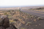
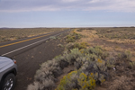
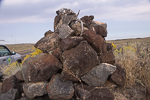
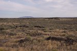
This is a quick pulloff on a small local rise in the terrain, near the only bend for a few miles each way. It's marked with a decorative rock stack. There's not really a wide spot here, but if you can safely get off the road then it's an easy path to work another grid-circling rover in DN03-13-12 nearby.
Gravel Pit 1, DN02xx30
| 42.958588, -118.051784 |
Another highway pull-off alongside '78 near the grid corner. There is instant access from the highway but it's not much above average terrain.
Rock Quarry, DN02xw39
| 42.957540, -118.050970 |
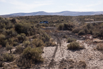
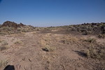
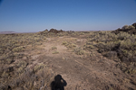
This rock quarry provides a level spot alongside the Steens Hwy. You will need to clear some brush to drive off the highway to park in here.
Hwy 95 Gravel Pit, DN12hv20
| 42.878993, -117.391667 |
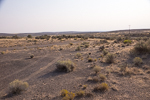
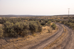
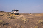
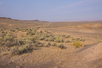
This gravel pit along Hwy 95 "ION Hwy" provides a convenient quick pulloff that's not far from the adjacent grids DN02-03-13. But don't get your hopes up; it's barely above the desert floor and long-distance propagation will be marginal. This is good for local contacts while grid-circling but not for a grid expedition.
Cow Lakes, DN13ic03
| 43.096440, -117.328270 |
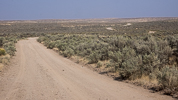
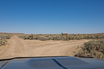
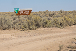
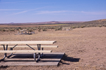
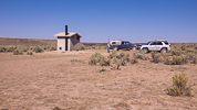
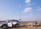
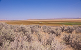
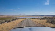
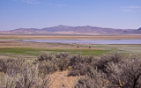
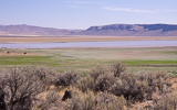
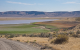
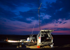
Cow Lakes is a nice BLM campground with a little elevation that is an easy 20-minute drive from DN12 to the south, and not far from the DN02-03-02-13 grid corner. This is a beautiful oasis in the desert but, as with most lakes, it's not a really high point. There are lots of birds and wildlife and fish and a rough boat ramp at this good-sized lake. The Lower Cow Lake was dry when we visited in Sept 2015.
Restrictions: No water.
Danner Water Tank, DN12hv95
| 42.897980, -117.333440 |
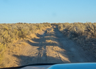
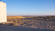

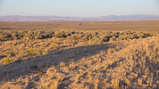
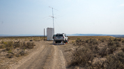
This water tank is immediately off Hwy 95 "Ion Highway" just south of Danner, OR, an easy drive from Cow Lakes to the north in DN13. This was one of my most productive hilltops in the 2015 Sept VHF Contest.
Note that Thompson Creek Ridge has better altitude and probably has better propagation, but it's also an hour further from the grid corner.
Driving directions: The water tank is on Hwy 95, halfway between Jordan Valley and Rome. The entrance road is stright across from the turnoff to Danner.
Restrictions: No water.
Antelope Reservoir, DN12jv18
| 42.908997, -117.237125 |
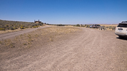
A nice basic campsite near the grid corner DN02-03-12-13. Open horizon in all directions but hey, it's a lake, this is not a high spot.
No water, no services. Vault toilet.
Pharmacy Hill, DN12lx24
| 42.979033, -117.061136 |
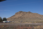
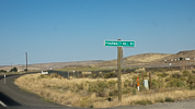
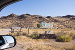
An table overlooking the city of Jordan Valley near the DN12/DN13 grid line.
This is not as good as it sounds. The road is terrible and the hill is not very high.
Gravel Pit 2, DN12bt50
| 42.793196, -117.871542 |
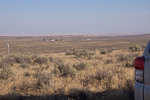
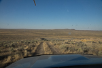
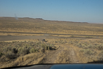
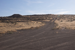
A highway service gravel pit alongside '78 near the grid corner. There is instant access from the highway and you can climb 100' up to the top with a good view down the valley each way.
Restrictions: It's a long way, 42 miles, to food and gas in Jordan Valley.
Fifteenmile Reservoir, DN02xc37
| 42.114330, -118.053246 |
West of McDermitt, on the OR-NV border, is this very high point. It's a long way from Hwy 95 and might not be drivable, but it's near the DN02-DN03 grid line.
Hwy 95 Hill, DN12dd65
| 42.149278, -117.697649 |
Near the Oregon-Nevada border is a dirt track up to a very good hilltop with a small antenna of some sort. (Cellphone?)
Driving directions: Turnoff from Hwy 95 is at 42.121368, -117.74558. Follow this dirt track up hill.
North Blue Mtn, DN12bj31
| 42.379661, -117.888837 |
Not far off Hwy 95, near Basque, is a dirt road up to North Blue Mountain Reservoir. It seems like a good accessible local high point at 5,800'.
Iron Mtn Rd, DN13aa00
| 43.003588, -117.996326 |
A dirt road, practically on the grid corner.
Iron Mtn Road, DN03xa30
| 43.003430, -118.057680 |
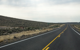
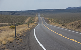
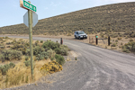
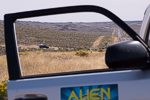
Iron Mtn Road is a dirt road loop from Steens Hwy 78 that serves a single ranch and leads to a spot near the 118-degree and 43-degree confluence. There is no access to any good hilltops and so long-distance propagation is terrible, but it's so close to the grid corner that it's a very convenient place for grid-circling rovers to pull off the highway.
There are a few reasonable spots to park. The entrance gate itself is DN02 and a hundred yards north on the main highway is DN03 (as seen through my open door picture). Or you can drive a half mile down Iron Mtn gravel road(DN03), and park in a clearing with a decent line toward Danner (DN12) and Cow Lakes (DN13).
Upper Dam West, DN13qn04
| 43.561911, -116.662711 |
Deer Flat on Lake Lowell has a boat launch and fishing pier, where a large parking lot for the Upper Dam Rec Area provides an open horizon and toilet. At the time of writing (Aug 2025), Google Street View shows a POTA operator with a vertical antenna. Nearby is the Lower Dam recreation area with another big parking lot and restroom.
Thomas Creek Ridge, DN13ld15
| 43.149878, -117.069030 |
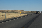
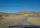
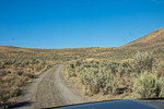
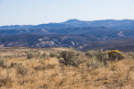
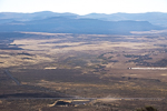
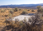
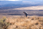
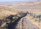
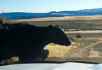
Thomas Creek Ridge is just a few miles north of Jordan Valley and offers an excellent view in all directions. There's a concrete base leftover from some small previous communications building, and we found some of the original guy wire anchors. Just like the sign says, "Caution: Cattle Guards."
Driving directions: Go north from Jordan Valley, OR. Turn left into the gravel pit and turn left again onto the first dirt road leading up into the hills.
Purser Ridge, DN13lc74
| 43.102933, -117.017360 |
Juniper Ridge, DN13il51
| 43.463493, -117.286272 |
Juniper Ridge 2, DN12ju46
| 42.858766, -117.208477 |
Grahams Hill, DN12fv99
| 42.916266, -117.503764 |
Might be drivable.
Red Hill, DN12lt45
| 42.812655, -117.042914 |
Driving directions: Off road.
Red Hills, DN12do16
| 42.608769, -117.740706 |
Driving directions: Find Rome State Airport, then east off-road.
Restrictions: It's a long way, 66 miles, to get food and gas in Jordan Valley.
Sand Hills, DN13gk79
| 43.455438, -117.435168 |
Calamity Butte, DN03ow02
| 43.928600, -118.825710 |
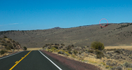
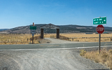
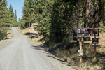
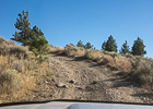
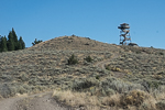

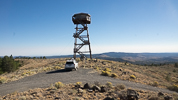
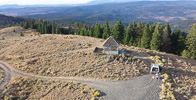
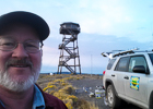

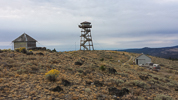
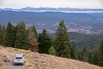
Calamity Butte at 6,700' with a staffed lookout tower was my favorite location in the 2015 Sept VHF Contest.
Tap on a tower leg to see if anyone is home; he doesn't always look down and the upper wind prevents him from hearing anything. Ken Wagner was friendly and accommodating and I was deeply grateful for the morning coffee. Be calm around his border collie who can become protective. You'll pass his cabin on the road up at the 5,000' level.
Driving directions: Look for the Silvie's Ranch turnoff on Hwy 395 (43.927830, -118.932286).
The turnoff is signposted "USFS RD 2840, Calamity L.O. 8 miles".
Note the sign is "2840" but Google maps says "2480". Go figure.
Drive 8 miles on smooth gravel road to reach county road 28.
Go straight across 28 uphill onto NF-2860.
Drive 4 miles; it took me about 19 minutes from Co 28 to the lookout.
NF-2860 is a poor road that gets progressively worse.
The final ascent is very steep and rocky; it requires 4WD and good ground clearance.
Total driving time from Hwy 395 turnoff to Calamity Lookout took me 32 minutes.
Riddle Mtn, DN03sc04
| 43.100141, -118.497997 |
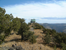
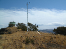
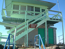
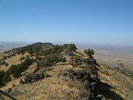
Riddle Mtn is in DN03sc a bit north of Steens Mtn DN02rp. Although upper roads to Steens are not plowed clear until after the June VHF contest, Riddle Mtn doesn't have a snow clearing maintenance issue. Tim AL1VE has worked from there for the June contest as well as some locations in DN02 and DN12 outside of McDermitt, all at about 6400'.
Tim - AL1VE
Little Lookout Mtn, DN14hq95
| 44.691150, -117.340057 |
The paved road to Salt Creek continues south as N Pine Road or FR-39 into DN14. There may be a road going to 5800 feet on the flanks of Little Lookout Mountain in DN14. But it looks like a long drive on back roads.
Salt Creek Sno-Park, DN15lf10
| 45.208715, -117.072399 |
Fish Lake, DN02qr27
| 42.738660, -118.643417 |
Fish Lake offers a good camping site for a grid expedition on Steens Mtn.
Steens Rim, DN02ms23
| 42.763382, -118.977679 |
Flagstaff Butte, DN15fb79
| 45.079870, -117.517080 |
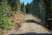
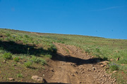
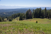
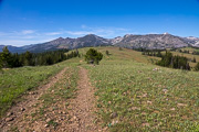
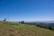
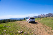
I tried unsuccessfully to find a good high point and ended up at Flagstaff Butte, a difficult-to-reach ledge high up on the mountain. This was a long slow trip with 4wd to get there. The horizon is blocked by more mountain to the NW, N, E, SE.
More scouting is needed.
Haskin Butte, DN15lq17
| 45.696260, -117.069600 |
Sheep Rock, DN15jp70
| 45.627676, -117.186053 |
Kuhn Ridge, DN15ht05
| 45.813178, -117.409270 |
Table Mtn, DN15ju54
| 45.853124, -117.206250 |
Deadhorse Butte, DN15nt54
| 45.811420, -116.874150 |
Cactus Mtn, DN15pt12
| 45.801840, -116.738460 |
Grassy Knoll, DN15qn52
| 45.550190, -116.617840 |
Hat Point, DN15qk04
| 45.436970, -116.661600 |
Sacajawea Spring Camp, DN15qk06
| 45.442840, -116.664390 |
Harl Butte, DN15nh48
| 45.328220, -116.877010 |
Miller Butte, DN15me18
| 45.204110, -116.988780 |
Skyline Road, DN05xo97
| 45.613150, -118.001600 |
Bald Mtn, DN14bn27
| 44.574620, -117.895780 |
Dooley Mtn, DN14co17
| 44.616073, -117.821864 |
Big Lookout, DN14io66
| 44.610220, -117.278450 |
Mountain Lookout Road, DN14fc27
| 44.115650, -117.565340 |
Meadow Brook Summit, DN04lw24
| 44.936826, -119.059310 |
Steens Mountain, DN02rp02
| 42.636418, -118.576717 |
The highest road in Oregon.
Steens Mountain is a large fault-block mountain in the southeastern part of Oregon. Located in Harney County, it stretches some 50 miles (80 km) long north to south, and rises from alongside the Alvord Desert at elevation of about 4,200 feet (1,300 m) to a summit elevation of 9,733 feet (2,967 m).
Battle Mtn, DN05mh22
| 45.301848, -118.980528 |
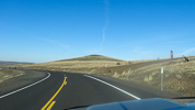
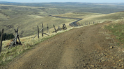
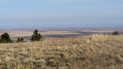
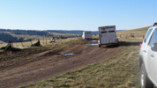
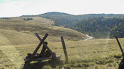
Convenient access from Hwy 395 makes this local high point a quick stop with good propagation in all directions except east. Near a knob, we stopped at a wide point that provided ample space to pull off, but the dirt road continues upward to the mountaintop.
Battle Mountain State Park with campground is nearby at 45.28361,-118.96972 on Carney Butte.
Restrictions:
Be sure to park off the road as big trailers for cattle ranchers can be common.
Pendleton, DN05op68
| 45.661732, -118.781047 |
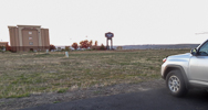
This used to be an easy hilltop in Pendleton among a strip of hotels, providing quick setup and good propagation to Tri-Cities area and beyond. Look around and try something nearby; this particular spot is under construction.
Driving directions: Easy access from I-84 exit 210. There are several areas along SE Nye Avenue that could be used. I like the paved lot between Hampton Inn and Social Security office. Note there are higher hilltops a few miles west of Pendleton on I-84.
Restrictions: 2014-08-17: Unavailable. This area is fenced and under construction.
Juniper Mountain, DN02aw73
| 42.929217, -119.933381 |
Dig out the map to locate this one. It is off Hwy 395 south of Wagontire near the DN02/DN03 grid line.
Driving directions: Hwy 395 to south of Wagontire.
- West on road to mountain. Not sure about lat/long.
- No further information available - better get some maps!
King Mtn Lookout, DN03nt54
| 43.810128, -118.868651 |
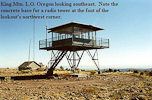
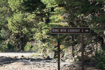
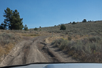
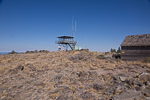
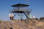
This is a Forest Service Lookout 18 miles NNE of Burns, OR.
This site is about the same elevation as Calamity Butte Lookout which is about 10 miles to the northeast and is staffed. This lookout is not manned, it's a 10' all-steel live-in with a garage nearby. Broad, wide-open summit.
In Sept 2015, the road for the final ascent is in very poor shape with rocks, gullies and very slow going. It took an hour to drive up to King Mtn Lookout, and there's a 2-meter repeater. It would be easier and a better spot at the Calamity Lookout instead.
Driving directions: Some distance from Highway 395.
Snow Mtn Lookout, DN03gx02
| 43.970357, -119.496587 |
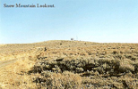
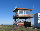
A Forest Service Lookout 35 miles NW of Burns, OR. Broad and open on top. The lookout cabin on top sits on a 10' wooden tower.
It is staffed in the summer, so you might want to check ahead with the Forest Service since the lookout on duty probably won't appreciate company for a whole weekend. There are a couple of VHF repeaters on site.
Driving directions: 35 miles NW of Burns, OR.
- Road is paved a great deal of the way from Burns.
- That which is gravel is kept up really well to the summit.
Upper Dugout Creek, DN03xq69
| 43.704708, -118.029470 |
Thumbtack Resevoir, DN03ax01
| 43.963291, -119.992933 |
Thumbtack Resevoir might be a place to stop on a small plateau in the northeast corner of DN03. If you can get there, it might have easy access to CN93-94 and DN04.
Cottonwood Mtn, DN14ed08
| 44.159203, -117.666496 |
Poison Springs Bluff, DN13hr23
| 43.722099, -117.395599 |
This is identified as SOTA peak W7O/SE-179, an unnamed ridge above Poison Springs in Eastern Oregon, and there appears to be a visible track to the top.
As of Oct 2014, it has not been activated for SOTA.
Tub Mtn, DN14jd18
| 44.159401, -117.239098 |
There appears to be a visible track to the top of Tub Mountain.
This is SOTA peak W7O/SE-114. As of Oct 2014, it has not been activated for SOTA.
Dixie Butte, DN04qn49
| 44.582778, -118.626944 |
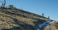
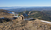
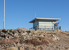
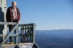
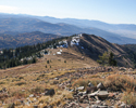
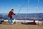
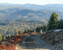
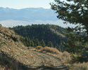
Summit is open with no trees to block the view. There are a couple of VHF repeaters on site.
Lookout cabin on top sits on the ground. It is staffed in the summer, but you might want to check ahead with the Forest Service, as the lookout might be occupied during your visit. We found the cabin shuttered and locked in October 2013.
Driving directions: Forest Service lookout 15 miles northeast of John Day, OR.
The road is very rocky, narrow and steep with few places pull out. Not for the feint hearted.
Allow 45 - 60 minutes to drive the four miles from the main highway to the top.
Fall Mountain, DN04lh40
| 44.293333, -119.042500 |
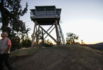
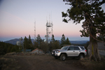
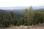
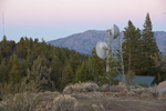
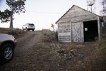
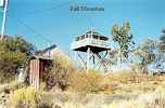
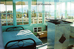
Site has several communications facilities including an FM radio station. Lookout tower on top can be rented and has electricity. Drawback is the mountain does not prominently rise above the surrounding terrain and is somewhat shielded to the east by the Strawberry Mountains.
Driving directions: Forest Service lookout 9 miles SSW of John Day, OR.
It has a nice road to the top and easy access off Hwy 395.
Ritter Butte, DN04lu10
| 44.833633, -119.071583 |
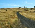
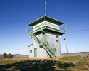

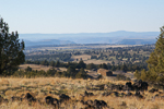
This is a fire watch tower that is approximately 3/4 mile west of hiway 395. It is in plain view of the hiway, so you can't really miss it. The dirt road going to the lookout is smooth and accessible to all vehicles. There is no access to the cab of the lookout, but there is good propagation in all directions.
This is an excellent hit and run location for a rover operation.
Driving directions: Forest Service lookout is approximately 35 miles north of Mt. Vernon on Highway 395.
Table Rock Lookout, DN04ui20
| 44.333620, -118.316390 |
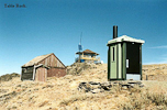
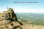
Lookout cabin on top sits on the ground. 12 miles southwest of Unity, OR.
It is staffed in the summer, so you might want to check ahead with the FS, the lookout on duty probably won't appreciate company for a whole weekend. There are a couple of VHF repeaters on site.
Driving directions: The road is not too bad - typical lookout road.
Nice parking area on top with no obstructions.
Mt Emily, DN05wk95
| 45.438167, -118.091500 |
I visited Mt. Emily in August 2001. The final run from the tree line up to the top is extremely rough and rutted. I do not recommend it with a two wheel drive vehicle. The road is very badly rutted with numerous rocks in the center - great for tearing a hole in your oil pan.
The roads getting there are not marked, and you will come to a lot of forks. I just kept heading for high ground and eventually made it. The top of Mt. Emily was a disappointment. There are five antenna towers up there, and quite a lot of trees that make finding a path difficult. There is a lot of RF flying around - I finally turned my two meter mobile rig off because the squelch control was completely overwhelmed. There is a good path to the SE, but other directions are blocked because of trees. It would take some tall masts to get over this.
Indian Rock looks like a better site. There are some trees in the way, but you can easily work around them.
Driving directions: Take exit 243 (Summit Road/Mount Emily Road, NFD 031) off of hiway 84.
- Go east on NFD 031 18.9 miles to junction of NFD 31 and NFD 3120.
- Turn right (south) on NFD 3120 (Skyline Road).
- Travel 4.9 miles to Mt. Emily.
Indian Rock, DN05wl81
| 45.466650, -118.096967 |
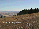
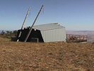
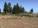
I visited this site in August 2001. The last 2.6 miles into this location is a real bone rattler. Clearance not a problem, but it is a lot like driving on cobblestones. The road is all sharp rock and could be very hard on tires. This is an isolated location, but they actually have a small campground with a picnic shelter and a campground host.
The picnic shelter has an excellent view to the SE. (See the photos) The campground has pit toilets and no other amenities other than a great view. Many maps show a campground about 1/2 mile south of Indian rock, but it no longer exists.
I came into Indian Rock from the north, and the campground host warned me about continuing south towards LaGrande on Compton Road and Fox Hill Road. He claimed that there is a steep grade that is nearly impassible, so his suggestion was to leave the area by going west to I-84.
Driving directions: Take exit 243 (Summit Road/Mount Emily Road, Forest Road 031) off of hiway 84.
- Go east on Forest Road 31 18.9 miles to junction of Forest Road 31 and Forest Road 3120.
- Turn right (south) on NFD 3120 (Skyline Road).
- Travel 2.54 miles to Indian Rock.
- The last 2.6 miles is extremely rough!
Emigrant Hill, DN05qn29
| 45.581783, -118.644067 |
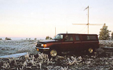
There are several good operating locations along the old highway between exits 224 and 228. Just look for the clusters of radio facilities and the gravel roads leading to them. Watch for "no trespassing" signs as there is one cluster of radio facilities that is off limits. Plus, for the modest radio operator, you are conveniently within a short drive of a restroom at Exit 228!
The image above is WR7X on Emigrant Hill in the January 2003 VHF contest.
Be forewarned, the underpass at Exit 228 was not designed with radio contesters in mind, it is very narrow and VERY low clearance. Should you need to head east while parked at the rest area north of the freeway, you'll need to proceed down the old highway to Exit 234 and get back on the freeway. Same is true if you missed the 224 exit heading eastbound, you'll want to go to Exit 234 and double back.
Driving directions: I-84 east from Pendleton to Exit 224.
- Go north back under the freeway to Old Emigrant Hill Road.
- Turn right.
- Or, I-84 west from Meacham, take Exit 228 at Deadman Pass.
- Stay north of the freeway past the rest area on the 2-lane road.
High Ridge Lookout, DN05wq73
| 45.682150, -118.101767 |
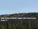
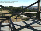
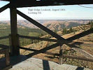
This is a Forest Service fire lookout located on a ridge North of LaGrande, Oregon and due east of Pendleton.
Update 9/2003: Per Rex, WR7X the road to High Ridge is now gated.
It has excellent exposure in all directions. The location on the ground is great, but the decked platform just under the cab on the lookout is even better. Judging by the amount of lightning grounding on the guard tower they must get some horrendous lightning storms up there. This is a great site and is easy to get to. See the photos - I counted 79 steps from the ground to the deck below the cab, so it has to be at least 60 feet off the ground.
This location is not marked on the DeLorme maps, but shows up in the Benchmark map book, Map 43, grid D8.
Driving directions: It is best to locate this site on a good map and then determine the best route. It is on Forest Road 31 (Skyline Road).
The roads are well maintained, but many signs are missing. Set your GPS for N45.68091, W118.09009 - this will take you
to the turn-off from Skyline Road to the lookout. I recommend that you go there via Highway 82 and Elgin - it is a little
farther, but the roads are much better and a lot faster. Coming in from I-84 you have to travel a lot of gravel road,
and it is very dusty. The route from Highway 82 is paved except for the last mile.
From I-84.
Take Exit 243 (Summit Road/Mount Emily Road, Forest Road 31) off highway 84
- Go NE on Forest Road 31 approximately 30 miles to High Ridge Lookout Road
- As soon as you take High Ridge Lookout Road, the road splits
- Take the road on the left that parallels the main road
- Go north approximately one mile on High Ridge Lookout Road
From Highway 82. Go to Elgin on Highway 82
- From Elgin, take Highway 204 to Forest Road 31
- Go SW on Forest Road 31 approximately four miles to High Ridge Lookout road
- As soon as you take High Ridge Lookout Road, the road splits
- Take the road on the left that parallels the main road
- Go north approximately one mile on High Ridge Lookout Road
Restrictions: 9/2003: Rex WR7X reports the road to High Ridge is gated.
White Pine Trough, DN05pa06
| 45.026167, -118.744167 |
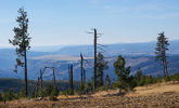
High ground in burned off area, about 14 miles east of Ukiah, OR and south of Pendleton.
There are several good operating locations along Oregon Highway 52 - the Blue Mountain Scenic Highway. We chose this one along a ridge line but many others would work well, too. The Benchmark book shows a fire lookout just south of Highway 52 that is not in the DeLorme book.
Driving directions: Take Hwy 395 to the intersection of 395 and highway 244.
- Go east about two miles to Ukiah and then take Highway 52 east about 14 miles.
- There are numerous high points that are easily accessible from the highway road.
War Eagle Mtn, DN13pa51
| 43.006356, -116.704433 |
8000 feet and a drive-up site, with a 2M and 440 ham repeater (callsign W7VOI) ... and a 1KW FM transmitter. - Rod WE7X
Mt Baldy, DN25xd84
| 45.143596, -114.009856 |
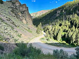
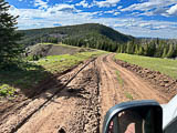
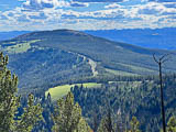
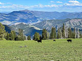
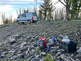
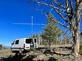
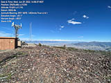
Mt Baldy is a very high and exposed peak west of Salmon, ID. If you can get away from all the radio towers at the top, this site works really well on VHF.
Driving directions:
Call the ranger station for road conditions. Take Ridge Road to the top, which approaches from the north side. This road is maintained but snow drifts may remain longer.
I strongly recommend against Road 026 on the west side even though it might be clear of snow earlier. It is an unmaintained Jeep trail. Don't take Road 026 unless you have a highly capable 4x4 with lockers and ground clearance and tree-removal tools. It took me over 3 hours to go ten miles on this route, which is basically made of sharp rocks the entire route.
Restrictions: Snow can remain through the end of June or later.
Be prepared for altitude sickness.
Hwy 28 and 22, DN33px27
| 43.987665, -112.729776 |
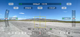
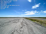
There's a very large apron alongside the intersection of Idaho Hwy 28 and 22, with a nearly-zero horizon to the east and south.
Restrictions: This is a busy and exposed area. No toilet.
Lemhi Pass West Viewpoint, DN34gx65
| 44.981492, -113.446033 |
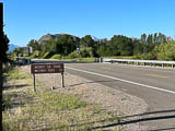
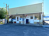
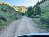
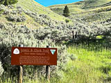
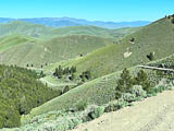
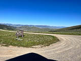
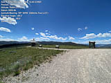
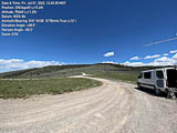
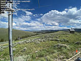
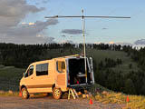
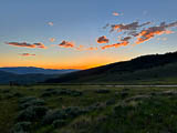
Another spot on Lemhi Pass is the "Westward Viewpoint" parking circle. It has a good view of the horizon in all directions except north. Barry K7BWH activated this in July 2022 and provides this update.
I think this is the premier spot for DN34, for both working really well on the air and the camping comfort and drivability.
Lemhi Pass is a historic place on the Lewis and Clark Trail. On Monday August 12, 1805, Lewis, with three men as an advance party, crossed the Lemhi Pass and spent their first night in Idaho near Agency Creek. Lewis wrote, "... after a short halt of a few minutes we continued our march along the Indian road which lead us over steep hills and deep hollows to a spring on the side of the mountain. Here we encamped for the night having traveled about 20 miles."
Driving directions:
- From Salmon, drive southeast on Hwy 28 for 33 miles.
- Look for Tendoy - it's hard to miss, since it only has one building: the Post Office.
- Turn left at the Tendoy Post Office onto unpaved roads.
- A short distance and turn right.
- Another short distance and turn left onto Agency Creek Road.
- Follow the road up to Lemhi Pass.
- It can get a little steep but the road is in good condition and any sedan can make it.
Restrictions: Warning sign cautions "RVs and Trailers Not Advised".
Lemhi Pass, DN34gx65
| 44.981587, -113.446326 |
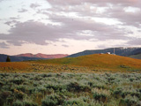
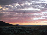
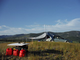
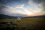
Lemhi Pass is a ridge on the border of Idaho and Montana, on the northern edge of DN34. It has a good view of the horizon in all directions except north. This spot was activated by Susanna K7SGP and Lance W7GJ on 6m during the 2015 Field Day weekend.
More details and photos at K7SGP and W7GJ Grid Expedition
Lemhi Pass is high and has a clear shot pretty much in all directions except due north, with the lowest horizons to the east and west. Lemhi pass in DN34gx is just barely south of the DN35/DN34 line. Surprisingly, there actually WAS a bit of cell phone coverage up there.
It also actually has 3 outhouses (one on the Montana side of the pass, one in the Sacajawea Memorial Picnic Area, and another on the Continental Divide just north of the pass), which were a very welcome convenience when you are camping there for 3 nights. Lance took a mountain bike for easy access to the facilities on Lemhi Pass, which were only 0.7 miles downhill from our operating site southwest of the pass. Because of the day use restrictions at the Sacajawea Memorial Picnic Area, on the Montana side southeast of the actual pass, we needed to set up on the Idaho side of the Continental Divide, just south of the day use area on the Idaho side. Lance set up on a knoll in Idaho just west of and overlooking the Continental Divide (which is also the border between Montana and Idaho at this point).
Leadore City Park, DN34hq54
| 44.687102, -113.367928 |

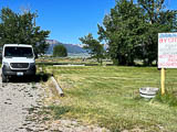
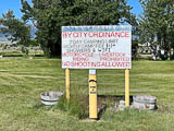
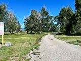
Leadore City Park is a cheap and easy campsite with shade, showers and WiFi. This is in a valley with horizon at +4 to +8 degrees toward east and west.
Restrictions: $12/night camping. No reservations; first come first served.
Check the city's park schedule for rodeos and special events.
Birch Creek, DN34nc43
| 44.096100, -112.875888 |
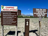

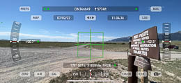
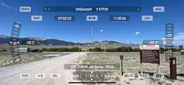
Birch Creek Campground is several miles of boondocking in a valley along Hwy 28. It's a popular area that offers a cool stream, fishing, hiking and outdoor activities.
The horizon is +4 to +8 degrees on the valley sides; not the best for VHF.
Entrances are very few, far between and easy to miss. Use the turnoff at 44.09816, -112.868217 which is in much better condition than Eightmile Canyon Road four miles further south.
Restrictions: Free camping. Tips accepted. First come first served. Ten miles of creekside camping. Two or three pit toilets.
Anderson Canyon, DN44hd98
| 44.161209, -111.335506 |
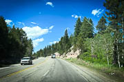
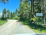
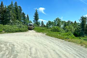

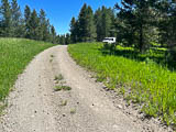
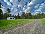
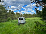
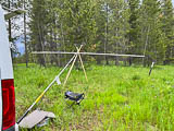
Anderson Mill Canyon Road runs along the top of the hills east of Ashton, ID. However, most of it is a small valley (not exactly what I'd call a "canyon") along the hilltop. I ended up at the south end where it opens out and had good propagation and decent horizon from there. I parked a half mile from a closed gate further on.
Pictures show the turn-off from Hwy 26. The best VHF spot would be on the first spot inside the park but it was occupied by a large RV trailer when I visited. This spot has the best horizon but is also very exposed to public traffic.
There was frequent ATV and dirt bike traffic.
North Bingham RV Park, DN33wi09
| 43.374117, -112.163621 |
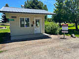
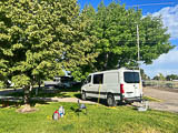
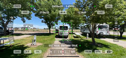
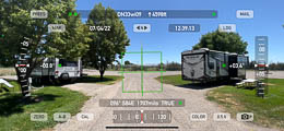
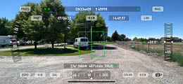
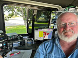
Sometimes we just want a pleasant place with showers to park under the trees for the night. This is a nice clean friendly RV park that's only a mile from Hwy 26, the main road through Shelley, ID.
Propagation on 6m was lousy and there was some background noise, but it was an easy stop and excellent respite from summer heat.
There is a good horizon, only 3-4 degrees in all directions, so it was simply a bad day of propagation.
Restrictions:
The RV plug-in pedestals have only 220v and not 110v. Be sure to bring an adapter if you need 110v, like me.
I had no problem with self-checkin when arriving without a reservation. Be sure to phone the number given and tell them you're a drive-in camper and your slot number.
Riverside Campground, DN44gg54
| 44.266768, -111.458102 |
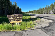
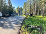
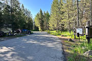
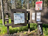
Here's a great campground in the Targhee National Forest that's clean, quiet, and full of nature along a lovely mountain stream. They take reservations for the nicest spots (Loop A and B) and also have a large section of first-come-first-served (Loop C).
Driving directions:
- From Idaho Falls, go north on Hwy 20 north for 66 miles.
- Look for Riverside Campground sign on the right (east) side.
DN23-DN24 Line, DN24oa00
| 44.000010, -114.833061 |
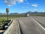
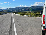
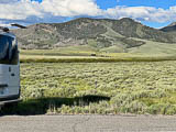
A lucky coincidence provides a wide pullout on Hwy 75 a little north of Stanley, Idaho, exactly on the DN23-DN24 grid line.
The horizon is fairly high in all directions but the location is beautiful. The grid line is toward the south end of this pullout.
Arco Hilltop, DN33ko23
| 43.599407, -113.144337 |
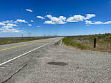
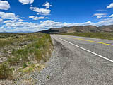
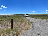
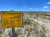
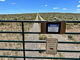
There's a moderate rise along US Hwy 26 on the plains between Arco and Atomic City. It makes a fair pullout for a quick stop along the road, and has a little better horizon than the pullout at DN33kr52.
The path to the hilltop is gated with several warning signs. Too bad, since the terrain looks good for VHF.
Arco Pullout, DN33ko52
| 43.592323, -113.124457 |
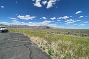
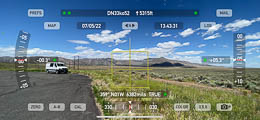
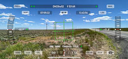
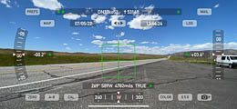
This is a paved wide spot along Hwy 26 on the plains between Arco and Atomic City. It makes the quickest possible pullout for a quick stop along the road. The horizon is +5 degrees in most directions and not as quite as good as the hilltop a half mile west at DN33ko23, but easier to reach.
Restrictions: Nothing here but parking. Actually, nothing anywhere for many miles.
Howe Peak, DN33kr71
| 43.713295, -113.100503 |
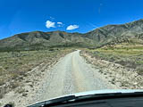
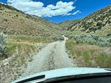
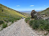
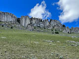
Don't go without 4x4, lockers and high clearance. The route from Hwy 33 (Road 557, aka Right Fork) starts out pleasant and then gets very steep with loose shale. There appears to be three unpaved roads converging on this peak; you should try the other routes.
The rock formations look like dinosaur fins poking straight up from the hillside. These are popular with rock climbers. A couple primitive campsites are available on the way up.
Rose Ponds Park, DN33uf18
| 43.245562, -112.318926 |
Rose Pond Park is right off the I-15 freeway between Pocatello and Idaho Falls.
This is a county-owned park along the Snake River with a 40-acre fishing lake. Open to the public, fishing, swimming, bike/walking path, dispersed camping. Free, no services. Their website is Bingham County Parks and Rec
You can park pretty far from the noisy highway if you want but cellphone service drops to almost nothing. Near the highway, Verizon clocks in at a consistent 24 mbps down/8 up. ATT varied, sometimes 3 down/1 up, other times shot up to 20 down/3 up. Received 40 over-the-air TV stations.
Driving directions: Traveling North on Highway 91, just outside of Blackfoot, turn left at the Oakridge Chevron, then turn right onto Rose Road and follow Rose Road out to the entrance just prior to going over the Interstate overpass.
Restrictions: No services. Five day max stay. Some rough roads but any size rig can access.
Poison Creek Campground, DN14wq60
| 44.668408, -116.111238 |
Notch Butte Lookout, DN22sv92
| 42.884833, -114.418690 |
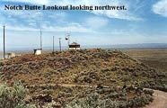
Notch Butte is a BLM lookout, at a quick 1/2 mile side trip off Highway 93 between Twin Falls and Shoshone. The butte is only about 300' above the immediate surrounding terrain, but might make a good rover stop.
There are two summits on the butte (both loaded with repeaters), with a "notch" in between them. The lookout may be staffed in the summer.
Driving directions: Three miles south of Shoshone, ID.
Big Southern Butte, DN33lj75
| 43.396120, -113.022619 |
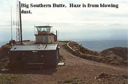
Big Southern is a good 2,000-3,500' above the surrounding sagelands with nothing of comparable height for miles. There are a few repeaters on the summit.
Check ahead with BLM on this. If there is a lookout on duty, they may not appreciate having company for a weekend.
Driving directions:
23 miles SE of Arco ID. In 2003, there was an opened gate at the base of the butte.
DeLorme maps aren't real accurate for this desolate part of Idaho. Access is via Taber Road 1 mile south of Atomic City, with a signed intersection pointing toward the butte. There are two ways to get to the top, but the best I found was staying to the south of the butte, and circling around the west side, dodging potholes the whole way. The road to the top doesn't show on the maps, but it comes up from the northwest side.
Thorn Creek Lookout, DN23cr98
| 43.744622, -115.751188 |
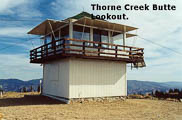
The lookout may be staffed in the summer months. Unobstructed 360 degree view. Excellent coverage into Boise and points west. Disappointing propagation elsewhere, probably due to lack of activity.
Driving directions:
From Idaho City, head east 1.5 miles on Hwy. 21 to a right turn on F.S. road 304. The road is in fairly decent shape up to a mile below the summit, where there is a 4-unit campground with nice vault toilet facilities.
The rest of the way to the summit is typical mountain road, rocky and washed out in places. There are two routes to the lookout which split near the top; neither is preferred over the other.
Restrictions: Expect some remaining snow in June.
Deadwood Lookout, DN24dd50
| 44.125843, -115.704410 |
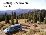
Deadwood Lookout is a Forest Service lookout that can be rented. See the Forest Service webpage: www.fs.fed.us/r4/boise/emmett/cabins/deadwoodlookout.htm
Cottonwood Butte, DN16sb46
| 46.068296, -116.464696 |
Black Mtn, DN18vo17
| 48.612814, -116.240798 |
Black Mountain has a fire lookout tower and lot of communication towers onsite. The lookout can be rented. It is somewhat shielded by Mt Clifty (6700') a few miles east. Nice clear shots north and south.
Galena Pass, DN23pu48
| 43.870033, -114.712463 |

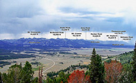
Galena Summit is one of the highest paved roads in Idaho. This is a high mountain pass on Hwy 75, the Sawtooth Scenic Byway, leading from Ketchum to Stanley.
About a mile west of the summit is Galena Overlook, a handy place to park with a decent view east. Google Street View.
DN21-22 Jackpot, DN22pa90
| 42.000000, -114.673780 |
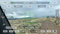
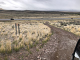
How handy! The DN21-22 grid line is a short 1/4-mile scramble from the main Hwy 93. A bare and level spot in scrub brush lets you keep the unpaved road clear, which leads to a cellphone tower toward the south.
Driving directions: From Jackpot, NV, drive north on Hwy 93.
In a half mile, after speed limit rises, look for turnoff on the left.
A signpost has "River 3 miles, 4WD or high clearance advised".
Cross a cattle grate and turn left.
Restrictions: 4WD is needed for loose stuff on unpaved road.
Park Creek, DN24lg67
| 44.282516, -115.027291 |
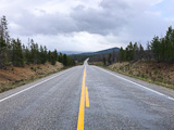
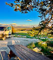
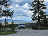
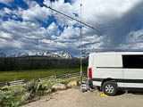

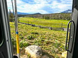
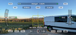
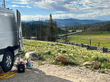
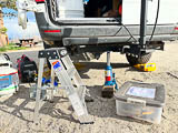
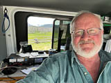
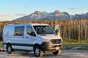
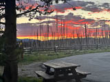
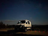
Park Creek Overlook is pretty much the best spot for VHF right on Hwy 21 just north of Stanley. It's on a local high point where the valley is a little wider than other places. The scenery is incredible. There are gobs of other turnouts and side roads along this stretch so there's lots of choices; this one has a handy vault toilet and level parking and is paved to reduce dust.
My parking spot has a little more slope than I could accomodate with my leveling ramps. I used the car jack to raise the back end slightly to level out my bed.
Challis RV Park, DN24vm00
| 44.501799, -114.248379 |
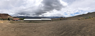
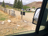
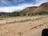
Challis Golf Course and RV park is a ways up the eastern hillside of a wide valley on Hwy 93, giving you some viable horizon from East to South directions. It's not great but it's better than all the rest of Hwy 93. At least, it's convenient and you could have shore power if you rent a spot in the RV park.
McKim Creek, DN34at46
| 44.819956, -113.960979 |
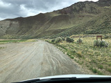
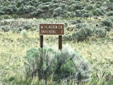
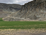
McKim Creek is a turn-off from Hwy 93 that appears to head up into the hills for 7 miles. Scouting may (or may not) find a decent hilltop.
Driving directions: Turn off from Hwy 93 at 44.797271, -114.002572.
Restrictions: Must have a high-clearance 4x4 and a chainsaw. Rough road is unmaintained after the first two miles.
Clover Mtn, DN12sr96
| 42.734867, -116.418627 |
Williams Lake, DN24xx99
| 44.997471, -114.000100 |
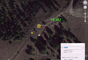
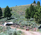
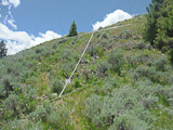


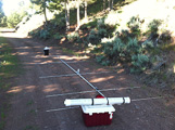

The DN24-DN34 grid line is about an hour from Salmon, Idaho.
Read the whole story from Lance W7GJ at W7GJ solo Field Day 6m Grid DXpedition to the DN24xx/DN34ax line in Lemhi County, Idaho, June 23-27, 2016
The site was only about an hour from Salmon, Idaho and all but the last 8 miles was on paved roads. What's not obvious from Google Earth was that the old jeep trail up to the grid line is very steep, rocky and overgrown with sagebrush, as well as deliberately closed off by small downed trees, making it necessary to operate out of the car down on Salmon National Forest Road 413, at a spot close enough to reach the antenna with the feedline.
Sula Peak, DN25xu96
| 45.859828, -114.000100 |
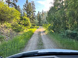
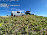
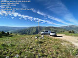
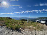
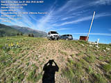
Sula Peak is exactly on DN25-DN35 grid line, a relatively short climb up unpaved roads to a high point off Hwy 93. There is a cellphone tower and a cattle-feeding station. About 35 minutes driving time from Darby.
However, there is no level area to sleep, there are people around in the summer because the lookout is staffed, and it's a small knob that can be crowded. You can't park on the grid line, so if your antenna is attached to your vehicle (like mine) then you're out of luck.
Woods Creek Pass, DN25sm77
| 45.532308, -114.438282 |
Woods Creek Pass is on the ridge line of the MT-ID border. This is a good launching point to explore NG-044 in both directions for good operating spots on the ridges.
Hell's Half Acre, DN25qp44
| 45.645595, -114.628557 |
Driving directions: Approach from the east side, i.e. using Hwy 12 from Missoula or Salmon.
Restrictions: Typically snowed in until June.
Bare Cone Lookout, DN25tr02
| 45.719174, -114.412236 |
Driving directions: Approach from the east side, i.e. using Hwy 12 from Missoula or Salmon.
Restrictions: Typically snowed in until June.
Lolo Pass, DN26qp71
| 46.631470, -114.604990 |
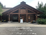
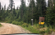
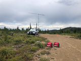
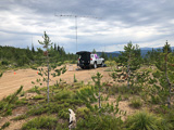
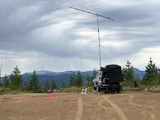
Lolo Pass is 45 miles south of Missoula, MT. Take Hwy 93 south to Lolo, and turn onto Hwy 12 up to the pass.
Highway 12 from Lolo Pass to Lewiston-Clarkston is one of the most scenic and picturesque mountainous routes in the country. I've ridden this on motorcycle and thrilled to the sign "Curves 99 miles". Every turn highlights a new look at clear streams running over mossy rocks burbling down through narrow valleys framed by lush green forests. Allow time to stop and enjoy it.
Lolo Pass Visitor Center at 5,225' offers a large parking lot for a quick stop for contacts. Better yet, take the unpaved road west from 100 yards north of the visitor center. It takes you up to the ridge line at 6,180' with open horizons in all directions.
Driving directions: Drive to Lolo Pass visitor center on Hwy 12.
Find the unpaved road leading west, marked by brown sign "Crooked Cr 12"
and "Boulder Cr 20" and "Granite Pass 6" and "FS 595".
This road starts in the Lolo National Forest and travels through
the Nez Perce - Clearwater National Forests.
Restrictions: No cellphone, no internet, no APRS.
Highway 12 is a beautiful, smooth road but this is a very remote
national park area with no services for a hundred miles or more.
Lookout Pass, DN27dk99
| 47.454480, -115.671090 |
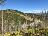
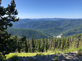
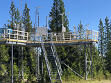
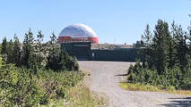
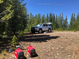
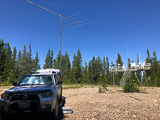

Lookout Pass is on the Idaho-Montana border on I-90. You can operate from the ski area at Exit 0, but better yet, drive up the well-maintained forest service road on the opposite side from the ski area. This is an excellent road and in twenty minutes or less you will enjoy an unobstructed horizon in all directions.
The easy drive up offers some great views of the ski area across the small valley. There is a gate on this road which is locked open during the summer. A sedan or RV can climb this hill by exercizing normal caution. Note there are rain-runoff strips in the road which look like they'll slash your tires, but they're made of heavy plasticized canvas and are no danger.
At the top, you could continue a mile to the FAA Air Traffice Control radar golf ball. Note large warning signs of "STAY BACK AT LEAST 150 FEET" and "Any person who interferes with air traffic control or trespasses on this property will be prosecuted under federal law." So, go back west a half mile to a large level clearing that can hold a dozen cars or a few large RVs. There is good Internet access via Verizon.
The clearing is shared with a NOAA ASOS (Automated Surface Observing Station) which looks new in 2019 and is very high tech, with camera stalks facing each other and flashing lights and a small blue merry-go-round. I’ve been around the block a few times but didn’t recognize most of the measurement devices.
Driving directions: Drive on I-90 to Montana Exit 0.
Turn west to operate from the ski area.
Turn east onto unpaved Beacon Road to climb onto the ridge line.
The MT-ID border follows this ridge and Beacon Road is alternately in
each state.
At the clearing with the weather monitor, check your GPS to figure out
which side of the state line you're in. The clearing covers mostly ID (north) but
includes MT (south). There's a survey post marked "MONT-IDA" but it's hard to
tell where the line extends from.
Sunset Peak, DN27bn95
| 47.563513, -115.834463 |
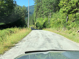
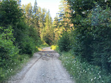
Sunset Peak and nearby Goose Peak are high spots on Dobson Pass near the west edge of DN27, and near the eastern border of Idaho.
However, it's probably not worth the trip. I started up this unpaved road and found it to be poorly maintained, narrow, with potholes and overgrown vegetation. It started out paved and quickly devolved into a bad forest service road. It's not the worst road I've climbed but I didn't want to scratch up my paint for a ridge line that didn't seem that promising in the first place. I turned around and went on to DN27dk on I-90 Lookout Pass, which was excellent.
Driving directions: Five miles east of Wallace, ID, is the small town of Osburn. Turn off I-90 and go north on Two Mile Road until you either reach Dobson Pass or get tired of fighting the potholes and overgrowth.
China Hat, DN42es88
| 42.786220, -111.597090 |
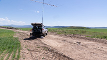
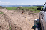
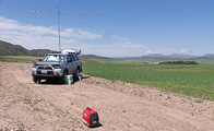
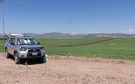
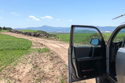
This spot is a field access road near a sharp bend on the way to the Blackfoot Resevoir recreation area. The actual China Hat is a pointed hill nearby in sight of this parking spot. I stopped here before reaching Blackfoot Reservoir because it had wide open sky and far-away hills. Basically this is one of many flat valleys in southern Idaho surrounded by high ridges. This is one of the wider valleys with more open sky than most others.
There is a KOA Kampground in Soda Springs.
Driving directions: From Soda Spring, go north on Hwy 34 for 22 miles.
Turn left (west) on China Camp Road, drive 1.7 miles.
Look for good turnouts; if you turn right (north) on Government Dam Road, you've gone too far.
Restrictions: If it has rained recently, be wary of slick mud.
Blackfoot Reservoir, DN42ev42
| 42.885180, -111.632100 |
Blackfoot Resevoir is forty minutes north of Soda Springs. There is a park and boat ramp at the south end but the spot chosen here might be a bit more secluded with a better chance of horizons to the east and southeast.
There is a KOA Kampground in Soda Springs.
Driving directions: From Soda Spring, go north on Hwy 34 for 22 miles.
Turn left (west) on China Camp Road, drive 4.1 miles.
Turn right (north) onto Government Dam Road, drive 5.0 miles.
Turn right (east) onto unpaved loop road.
American Falls Reservoir, DN32ns46
| 42.778917, -112.882165 |
Coldwater Hill, DN32ko27
| 42.613870, -113.145200 |
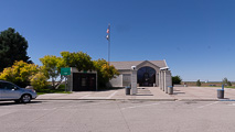
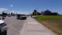
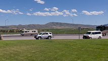
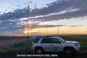
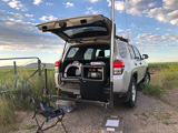
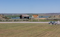
Coldwater Hill is a rest area along I-86 in the Snake River valley with a historical site regarding early emigrant trails to California and Oregon in the 1850s. Some ruts have been preserved from settlers' wagon trains. Spend a few minutes on this bluff to appreciate how hard people worked to Go West.
The rest area has ample parking, but you can gain a little more altitude and a more open horizon by using the nearby frontage road (Coldwater Road). Continue eastbound on I-86 for one mile, take the next exit (Osborn Loop road) and double back. Find a wide spot or a farmer's field access apron and set up there.
I had a delightful morning on MSK144 meteor scatter from 6 - 10am on Coldwater Hill.
Driving directions: It's about 30 minutes west of American Falls on I-86.
The rest stop is only on the eastbound lanes, so take one of the exits on either side
(Exit 15 or Exit 21) and use the frontage road to find an operating spot.
Cotterell Rest Area, DN32hm01
| 42.504788, -113.408781 |
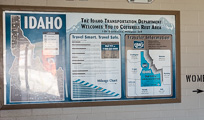
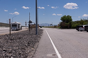
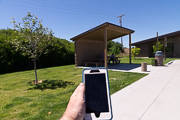
Sometimes the freeway's Rest Area is a great place to pull off and make a few contacts. Cotterell Rest Area is not one of them. Sure, it has easy access, but the parking area is small, in a slight depression and it's surrounded by a 10' berm. You might make some contacts but this is not favorable for VHF distant contacts.
Bliss Rest Area, DN22lw15
| 42.939310, -115.071183 |
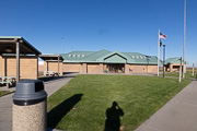
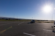
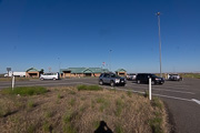
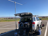
This is a wide open Rest Area on I-84 (US Hwy 26) between Glenns Ferry and Gooding, ID. Look for it between Exit 129 and 137 in southern Idaho.
It's a good easy quick stop off the highway with parking, restrooms and open horizon in all directions.
Jerome Rest Area, DN22sp36
| 42.651344, -114.473458 |
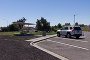
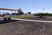
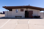
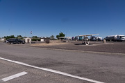
This rest area near the intersection of I-84 and Hwy 93. However, it is only reached from Eastbound I-84. You can try the nearby Flying J Travel Center if travelling from any direction and for more services.
CJ Strike Park, DN22aw39
| 42.954256, -115.971130 |
CJ Strike Dam includes a large wildlife management area about 30 minutes southwest of Mountain Home. This spot on the backed-up Snake River is in the northwest corner of DN22 and offers ample parking for recreation activities. It has an open view toward the southeast across the lake. The park surrounds the lake and you might find other spots with horizons in different directions.
Driving directions: From Mountain Home, take Hwy 51 - 67 - 167.
Turn left (south) onto Strike Dam Cut-Off Road.
Sunset Mtn Lookout, DN23ev25
| 43.898790, -115.646818 |
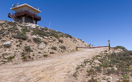
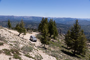
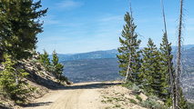
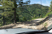
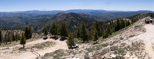
This peak with a lookout seemed promising in theory, but it's a very long drive with no reward because I couldn't park up on top to reach a clear horizon. The last bit is gated, leaving me with only a northeast view toward emptiness and Canada. I spent all afternoon with a long drive but made zero contacts.
On the plus side, the views are spectacular and it does have a vault toilet.
The lookout was unstaffed when I visited June 2018, although a friendly park ranger made a routine visit.
A nearby spot that's much easier to reach is DN23ew Mores Creek Summit parking lot. It has just as good of a horizon view as the lookout.
Driving directions: From Idaho City, drive north on Hwy 21 (Ponderosa Pine Scenic Route).
Turn right at the Mores Creek Summit trailhead parking area (43.931809, -115.668737).
Follow this unpaved road, FS 316, to the top.
Total driving time is about an hour from Idaho City.
Restrictions: Rough unpaved road. Any vehicle with decent ground clearance could make it. The first bit is a steep stretch but then it's not too bad; it's just a long slow drive to the top, about half an hour.
Mores Creek Summit, DN23ew01
| 43.922370, -115.662270 |
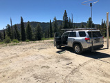
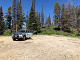
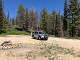
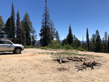
Mores Creek Summit is a large flat easy-to-reach parking area with good horizon in most directions. It's exactly at the turnoff to Sunset Mtn Lookout, but I vastly prefer its convenience over the extra drive to the mountain peak. The horizon here seems just as good as the peak; stop here unless you know the peak's final gate is open.
Driving directions: From Idaho City, drive north on Hwy 21 (Ponderosa Pine Scenic Route).
Enjoy the extremely picturesque drive up the mountain.
Turn off at the Mores Creek Summit trailhead parking area.
Gooding Gravel Pit, DN23qd18
| 43.162287, -114.650694 |
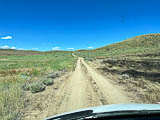
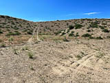
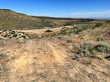
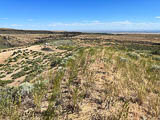
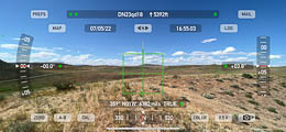
Why are so many gravel pits at the top of hills? Hwy 46 between Fairfield and Gooding is a high plain and contains an even higher large gravel pit on a hilltop. Look for a sign to the "City of Rocks" road, and on the east side there's an open hilltop with excellent horizon. This is much better than the Camas Prairie Overlook a few miles west.
Driving directions: From Mountain Home take Hwy 20 east, drive 52 miles.
At Fairfield turn right onto Hwy 46 south, drive 13 miles.
At 43.163824, -114.658626 turn east on unpaved road, drive a half mile.
After entering the gravel pit, try driving up the last little ascent
to the very top.
Blacks Creek Rest Area, DN13wl74
| 43.478511, -116.106761 |
Blacks Creek Rest Area is a quick pull-off from I-84 about ten minutes south of Boise in a large flat plain. There are separate areas for eastbound and westbound traffic. There's a nice "Oregon Trail" display in the parking area.
Driving directions: I-84 exit 64.
Soda Point, DN42dp53
| 42.641640, -111.702299 |
Baldy Mtn, DN42an61
| 42.548354, -111.947672 |
Might be some likely VHF spots along the ridge line south of Lava Hot Springs.
Cow Camp Rd, DN42cv13
| 42.891526, -111.822490 |
Dirt road along N-S ridge. Look for a good spot starting here.
Threemile Knoll, DN42bh98
| 42.325163, -111.837117 |
Hill with an access road through a sand pit.
Windy Point, DN13nk41
| 43.424020, -116.881875 |
Satellite view shows dirt road across gently rounded hilltops.
Hawley Mtn, DN13xx68
| 43.992696, -116.030994 |
Hawley Mtn is in the NE corner of DN13 grid square, with good prospects of driving to DN14-DN23-DN24. There is a lookout tower that is no longer in use.
More info on IdahoClimbingGuide.com and IdahoSummits.com
Danskin Lookout, DN23ej09
| 43.413049, -115.659557 |
Danksin Peak is 20 miles due north of Mountain Home and is very visible from the Interstate as you head to/from Boise. The peak rises high above the desert to its south and very steeply above the South Fork Boise River to its north. The top has impressive views in all directions, with the Snake River Plain and Owyhee mountains to the south. To the north is the green Smith Prairie and the Boise and Trinity Mountains, which are very impressive from this angle. Read more at IdahoSummits.com
Trinity Mtn, DN23go83
| 43.598851, -115.428957 |
Satellite view of road looks impassable. At this altitude the road will be snow-covered for most of the year. But it sure is a nice tall peak, even though it's so remote.
Bell Mtn, DN23wk63
| 43.431048, -114.111146 |
A good peak where ground slopes away in all directions. Satellite view shows one radio tower and some cars.
Driving directions: Bell Mtn is 3 hours east of Boise (about 2.5 hours east of Mountain Home)
Careful with your GPS and Google Maps - there is another different Bell Mtn near Clyde that has no roads
Your route must be through Gannett or Bellevue
Hwy 20 east from Mountain Home
At Stanton Crossing, turn north onto State Hwy 75
Drive through Bellevue on Main Street
Turn right onto Pine Street, this becomes Muldoon Canyon Road (5.5 mi)
Turn right onto Sharps Canyon Road (5 mi to top)
East Butte, DN33ql09
| 43.497630, -112.665105 |
This is a prime hilltop that's loaded with commercial radio towers, which is always a dead giveaway of its propagation value. Not sure if it has a good operating spot away from the existing antennas.
Driving directions: Hwy 20 between Arco and Idaho Falls.
Turn south onto Grant Road and follow it to the top.
Circular Butte, DN33qt39
| 43.831032, -112.635245 |
Easy access on dirt road from Hwy 33 near Terreton.
Swan Valley, DN43hk46
| 43.444685, -111.382602 |
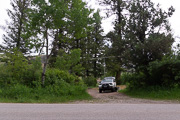
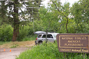
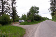
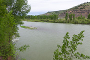
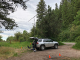
Swan Valley is a town along the Snake River below the big Palisades Dam. This operating spot is in National Park land directly along the river, down in somewhat of a slot canyon where it narrows near this spot. Steep hills on either side might restrict your possibilities but the canyon points NW-to-SE and gave me contacts from Portland to Seattle.
Try using meteor scatter here - it has a good chance of working much better than waiting for 6m skip.
Driving directions: Drive north from the city of Swan Valley on Hwy 26.
Turn left immediately after crossing the bridge at Fall Creek Road.
I took NF-058 and drove a mile to the Targhee National Forest sign on the left.
Also try Fall Creek Road a very short ways west from NF-058. It climbs up the ridge
to a tower and clearing.
Restrictions: This is a busy road; expect lots of traffic as this is the only road that gives access from the south side of the Snake River. The recreation area near the Palisades Dam attracts hunters, fishermen, ATV and horse trailers.
Dalton Hill, DN43fi05
| 43.356707, -111.576290 |
Kepps Crossing Road runs along the top of a good-looking ridge line. This spot is one possible turnout.
Driving directions: NF-077 also known as Skyline Rd, also known as Kepps Crossing Rd.
Drive to Idaho Falls which is on I-15.
Follow S Blvd to E Sunnyside Rd (1.6 mi)
Follow E Sunnyside Rd to Eagle Pass Rd (13.0 mi)
Drive to Kepps Crossing Rd / NF-077 (17.2 mi)
Ninemile Knoll, DN43aw35
| 43.940015, -111.969767 |
It's not much of a hill but looks like a wide open spot with no trees and easy drive far from the mountains, on the satellite view.
White Owl Butte, DN43fs23
| 43.763249, -111.560790 |
Satellite view suggests this is reasonably accessible from White Owl Road.
Bennett Mtn South, DN23gf56
| 43.235502, -115.451548 |
The south peak of Bennett Mtn is (almost) free of commercial towers. The north peak is loaded with'm. This spot is ten miles northeast of Mountain Home and should be relatively easy to reach from I-84.
Sid Butte, DN32au43
| 42.848670, -113.959654 |
This spot along Shale Butte Road (which touches the lava fields) is 200' higher than Shale Butte. Sid Butte is three miles south of Hwy 24 on dirt roads.
Shale Butte, DN32cx15
| 42.981156, -113.818618 |
Shale Butte is a local high spot in the arid plane that is a half mile from DN33 to the north. Might be worth a try to see if you can park exactly on the DN32-33 grid line, a thousand feet north of Shale Butte Lake.
Stevens Peak, DN33ud42
| 43.136691, -112.294787 |
Satellite view seems to show a road up to Stevens Peak.
Driving directions: Drive to Blackfoot (home of the Idaho Potato Museum) and drive southeast on Cromwell Lane to the Equalizing Resevoir. Cross the Blackfoot River and continue straight on dirt roads, turning right to go south under the power lines.
Gedney Butte, DN22bl33
| 42.474732, -115.888435 |
Gedney Butte is a mild rise alongside Hwy 51 with a convenient turnoff at a sand pit. Quick and easy access.
Pence Butte, DN22ic53
| 42.096610, -115.287746 |
It's called a "butte" and it has a road, but it sure looks flat.
Sugar Loaf, DN22ti76
| 42.361190, -114.356187 |
This spot on Indian Spring Road has a turnoff to Sugar Loaf about 500' to the west. The road follows a n-s ridge line that probably has some operating spots.
Cherry Springs Rd, DN22uj14
| 42.394188, -114.323405 |
From FR-554 take Cherry Springs Road to explore a long n-s bare open ridge line.
Dave's Pass, DN22xb49
| 42.081599, -114.044491 |
Satellite view suggests off-road access from this point on Coal Bank Road to reach a knoll just north.
Graham Peak, DN32dc39
| 42.124447, -113.717122 |
Satellite view suggests a road goes to the top of Graham Peak.
Graham Peak, at 8,867 feet above sea level is the fourth highest peak in the Albion Mountains of Idaho. The peak is located in the City of Rocks National Reserve and Cassia County less than 0.2 mi south of the Sawtooth National Forest border. Wikipedia
Horse Butte Rest Area, DN32hm11
| 42.504550, -113.407381 |
Rest area along I-84 provides easy stop and large open area, but no special altitude.
North Chapin Mtn, DN32jm91
| 42.505066, -113.172209 |
The North Chapin Mtn road runs along a bare, open ridge line. There's probably a good spot somewhere along here.
Sand Gulch, DN32ql16
| 42.485623, -112.657443 |
This road might give access to the ridge along Deep Creek Mountains.
Canyon Bluff, DN32se57
| 42.196147, -112.452902 |
Looks like a decent bluff near an aircraft VOR navigation site.
Samaria Mtns, DN32tb25
| 42.065144, -112.396653 |
Looks like a driveable peak.
Lake Walcott SP, DN32gq21
| 42.674957, -113.482235 |
Lake Walcott State Park is an RV campsite in the Minidoka National Wildlife Refuge on the Snake River, along I-84 halfway between Twin Falls and American Falls.
You might find a good campsite to operate from, or drive from here clockwise around the lake to find another location. This area is a wide, flat valley at the south end of Crater of the Moon.
Twin Peaks, DN24so22
| 44.593218, -114.476509 |
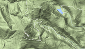
Details and photos at W7GJ Expedition to Twin Peaks Lookout at DN24so, Custer County, ID
Restrictions: High altitude, so check road conditions before departure.
Sturgill Peak, DN14mo68
| 44.620137, -116.943271 |
Hawley Mtn, DN14xa83
| 44.013126, -116.013522 |
Hawley Mtn is in the SE corner of DN14, and offers DN24 a quarter mile east.
Hawley Mtn, DN24aa04
| 44.017956, -115.998030 |
Hawley Mtn is in the SW corner of DN24, and offers DN14 a quarter mile west.
Sheep Trail Campground, DN24lh33
| 44.305770, -115.056610 |
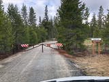
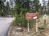
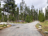
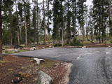
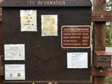
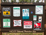
This is a convenient and extremely nice campground along Highway 21, about 15 minutes north and west of Stanley in the Sawtooth National Forest.
Although this spot is deep in a valley, it's a good base for finding accessible hilltops. For example, the next turnoff south of here onto Elk Creek Road (44.296056, -115.043013) needs scouting to see if there's a good spot.
Restrictions: Reservation recommended for this popular spot.
Fee area, base rate is $16/night.
Maximum 10-day stay.
Clarkia, DN17ua70
| 47.000100, -116.269835 |
The city of Clarkia on Hwy 3 is very near the DN16-17 grid line, and makes a good starting point to find a hilltop for VHF operation. Also, this is only about 11 miles west of the grid corner for DN16-17-26-27.
Clarkia, DN16ux79
| 46.999900, -116.269835 |
The city of Clarkia on Hwy 3 is very near the DN16-17 grid line, and makes a good starting point to find a hilltop for VHF operation. Also, this is only about 11 miles wst of the grid corner for DN16-17-26-27.
Squaw Butte, DN14ta17
| 44.032700, -116.407600 |
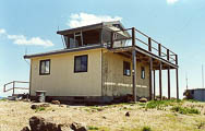
This is a Forest Service fire lookout location.
Driving directions: From Emmett, head north on Hwy. 52
- Staying northbound on Van Dussen Road from a 4-way intersection where Hwy 52 heads east
- At about 5 miles, turn right (east) on Butte Road
- Road is gravel the rest of the way to the summit
- At about a mile, you'll turn left (north) and skirt around the west side of the butte
- Head up a washboarded ravine, eventually topping out in a saddle
- There are two summits that can be reached from here, both approximately the same elevation about 1/2 mile apart
- The more southerly summit is home to a BLM fire lookout station that is staffed in the summer
- Both summits are antenna- and repeater-laden
Cold Springs, DN15sm61
| 45.505333, -116.449695 |
Located NW of Riggins, Idaho.
Access is via the Cattle Creek Road off US 95 at Lucile, Idaho. It has a clear take off in all directions except the south where the Seven Devils Mountains about 15 miles away peak up over 9000'.
Stanley Estates, DN24mf73
| 44.220973, -114.939943 |
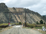
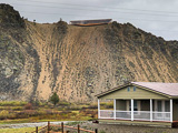
Don't go. This looks good on the satellite view but it's a private road and gated off. At the top is some sort of fabulous building under construction, obviously not inviting to rovers.
Cranbrook Visitor Center, DN29cl49
| 49.499093, -115.792816 |


The Elizabeth Lake Visitor Center is a lovely place to visit in a wide-open area. Many people come here to walk their dogs and admire the migrating birds on the big lake.
Although the web says the center is closed in the winter, that only means the restrooms and information booth are shuttered and locked. The parking lot is open year-round.
Note there is a Cranbrook Radio Club Society for ham radio with has repeaters. See their facebook page and the Cranbrook RCS website, and get in touch with kevin@cranbrookarc.ca to find repeater frequencies.
Restrictions: Park hours 6 am to 11 pm. No overnight parking or camping. All dogs must be leashed at all times.
Pulloff 1, DN29ae08
| 49.200972, -115.998473 |
Hwy 95 has pullouts every 1-5 miles. Along this stretch, pullouts are all in a deep narrow valley. The horizon is at least 15 degrees up in all directions.
It might be an okay spot to sleep for the night but no view of the sky for radio propagation.
Restrictions: No services.
Pulloff 2, DN29bf57
| 49.238155, -115.869941 |
This wide spot is deep in a narrow valley. No services.
Pulloff 3, DN29ch19
| 49.330762, -115.822934 |
This wide spot is deep in a narrow valley. No services.
Pulloff 4, DN29bo36
| 49.609667, -115.889954 |
Pulloff 5, DN29cx89
| 49.998193, -115.759464 |
Mt Kobau, DN09dc97
| 49.113271, -119.673197 |
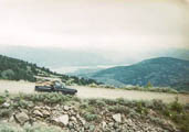
Mt Kobau has a scenic view from a high spot northwest of Lake Osoyoos in the southern part of the Canadian Okanogan.
Driving directions:
The road is well marked from the highway and is 12 miles of gravel to the viewpoint. In the photo, the U.S.-Canada border can be seen on the far right, above the lake. You can see Lake Osoyoos in the photo.
Per VE7FO, the junction of highway and road up the mountain is N 49 deg 04.874' min, W 119 deg 35.679 min, and the Parking lot at the top is N 49 deg 06.791 min W 119 deg 40.401 min.
Creston Hillside, DN19rc94
| 49.102200, -116.502400 |


There is a new housing development on the east side of Creston that has streets but not yet built up with houses in 2024. This can be a convenient place to operate with nobody but all the intrepid dog-walkers going by.
AW Root Beer, DN19rc74
| 49.103597, -116.519370 |


There is a nice wide parking area across from A/W Root Beer on Hwy 3 in Creston. It offers a dropoff from south to west, and a quick highway stop with nearby lunch and shopping. Note there is a great deal of traffic on this main road.
Wolf S3, DN19kb97
| 49.072033, -117.083400 |
Wolf S3 is a bare peak after a steep 2,000' climb with switchbacks from Hwy-3 (Crowsnest Hwy), near Stagleap Provincial Park and Ripple Mountain.
Driving directions: Look for the turnoff going north from 49.06275, -117.088369.
DN11-21 Mountain City, DN21at09
| 41.829902, -116.000000 |
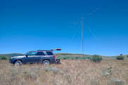
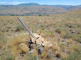


This grid line has a large flat place where setup is easy if the wind dies down long enough to hoist an antenna. There's a marker for 166 degrees latitude.
Driving directions: Follow a barely visible and very rough double track tail up to a hill with a perfect view in all directions. High clearance and 4x4 required. Spare tire required.
DN11-21 Ridge, DN21af07
| 41.238449, -116.000000 |
DN00-DN01 Bottle Creek, DN01ta30
| 41.000000, -118.389583 |
Llewellyn Johns Park, DN85vs85
| 45.774305, -102.178591 |
South Dakota State Park Llewellyn Johns Recreation Area
Mountain Shadows RV Park, DN21mc35
| 41.107825, -114.974316 |
Poor reviews at Park Advisor: Mountain Shadows
University Mtn, DN36au84
| 46.852846, -113.929065 |
Blue Lake, DN20xm50
| 40.502617, -114.037059 |
Goshute Ridge, DN20nc43
| 40.099074, -114.879288 |
Coyote Cove, DN20cp98
| 40.659036, -115.753173 |
Grindstone Mtn, DN20bq17
| 40.698181, -115.903541 |
Ridge Road, DN67ju27
| 47.865493, -107.231970 |
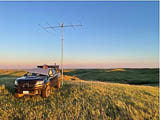
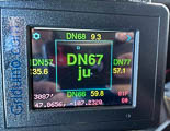
Amazing views in all but northward direction. This is BLM land. Cattle may graze here but they tend to be at lower elevations. There are higher locations on the ridge if someone has time to explore.
Driving directions: Long gravel road drive from Glasgow MT to ridge line and a short dirt track to location. It's manageable with high ground clearance.
Restrictions: Prepare for biting insects if the wind ever stops blowing.
Gravel Hill Ridge, DN76de98
| 46.202246, -105.672421 |
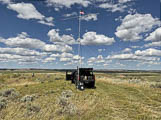
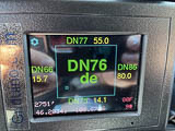
I setup on a nice spot within a mile of the Hwy but the trail continues on and on, ready for further adventure. Great view of the horizon in all directions. Cattle grazing land but thankfully quiet while I was there.
Driving directions:
- From Miles City, MT, drive southeast on Hwy 59 for 17 miles.
- Look for a seldom used track with a BLM sign warning to stay on the trail.
Restrictions: 4WD is required as track has significant erosion in 2022.
Spruce Mtn, DN20on12
| 40.553454, -114.821410 |
Heavenly spot. Hellish drive.
Nelson Reservoir, DN68fm68
| 48.536559, -107.526060 |
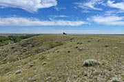
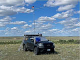
This is a hilltop just north of Nelson Reservior on BLM land. Gravel road right up to the hill then look for a couple of tire tracks leading up onto the hill. The field is used for grazing but it was empty while I visited. Full 360 degree view of the horizon. Friendly locals will come visit and ask what you are up to.
Restrictions: 4WD is recommended but not strictly required.
There are many, many mosquitos.
Kremlin Campground, DN58ao27
| 48.614438, -109.980425 |
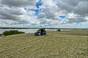
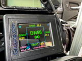
BLM recreation area campground with boat launch and vault toilet. Gravel road access but to reach the high point on the property 4WD is required. Fantastic view of the horizon in all directions except West, which is a few degrees rise. Campers stay near the lake, leaving this area in solitude.
Restrictions: Prepare for biting insects.
Bootlegger Campground, DN48hi96
| 48.361694, -111.333906 |
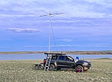
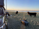
BLM recreation area providing campsites, boat ramp, and vault toilet. It's a gravel road all the way to the water. The high point of the property is accessible via a rough dirt track at back of property, 4WD recommended for that list bit of travel. The horizon view is very good from West to South to East. Cell coverage is mediocre. Plenty of room to setup as other campers stay near the water.
Restrictions: Biting insects are a nuisance and a cattle visit is a possibility.
Fremont Lake Campground, DN52cw46
| 42.941983, -109.795262 |
Hershey, DN91ld92
| 41.134028, -101.003125 |
There's a handy frontage road "W Oregon Trail Rd" along I-80 at Exit 56C. Across the freeway is a Fast Stop Travel Center for services. A mile west is the I-80 Rest Area at milepost 159.
Logan Pass, DN38dq37
| 48.695847, -113.716870 |
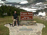
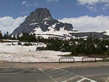
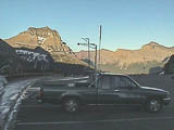
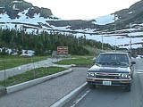
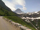
The trip getting to this location is well worth it. Lynn N7CFO visited this site in 1999 just before the Glacier Waterton Hamfair, and had several good six meter openings, both east and west. The path is excellent in these directions, but somewhat obstructed to the north and south. The elevation is so good that I doubt if it matters.
Lynn N7CFO
Restrictions: Closed winters.
Webb Mtn, DN28ht86
| 48.818122, -115.343879 |

Webb Mountain Lookout is a peak near the US-Canada border.
Fort Peck RV Park, DN67sx18
| 47.995036, -106.488777 |
Fort Peck is a community that was built during the Depression to provide housing for the construction crew for Fort Peck Dam on the Missouri River. The town of Glasgow is only about 20 miles away and they have full services.
This is in the NE corner of DN67, where you can drive to the more-rare grids of DN77 or DN78, about 25 miles east, for morning meteors and other activity.
There are a number of campgrounds near the dam, and several of them are in DN67. See the maps and legend below. Take your pick.
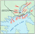
Downstream Campground. Unfortunately the "Downstream Campground" is in DN77. It is the best of the bunch with nice views, lots of room and shade.
Fort Peck West. This campground is in DN67. It has water/electric hookups, but the spaces are crammed in together and it is likely that a six meter operation would cause lots of RFI with other campers. One bonus is that there is a marina store there and they sell ice! This campground is near a boat ramp, so most of the other campers are pulling trailers.
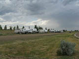
West End Campground. This is where I stayed. It is a very pleasant campground on a ridge overlooking the lake. It has water/electric connections and nice restrooms, complete with showers. It is a windy location, but is excellent from a radio point of view. Some of the campsites are isolated from others which minimizes the chances of interfering with their electronics.
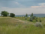
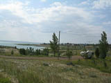
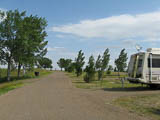
Note that there are numerous other campgrounds in the area, and the amenities range from boondocking to water/electric hookups. In the summer you will find that two things become very important - shade and electricity to run the air conditioning!
A word of caution about backroads in Montana. There is a road hazard that the locals refer to as "Gumbo". You have to see it to believe it.
If it rains, stay the heck off gravel roads or you will learn the hard way about this stuff. I pulled off the road to exercise my dog and got into about ten feet of it and didn't believe the amount of glop that stuck to my tires. Apparently it often gets bad enough to stall vehicles.
Big Gumbo, DN86ab06
| 46.069639, -104.000000 |
Here's a road on the DN76-86 line on BLM Public Land. It's on a service road among some gas wells, but has good takeoff and visibility in all directions.
Saddle Butte, DN87aa02
| 47.008763, -103.999890 |
Here's a spot on the DN77-87 Line. It's just a road, but it has a great takeoff, and is an easy 5-mile drive from I-94.
Fort Buford DN77-87, DN77xx96
| 47.983888, -104.001944 |
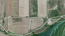

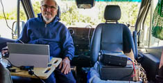
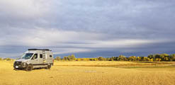
The Fort Buford Campground is easy to reach and a good camping spot by the Montana border and near the town of Buford.
We spent the night in the free campground (4 day limit) at Fort Buford State Historic Site, while the Yellowstone and Missouri Confluence Interpretive center (nice to visit) has a nearby fee-based campground but it’s in nearby DN87.
We set up in a big open space in the southeast end of the huge campground that was freshly mowed (could be higher grass in the spring/summer). We used an activation spot that was very open and away from the trees, fire rings and the other two campers who were located in a lower central camping location. The main camping location would provide shade, wind shelter, fire rings, picnic tables, flat ground (no hook-ups) but it is a bit lower and more obstructed than our spot.
We were operating prior to sunrise and finished by noon using WSJT meteor-scatter mode on 6m.
Although our spot was in DN77, it is just yards away from DN87 and could easily become a 2-fer-1 with a slight move due eastward by 500', crossing over a dirt road. With additional scouting about a mile due north, it could be possible to make a 4-fer-1 activation (DN77, DN78, DN87, DN88).
Also in the area it's worth visiting the Fort Union Trading Post Historic site.
John NA6L
Snowden Bridge, DN78wa70
| 48.000000, -104.101636 |
This spot has a wide spot on the road for parking on the DN77-78 line and is on BLM Land (i.e. public). The takeoff isn't outstanding since it's so close to the river, but it doesn't look too bad from the satellite view.
Medicine Lake, DN78tl14
| 48.476886, -104.406754 |
There might be more DN78 ideas in SOTA Summits Northeast Plains.
Brockton Hilltop, DN78md97
| 48.157345, -104.918630 |
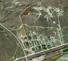

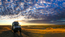
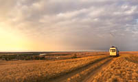

This hilltop is above and north by 0.6 mile of the little town of Brockton and is exceptional for the area.
The challenge is it's in full view of the tiny town AND on reservation land. We "sort-of" got permission to operate from the top of the hill but camping all night, with bright LED lighting for set-up starting well before sunrise and a large antenna going up every morning we did create some curiosity.
During the initial mid-mornings we had several local visitors stop by to say hello and ask great questions, no problem.
Well into our 3rd morning (4th day in the area) we had a friendly gentleman stop by to actually ask (nicely) what we were doing. It turned out that he was from the tribal office (TERO) and was the person that regulated commercial projects on tribal land.
He was happy to hear that we were just "bouncing radio signals off of meteor trails" with no commercial application. He was also pleased to see that we had collected four giant bags of trash from the hilltop – I think we made a friend.
I have his contact information and will reach out to him for instructions for future activators. An in-season activation would be a great time to have local groups visit the hill to observe, and maybe even invite a science class.
There is a small store/gas station and a nice little (very little) restaurant (Fred’s) in Brockton for pizza and such (we even took takeout up to the hill with us). We visited the restaurant several times for pizza and sandwiches and always felt welcome. Some of the people we met at Fred’s told us the name of the person that "owned" the hill and assured us that she would have no problem with us using the location – that turned out to be true.
Fred’s Grill and Casino:
- Facebook: facebook.com/Freds-Grill-and-Casino-110305820567040
- Address:
711 Grandma B Blvd, Brockton, MT 59213

You can check back with me (John NA6L) if you plan a trip, to learn what I hear from the tribal office. I hope to get specific "how-to" information.
By the way, we looked at several other potential locations in DN78 grid while driving hundreds of miles even as far as Scobey ND but the Brocton location was the best.
We worked 63 stations on 6m using mostly MSK144 – good for a September meteor-scatter activation.
Regards, John NA6L San Diego CA USA
There might be more DN78 ideas in SOTA Summits Northeast Plains.
Restrictions: Be respectful while on reservation land.
Jack's Spot, DN51ij37
| 41.406560, -109.307776 |
Jack W0XR found this spot along Hwy 191 in July 2021. It's on a shelf overlooking a valley toward the east with an open horizon.
Stateline Cove, DN51ea70
| 41.000521, -109.604861 |
Stateline Cove Campground offers dispersed beach camping on the sandy shore of Flaming Gorge Reservoir. It's on the Utah/Wyoming border and the DN50-DN51 grid line.
See the Forest Service website for Stateline Cove Campground.
There are campgrounds, both pay and primitive, all along Flaming Gorge on both shores. It's a nice area if you think trees and green things are over rated.
According to Google Earth the exact line position is on the road/boat ramp in the campground. You would have to change position in this campground to hit both DN50 and DN51.
Driving directions: From Manila, UT take UT-44 to UT/WY stateline on WY-530.
Turn right on Lucerne Valley Road.
Travel 2.5 miles to Stateline Cove Road.
Follow dirt road to campground kiosk/entrance.
Restrictions: Open May - September.
Vault toilets, no water.
$12/night for single site.
Theodore Roosevelt Ranch, DN38qb39
| 48.080656, -112.641286 |
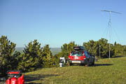
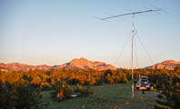

This spot was activated by Lance W7GJ on June 11-13, 2021:
On Thursday, morning June 10, 2021, I drove over the Continental Divide to eastern Montana. I arrived in Dupuyer, MT in time to check out the roads up on the Theodore Roosevelt Memorial Ranch, including the one to the planned operating site. I had already obtained permission from the ranch manager of the Boone and Crocket Club to set up and operate for several days in that high remote corner of the ranch. The weather was clear and the roads were not too muddy to drive on, which was reassuring. I then returned to Dupuyer and checked into Buffalo Joe's motel for the night.
At dawn on Friday June 11, I headed up to the site. I drove in a ground rod and set up the generator 50' west of the car and put up the 6M5XHG antenna at 5300' on a 24' mast 20' east of the car in order to provide maximum separation between the two, and also to avoid needing to aim the antenna at either the car or the generator. I use 50' of heavy extension cord to carry 220 VAC from the generator to the station set up in the car, and 50' of LMR-600 UF low loss feedline to run from the antenna to the car.
My intended site was about 18' higher and about 500' further on the "road", but there was a gully that was pretty steep between me and my intended spot and I was not willing to take a chance on getting stuck down there with the car. The ranch manager had told me his wife got the tractor stuck up on that road last June, and I was worried that if it rained (which it did, my last night up there) I might be stranded :-( Anyway, the antenna up on the 25' mast was still above 5300', so provided a really clear shot all over from the spot where I stopped.
The 6m band was open by the time I got set up. I slept in the back of the car just to be safe, but fortunately I had no grizzly bear encounters! I operated until 0200Z on Monday June 14, when an approaching thunderstorm made me shut down, lower the antenna and mast, and disconnect everything from the equipment in the car. The storm hit at 0300Z with lightning and tremendous winds. There was a bright double rainbow as the storm approached because it also was hitting right at sunset. The car was buffeted around but everything remained intact. There was some severe storm damage and power outages in the towns south of me.
I started packing up at dawn on Monday and by 10 am was on the road home. I didn't get reliable cell phone service until around 11 am. All in all, it was a beautiful place, although sleeping and operating in the car for that long was tough on these old bones! I hope this lessens the immediate demand for DN38, for awhile at least!
Lance W7GJ, June 2021
Restrictions: Closed winters.
Get permission from ranch manager.
Lost Trail Ski Area, DN35aq56
| 45.693188, -113.952070 |
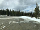
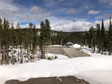
Lost Trail Ski Area provides a huge flat parking lot at the summit of Chief Joseph Pass on Hwy 93 where it crosses from Montana to Idaho. A nice rest area is right below the parking lot (although it might not be open).
This is my preferred spot among everything I've seen in DN35.
DN25-35 Line, DN35au02
| 45.843829, -114.000000 |
Exactly on the DN25-DN35 grid line there's a large pullout parking area. It's in a valley surrounded by steep hills, so it's not good for distance on VHF but it's perfect for grid-circling with a friend.
Orovada, DN01xr38
| 41.743361, -118.057639 |
This is alongside dirt road with meadows and easy to setup. There is unlimited space and you are pretty high against Santa Rosa ranger, which is more to east which matters for MSK season
Yellow Peak, DN01eu50
| 41.836417, -119.622556 |
Yellow Peak is a fire lookout tower (unstaffed) in the Sheldon National Antelope Refuge.
A very good location, including some cellphone tower access, very RF quiet (compared to Fox mountain which was very noisy).
Virgin Valley, DN01lu94
| 41.852431, -119.002083 |
Virgin Valley Campground is a free developed campground with hot springs and a shower.
Bog Hot Springs, DN01ow31
| 41.921840, -118.800683 |
If you want a hot springs with more privacy and warmer water en mass, go here.
Paradise Hill, DN11dh57
| 41.324184, -117.705627 |
The top of Paradise Hill offers a quick pullout along Hwy 95 just north of Winnemucca with a decent horizon in most directions, particularly SE to SW. Needs scouting.
Hwy 140 Grid Line, DN11aj06
| 41.400783, -117.999990 |
Here's a spot on the DN01-11 grid line right off highway 140 with easy access. Needs scouting.
DN01-DN11 Grid Line, DN11ah03
| 41.307722, -118.000000 |
I have strong doubts you can get there in van. This road is 4x4 high clearance location for sure.
Water Pipe Ridge, DN11xg82
| 41.260363, -116.015548 |
Hwy 226, DN11xf83
| 41.223981, -116.014190 |
Hwy 299, DN01an03
| 41.556076, -120.000000 |
The CN91-DN01 grid line crosses CA Hwy 299 about 9.3 miles east of Cedarville CA, where there's a wide spot that lets you park well away from the highway. This is a wide-open plain a good distance from the mountains on both sides.
The grid line is a few hundred yards west of the border between California and Nevada, since the state border is not exactly on longitude 120.0. The road becomes unpaved as it enters Nevada.
Breakfast outstanding at Bakery in little town of Cedarville, CA.
Driving directions: From Cedarville, drive east on CA-299 about 9.3 miles, crossing over Middle Alkali Lake until you reach the state line.
Arod Lakes, DN37xx68
| 47.995146, -112.028458 |
Arod Lakes is in the extreme NE corner of DN37, and with any luck and lots of scouting there might be something on the DN37-38 grid line around here. If you're bold, you might talk to the farmhouse at DN38xa40 and see if they'll let you park on the grid line.
This marker here is at a parking area and boat ramp along the shore of Arod Lakes.
Smoke Ridge, DN38wa13
| 48.013259, -112.153073 |
Satellite view suggests there may be a gravel pit in the SW corner of DN38 that might be used without bothering anyone. Scouting is needed.
Looking Glass Hill, DN38im37
| 48.529273, -113.304009 |
A satellite image suggests there may be a road and viewpoint at the top of Looking Glass Hill on the eastern edge of Glacier National Park. Scouting is needed.
Restrictions: State Route 49 is closed in winters.
Mt Lewis, DN10nj66
| 40.402479, -116.866440 |
Mt. Lewis may be reachable in passenger car in summer, but it's a long steep road. Check your brakes often on the way down, otherwise it could be free flight for hundreds of feet.
Mt. Lewis webcams may help with current conditions on Nevada peaks.
Dead Boat Mtn, DN00oc90
| 40.085355, -118.753880 |
Dead Boat Mountain in DN00 is a few minutes off Hwy 80 at the Toulon Exit.
I call it that as someone dragged a fiberglass boat up there and tore out the bottom.
Driving directions: Toulon Exit on I-80 just north of Fallon, go under freeway.
Take unpaved road to NW and go up towards Ragged Top to a top flat spot.
Turn right 4x4 low climb dirt trail till it ends... dead boat mountain.
2wd vehicle with ground clearance OK to summit, then 4x4 needed.
Black Rock, DN00jt29
| 40.830464, -119.231945 |
W7HKD: We do radio every year from the Playa NE of Gerlach. Not too bad. This is where I set my UHF Repeater for our Sept stay out there. It's about the only hill that has a road to it, and it is right above the playa.
Denio Junction, DN01qw48
| 41.952231, -118.626903 |
Denio Junction is the intersection of 140 and 292.
If you need supplies or a motel, Denio Junction (not Denio!) has gas, a 6-room motel, and a bar and grill. The grill is open 8am to 6pm, the bar till 9pm, and they're on Facebook.
Alternatively, a little north of here is Fields, OR (DN02), 26 miles north of Denio Jct. Fields has a 1-pump gas station, a general store (and pretty good milkshakes), a small cafe/kitchen, and a 2-room motel.
Fox Mtn, DN01fa35
| 41.024425, -119.558218 |
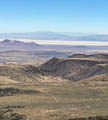
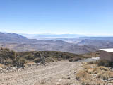

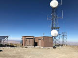
Petr AG6EE: Don't go here. The GSM tower is hanging low sending all its RF into your antenna.
Al W7KHD: Fox Mtn is SE of Duck Lake Valley, NV. Has a good 360 take off, maybe because of the lack of any other mountains that are taller or close. There are communications towers up there, which causes problems on the air.
Mike KB7ME: There's actually a decent operating spot below the summit which gets away from noise Petr mentions. Photos above are from an ATV trip a while back, rockhounding with XYL.
Driving directions: Old Camp Canyon Rd is normally in pretty good shape.
Restrictions: The wind blows hard up there.
Ragged Top Rd, DN00ob99
| 40.080346, -118.753145 |
Petr AG6EE activated this several times in 2019 and 2020. He writes: This is not remote, about 6 miles to I-80, and frequently traveled. If you had trouble you would not wait for help too long, the road is a major shortcut. Noisy overhead High Voltage lines, so I usually descend a bit to lose the view to North here.
Lloyd K7NX activated DN00ob back in 2011. His QSL card was a picture of his truck and camper atop this hill near Lovelock, NV. The photo looks like he had a negative horizon in some directions and it was a VERY desolate location. Completely barren but tremendous view. It doesn't look like it requires a 4WD vehicle to get there.
Road 436, DN63jx62
| 43.969759, -107.199120 |
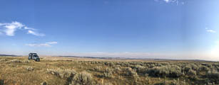
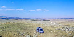
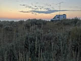
Road 436 / 56 runs east from Ten Sleep, WY, along a lengthy bench with a dropoff to the south. This is a very radio-quiet remote place.
The location worked great for overnight camping and allowed us an early morning start on 6m meteor scatter. This is a pretty remote place - no one bugged us in our early September visit.
This place would also be very good for a 6m in-season (June) activation with its high altitude giving cooler temperatures.
Our spot had fairly average drops-offs. It'd be worthwhile to do a little more scouting to see if there's a little better spot along 436 in the area.
John NA6L
Driving directions:
Coming from the north on Hwy 16, turn left onto Road 436 before you reach Ten Sleep.
Coming from the south on Hwy 16, turn right onto Juniper Rd a mile before Ten Sleep.
Once on 436 head toward Monument Hill past the Nature Conservancy (a nice place to visit)
and take a smaller dirt road to the left to an isolated location on a knoll.
Castle Garden, DN63db50
| 43.043169, -107.707437 |
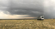
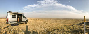

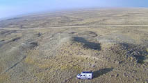
In southern Wyoming, about 21 miles east of Shoshoni (via Hwy 26), you’ll find Castle Garden Road, about 3/4th of a mile east of the micro town of Moneta.
The area has drop offs to the Southeast, South and West. No issues with the gas line, not even “no smoking” signs. Some curious locals visited us to see if we were "tracking wolves" with our "contraption".
We stayed 3 days and 2 nights in early September using MSK144 on 6m in the early morning hours but had limited activation time because of high wind.
There may be even better locations in the immediate area. This spot worked very well and was easy to get to and there was no problem camping for a few nights.
John NA6L
Driving directions:
Take Castle Garden Road south for about 10 miles – if you see turns then
generally take the better more-traveled branch or look for signs.
There is a large concrete water tower on your left
just prior to arriving at the turn off for this location.
We drove off of the main dirt road for maybe 200 yards using a smaller
two track dirt road/trail onto a small rise near some gas pipeline
risers.
We might have gone out a bit further on some ridges that branched
off of the bluff but hey, we're not heroes :-)
Fort Peck, DN68sa00
| 48.003396, -106.496388 |
This is a wide spot along Montana Hwy 24 with a few (very few!) amenities. It's at the north end of Fort Peck Lake, about 5 miles from Hwy 2.
The Lakeridge Motel just might be amenable, if I ask nicely, to let me use the back lot to set up my rover station. This would be out of the way from the road and yet close by a room to rent, gas station and diner.
Alternatively, there is Roundhouse Point Camping at DN68sa75ct (48.02418, -106.440934).
Chief Joseph Pass, DN35bp15
| 45.647606, -113.901972 |
There is a spot south of Chief Joseph Pass in ID at 7700' that I have ridden my bike to, which seems like it would be a good place to set up. However, it is high and very snowy because the road is on the north side and in the woods. I am not sure DN35bp is such a rare grid, either - that's why I never seriously considered it. I seem to recall that there were old foundation footings for a fire lookout there.
Sula Peak Lookout, DN35au06
| 45.859854, -114.000000 |
K7VK and others have operated from the Sula Peak Lookout on the DN25-DN35 grid line. It is relatively easy to get to.
Morell Lookout, DN37he75
| 47.190017, -113.358020 |
K7VK has camped at this spot in DN37 up next to the Morrell Fire Lookout in Seeley Lake, MT.
DN55-56-65-66, DN65aa00
| 45.000000, -108.000000 |

The confluence of DN55, DN56, DN65 and DN66 is practically on the Montana-Wyoming border.
The profile image above shows the highest point on the horizon is below 2.3 degrees elevation, and that is toward KL7. Most of the rest of the horizon is below 1 degree elevation.
KB7Q and W7GJ plan to activate it in summer of 2020, running a kw and 6M8GJ yagi, just like he uses on his 6m EME DXpeditions.
Read about Lance's trip at Big Sky Spaces
Sunset Mtn, DN37tc92
| 47.093708, -112.334071 |

Sunset Mtn is a peak east of Missoula with a good access but a few radio towers.
From here, highest point on the horizon is 3 degrees elevation toward central California. As shown in the profile, much of the horizon is below 0 degrees. Lance W7GJ plans to activate it in 2020 with a kw and 6M5XHG during the ARRL June VHF Contest.
Read about Lance's trip at Big Sky Spaces
Restrictions: Typically snowed in until mid June.
Point Six, DN37aa19
| 47.040963, -113.986478 |
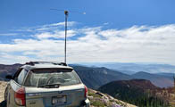

Point Six is a peak just north of Missoula and not far from the Snowbowl Ski Resort. It's in the very southwest corner of DN37.
Here is a view to the southeast when Lance W7GJ checked out the site in 2019 with a rotatable dipole and 100w. Horizon is under 5 degrees elevation from 45 degrees azimuth around through south to 340 degrees, providing a clear shot at the entire continental US plus KH6 and KL7.
As you can see in the profile image, much of the horizon is below 0 degrees. Lance plans to activate it in 2020 with several hundred watts and a 6M5XHG antenna.
Restrictions: Typically snowed in until mid June.
Hwy 20, DN92ts00
| 42.750000, -100.409660 |
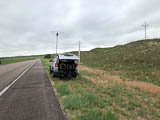
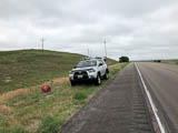
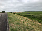
Hwy 20 is has some long straight stretches with wide shoulders and an open horizon. You can pick a spot (like this one) almost anywhere, pull off and be on the air. I only mention it here to offer a quick and handy way to activate DN92.
| < Previous | Page 11 of 20 | Next > |
©1998-2026 Barry Hansen