Rover Location Database
United States Rover Locations
- Select Grid
- USA
- USA List
- BO Alaska
- BP Alaska
- CM California
- CN Pacific NW
- CO Canada
- DL Mexico
- DM Southwest
- DN Rockies
- DO Canada
- EL Texas Florida
- EM South
- EN Central
- EO Canada
- FM East Coast
- FN Northeast
- FO Canada
- Data Check
Grid Field EL
8 locations - Choke Canyon Park - Dirt Lot - Ochlockonee Bay - Tropical Trails RV - St. Bernard SP - EL28-EL29 Surfside Beach - Matagorda Airpark - Bermea Park
Potential VHF rover sites in the grid field EL.
EL dimensions are 2111.8 by 1623.5 miles.
Choke Canyon Park, EL08tl71
| 28.466082, -98.353948 |
Dirt Lot, EL89fx98
| 29.995120, -83.501530 |
This is a dirt lot just off of US 19/98 and just across the EM80 grid line.
There is often a semi tractor trailer parked there; he was just leaving when I arrived. There's plenty of room even if his truck is still there.
Driving directions: Use your GPS to the coordinates. No street names and it's easy to miss. Take US 98 about 7 miles south of Perry.
Ochlockonee Bay, EL79tx30
| 29.960153, -84.384940 |
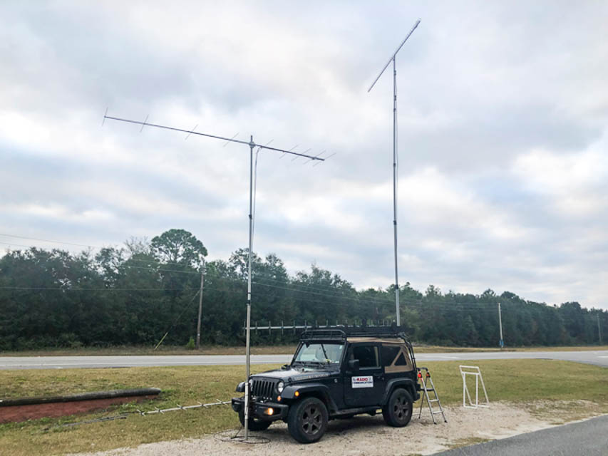
This is a boat ramp on the south shore of Ochlockonee Bay.
Driving directions: 12 Coastal Hwy, Panacea, FL 32346
Restrictions: No restrictions. I operated from before dark to early morning with no issues. I did have a couple of inquires about my activities, all positive. When you tell them you are bouncing radio signals off of meteor trails they are amazed.
Tropical Trails RV, EL15gx67
| 25.987566, -97.443580 |
This RV park at the southern tip of Texas provides a flat place to camp in EL15, the 3rd most wanted grid on the FFMA Leader Board as of Dec 2021.
St. Bernard SP, EL59bu27
| 29.863028, -89.899002 |

See the St. Bernard State Park website or call 504-682-2101 for fees or to make reservations.
This terrain is all pretty flat. 6m and 2m worked well. Jeff WB8LYJ was here April 2021.
EL28-EL29 Surfside Beach, EL29ja30
| 29.000000, -95.224319 |
Surfside Beach is a barrier island one hour south of Houston. Surfside Beach is also the name of the city, with a website at cityofsurfside.com
Yes, they allow overnight camping. I'm not sure what the rules are, but I've seen people with campers out there for many days. It's a perfect place to camp and play radio for sure.
Alternatively, the area is loaded with nearby motels and beach houses and RV parks such as The Breeze Hotel & RV Park, surfsidebreeze.com
Matagorda Airpark, EL28aw67
| 28.948958, -95.948958 |
Bermea Park, EL08bw86
| 28.943403, -99.844444 |
| < Previous | Page 13 of 20 | Next > |
©1998-2026 Barry Hansen