Rover Location Database
United States Rover Locations
- Select Grid
- USA
- USA List
- BO Alaska
- BP Alaska
- CM California
- CN Pacific NW
- CO Canada
- DL Mexico
- DM Southwest
- DN Rockies
- DO Canada
- EL Texas Florida
- EM South
- EN Central
- EO Canada
- FM East Coast
- FN Northeast
- FO Canada
- Data Check
Grid Field EN
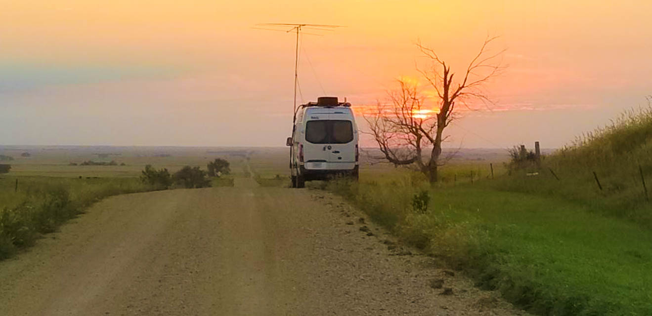
65 locations - Manning Hill - Lumberman's Monument Park - AuSable Vista Overlook - Deanville Hill - Long Lake - Allen Park - Lake Erie Metro Park - Pointe Mouillee Boat Ramp - Mt Christie - Hines Drive - Kerr Hill - Garbage Pit Hill - I-94 Chelsea Rest Stop - Sterling State Park - Michigan's Lost Peninsula - EN71-72-81-82 Grid Corner - Roadside Park at Epoufette - I-75 Scenic Overlook 328 - I-75 Scenic Overlook 316 - Braman Hill - Grove Hill - US131 Scenic Overlook - Caberfae Scenic Overlook - Pyramid Point - Miller Hill Overlook - Aylsworth & Johnson Overlook - Fisk Knob - Sack Rider Hill - Bundy Hill - Windsor Hill - Dias Hill - Jamestown Hill - Wheatland - Mt Brockway - Sugarloaf Mtn - Shauger Hill - Empire Bluffs - Inspiration Point - Mt Lookout - Mt Horace Greeley - Silver Mtn - Lookout Mtn - Bergland Lookout - Trap Hills - Porcupine Picnic Area - Lake Of The Clouds Overlook - Summit Peak - Wolf Mtn - Mt Zion Park - Bald Mtn - Black River Campground - Elberta Bluffs Overlook - Arcadia Scenic Turnout - Sterling State Park - EN52-62 HS - Grove26 - 45-90 Confluence - Fort Wilkins Campground - High Rock Bay - Brockway Mtn - Craig K9CT - Heerten's Farm - Lost Creek Cemetary - Crocker - Neligh
Potential VHF rover sites in the grid field EN.
EN dimensions are 1154.9 by 1623.5 miles.
Manning Hill, EN85db24
| 45.060800, -83.726100 |
Reproduced with permission from Michigan Rover Sites by the Michigan VHF-UHF Society.
Lumberman's Monument Park, EN84ek54
| 44.436900, -83.621700 |
On River Road, west of Oscoda. Overlooks Cooke Dam Pond, sounds like good view to N & NW. There is also a picnic area 1.5 miles west on River Road that looks like it have a good view to N & NE, another report says there is a 30-foot high observation deck here.
Reproduced with permission from Michigan Rover Sites by the Michigan VHF-UHF Society.
AuSable Vista Overlook, EN84co07
| 44.614400, -83.832200 |
On AuSable River Rd, 4 miles N of road F30, NW of Glennie. Reports claim you can see 20 miles of the river from here.
Reproduced with permission from Michigan Rover Sites by the Michigan VHF-UHF Society.
Deanville Hill, EN83le33
| 43.183300, -83.058300 |
Deanville Rd between Churchhill Rd and Scheinhall, N of Imlay City. Also nice on Deanville Rd South of Deanville Rd (abt 1020ft.)
Reproduced with permission from Michigan Rover Sites by the Michigan VHF-UHF Society.
Long Lake, EN83jd61
| 43.133300, -83.200000 |
Corner of Cedar Lake Rd and trail going West between Welch Rd & Kings Mill Rd, NW of Imlay City. Good view to W and S. NOT good to E.
Reproduced with permission from Michigan Rover Sites by the Michigan VHF-UHF Society.
Allen Park, EN82jg57
| 42.279700, -83.208100 |
I-94 to Southfield Expressway. North to Outer Drive and take the exit to turn right. Go to second light (Fairlane Dr.) and go up the hill. As you crest, there is a utility building on the left side that has space for about five vehicles. Local PD and security will drive by and ask about what you are doing. Be friendly and you'll have no issues.
Reproduced with permission from Michigan Rover Sites by the Michigan VHF-UHF Society.
Lake Erie Metro Park, EN82jb46
| 42.070600, -83.210800 |
There are a number of spots to use for VHF/UHF to 1.2GHz. If you utilize the Cove Point picnic area, this is good to 10GHz East and Southeast. There is also the Lee Rd. entrance for the marina that has a scenic lookout that could be utilized to better advantage for 10GHz + activity.
Reproduced with permission from Michigan Rover Sites by the Michigan VHF-UHF Society.
Driving directions: EN82jb entrance: I-75 to Huron River Dr. NORTH (exit 27). East to W. Jefferson Ave. North to park entrance.
Pointe Mouillee Boat Ramp, EN82ja69
| 42.038300, -83.199200 |
Driving directions: EN82ja site: I-75 to Huron River Dr. NORTH (exit 27). East to W. Jefferson Ave then South to Campau Dr then East. Campau Drive changes names to Point Mouille Road. Follow this to the boat ramp area. You'll be on Michigan DNR property, so you may need to have a state permit.
Reproduced with permission from Michigan Rover Sites by the Michigan VHF-UHF Society.
Restrictions: Entrance fee required.
Mt Christie, EN82iv02
| 42.884400, -83.326400 |
Northwest of Oxford. Go west of M-24 on Davison Road about 1 mile then into Mt. Christie subdivision. Follow signs to dirt trail to gazebo at top of hill. Nice view in all directions except west. Able to work 1282.400Mhz repeater in Clawson with H.T. from here.
Reproduced with permission from Michigan Rover Sites by the Michigan VHF-UHF Society.
Hines Drive, EN82ii12
| 42.345000, -83.324700 |
This is a county park which is a sled hill with a gazebo at the top of the hill. Has ac plugs but unknown if they work. Equipment has to be carried up the hill. Good portable site.
Reproduced with permission from Michigan Rover Sites by the Michigan VHF-UHF Society.
Driving directions: Merriman Rd. to Hawthorne Dr to Hawthorne Dr to Edward Hines Dr. Make a left turn and go about 2-1/2 miles and the site will be on your right side.
Restrictions: Official closing time is dusk. Unknown what sheriff patrols will do if they see the antennas.
Kerr Hill, EN82hw23
| 42.929400, -83.398100 |
Corner of Hadley Rd. and Fox Lake Rd. About 4 miles south of Hadley. Christ Lutheran Cemetery on top of hill, many trees. OK view to west.
Reproduced with permission from Michigan Rover Sites by the Michigan VHF-UHF Society.
Garbage Pit Hill, EN82em54
| 42.518100, -83.621400 |
Also known as South Lyon Township Park. Off of I-96, Milford RD. S to Grand River, W on Grand River turn right into park. Good view to E, & SE.
Reproduced with permission from Michigan Rover Sites by the Michigan VHF-UHF Society.
I-94 Chelsea Rest Stop, EN82ah00
| 42.293600, -83.999700 |
This spot is a parking lot on the grid line for EN72xh and EN82ah.
Driving directions: Head East on I-94 from M52. The entrance ramp is just past the Freer Rd. overpass. Only accessible form the East bound side of I-94.
Reproduced with permission from Michigan Rover Sites by the Michigan VHF-UHF Society.
Sterling State Park, EN81hv98
| 41.910600, -83.334700 |
I-75 to N. Dixie Highway (Monroe exit). Head East to State Park Rd. Careful as you come upon the entrance as it is easy to pass up if your not familiar with the entrance. Entrance on right. Pay booth is about a mile from Dixie Highway. Follow road past first turn (boat ramps on left side). Go to second left turn and park as close to the beach as permissible. The state rangers here are friendly.
Reproduced with permission from Michigan Rover Sites by the Michigan VHF-UHF Society.
Restrictions: State Park Permit required.
Michigan's Lost Peninsula, EN81gr45
| 41.733100, -83.462800 |
This spot is a parking lot across from a restaurant. On Edgewater Drive just as you cross back into Michigan from Ohio. The ONLY way to get to this location is exiting Michigan into Ohio and then back into Michigan.
Reproduced with permission from Michigan Rover Sites by the Michigan VHF-UHF Society.
EN71-72-81-82 Grid Corner, EN81ax09
| 41.999900, -83.999900 |
Russell Rd. 1/4 mile East of M52, West of Tecumseh, NW corner of EN81.
Reproduced with permission from Michigan Rover Sites by the Michigan VHF-UHF Society.
Roadside Park at Epoufette, EN76jb85
| 46.062500, -85.180800 |
Roadside park on US-2 overlooking Epoufette Bay. Nice view to SE, S, & SW.
Reproduced with permission from Michigan Rover Sites by the Michigan VHF-UHF Society.
I-75 Scenic Overlook 328, EN75qp38
| 45.661400, -84.641400 |
Scenic overlook at rest area on southbound I-75, south of Mackinaw City at Mile marker 328. Good view E, SE, S, SW, W, NW. Parking lot on top of hill.
Reproduced with permission from Michigan Rover Sites by the Michigan VHF-UHF Society.
I-75 Scenic Overlook 316, EN75qm61
| 45.506100, -84.614700 |
Scenic overlook at rest area on northbound I-75 north of Indian River at Mile marker 316. Good view to from SSW to NNW. Can drive to parking area at top of hill, short walk to wood deck.
Reproduced with permission from Michigan Rover Sites by the Michigan VHF-UHF Society.
Braman Hill, EN75ed32
| 45.136400, -85.638300 |
Scenic overlook and park, with tables. Can drive to top of hill. West of Northport about 1.5 miles off of Melkild Rd. (Third St. in Northport). Great view from SE to NNE, trees in other directions.
Reproduced with permission from Michigan Rover Sites by the Michigan VHF-UHF Society.
Grove Hill, EN74hd81
| 44.133300, -85.350000 |
SE of Cadillac, next to WWTV. Park at top of hill is covered with trees, road in front of park is a little lower, but it has a good view to S.
Reproduced with permission from Michigan Rover Sites by the Michigan VHF-UHF Society.
US131 Scenic Overlook, EN74gc39
| 44.123600, -85.474700 |
Rest area about 7 miles S of Cadillac on Southbound US131. Not really high, but a good view in most directions. Parking area near top of hill.
Reproduced with permission from Michigan Rover Sites by the Michigan VHF-UHF Society.
Caberfae Scenic Overlook, EN74dg45
| 44.274400, -85.712800 |
This is the scenic overlook, not the Caberfae Ski Hill.
Go west on M55 about 11 miles from junction of M115 and M55. Then go north on road toward Caberfae Ski Lodge, and turn right on NO 11 1/5 Rd. (follow signs). Large radio tower on hill. Wood deck at overlook. Good view from about 140 to 280 degrees SE to W, rest trees.
Reproduced with permission from Michigan Rover Sites by the Michigan VHF-UHF Society.
Pyramid Point, EN74ax80
| 44.961100, -85.927800 |
NE of Glen Arbor, overlooking Lake Michigan, great view of the lake and islands. Park at lot and walk about a mile (up hill).
Reproduced with permission from Michigan Rover Sites by the Michigan VHF-UHF Society.
Miller Hill Overlook, EN74av67
| 44.905300, -85.943600 |
East of Glen Arbor, overlooking Glen Lake and Lake Michigan. Great view to west, trees in all other directions. Can drive a car to overlook.
Reproduced with permission from Michigan Rover Sites by the Michigan VHF-UHF Society.
Aylsworth & Johnson Overlook, EN74at06
| 44.819700, -85.999400 |
1.5 miles N of M72 on Co. Rd. 677, about 2 miles NE of Empire. Nice view to S, SE, & SW, trees in other directions. County. Rr. 677. Maps and WB9SPT's GPS claim parking area is EN74at, NE8I's and WB8TGY's GPS claim EN64xt. Believe EN74at is right.
Reproduced with permission from Michigan Rover Sites by the Michigan VHF-UHF Society.
Fisk Knob, EN73eg67
| 43.283300, -85.612500 |
W. of Algoma Av. between 21 Mile and 22 Mile NW of Rockford. Parking lot at road, short walk to top, nice view all directions.
Reproduced with permission from Michigan Rover Sites by the Michigan VHF-UHF Society.
Sack Rider Hill, EN72vh42
| 42.301700, -84.210000 |
One mile north of I-94 on Mt. Hope (Grass Lake. exit), about 8 miles E of Jackson. Parking lot on west side of Mt. Hope (outhouse at parking lot), .2 mile walk to wood deck at top of hill. Some treetops are same height as deck, good view in most directions.
Reproduced with permission from Michigan Rover Sites by the Michigan VHF-UHF Society.
Bundy Hill, EN72sb52
| 42.051700, -84.452500 |
E of Moscow off of U.S.12. Can operate from parking lot at truckstop on the hill (but not the top of the hill). Chuck, WD8DTH reports trees blocking view in most directions.
Reproduced with permission from Michigan Rover Sites by the Michigan VHF-UHF Society.
Windsor Hill, EN72pp54
| 42.642200, -84.700800 |
Lansing Road 2 miles NW of Potterville. WB8TGY's QTH is on this hill. Good view SW, NE, & E.
Reproduced with permission from Michigan Rover Sites by the Michigan VHF-UHF Society.
Dias Hill, EN72et22
| 42.800000, -85.650000 |
92nd St. between Eastern Av. Division Av. You can usually park in the driveway of the old AT&T tower. There is a lot of RF here, 2 FM's and the 147.16 repeater, and plenty of 920 Mhz crud.
Reproduced with permission from Michigan Rover Sites by the Michigan VHF-UHF Society.
Jamestown Hill, EN72ct14
| 42.809200, -85.821700 |
2316 16th Ave, Jamestown. Pull into the driveway of the microwave tower. Great look in most directions. The 120-foot radio tower 1/2 mile to the west is John, K8IHY, who is very accommodating.
Reproduced with permission from Michigan Rover Sites by the Michigan VHF-UHF Society.
Wheatland, EN71sw84
| 41.934700, -84.433300 |
Juction of Wood Road & Kelso Road. NW of Chruchs Corners. Great view NE, E, SE & S, but not to W or N.
Reproduced with permission from Michigan Rover Sites by the Michigan VHF-UHF Society.
Mt Brockway, EN67al31
| 47.463900, -87.966700 |
W of Copper Harbor, you can drive up to top, now an open park with a parking lot. Great view, a few hills to the south. 740ft. above Lake Superior.
Reproduced with permission from Michigan Rover Sites by the Michigan VHF-UHF Society.
Sugarloaf Mtn, EN66go45
| 46.605000, -87.461900 |
N of Marquette, off of county road 550. Park at lot, hike about a mile to top. Nice view to E, N, & S.
Reproduced with permission from Michigan Rover Sites by the Michigan VHF-UHF Society.
Shauger Hill, EN64xu17
| 44.865000, -86.073100 |
"Lake Michigan" overlook on Pierce Stocking Drive. Great view of Lake Michigan, Manitou Islands, and some of Glen Lake.
Reproduced with permission from Michigan Rover Sites by the Michigan VHF-UHF Society.
Driving directions: About 5 miles north of Empire off of M109. NPS owns road and you must pay park fee. Park in lot and carry equipment over boardwalk to top, it's not a hard walk.
Empire Bluffs, EN64xt12
| 44.801100, -86.070800 |
Bluff on Lake Michigan, just south of Empire. Great view to west.
Reproduced with permission from Michigan Rover Sites by the Michigan VHF-UHF Society.
Driving directions: Parking lot off of Wilco Rd, hike to top.
Inspiration Point, EN64vm24
| 44.520300, -86.233300 |
Roadside Park on M22 at Benzie/Manistee countyline. Nice view of Lake Michigan and South, there are trees in other direcitons. 125 steps to top of observation deck; you can also operate from parking lot.
Locals claim it's the highest point on the shore of Lake Michigan.
Reproduced with permission from Michigan Rover Sites by the Michigan VHF-UHF Society.
Mt Lookout, EN57wk77
| 47.447800, -88.101900 |
SE of Eagle Harbor. Good view in all directions (per web site).
Reproduced with permission from Michigan Rover Sites by the Michigan VHF-UHF Society.
Driving directions: Go about 1/4 miles out of Eagle Harbor on road to Delaware, and turn on first dirt road. Go down dirt road about 1/4 mile park at base of steep sand slope. Walk up sandy hill to top and then walk two track to top of Mt. Lookout. Total walk is about 3 miles (one way). First hilltop is not Mt. Lookout, go on to the second hilltop on trail.
Mt Horace Greeley, EN57vi98
| 47.370800, -88.169700 |
SE of Central, old Air Force Radar station. Good view in most directions. Need updated report, please someone.
Reproduced with permission from Michigan Rover Sites by the Michigan VHF-UHF Society.
Silver Mtn, EN56pq00
| 46.666900, -88.741700 |
SW of Baraga. On Forest Hwy 2270, about 1 mile South of junction of Hwy 2270 & 2276. Park at base of hill, hike to top. Nice view.
Reproduced with permission from Michigan Rover Sites by the Michigan VHF-UHF Society.
Lookout Mtn, EN56jq05
| 46.689700, -89.245800 |
S of Victoria, parking off of road to Victoria Dam, walk to top. Nice view to E & SE.
Reproduced with permission from Michigan Rover Sites by the Michigan VHF-UHF Society.
Bergland Lookout, EN56fq02
| 46.677500, -89.577200 |
N. of Bergland, W of Old M64. Road to the top. Lot of trees, view to E.
Reproduced with permission from Michigan Rover Sites by the Michigan VHF-UHF Society.
Trap Hills, EN56fp77
| 46.655300, -89.518100 |
North of Bergland, East of Old M64. Nice view to E & S.
Reproduced with permission from Michigan Rover Sites by the Michigan VHF-UHF Society.
Porcupine Picnic Area, EN56dt26
| 46.816900, -89.726100 |
E of Lake of the Clouds Overlook on M107. Nice view to the W, N, NE.
Reproduced with permission from Michigan Rover Sites by the Michigan VHF-UHF Society.
Lake Of The Clouds Overlook, EN56ct82
| 46.803300, -89.763300 |
End of M107, W of Silver City. Short walk from parking lot to summit. Nice view to E, S, & W
Reproduced with permission from Michigan Rover Sites by the Michigan VHF-UHF Society.
Summit Peak, EN56cr79
| 46.747200, -89.771100 |
Located on south side of Porcupine Mount. St. Park. Short walk from parking area.
Reproduced with permission from Michigan Rover Sites by the Michigan VHF-UHF Society.
Wolf Mtn, EN56ck76
| 46.441700, -89.770800 |
SE of Wakefield off US2.
Reproduced with permission from Michigan Rover Sites by the Michigan VHF-UHF Society.
Mt Zion Park, EN46vl94
| 46.476700, -90.167800 |
North edge of Ironwood. Report says nice view.
Reproduced with permission from Michigan Rover Sites by the Michigan VHF-UHF Society.
Bald Mtn, EN46tn95
| 46.566100, -90.335000 |
North of Ironwood.
Reproduced with permission from Michigan Rover Sites by the Michigan VHF-UHF Society.
Black River Campground, EN46xp39
| 46.665451, -90.052083 |
Black River NFCG is a nice campground alongside the southern shore of Lake Superior in the Ottowa National Forest. It has an open horizon with an especially clear path toward the Pacific NW.
There are 40 campsites; seventeen are first-come first-served, and twenty three can be reserved in advance. See US Forest service website.
Reproduced with permission from Michigan Rover Sites by the Michigan VHF-UHF Society.
Elberta Bluffs Overlook, EN64vp10
| 44.626400, -86.240730 |
Overlook on Lake Michigan in a city park. See Google Street View for pictures.
Driving directions: Take Bye Street to the park, the lot is right before a turn toward the beach.
Restrictions: No services. However, the Furnace Street Distillery is within stumbling distance. :-)
Arcadia Scenic Turnout, EN64vm24
| 44.519800, -86.232700 |
This is a convenient parking area above the beach along Lake Michigan in the Huron-Manistee National Forests. It offers drive-up views right off the highway, picnic tables, a viewing platform and a toilet.
This is also known as Inspiration Point. The Manistee County line is about 300' south.
See Google Street View for pictures.
Driving directions: Directly off of M-22
Sterling State Park, EN81hv98
| 41.909711, -83.335472 |
William C. Sterling State Park offers a clear view of Lake Erie from the beach parking area. Food trailer open in the summer. This is the only Michigan park on Lake Erie.
See also Michigan's DNR Sterling State Park website.
Driving directions: 2800 State Park Road, I-75 Exit 15, Monroe, MI 48162
Follow the park road and turn into the parking area right before
the RV campground.
The south east corner of the lot is closest to the facilities.
Restrictions: Open 8am-10pm. Entrance fee is required. Overnight camping is available.
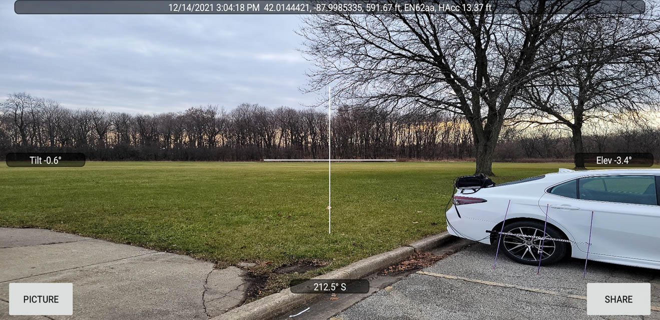
EN52-62 HS, EN62aa02
| 42.012112, -87.999900 |
The EN52-62 grid line includes through the west corner of the large parking lot for Elk Grove High School.
Grove26, EN62aa03
| 42.014411, -87.998461 |
45-90 Confluence, EN55aa00
| 45.000000, -90.000000 |
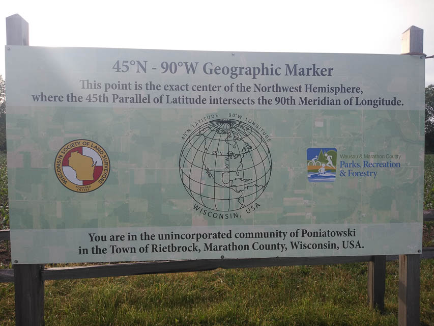
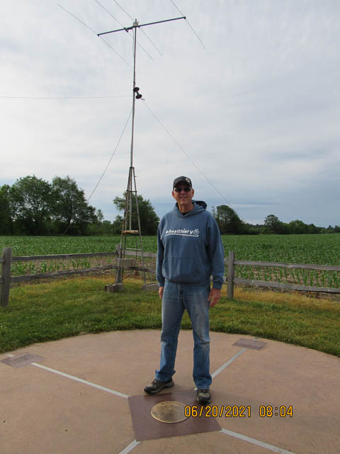
This is the confluence of EN44-45-54-55. The 45°N - 90°W Geographic Marker is located in northwest Marathon County in the Town of Rietbrock.
A quarter-mile pathway will lead you to the point that is the exact center of the Northwest Hemisphere where the 45th Parallel of Latitude intersects the 90th Meridian of Longitude.
There are only four 45° - 90° locations in the world. Two of these are located in oceans, one is located on a mountainous portion of China and one is located here in Central Wisconsin. Marathon County’s location is the only conveniently accessible marker in the world. There is a perceived significance that this geographical location is responsible for the prevalence and high quality of ginseng in Marathon County.
Anyone who visits the marker is encouraged to stop at the Wausau/Central Wisconsin Convention and visitors Bureau in downtown Wausau to sign the official 45°N - 90°W Club Registration Book and receive a commemorative coin.
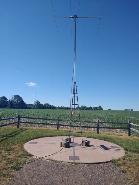
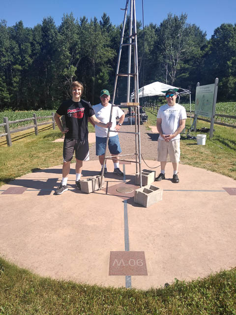
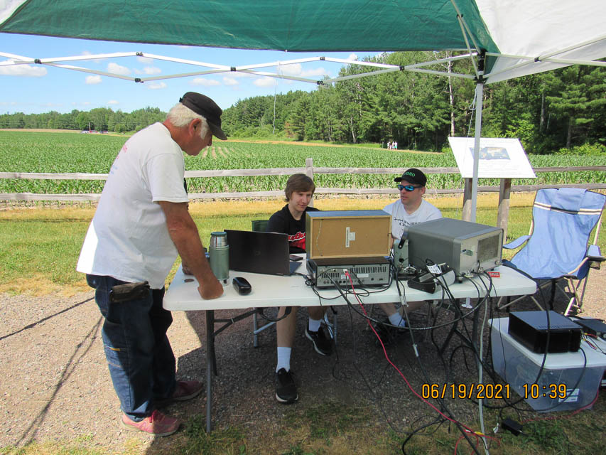
On June 20, 2021, John W9JN and his team activated this 45-90 degree spot. Operators were Jacob K9TVG, Gene N9GEP, Rick WX9M, Dave K9DRO and myself John W9JN.
Fort Wilkins Campground, EN67bl61
| 47.466319, -87.858681 |
Fort Wilkins Historic State Park offers East and West campgrounds with numerous campsites for tents, trailers, RVs and mini cabins. Located between Lake Superior and tiny Lake Fanny Hooe, it's a destination for outdoorsmen.
Campground reservations are accepted online up to 6 months in advance. Camp Sites/Fees: (159) $25 (20/30 amp); $29 (50 amp) or $20/$24 off-season.
Pick as far east as you can go, to reduce affect of Brockway Mtn about 1.75 miles away. If you pick a slot with 20/30-amp outlets then you won't need to run a generator.
High Rock Bay, EN67dk42
| 47.426562, -87.713889 |
Takes an hour from US-41 on very rough unpaved road. Est 7.5 miles. TripAdvisor review. No water, no toilet. Dangerous roads. Don’t attempt after a heavy rain. Public, state forest, free. Street view shows a tent camper.
This is an empty promonitory along the water at the end of a long road toward the eastern tip. Expect less traffic and fewer day-trip visitors. Open exposure to south and east. Heading to Seattle is 257 degrees and goes through Brockway Mtn.
State Forest land camping permits are required and can be applied for online. Pathfinder, Keweenaw Traveler.
Brockway Mtn, EN67al31
| 47.464063, -87.969444 |
Brockway Mtn Drive is a terrific E-W ridge along the highest point of the EN67 grid. However, it is also part of the James H. Klipfel Memorial Nature Sanctuary and the John J. Helstrom Nature Sanctuary. Utmost care is required to maintain the sensitive bird migration area.
No services. 200 cars/day. Written permit required from Eagle Harbor Township.
Craig K9CT, EN50bp28
| 40.662306, -89.894307 |
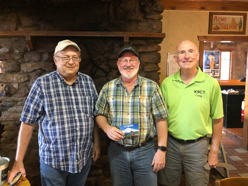
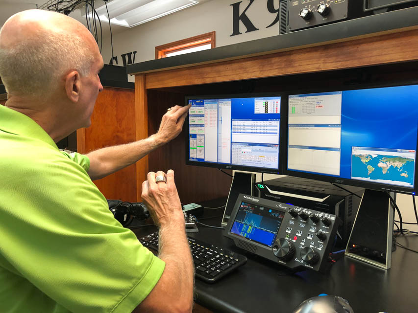

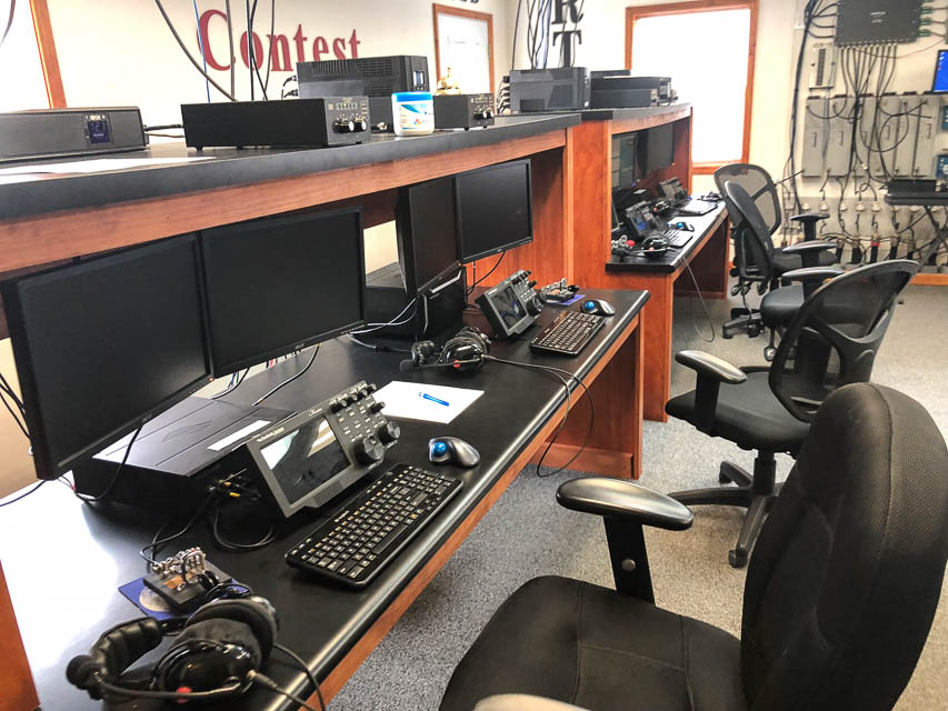
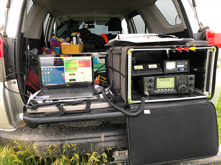
I had pizza lunch with Roger W9FF and Craig K9CT. Both are avid grid-chasers in Illinois, with whom we worked hard to complete contacts a week earlier when I was back on Gold Mtn in DN08 Okanogan, WA. We succeeded with Roger W9FF but the propagation didn't work out with Craig K9CT. Regardless, Craig bought us lunch and invited us for a shack tour. Imagine my surprise when I saw the scale of Craig's contest station which features many of the top devices and software currently available. For more, see www.k9ct.us
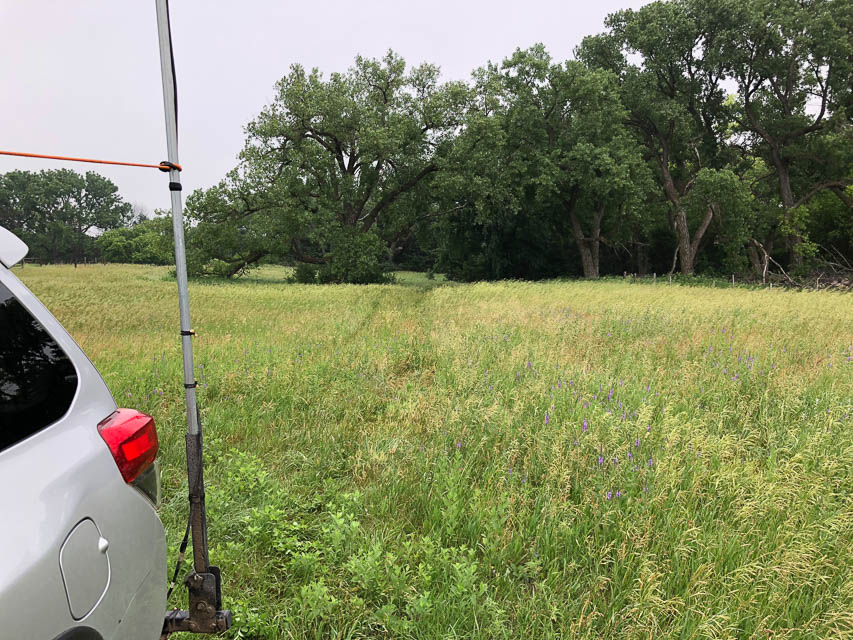
Heerten's Farm, EN02av61
| 42.881798, -99.944368 |

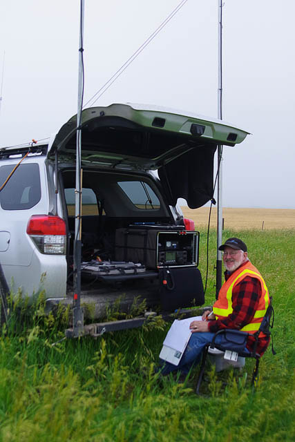
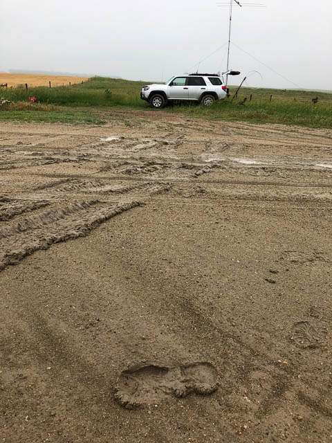
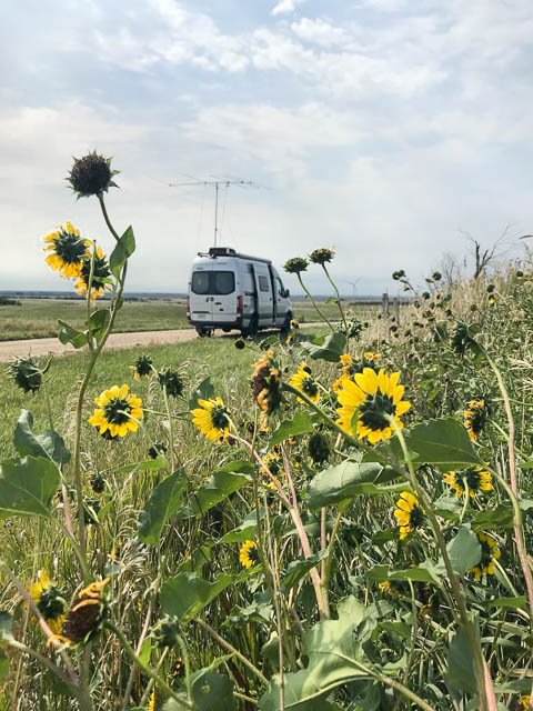
Hilltopping in Nebraska is about the same everywhere, since there are so few hills. However, there are valleys for the rivers so our activity might better named "valley topping." My intention was to visit the Springview Cemetary about five miles further north but the overnight rains made these roads very slippery.
I used this convenient pull-off north of Springview, NE, in June 2018. It worked great and made many meteor scatter and FT8 contacts. There were no houses or power lines nearby and background noise was non-existent.
There is very little traffic, but anyone that passed did stop to chat and see what I'm doing, including a reporter from the Springview Herald local paper.
Lost Creek Cemetary, EN02aw47
| 42.948759, -99.964465 |
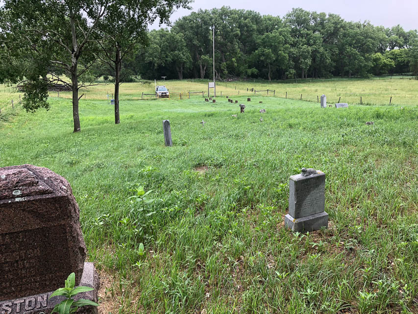
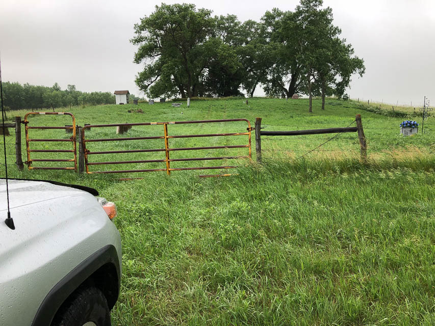
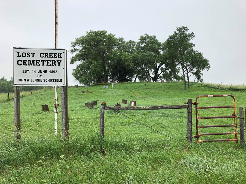
Lost Creek Cemetary is a lonely spot near the northwest corner of EN02. It has a slight (20 feet?) rise above local terrain, but you might as well be anywhere at all on the Nebraska plains. A few feet doesn't make any difference to propagation. Frankly, there's no such thing as "hilltopping" in Nebraska; however they do have valleys, so we should rename this hobby as "valley topping."
This cemetary is mostly unmaintained and there will be lots of tall grass that's probably wet with dew all day.
I found this spot while searching around EN02 but the next day, on my return, the clay roads were slick with mud so I cut my return drive short and stopped a few miles further south at Heerten's Farm.
Driving directions: From Springview, drive west on Hwy 12 for 11.2 miles,
following it around the gentle righthand bend to go north.
Turn right (42.861304, -99.925141) in order to continue driving north.
Go north 1.9 miles; at Tee intersection (42.939653, -99.925203) turn left.
Go west 0.6 miles and turn right.
Follow driveway and continue straight north into unmaintained path to cemetary.
Do not turn right into farmhouse driveway.
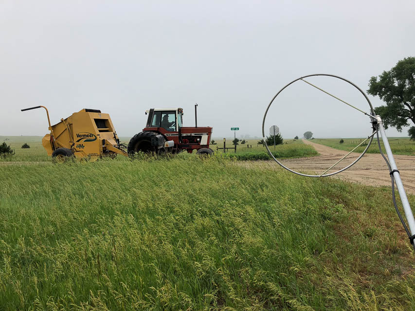
Crocker, EN15ba38
| 45.036944, -97.885833 |
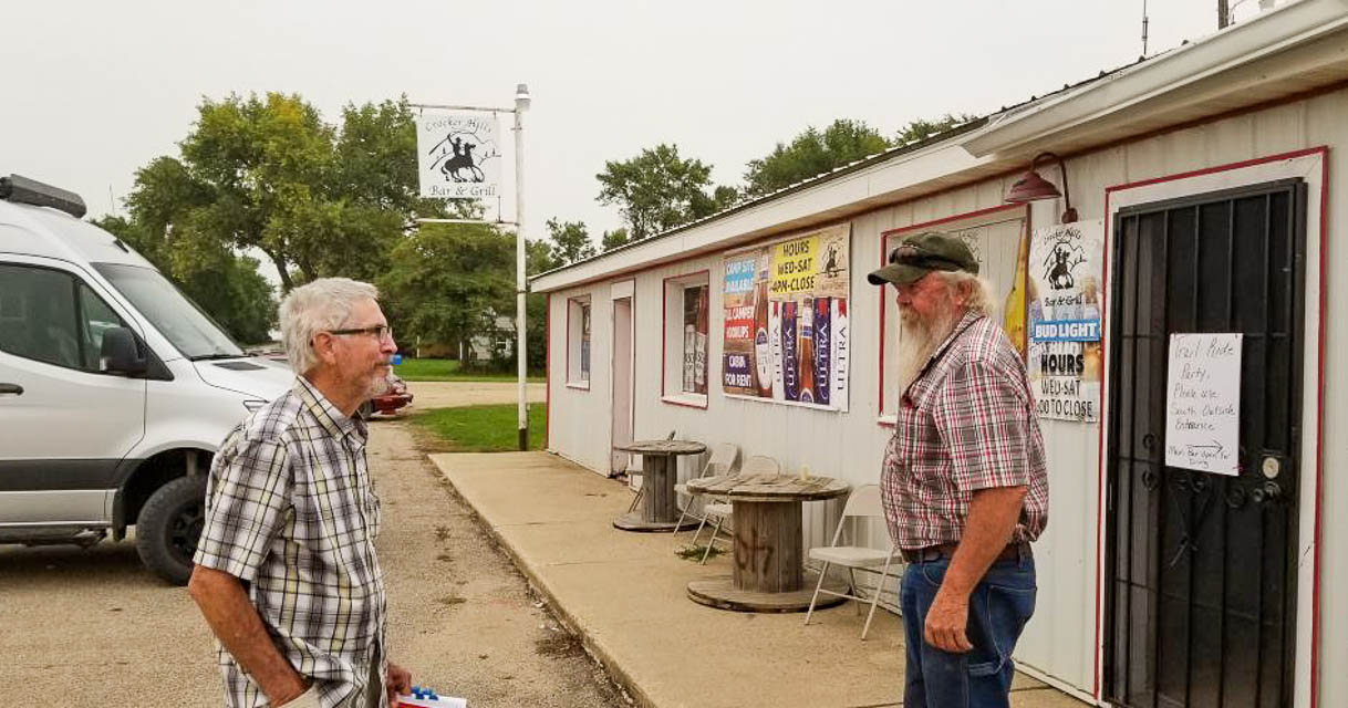
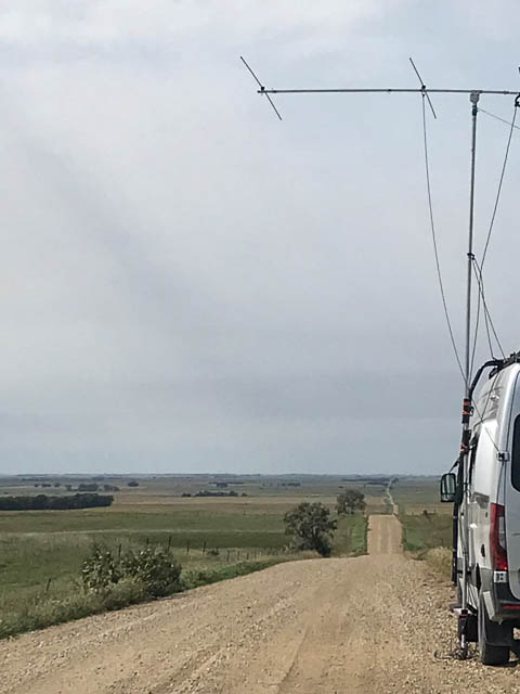
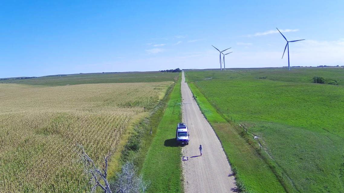
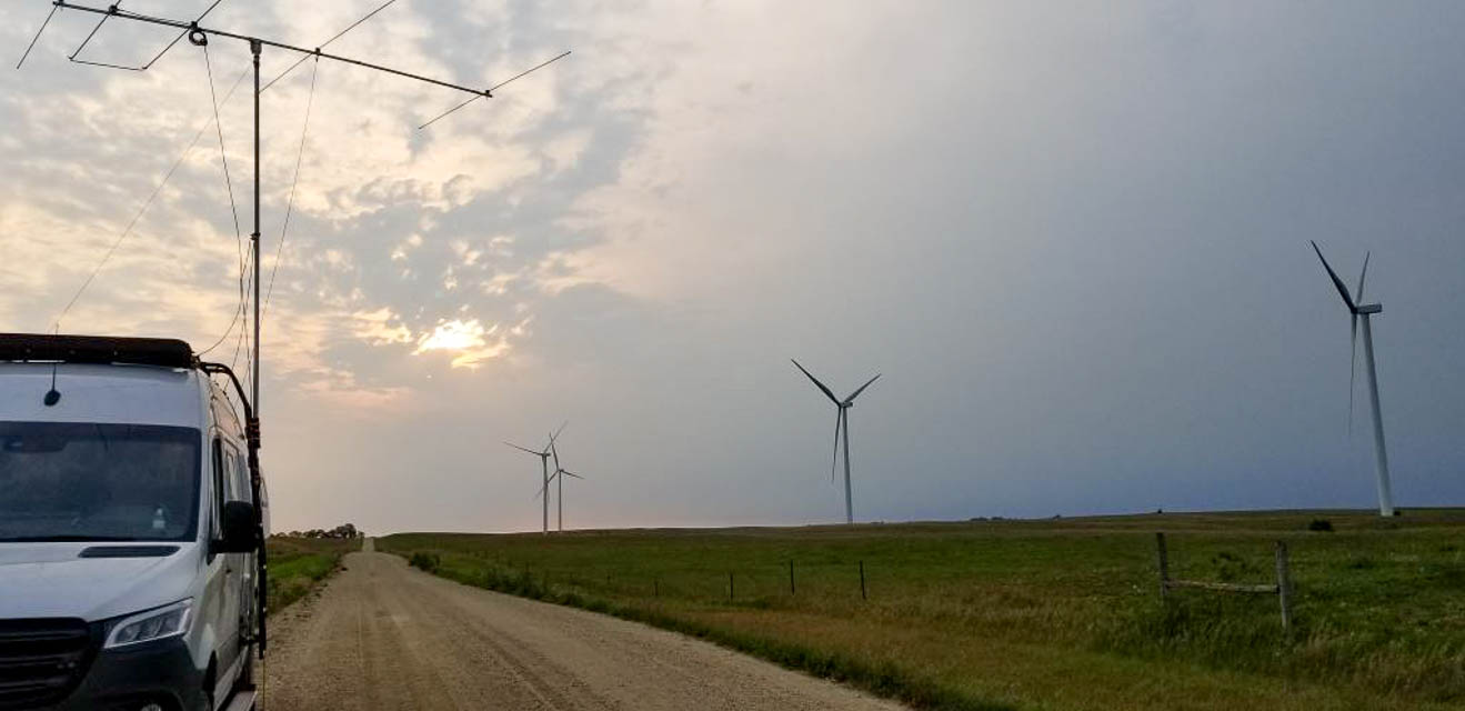
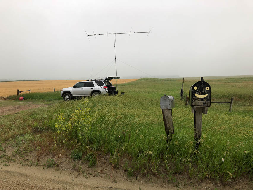
This is a random spot in a remote wind farm in South Dakota, off of Highway 20, just south of the town of Crocker.
There is a very cool small local bar/restaurant called "Crocker hills Bar and Grill" in the corn fields on the south edge of Crocker where you might be able to ask for additional directions. The Crocker Hills Bar and Grill also has camp/RV sites for a nice base camp area for a June activation.
Look for an elevated rise in the area called Buffalo Ridge that is worth additional exploration. We ran out of time to search out the "perfect take-off site" and settled on a spot between cornfields in a wind generator farm. We had a gentle slope downhill to the north west, west, south west and south, not perfect, but OK. We asked farmer where to set up and he said all the roads are county roads, so set up anyplace just off the side of the road.
As always, given more time you could probably find better locations (and report back here!!) but we were trying to hit the most distant needy FFMA stations to our South and West that were clearly too far for 6m meteor-scatter contacts, i.e., anything up to about 1200 miles out to the east. We found SE and South were easier to complete the contacts.
John NA6L
Restrictions: Be aware of and respect reservation land in grid EN15.
Neligh, EN02xd62
| 42.135792, -98.030464 |
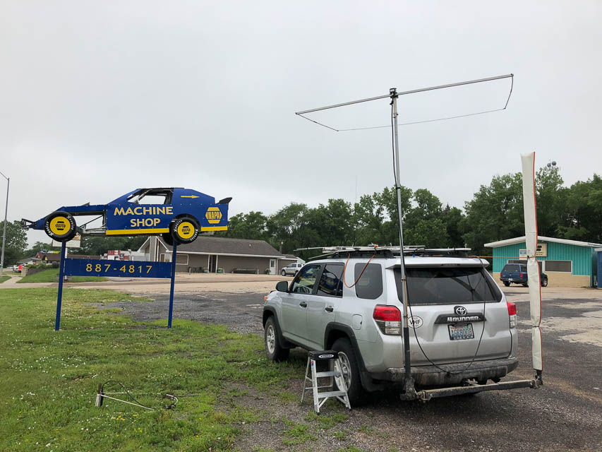

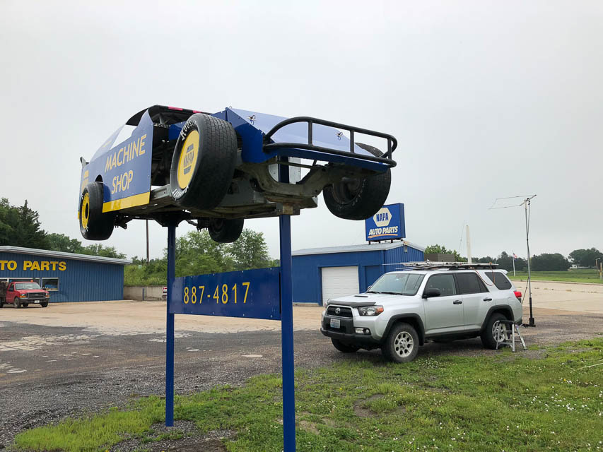

I needed a quick stop in southeast EN02 to get as close as possible (200 miles) to a ham in EM29cp. Neligh is a town on a mild hill before the highway descends slightly into lower ground. This parking lot by NAPA Auto Parts offers lots of room where I wouldn't bother anybody. Besides, it has a cool track racer on a post.
Driving directions: 1199 N Street, Neligh, NE 68756
| < Previous | Page 15 of 20 | Next > |
©1998-2026 Barry Hansen