Rover Location Database
United States Rover Locations
- Select Grid
- USA
- USA List
- BO Alaska
- BP Alaska
- CM California
- CN Pacific NW
- CO Canada
- DL Mexico
- DM Southwest
- DN Rockies
- DO Canada
- EL Texas Florida
- EM South
- EN Central
- EO Canada
- FM East Coast
- FN Northeast
- FO Canada
- Data Check
Grid Field FM
19 locations - Ebright Azimuth - Linvhille HS - Blueberry Hill - Mullica Hill - Cape May Terminal - River Rd Park - Partnership Drive - The Point Parking - Sewee Shell Ring - Riverland Terrace Boat Landing - Folly River Boat Ramp - US-158 Rest Area - NC-39 Pullout - Domino's Pizza - Currituck Recreation - Federal Point Boat Launch - Gull Rock Game Lands - Stumpy Point Emergency Ferry - Cisco Campground
Potential VHF rover sites in the grid field FM.
FM dimensions are 1655.8 by 1623.5 miles.
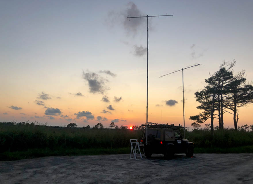
Ebright Azimuth, FM29fu70
| 39.835938, -75.519792 |
Linvhille HS, FM19xx22
| 39.969271, -76.064931 |
Blueberry Hill, FM29mt57
| 39.823785, -74.954167 |
Mullica Hill, FM29kr12
| 39.717124, -75.153429 |
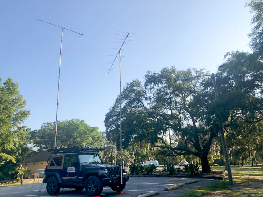
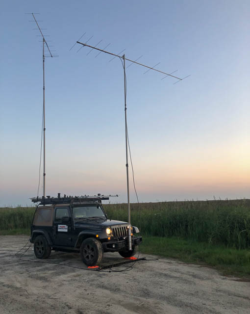
As shown in YouTube video 2025 Contest Rover Mt Airy Pack Rats
Cape May Terminal, FM28mx42
| 38.969484, -74.960962 |
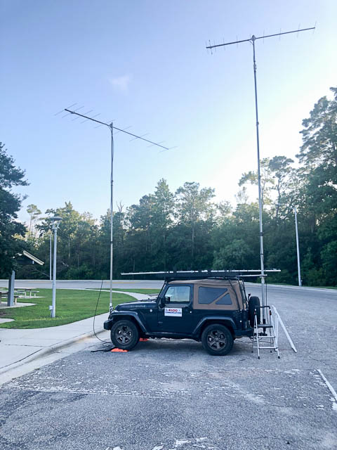
As shown in YouTube video 2025 Contest Rover Mt Airy Pack Rats
River Rd Park, FM14ac97
| 34.114717, -77.923122 |
River Road Park on the east bank of the Cape Fear River. It's actually a very attractive place, never mind the nearby scary names of Cape Fear, Green Swamp, Half Hell, and Boiling Spring Lakes.
Jeff WB8LYJ was here in August 2021 for meteor scatter and tropo, and it worked well. He chose this location for its proximity to FM13.
Driving directions:
River Rd. can be accessed at either end from US-421.
The park is well marked and is on the west side of the road.
Restrictions: Daylight only.
Partnership Drive, FM04ae88
| 34.200896, -79.925124 |
Partnership Drive is the entrance to a future industrial park. The road is blocked by concrete barriers but there is plenty of room between the road and the barriers to set up. This is easy to access from I-20.
If the industrial park is opened then this location will not be usable.
Jeff WB8LYJ was here in August 2021 and it worked well for both meteor scatter and tropo. The quick access to I-20 and the ability to use the location after dark were both considerations when choosing this site.
Driving directions:
3288 Timmonsville Hwy, Darlington, SC
Exit I-20 is the Timmonsville Hwy exit.
Head south about 0.9 miles on Timmonsville Hwy SC-340.
Partnership Drive / Parallel Road is on the right.
The Point Parking, FM03vv29
| 33.915522, -78.232317 |
The Point Parking is a handy parking lot for beach access to the Lockwoods Folly Inlet at the west end of Oak Island. This is on the same big bay as Myrtle Beach; to the south it's all Atlantic Ocean.
Jeff WB8LYJ was here for meteor scatter and tropo in December 2020. It worked fine.
Driving directions:
Take SC-906 to Oak Island.
Take W. Beach Rd. to Kings Lynn Dr.
Drive on Kings Lynn to the end.
Sewee Shell Ring, FM03ea60
| 33.000982, -79.608946 |
Don't go. Sewee Shell Ring is a parking lot for a walking trail. Jeff WB8LYJ thought this would work but it didn't.
Streetview showed an dirt parking lot that was completely open. In reality the tree cover is extensive. That meant that I couldn't put the antennas up all the way and I wasn't able to clear the slight elevation rise toward Door Rd. In addition the mosquitos were ferocious.
Driving directions:
Don't bother.
But if you must, from Charleston take I-17 north.
Turn right onto Doar Rd / State Rd S-10-432.
Turn right onto Gull Bay road. Find a spot to park.
Sit there a minute and the mosquitos will open your door for you.
Riverland Terrace Boat Landing, FM02as04
| 32.768608, -79.991802 |
Riverland Terrace Public Boat Landing is on Wappoo Creek with open river water from W - N - E.
Jeff WB8LYJ was here for meteor scatter and some tropo and this location worked well. He needed a location that could be accessed after dark. He was here in August 2021 for the Perseids meteor shower.
Driving directions:
Take Folly Beach Rd SC-171 from either US-17 or SC-30 to SC-700, Maybank Hwy.
Turn right onto Plymouth Ave and go north.
Continue to the end.
Folly River Boat Ramp, FM02ap68
| 32.659690, -79.943644 |
Folly River Boat Ramp is just as you cross into Folly Beach. Neaby is Folly Beach County Park but the park is not open after dark.
Jeff WB8LYJ was here in December 2020. He needed a spot that had access after dark to run meteor scatter and tropo. Most of the directions he needed were over water from the boat ramp.
Driving directions:
There is only one way into Folly Beach, Folly Beach Rd SC-171.
The boat ramp is on the right at the end of the bridge.
US-158 Rest Area, FM26ah83
| 36.305279, -75.930734 |
A nice small rest area along US-158. It is fairly rural and well away for the built up mess of Kitty Hawk and Kill Devil Hills. On the air, it's pretty quiet except to the north. There are some power lines that direction which is probably the source of the noise.
This was a handy spot along my route. Other than the noise to the north, there didn't seem any direction was better than another. Jeff WB8LYJ was here in August 2021.
Restrictions: None
NC-39 Pullout, FM05uu77
| 35.864174, -78.267771 |
This is a generously-sized dirt pullout on NC-39 near US-64. There is a gated road to a cell tower here. Jeff WB8LYJ visited in August 2021
Driving directions: From the junction of US-64 and NC-39, go north on '39 for 0.1 miles.
Domino's Pizza, FM06uc10
| 36.085567, -78.317828 |
A short dead end stub of "Retail Way" by Domino's Pizza and across from Walmart. I tucked myself in the corner to stay out of the way. Not the greatest place but it worked.
Currituck Recreation, FM16xj83
| 36.391563, -76.014782 |
This is a large YMCA recreation complex near the Currituck Co Regional Airport with several big parking lots to choose from.
Propagation was really bad the morning I was going to stop here. I skipped it and moved on. The terrain doesn't vary much in the area so that probably didn't affect propagation. Scouted in August 2021.
Driving directions:
From Elizabeth City, head east on US-158 and go 17 miles.
This is 7 miles from the FM26ah spot.
Federal Point Boat Launch, FM13ax70
| 33.959520, -77.941260 |
This is the parking area near the boat launch. It's just about the only place you can operate after dark in FM13 unless you rent a house in the FM13 part of Kure Beach.
It's a bit busy with people visiting the beach during the day, but it clears out after dark.
From here to the west is all over water for 1-3 miles. It is a real quiet site with just a little noise at times when pointed at the ferry terminal to the north. Most contacts will be made to the west. Jeff WB8LYJ was last there 8/9/2021 for the Perseids meteor shower.
Driving directions:
From Kure Beach, NC follow US-421 south until it ends.
The road is paved all the way to the end.
Restrictions: There are no special fees, permits, or restricted hours. At the ramp, the parking is for vehicles with trailers only. There is single vehicle parking along the road just before the boat ramp.
Gull Rock Game Lands, FM15wi66
| 35.361581, -76.110790 |
This spot is in Gull Rock Game Land. There is an unimproved boat launch there.
Propagation worked well from here. It is 7 or 8 miles from the nearest power pole so it it very radio quiet. This coastal area is all low and elevation doesn't vary much. From northeast through east, and south to west southwest all paths are over water across Pamlico sound. I was here in August 2021 during the Perseids meteor shower.
Driving directions:
This spot is at the end of a good dirt road about 8 or 9 miles south off of US-264.
The road is easily passible in a passenger car, pickup, or van. No 4WD needed.
Restrictions: There are no particular fees, permissions or hours. I was there starting at dusk for most of the night. Possibly this may not be a good spot during hunting season but this is just a guess.
Stumpy Point Emergency Ferry, FM25cq77
| 35.699459, -75.770871 |
This is on a short road off of US-264 to the emergency ferry. There are a couple of marine-related businesses and one house close by. The road to the (normally unused) ferry has an extra full width lane that's perfect for setting up. The ferry is only active when it is necessary to evacuate the Outer Banks.
Driving directions:
From US-264, go east on Log Storage Rd.
There is a sign on US-264 for the Stumpy Point Emergency Ferry.
Go about 100 yds and you're there.
Cisco Campground, FM25ef76
| 35.237244, -75.605696 |
Cisco Campground is part of the Cape Hatteras National Seashore. The only power here is in the bathrooms. Most of the other campers were here to bicycle, paddle board, kayak, or fish. There weren't large motorhomes and all the related radio noise they generate.
The campground was only partially full in July. I picked a spot on a ridge at the back of the campground. I was in site P064 but P066 and P059 were also good.
This is a very quiet spot. The biggest noise source was someone's ignition when they started their car.
On the air, it worked really well. We are surrounded by miles of salt water in all directions. I was here specifically for 6m and worked a bunch of E-skip and Q65 to Arizona, New Mexico, and California. I also did some 2m and 1.25m operating and it worked well on those bands, too.
Driving directions:
US-64 to the Outer Banks and NC-12 south for 53 miles to Park Rd.
There is also a ferry from Hatteras.
| < Previous | Page 17 of 20 | Next > |
©1998-2026 Barry Hansen