
Rover Location Database
Oregon Rover Locations
- OR Map
- OR List
- Select Grid
- OR from CN85
- DN15 Wallowa
- DN14 Baker City
- DN13 Boise
- DN12 Outback
- DN05 Pendleton
- DN04 John Day
- DN03 Burns
- DN02 Steens
- CN95 The Dalles
- CN94 Bend
- CN93
- CN92 Klamath
- CN86 Centralia
- CN85 Portland
- CN84 Corvallis
- CN83 Roseburg
- CN82 Medford
- CN76 Astoria
- CN75 Lincoln
- CN74 Newport
- CN73 Coos Bay
- CN72 Pt Orford
- Add a Place
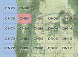
Grid Square CN85
20 locations - Larch Mtn - Woodland Ridge Alternative - Shell I-5 - Goose Hill - Woodland Ridge - Davis Peak - Beacon Rock - Kalama Gridline - Champoeg State Park - LL Stub Stewart - Dixie Mtn - Council Crest Park - Ham Radio Outlet - Milwaukie - Bald Peak - Cascade Head - Larch Mountain - Mt Hebo - Round Top - South Fork Mountain
Potential VHF rover sites in Washington and Oregon grid CN85.
CN85 dimensions are 96.9 by 69.2 miles.
Explore this grid in Google Earth or equivalent:
Larch Mtn, CN85ur41
| 45.716413, -122.295578 |
Larch Mtn is just east of Vancouver, WA. It was visited by Chris KG7OFQ in June 2015.
Restrictions: It can be busy. Chris got off the mountain in the nick of time as 100 people showed up to have a quick wedding.
Woodland Ridge Alternative, CN85ox95
| 45.979347, -122.753700 |
The Woodland Ridge location (at 900') is on a private road.
This spot provided excellent results into both the Portland and Seattle. A brief sporadic E opening netted QSOs into California and the South West U.S.
For the Jan 2013 VHF contest, I found this much higher spot on Green Mountain road. There is a gated dirt road that provides plenty of room.
Driving directions: The Google maps directions work fine. Nothing tricky.
Restrictions: This is a rural residential area, and the pull-over just off the paved road is probably a private (but gated) road. I had no issues for the ~2 hours I spent there.
Shell I-5, CN85pu54
| 45.852896, -122.701267 |
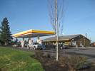
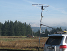
This truck stop offers instant access from I-5, along with food, gas and a rest area. It is clean and well-maintained.
This is a local high spot along the freeway. It has a good view of Mt Rainier from the back parking area.
If you want to avoid Oregon's full-service gas stations, this is a very convenient fill-up spot in CN85 near the state border before leaving Washington.
Driving directions: I-5 exit 16
- Shell station is on the east side of the freeway
- NW Paradise Park Rd and NW La Center Rd
Goose Hill, CN85pv57
| 45.907749, -122.701449 |
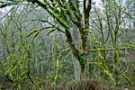
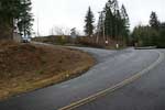
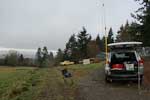
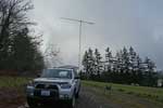

Goose Hill overlooks I-5 and the greater Columbia River valley, with easy access from the freeway. Although residents have gated the very top point, you can park on a gravel driveway for an open view in all directions with some low remaining rise to the north. And I even made some contacts northward into Seattle with my 15' mast and 7-element beam. Goose Hill has a radio tower nearby, but it's just a 911 transponder and did not cause 2-meter interference.
From I-5 take Exit 22 and wind your way up a mossy and scenic road. Turn left from Bratton Road onto NW Goose Hill Ave. Ignore the "Dead End" sign. Continue up to the top, turning left onto someone's dirt road before you reach their house. Driving time is about ten minutes from I-5.
This is a fine spot, but if you have a little more time and a 4wd vehicle, a much better spot is Davis Peak CN85qx up along the ridges just north near Ariel and Lake Merwin.
Woodland Ridge, CN85ow99
| 45.956630, -122.751630 |
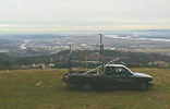
This is an excellent quick location from I-5. The exposure to the south is very good, but there is a hill to the north that blocks the Puget Sound area on UHF.
Driving directions: From I-5 take exit 22, (Dike Access Road). Go East.
- Go about 1 mile and take Green Mountain Road left near some Little League fields.
- Follow Green Mtn Road up the hill.
- Look for a large sign on the right side of the road advertising home sites or lots.
- Turn right and follow the roads up the steep hill.
- At the top of the hill there are several good locations.
- As of 6/01 the road was gated near the top of the hill.
- If you continue up Green Mtn. Road you'll start down the Kalama side of the mountain and eventually end up in Kalama. This is not recommended because of slow roads.
Davis Peak, CN85qx95
| 45.981167, -122.583833 |
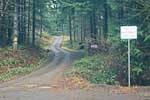
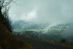
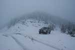
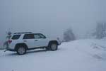
Davis Peak offers an outstanding ridge road with some pulloffs for operating with views in all directions. Note that a 4wd vehicle is needed for these forest service and logging roads. Note there is always snow in the winter, even when the lowlands are clear and warm.
Davis Peak is a half-hour drive from I-5 Exit 22 near Woodland. Follow highway 503 along the north side of Lewis River. Continue past Hansen Road (a dead end of course) and turn left onto the nicely paved Fredrickson Road. At the "end of maintained county road" sign, continue onto the logging roads. At every branch in the road, choose the upward path.
There is a longer alternate route suggested by Google Maps, which doesn't currently show the logging road at the end of Fredrickson Road. The alternate route turns off at Little Kalama River Road and climbs up to follow the ridge line to Davis Peak. There are likely even more good candidates along this path.
Check the area in advance for campgrounds. I saw several pull-outs that have been used for camping but of course there are no services. This road is well known to the local teenagers for summertime hangouts.
I did not operate the radio on my reconnoiter visit, but I'm tempted to come back for the Salmon Run contest in Cowlitz County. Also, it was very foggy and snow covered; the tiny dirt path along steep drop-offs makes an extremely disconcerting drive in these conditions.
Beacon Rock, CN85xp71
| 45.631167, -122.021833 |
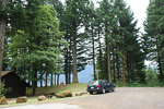
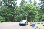
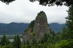
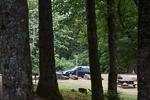
A national park picnic area with some altitude (500 feet) and fair propagation into Portland on 432 MHz.
I made an easy FM simplex contact into the Portland area.
This park requires a Discover Pass which you can buy on the spot using a drop box. A ranger came through to check, and offered to help me upgrade it from a day pass ($10) to a year pass ($30). Later, I wished I had taken her offer, since I visited Steptoe Butte and needed to have a pass there.
Kalama Gridline, CN85nx89
| 45.999900, -122.847500 |
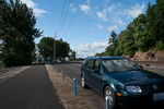
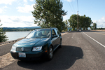
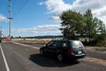
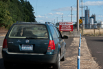
This is a good operating location for reaching Portland from the south side of the CN86-CN85 grid border.
This is along I-5 on the Washington side of the Columbia River, where you can watch lots of recreational boats, big river barges and railroad traffic. See also Kalama Gridline CN86.
There is a park and playground just north of the grid line. The park has clean restrooms.
Champoeg State Park, CN85ng40
| 45.251724, -122.876764 |
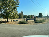
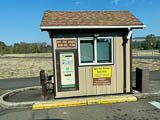
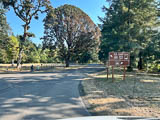
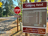
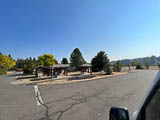
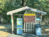
Champoeg State Park is a wonderfully large and clean park south of Portland. Although it's along a riverbed, it looks to be far enough from hills for an acceptable horizon.
See the Oregon State Parks website for info.
Champoeg State Heritage Area features a rare combination of history, nature, and recreation. Situated south of Newberg along the scenic Willamette River, Champoeg's forests, fields, and wetlands recreate the landscape of a bygone era.
LL Stub Stewart, CN85jr78
| 45.741944, -123.186111 |
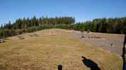
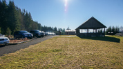
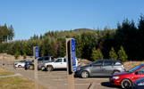
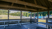
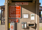
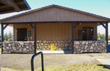
LL Stub Stewart State Park is a clean modern campground and recreation area with an extensive trail system and recreation opportunities on a hilltop. There are cabins, campsites, RV sites and horse-trailer parking in areas below the top of the hill.
The day-use picnic area on top has good exposure in all directions except NNE.
Dixie Mtn, CN85mq97
| 45.696034, -122.916874 |
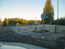
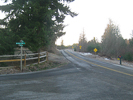
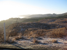
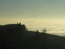
Excellent ridge line about 30 minutes from Portland. This spot gets you up and out of the river valley with good propagation into both Portland and Seattle from the Oregon side of the river.
Driving directions: 23755 NW Skyline Blvd, North Plains, OR 97133
Council Crest Park, CN85pl59
| 45.498960, -122.708318 |
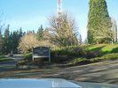
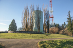
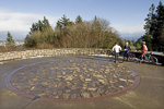
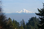
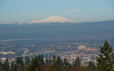
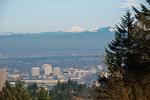
Easy to reach from Portland. On a clear day, five Cascade mountains are visible.
Ham Radio Outlet, CN85oj59
| 45.416398, -122.791416 |
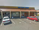
Best store in Oregon.
Driving directions: 14405 SW Pacific Hwy, Portland, OR 97224
Located alongside Harbor Freight.
Milwaukie, CN85qk10
| 45.419660, -122.653877 |
A suburb of Portland.
Bald Peak, CN85lj34
| 45.395400, -123.055900 |
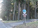
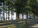
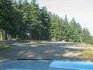
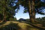
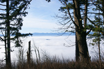
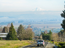
Located in Bald Peak State Park due west of Tigard, and 45 minutes SW of Portland.
It does take time to reach the top; these are slow country roads with plenty of turns and stop signs. Plan to stay awhile with good beams to make the drive pay off.
The state park is the highest point on this mountain and provides a good access to the north and east. From this spot you can see Mt Rainier, the Olympic Range, Mt Adams, Mt. Hood, Mt. Jefferson, and what's left of Mt. St. Helens. Restroom and picnic tables are available. Large circular parking area at top.
A repeater site that is only 20 feet lower is located 1/4 mile west of the entrance. From there you can work all directions clearly except west because of a thin tree line.
K3UHF has worked CN 82-73-89 and DN02-06-07-13-17 and points between from here on 2 meters with a 7 el beam. And he's worked about half that distance on 432. Also he's bounced signals off the mountains on 1296 to Bend, OR from there too.
Driving directions: It is located about 5 miles west of Hwy 219.
- Hwy 219 runs north and south between hwy 26 and Hwy 99w between the towns of Newberg and Hillsboro.
- The road to the park is well marked from Hwy 219 and the access road is named Bald Peak Road.
- Watch out for cyclists in the warmer months.
Restrictions: Signposted "Day use only. 7am to 8pm".
Cascade Head, CN85ab25
| 45.063667, -123.977167 |
SW corner of CN85, just minutes north of Lincoln City.
Driving directions: North on Hwy 101 about 4 miles north of the Hwy 18 (from Salem) intersection.
- Maps show FR-1861 or Cascade Head Road.
- But I only found a clearly marked FR-1861 sign a few hundred yards south of Milepost 101 (on Hwy 101).
- The road is at the top of the grade and travels west along it.
- As it leaves Hwy 101, it's about 800' and climbs to over 1600' in a little more than a mile.
- The road surface is well groomed gravel with few potholes.
- It is gated with a large turn around area at 101 but it appears the gate is generally open.
- The road climbs quickly, then turns and drops a bit.
- There is an excellent pullout at N45 03.82' W123 58.63'
- This has an open view (no trees) to the south and a rock wall about 40' high to the north.
- Just beyond this point the road forks and the right fork loops around toward the north side of the hill.
- It appears there would be a good short north as well.
Larch Mountain, CN85wm97
| 45.532722, -122.087873 |
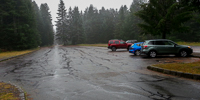
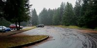
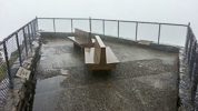
Larch Mountain is located on Forest Service land an hour's drive east of Portland, OR. It makes an excellent SOTA activation spot. See the SummitPost.org description and driving directions.
There's a nice parking lot with a hike up to a scenic overlook with benches.
Driving directions: From Portland take I-84 towards Hood River and take Exit #22 for Corbett.
- Zero your trip meter at the stop sign.
- At the stop sign you turn right and head up the hill towards Corbett.
- At 1.3 miles the road Y's, stay left at this "Y" and then take a left onto the Columbia Gorge Scenic Hwy.
- Zero your trip meter and proceed for 1.9 miles.
- Turn right onto Larch Mountain Road.
- It is paved and marked with a big sign.
Follow the road to the parking area near the top of Larch Mountain (14 miles).
Restrictions: A recreation pass is required ($5/day). There is no camping but there is a paved parking lot at 3900 feet with rest rooms, see photos above.
Mt Hebo, CN85cf91
| 45.213900, -123.756200 |
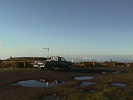
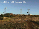
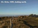
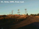
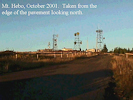
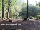
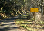
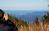
The best site at the northern end has been closed off because of an endangered butterfly in the area. The South site is good, as is the helicopter pad at the middle site. All of the USAF buildings have been torn down but most maps still show them.
2014-01 update: The site is practically unchanged since the last update in 2001. I added two photos. It's line-of-sight with almost everywhere and Rod WE7X /R and I made FM simplex contacts. - Barry K7BWH /R
Driving directions: Take Highway 101 or Highway 22 to Hebo.
- From the town of Hebo, go east on Highway 22.
- Go 0.2 mile and turn left on forest road 14.
- Look for the Hebo Lake Mt. Hebo sign.
- 4.5 miles from 101 you come to the Hebo Lake campground.
- It has 16 sites with piped-in water and pit toilet.
- From the campground you go up the hill 3.4 miles to the top of Mt. Hebo.
- The road is paved except for the last l00 yards or so.
- See also this Topo Map of Mt Hebo
- 5 microwave towers plus 4 buildings.
Restrictions: Road is not maintained for winter travel.
Round Top, CN85hq62
| 45.677300, -123.362400 |
This is where the Tecktronic club went for years for the June VHF contest. No RF on this one, bring your own.
Driving directions:
There are 2 ways in. I prefer coming in from Timber, but the other way is almost as good. You should drive in a week or 2 beforehand to check the road. There is very little maintenance on the roads. Make sure you take a shovel with you and dig out the drainage ditches in the big mud hole or to dig yourself out if you get stuck. This mud hole is spring fed and no place for a car.
See this Topo Map of Round Top.
Restrictions: Unmaintained road. Bring shovel.
South Fork Mountain, CN85vc11
| 45.091300, -122.240400 |
Paved road to within 3/4 mile of the top but watch the last 1/2 mile. This site is sometimes not open for the June contest because of snow. Have a chain saw with you as you go through a grove of trees before you get to the top - some years there are blow downs.
Driving directions: On the highway from Colton to Estacada turn east at sign to Dodge.
- Follow the road through Dodge and into the National Forest.
- Have a forest service map and you will get there ok.
- Also see this Topo Zone Map
| < Previous | Page 18 of 27 | Next > |
©1998-2026 Barry Hansen