Rover Location Database
Oregon Rover Locations
- OR Map
- OR List
- Select Grid
- OR from CN85
- DN15 Wallowa
- DN14 Baker City
- DN13 Boise
- DN12 Outback
- DN05 Pendleton
- DN04 John Day
- DN03 Burns
- DN02 Steens
- CN95 The Dalles
- CN94 Bend
- CN93
- CN92 Klamath
- CN86 Centralia
- CN85 Portland
- CN84 Corvallis
- CN83 Roseburg
- CN82 Medford
- CN76 Astoria
- CN75 Lincoln
- CN74 Newport
- CN73 Coos Bay
- CN72 Pt Orford
- Add a Place
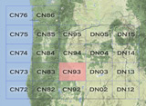
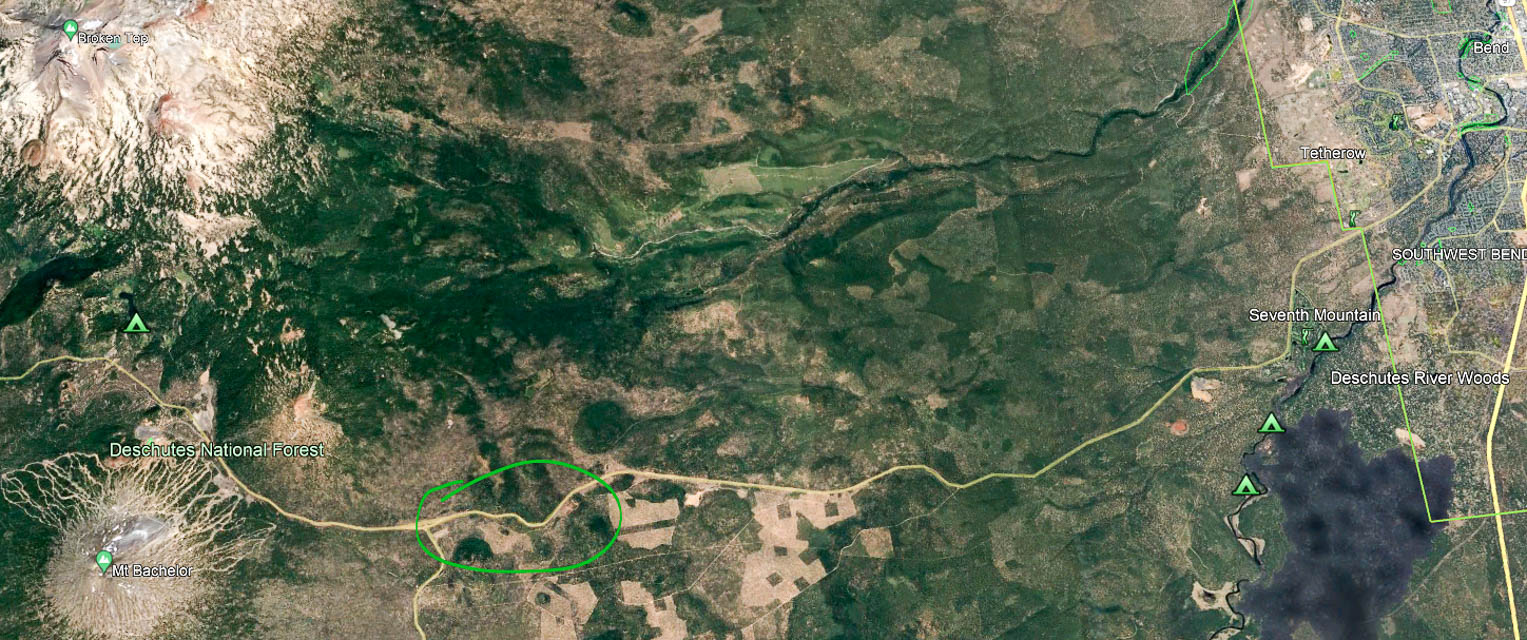
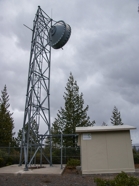
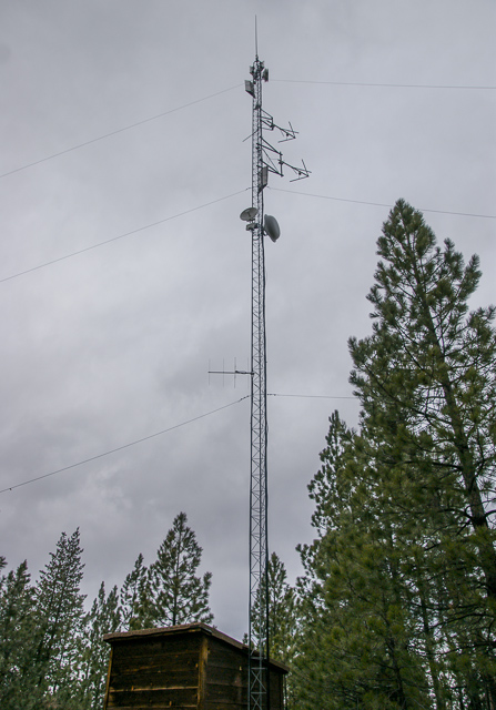
Grid Square CN93
17 locations - Flat Top Mtn - Swampy Lakes Sno Park - Kapka Butte Sno Park - Paulina Peak - Glass Butte - Knapper Camp Gridline - Alkali Lake Grid Line - Old MRA Campsite - Green Mtn Campground - Green Mtn Rock Pit - Hole in the Ground - Walker Mtn Lookout - Hampton Butte - China Hat - Gilchrist Butte - Pine Mtn - Lava Butte
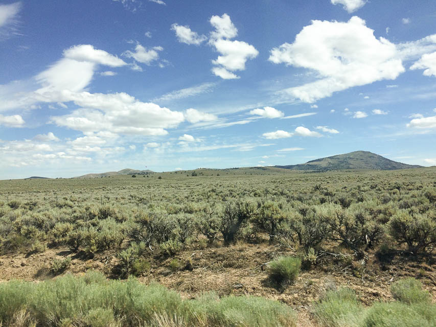
Potential VHF rover sites in grid CN93.
CN93 dimensions are 100.3 by 69.2 miles.
Explore this grid in Google Earth or equivalent:
Flat Top Mtn, CN93nd49
| 43.164543, -120.881015 |
A good place in CN93: relatively close to civilization, but not too close. 4 miles from the highway, of which 3 miles are easy dirt roads. The last mile is a tough climb requiring 4x4 low and high clearance. You can get to the large meadow, with the powerline in your back, and an incredible view to the east.
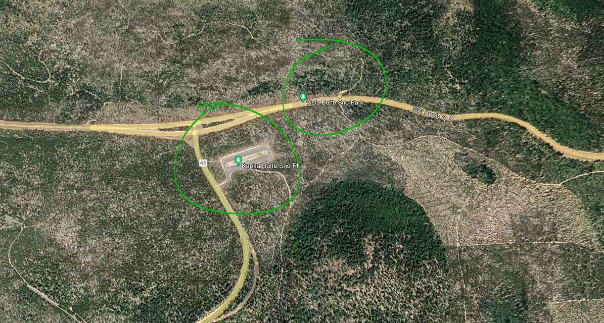
Swampy Lakes Sno Park, CN93fx17
| 43.989808, -121.567736 |


This is a convenient pulloff with a large parking lot. It's used heavily in winter and mostly empty after the snow is gone.
We had good cellphone signal here, 3 bars. There are two vault toilets.
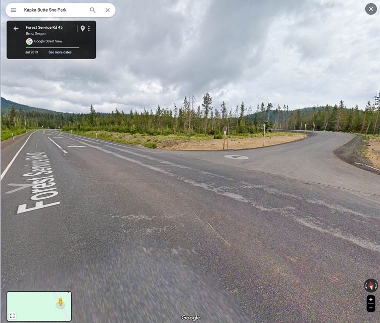
Kapka Butte Sno Park, CN93ex65
| 43.979980, -121.611322 |
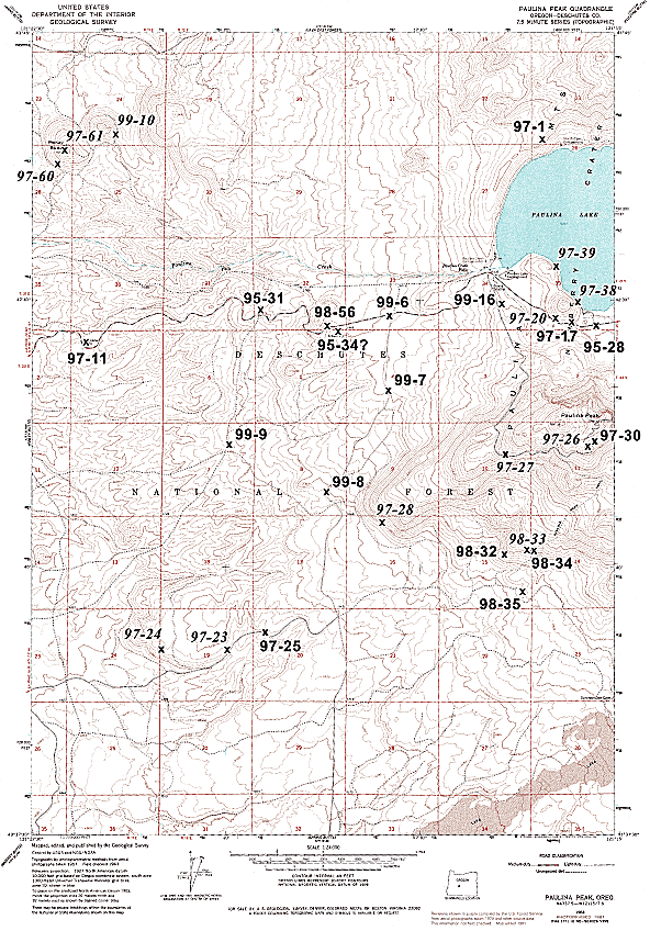
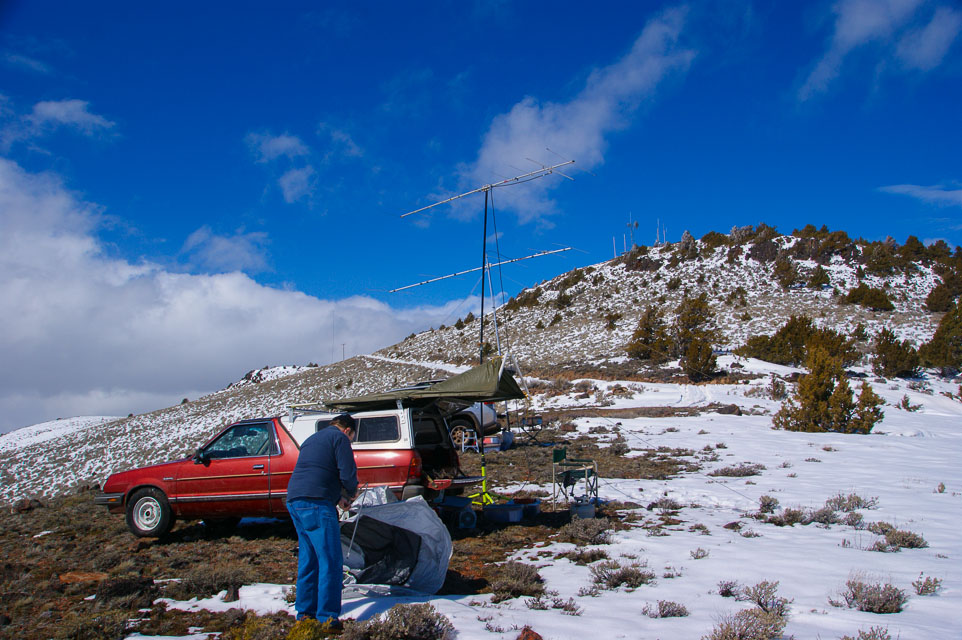
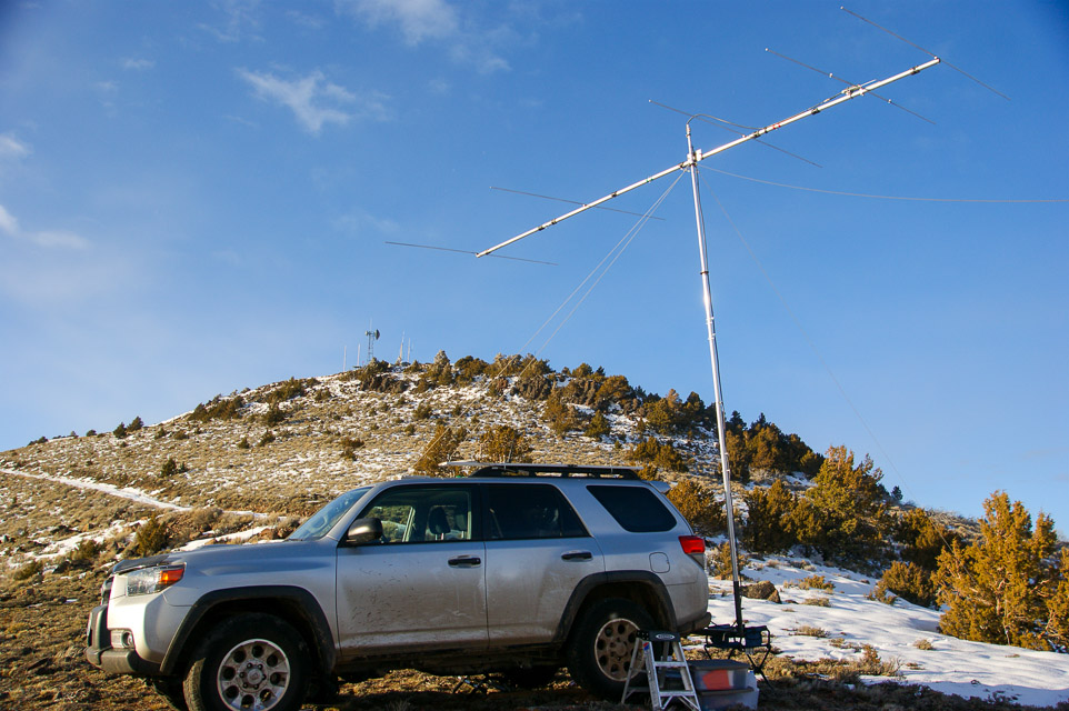
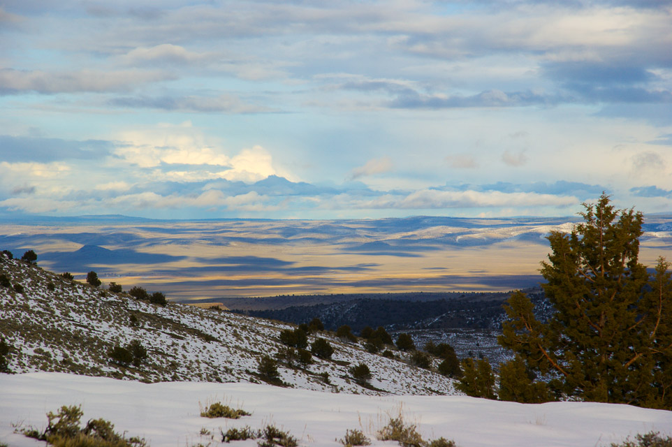
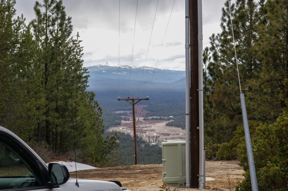
Paulina Peak, CN93iq95
| 43.689300, -121.254630 |
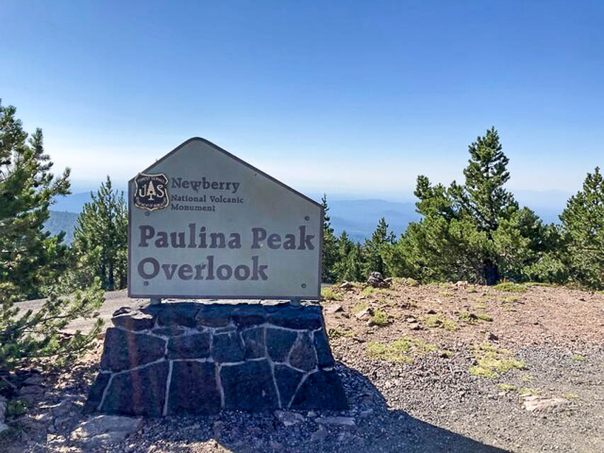
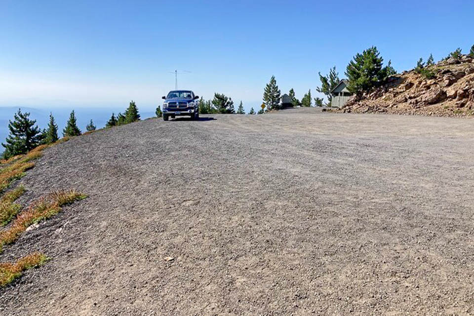
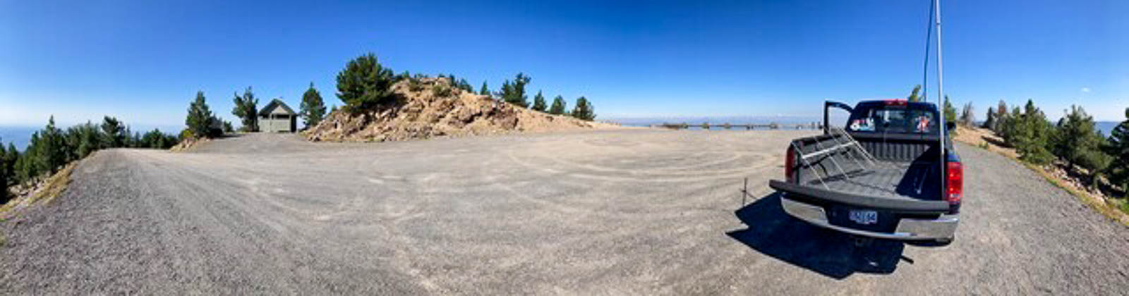
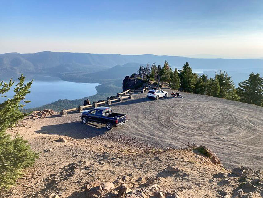
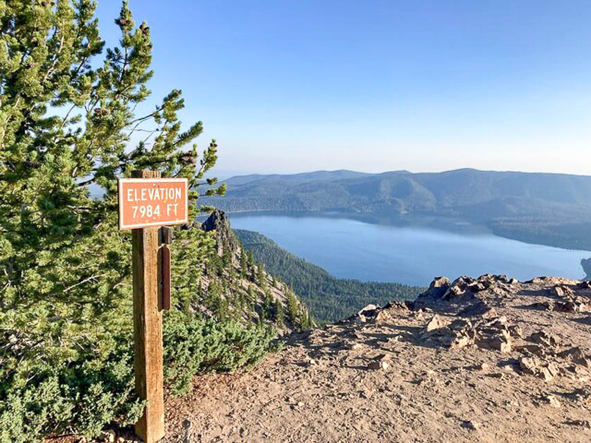
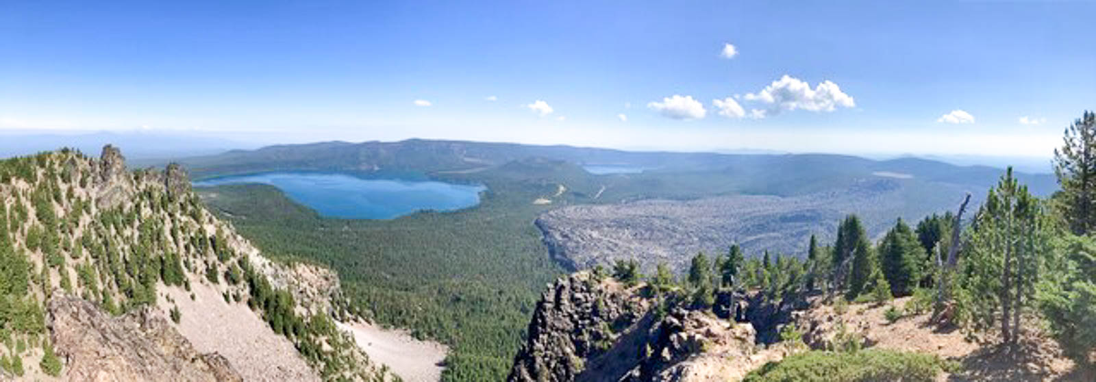
This is one of the premier operating locations in Oregon state.
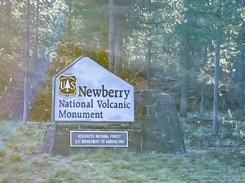
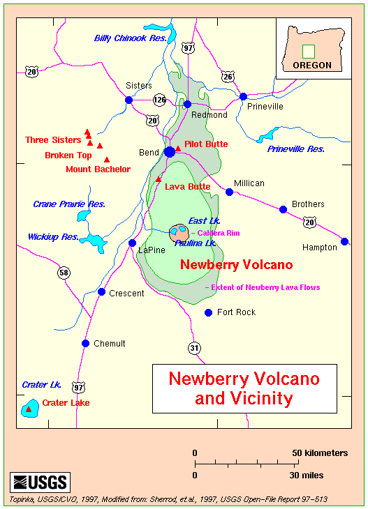
Paulina Peak is at the top (and I mean the VERY TOP) of the Newberry Volcano. It offers a grand overview of the Newberry Caldera, the south and west flanks of the Newberry Volcano, the Cascades, the Fort Rock Basin, and much of central Oregon. On a clear day, the Cascade Range is visible extending into California (Mt. Shasta) and Washington (Mt. Adams).
- Map of Newberry Caldera Area

- Map of Newberry National Volcanic Monument
- Washington State University Quadrangle Map
- USGS Map of Newberry Volcano area
- USGS Newberry National Monument Website
I recommend allowing time for hiking around the trails.
Recreation Fee Site: A check-in station on Paulina Lake Road will sell you the required park pass. If you have a permanent pass, no need to stop.
Buy your park pass online here: www.fs.usda.gov
Call the ranger station in advance to confirm the peak road is open. It is closed winters, typically Oct - Apr. You can also check online, but I would confirm with a call.
In the web info it is stated a park pass is required to park there. During my 8 hours there I did not see anyone check for passes. I parked all day without issues. I did get visits from people inquiring about my activity.
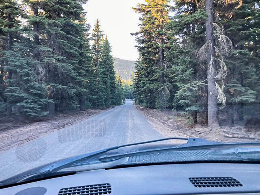
Road Conditions: The Paulina Lake road is a two lane paved in good condition connecting the highway to the forest service area. Speeds were slower due to winding nature of the road.
The entrance to the Forest Service Road 500 up to the peak is not well marked so watch for it on the right. There are signs for the approach but the turn itself you must watch for.
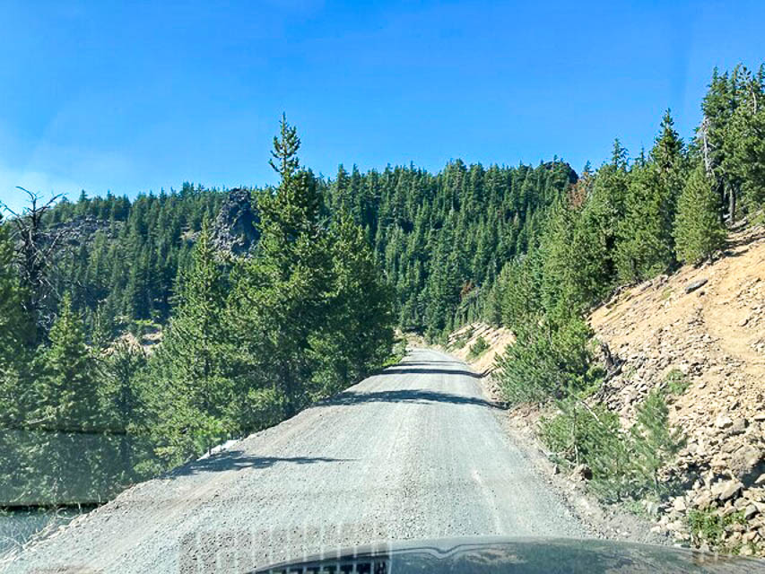
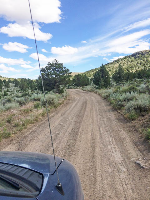
The road starts paved then turns to pea gravel. The ranger station said it is bladed once a year. However, there are washboards throughout the road. Slow and steady wins here. Clearance issues are not a problem, but the washboards will be tough on vehicles not suited for the condition.
The last quarter mile has twists and turns, so be cautious. The road is wide enough to have two vehicles pass with slow speeds in most places but the turns are tough if encountering another vehicle.
At the road where you turn to head up to the peak: if you turn left instead of going to the right, it goes to a nice campground for Paulina Lake, which makes a good base to camp/scout out the area.
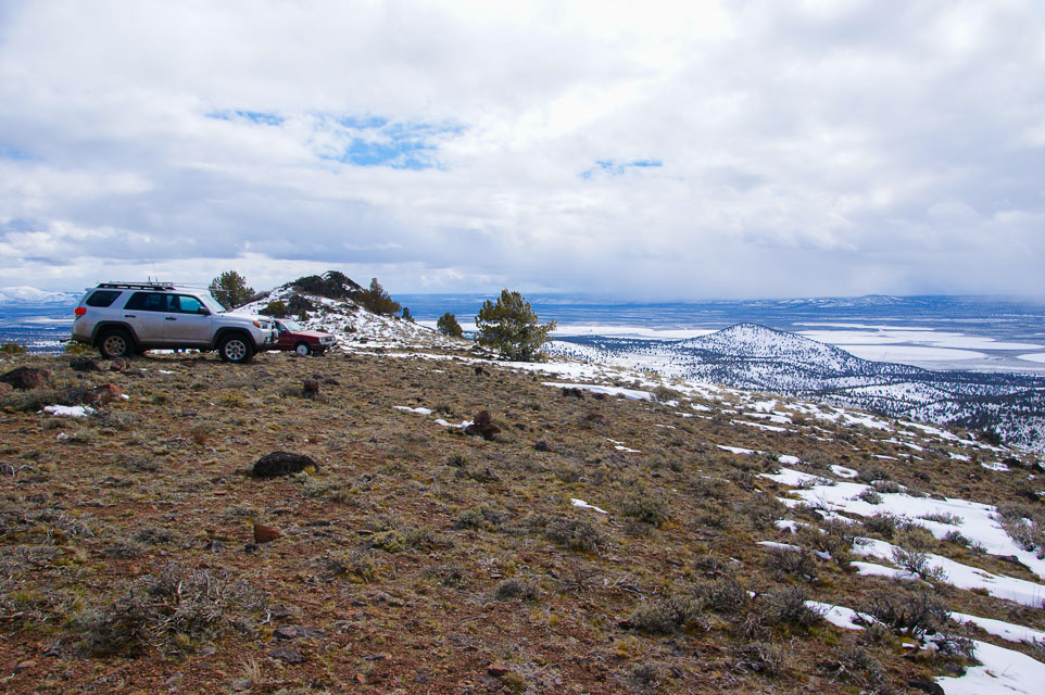
Parking Lot: The parking area is big enough for several vehicles and a good turn-around. When I arrived on a weekend in mid-August, there was only one other vehicle up there. During the day vehicles would come and go without a large pile up. A county sheriff patrolled through as well. No issues with long parking. Running a quiet generator should be ok. Be prepared for winds at the parking lot.
There is a vault toilet but no other services. Be sure to bring everything you need, food, water, fuel.
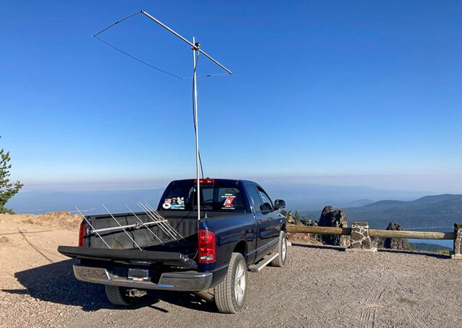
On the air: The noise level was very low. With 100 watts and a Moxon, I did ok. Wth an amplifier it would be much better. FT8 during the day I saw Alaska stations show up and got one QSO completed.
Drop-offs in almost all directions and the elevation makes this a great spot. If you get any propagation at all, you'll do really well here, even with a modest station.
Camping: Paulina Peak is in the Newberry National Volcanic Monument, a major recreation area in Central Oregon. Below the peak there are numerous campgrounds, at least two resorts and two large lakes. The resorts offer cabins, RV parks, showers, etc.
- Mark N7NWP
Driving directions: From Bend, drive south on Highway 97.
- Take the Newberry-Paulina road to the east. It is well marked.
- Go uphill about 11 miles to the guard station.
- You will have to pay a $5 day use fee to park on the peak.
- These passes are available at the entry guard station, or the Ranger Station, or online.
- The road to the peak is opposite Paulina Lake Campground at about mile 13.
- It goes to the right (south).
- This is a one lane road with turnouts.
Restrictions: Pass required. Motorhomes and trailers are prohibited.
Closed for winters at the Sno-Park lot.
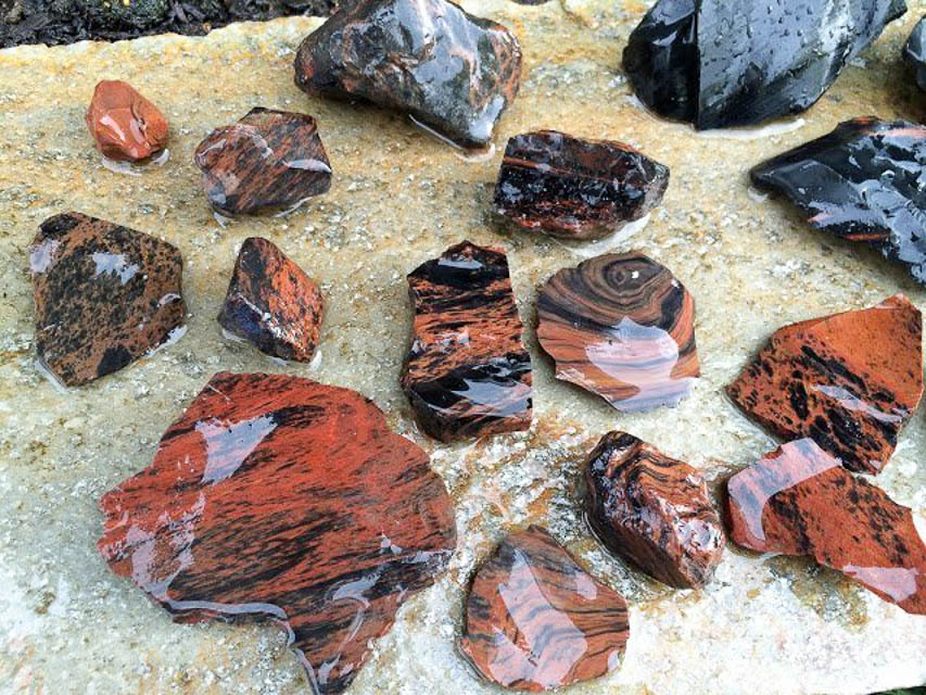
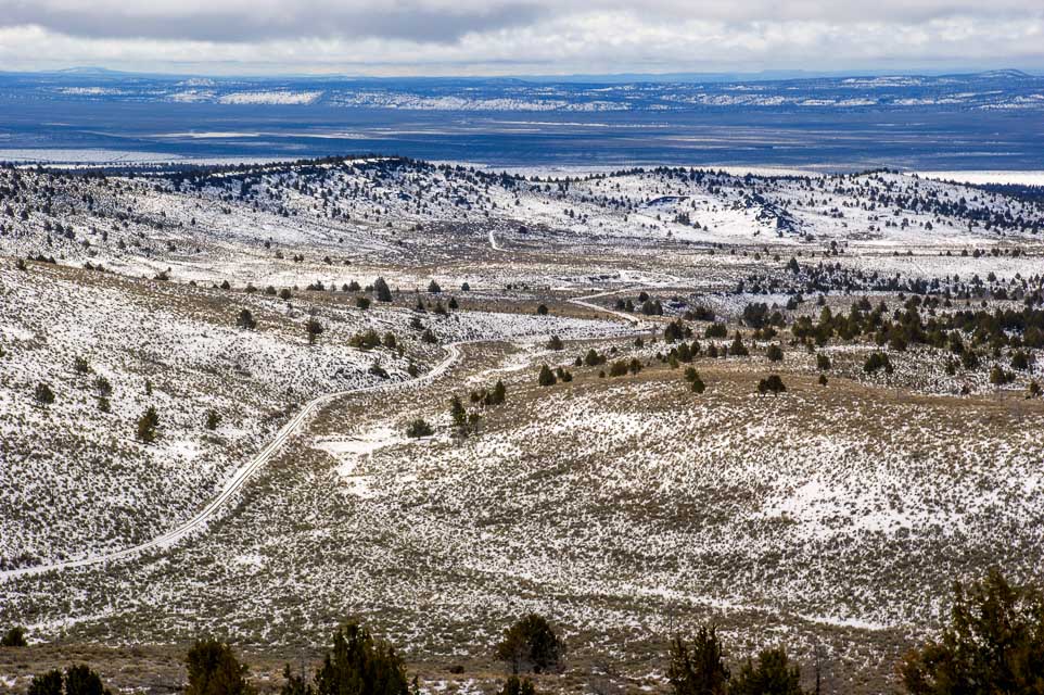
Glass Butte, CN93xn13
| 43.556004, -120.072696 |
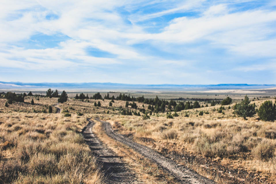
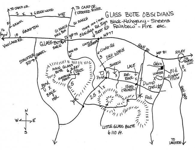
The road to the top was graveled in 2021. K7ATN wrote a SOTA report that it's a drive-up summit; he recommends 4wd.
It's a good rockhounding area. Even if the summit is no good on the air, it's an interesting area to explore. The road up is not for the claustrophobic; there are many steep dropoffs.
- Matt KC7OOY
See my Glass Butte Trip Report for more photos and details. - Barry K7BWH
Driving directions:
From Bend, take Hwy 20 approximately 77 miles East.
Before you reach milepost 77, look for a dirt road on your right side: 43.5866, -120.0210.
Do not turn onto "Glass Butte B-line Road" because it's in poor condition.
Follow the dirt road South for approximately 2 miles.
You’ll end up in a large parking area; this is "Knapper Camp BLM."
Continue 0.9 miles and turn right after the pond (usually almost dry).
Drive 2.2 miles and turn right onto "Glass Butte C-Line Road".
Drive uphill about 4.5 miles to the top. Stay on graveled road.
There are two good saddle points with a large space for a few campers: 43.5509, -120.0657
Restrictions:
Glass Butte and Knapper Camp are dispersed camping, zero amenities.
Be prepared to pack everything in and back out again.
No toilets, no designated campsites.
Knapper Camp Gridline, CN93xn94
| 43.558694, -120.000100 |
Needs scouting.
Alkali Lake Grid Line, CN93xb98
| 43.078221, -120.000100 |
Exactly on CN93-DN03 grid line, parked on a highly conductive alkaline soil.
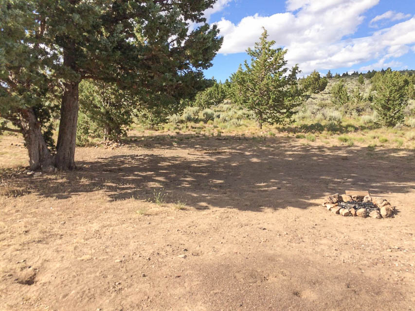
Old MRA Campsite, CN93qh03
| 43.305704, -120.665461 |
We used to camp out here every Memorial Day weekend, out of the weather with good takeoff. Would recommend driving by to scout at least on the way to or from Green Mountain.
- Matt KC7OOY
Green Mtn Campground, CN93pj32
| 43.386285, -120.723611 |
Green Mtn Campground is a few feet higher than the Rock Pit, and offers picnic tables and vault toilet. It can be windy.
From the BLM website at Green Mountain Campsite: "Featuring panoramic views of the lava flows, cinder cones, and the desert landscape of the Fort Rock and Christmas Valley area of central Oregon, the Green Mountain Campground offers a remote camping experience perfect for photography, solitude and stargazing. Whether using it as a basecamp for exploring nearby attractions like Crack-in-the-Ground and the Four Craters Lava Field, or simply seeking an out-of-the-way site with stunning sunrises and sunsets, visitors willing to brave its rough access road will not be disappointed."
Driving directions:
Arriving from the north will miss miles of washboards.
But if you must come from the south:
- From Christmas Valley, Oregon, head east on the Christmas Valley Highway
- Drive approximately 2 miles
- Turn north (left) onto Crack-in-the-Ground Road and continue for about 5 miles.
- Turn left onto Lava Craters Road, following signs to Crack-in-the-Ground.
- Follow the road past this site for about 4 miles, and continuing for another
3 miles as it turns west and north and becomes the Green Mountain Road (BLM Road 6109-00).
External map on Flickr: flic.kr/p/NGGA7v
Restrictions:
- Open Season Green Mountain Campground is open year round
- Four-wheel Drive vehicles recommended; access is via rugged dirt roads that may be impassable at times
- 6 primitive campsites
- Picnic tables and fire grates
- First come, first served
- Vault restroom
- No drinking water
- Pack out your trash
- Nearest services are in the nearby town of Christmas Valley, Oregon
Green Mtn Rock Pit, CN93pj31
| 43.383323, -120.722301 |
This is where I was/am going to go, a prominent spot next to the highest spot in the area. Campground right next door is very nice, but also can be windy.
- Matt KC7OOY
Driving directions:
Arriving from the north will miss miles of washboards. But if you get supplies in Christmas Valley then you pretty much have to come up from the south.
Hole in the Ground, CN93jj59
| 43.412774, -121.205595 |
Great location but lots of wind at times. There are a couple spots aroud the rim on the north side, if they're not occupied, that you can get somew windbreak in the trees.
Walker Mtn Lookout, CN93dh43
| 43.305091, -121.716600 |
Needs scouting.
Restrictions: Likely blocked by snow in winter.
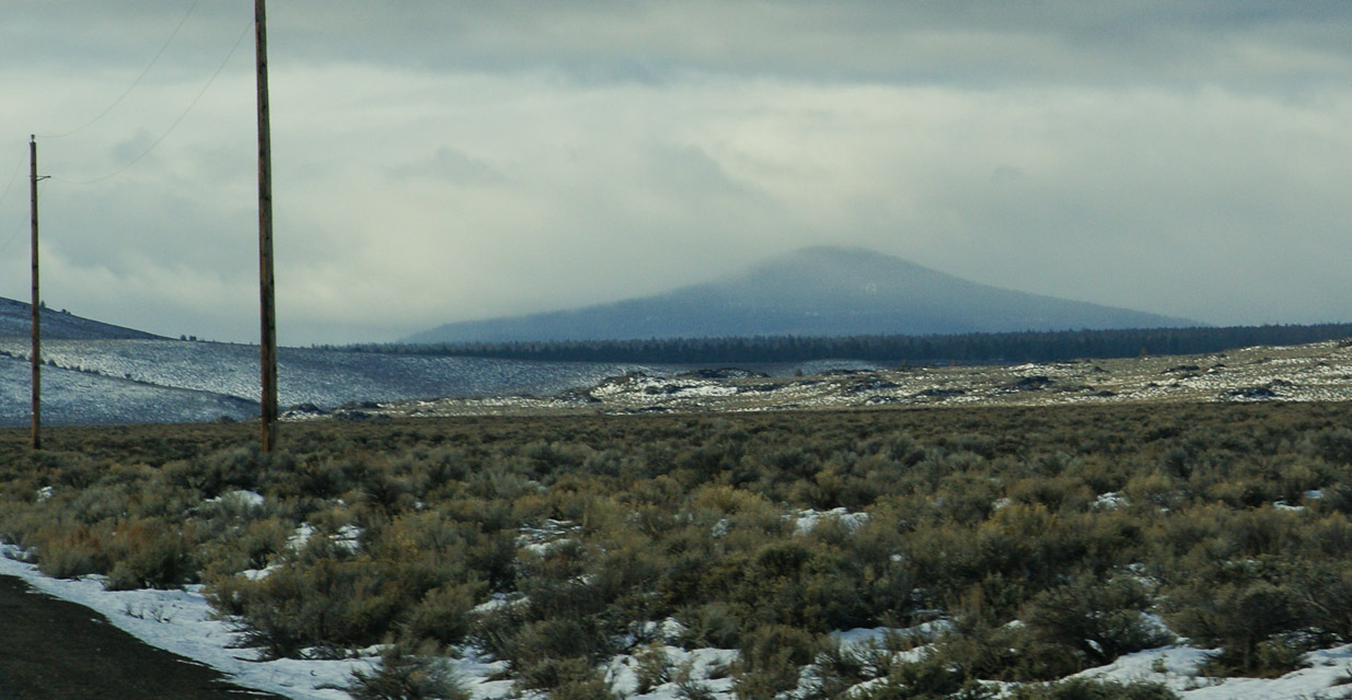
Hampton Butte, CN93us65
| 43.770850, -120.281970 |
Hampton Butte rises high above the valley plain, just north of Hwy 20 and the so-called city of Hampton (it's a wide spot with gas station), about 50 miles east of Bend.
Driving directions: From Bend, go east on Hwy 20.
- A few miles before you reach Hampton, turn north on Lizard Creek Road.
- Keep right at the wye, staying on Lizard Creek as it climbs the hill.
- Follow road to the top. No water or facilities.
- We camped on the last shoulder before the top.
Restrictions: Stay on road as it passes through private ranch land. The road is unmaintained in winter.
China Hat, CN93lq53
| 43.682026, -121.033902 |
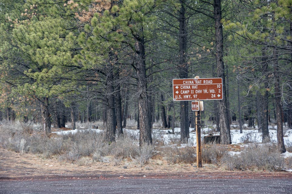
China Hat is a 6000' conehead peak east of Bend, Oregon. Rod WE7X and I tried to reach this in April 2014 but were turned back by snow and seasonal road closure.
Also nearby is another spot worth trying, the East Butte Lookout.
Restrictions: Closed in winter.
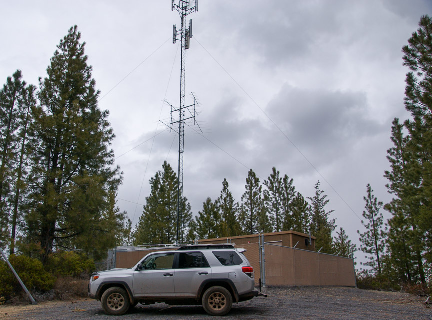
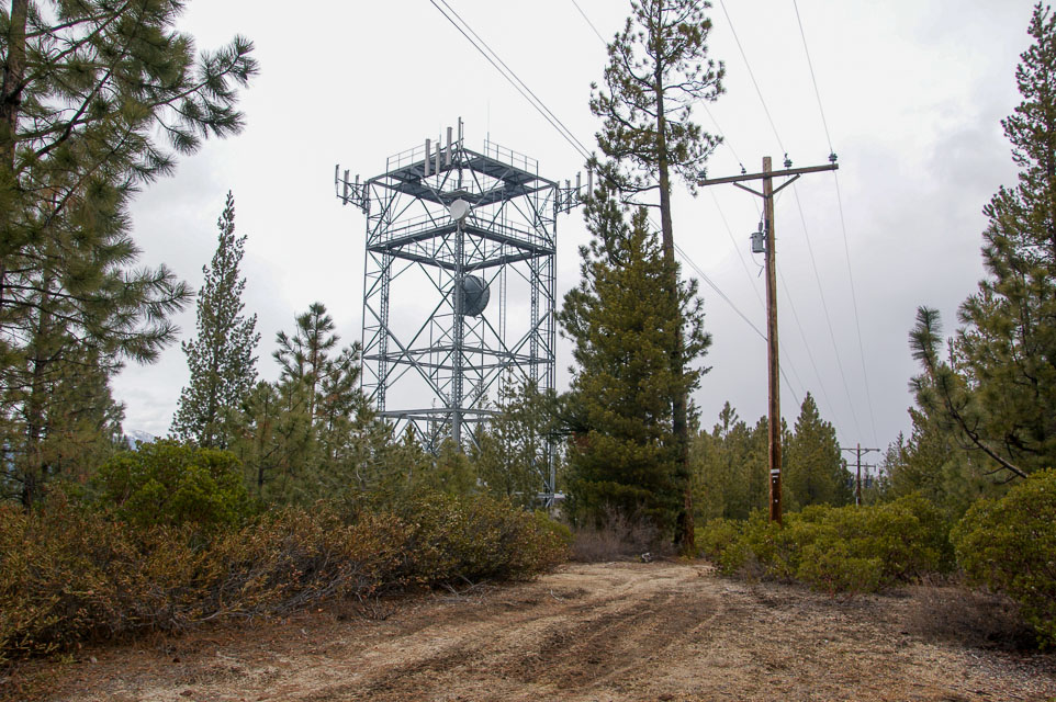
Gilchrist Butte, CN93dl91
| 43.462680, -121.668130 |
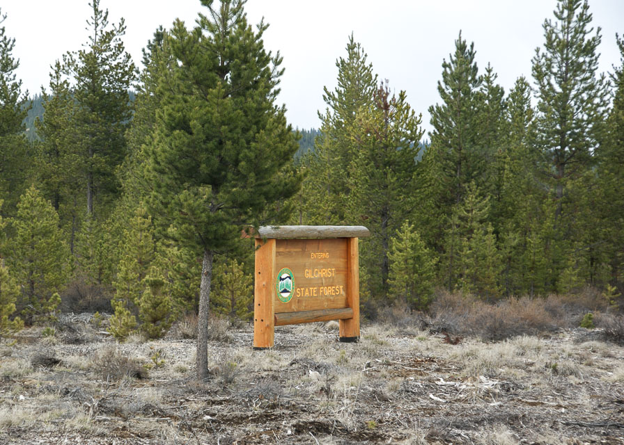
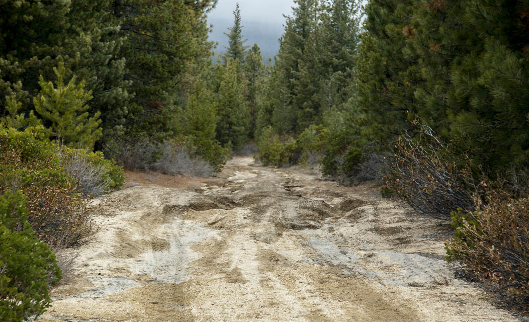
Gilchrist Butte is a local high point near Crescent City and Gilchrist. Although it's near Hwy 97, it takes 45 minutes or more to reach on very rough logging roads.
With lots of trees and transmitters at the top, I wouldn't call it a good operating location.
Restrictions: No good roads; unmaintained logging roads are narrow, steep, sandy and deeply rutted. It requires a good 4WD vehicle with plenty of ground clearance.
Pine Mtn, CN93ms69
| 43.791234, -120.947378 |
This is an observatory run by the University of Oregon with a primitive campground at the top.
Most of the mountain top is really "in the trees". There are a couple of locations that you can drive to and get good 180 degree openings, but rarely an unobstructed 360 degree view.
If you're willing to hike up a short trail, about 100 yards, there's a completely clear spot on the tip top of the mountain that has a 360 degree view. From the looks of the clearing, the observatory holds "star parties" and classes at this location. I should mention, there's another mountain top in the same immediate area (off the same access road) that has some antennas on it, I think it's a little lower than Pine Mtn. I didn't check it out, I just followed the road toward the higher ground.
See also:
Driving directions: 7 miles off hwy 20, S.E. of Bend.
- The road in is very good (graded with a nice washboard effect) clearly
marked to the observatory.
Restrictions: Snow cat required in January.
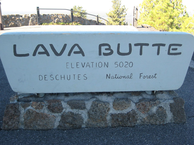
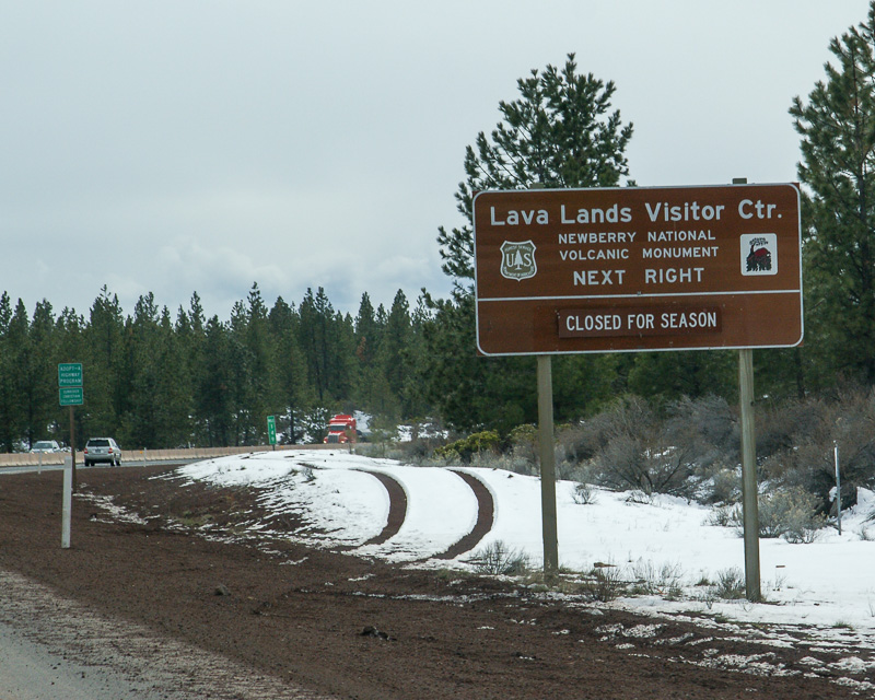
Lava Butte, CN93hw70
| 43.917433, -121.356797 |
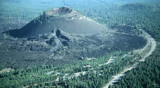
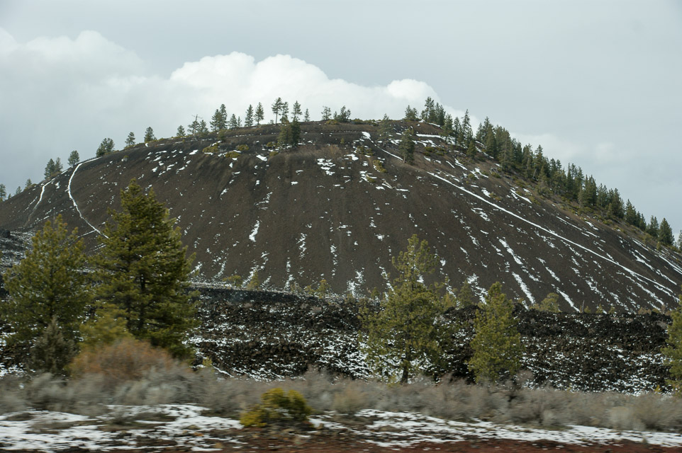
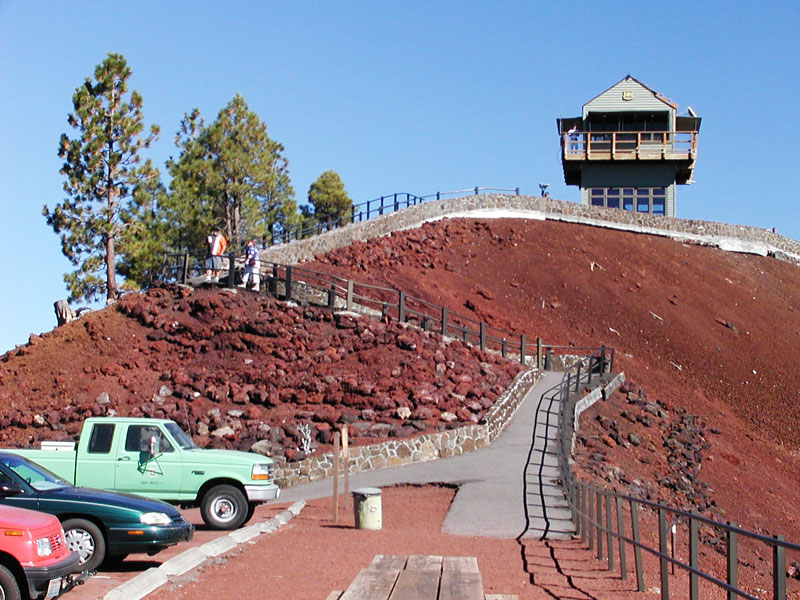
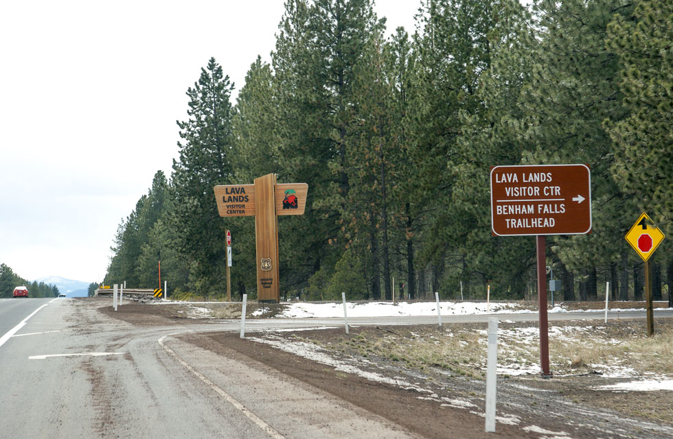
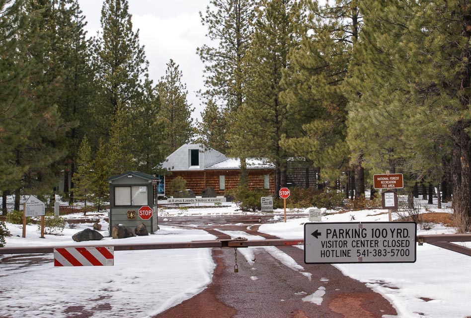
Lava Butte is a cinder cone rising 500 feet above Lava Lands Visitor Center. A cinder covered trail encircles the rim of the cone with outstanding views.
See also the Lava Butte Interpretive Site by the USDA Forest Service for conditions and fire warnings.
There is good but limited parking and a public toilet.
Driving directions: From Bend, travel 11.2 miles south on Hwy 97.
- It is located approximately five miles south of the High Desert Museum.
- It is only 4 or 5 minutes off Hwy 97.
Restrictions: Open 9:00 am to disk. A Forest Service pass is required to park, and they check.
The parking lot on top of Lava Butte is limited to 10 vehicles, so 30 minute time
passes are issued at the Lava Lands Welcome Station on a first come, first served basis.
Closed during winter.
Check the parks department hotline 541-383-5700 for additional restrictions.
| < Previous | Page 15 of 27 | Next > |
©1998-2026 Barry Hansen