Rover Location Database
Oregon Rover Locations
- OR Map
- OR List
- Select Grid
- OR from CN85
- DN15 Wallowa
- DN14 Baker City
- DN13 Boise
- DN12 Outback
- DN05 Pendleton
- DN04 John Day
- DN03 Burns
- DN02 Steens
- CN95 The Dalles
- CN94 Bend
- CN93
- CN92 Klamath
- CN86 Centralia
- CN85 Portland
- CN84 Corvallis
- CN83 Roseburg
- CN82 Medford
- CN76 Astoria
- CN75 Lincoln
- CN74 Newport
- CN73 Coos Bay
- CN72 Pt Orford
- Add a Place
Grid Square CN94
4 locations - Long Butte - Round Butte - Pilot Butte - CN94-95 Grid Line
Potential VHF rover sites in grid CN94.
CN94 dimensions are 98.6 by 69.2 miles.
Explore this grid in Google Earth or equivalent:
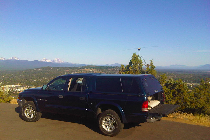
Long Butte, CN94ie61
| 44.173450, -121.277790 |
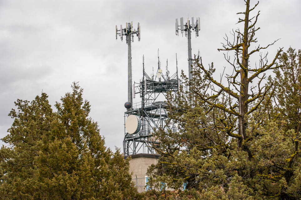
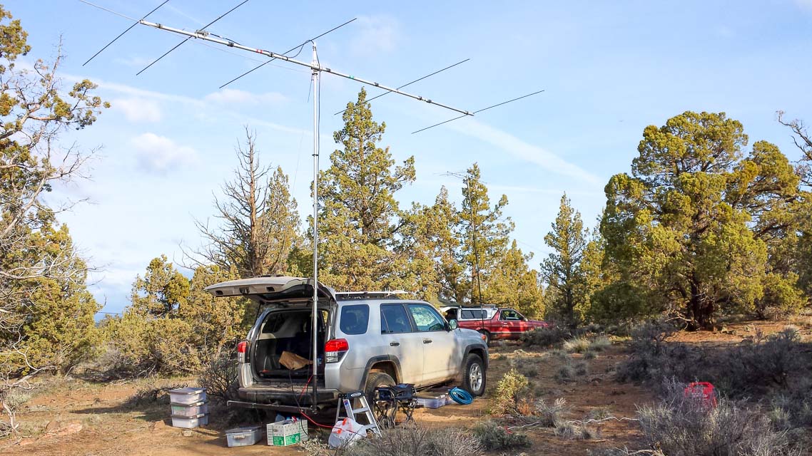
Long Butte is a convenient stop from Hwy 97 between Bend and Redmond. We had the best paths into Portland and Seattle from here, largely because it's closer to the metro centers than points further south.
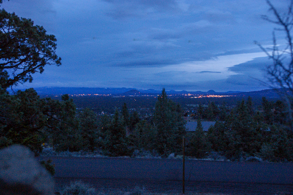
The modest altitude made this spot more accessible and comfortable in winter weather than the mountain peaks in April 2014. At night there are wonderful views of Bend's city lights in the distance to the south.
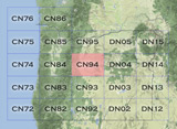
There are several antenna structures. The large frame construction at the highest point has some dishes and several cellphone arrays; it didn't bother us on the air. The nearby small ham repeater had some interference on 2m but it was infrequent.
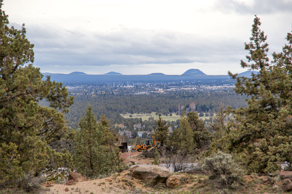
Driving directions: Best approach to Long Butte is along Limestone Ave. Other routes have poor or undeveloped roads. Although the area is fully developed for residential use, there is plenty of tree cover for a reasonably secluded spot to camp.
Round Butte, CN94jo16
| 44.610699, -121.238403 |
An easy all pavement drive up with no RFI issues nearby and public access. There would be a good amount of traffic up there on a summer weekend, but plenty of places to park off the road and set up.
Driving directions:
From the south end of Madras, take SW J Street east - it will turn into SW Belmont Lane. For pavement all the way to the summit, turn left after 7.1 miles onto SW Mountainview Dr. Ignore signs after this for Round Butte Park - that's not the summit. After 1.5 miles the road will turn to the left - continue for 1.1 miles to turn left onto SW Round Butte Dr. Continue to the north 1.6 miles to the summit.
There's a unmarked and unnamed but shorter dirt/gravel road suitable for passenger vehicles that joins Belmont about 0.8 miles before Mountainview and connects to the narrow summit track.
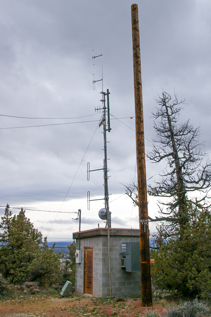
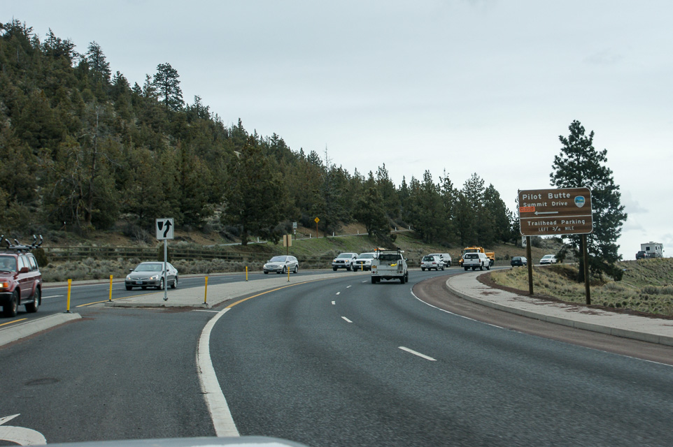
Pilot Butte, CN94ib64
| 44.060561, -121.283247 |
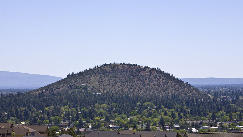
You will be able to see the butte as you come into town. Highway 97 goes between two high spots - the one on the east is Pilot Butte, and the one on the west is a residential area.
The best operating location to the north is the pull-off just opposite the bunker door (you will understand it when you see it). The top of the butte has a road going around the edge, with high ground in the center. The road is not all that wide, though there is room to pull off on the outer edge in several places.
Pilot Butte State Park is a thousand-foot bare cone within the city of Bend, Oregon. It offers great views and propagation in all directions, with low take-off angles and no obstructions.
The best operating location to the north is the pull-off just opposite the bunker door (you will understand it when you see it). The top of the butte has a road going around the edge, with high ground in the center. The road is not all that wide, though there is room to pull off on the outer edge in several places.
There is excellent exposure in all directions. This site is gated, but the gate is generally open, except in the winter.
Driving directions: Take Highway 97 to the middle of Bend. Go east on Highway 20.
- If you are southbound, look for the Safeway on the east side and turn just past it.
- Look for the "Pilot Butte" sign on the left.
- On the way, stop at the Pilot Butte Drive-In on the right for an extraordinary hamburger and an excellent chocolate malt.
Restrictions: Closed during the winter.
Expect a lot of traffic - vehicle and foot in the area. The road to the top is narrow, and there are a lot of hikers and runners on it.
CN94-95 Grid Line, CN94ox29
| 44.999900, -120.813700 |
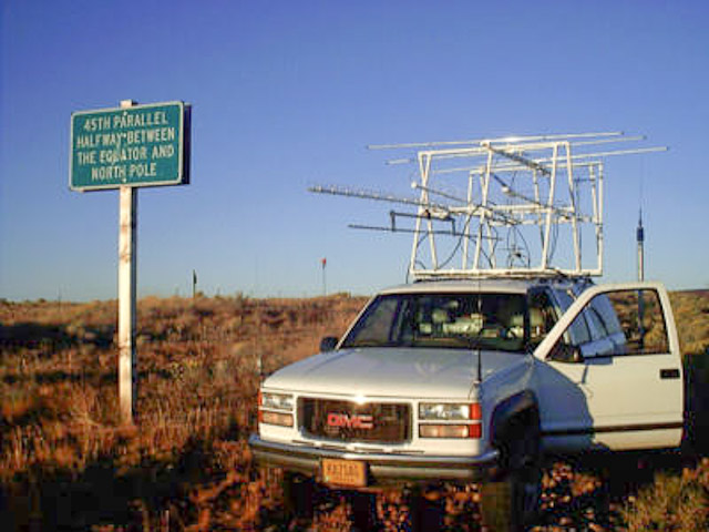
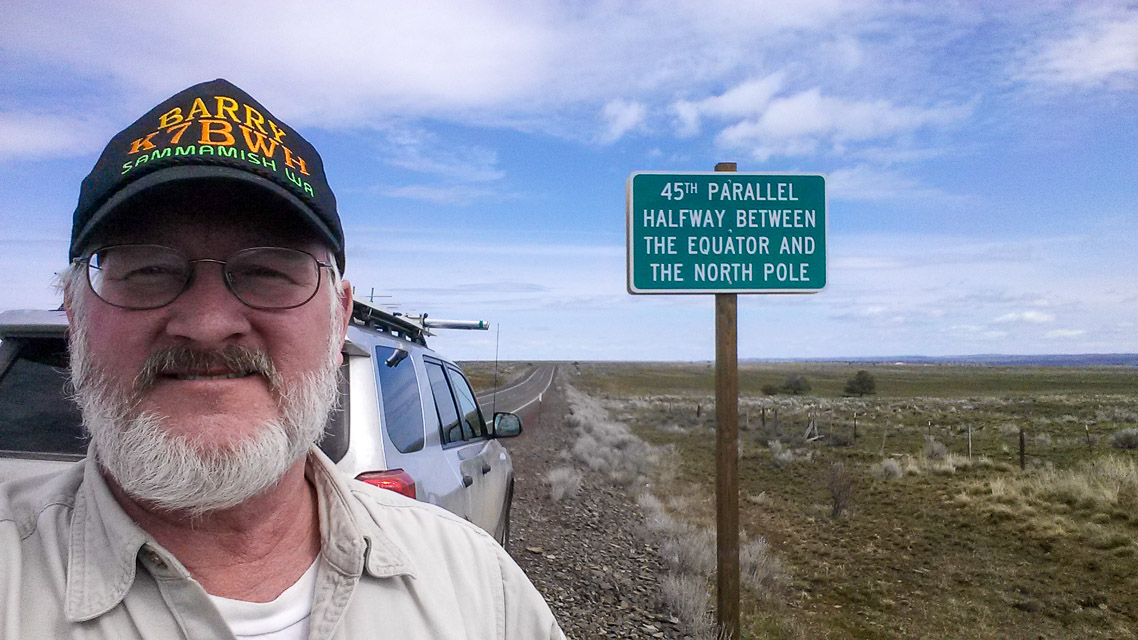
Take hwy 97 until you see the 45th parallel sign NE(?) of Shaniko Junction.
There is plenty of room to pull off the road. This is a good park and sleep location there is nothing around but buzzards and truckers.
Restrictions: Note that Hwy 97 does not run north and south here so watch the GPS for accuracy.
| < Previous | Page 14 of 27 | Next > |
©1998-2026 Barry Hansen