Rover Location Database
Oregon Rover Locations
- OR Map
- OR List
- Select Grid
- OR from CN85
- DN15 Wallowa
- DN14 Baker City
- DN13 Boise
- DN12 Outback
- DN05 Pendleton
- DN04 John Day
- DN03 Burns
- DN02 Steens
- CN95 The Dalles
- CN94 Bend
- CN93
- CN92 Klamath
- CN86 Centralia
- CN85 Portland
- CN84 Corvallis
- CN83 Roseburg
- CN82 Medford
- CN76 Astoria
- CN75 Lincoln
- CN74 Newport
- CN73 Coos Bay
- CN72 Pt Orford
- Add a Place
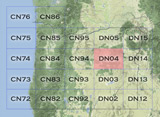
Grid Square DN04
9 locations - Bridge Creek - Spanish Peak - Elkhorn Summit - Baker Valley Overlook - Meadow Brook Summit - Dixie Butte - Fall Mountain - Ritter Butte - Table Rock Lookout
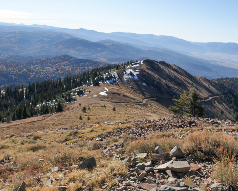
Potential VHF rover sites in grid DN04.
DN04 dimensions are 98.6 by 69.2 miles.
Explore this grid in Google Earth or equivalent:
Bridge Creek, DN04lx99
| 44.999990, -119.004273 |
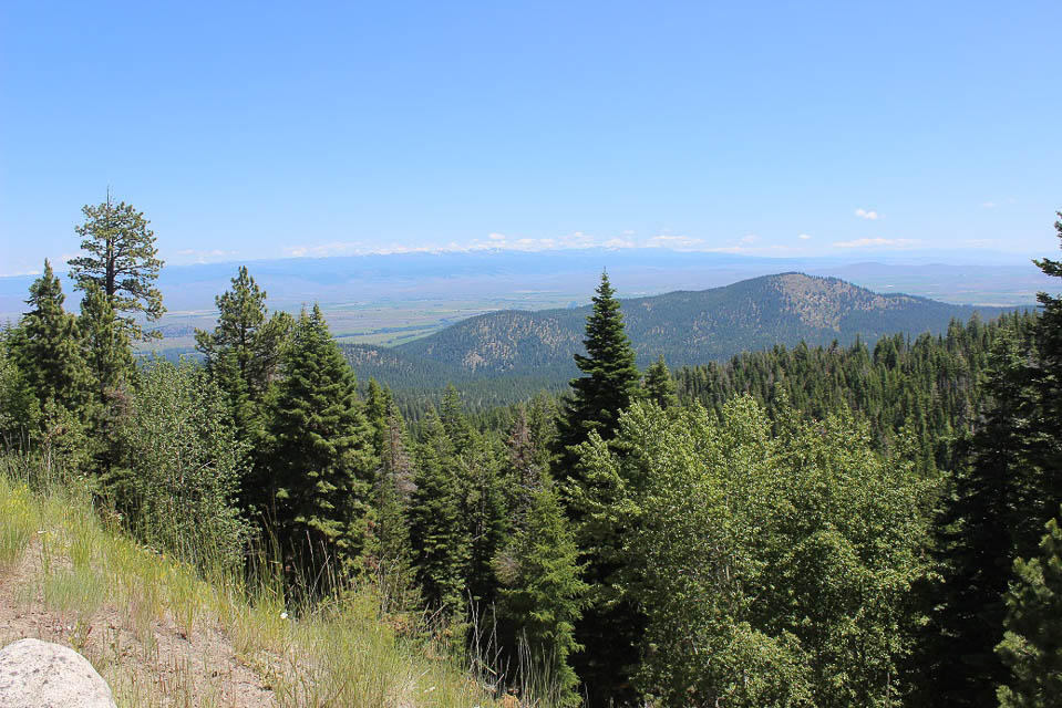
Spanish Peak, DN04cj67
| 44.407149, -119.775539 |

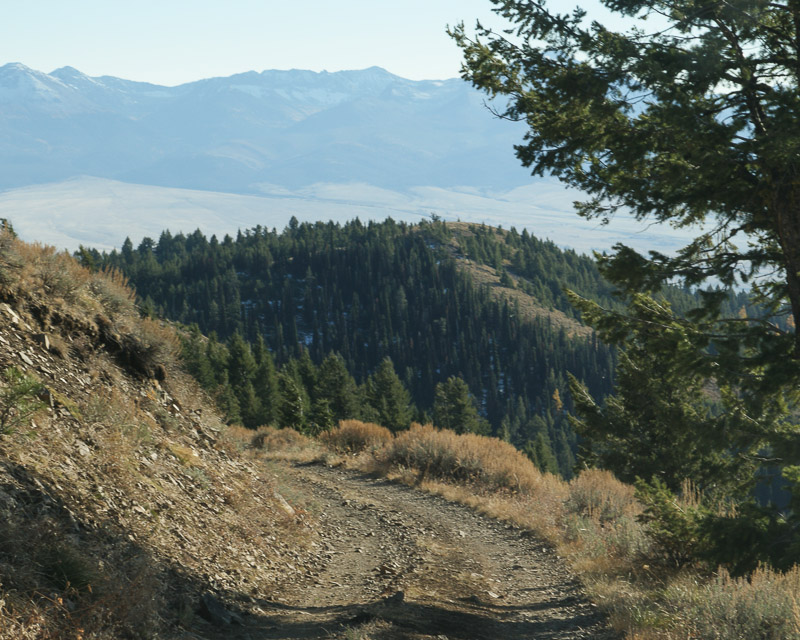
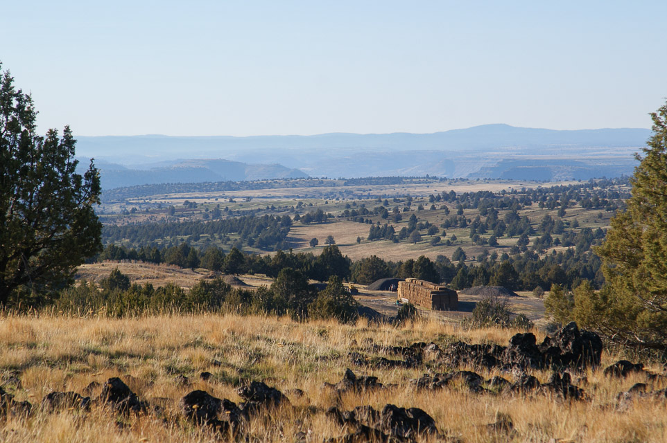
At 6400' and an unobstructed 360-degree summit and few trees, Spanish Peak is an excellent VHF site. 50 MHz conditions out to 300 miles seemed better than other places in DN04. Tim AL1VE could receive FT8 stations, throughout the contest period, westward from San Francisco to Seattle and across the north over to southern Idaho.
Road access was fairly easy, but portions were a bumpy and Tim certainly wouldn't advise trying the last five miles in wet conditions.
Elkhorn Summit, DN04vx03
| 44.974537, -118.249054 |
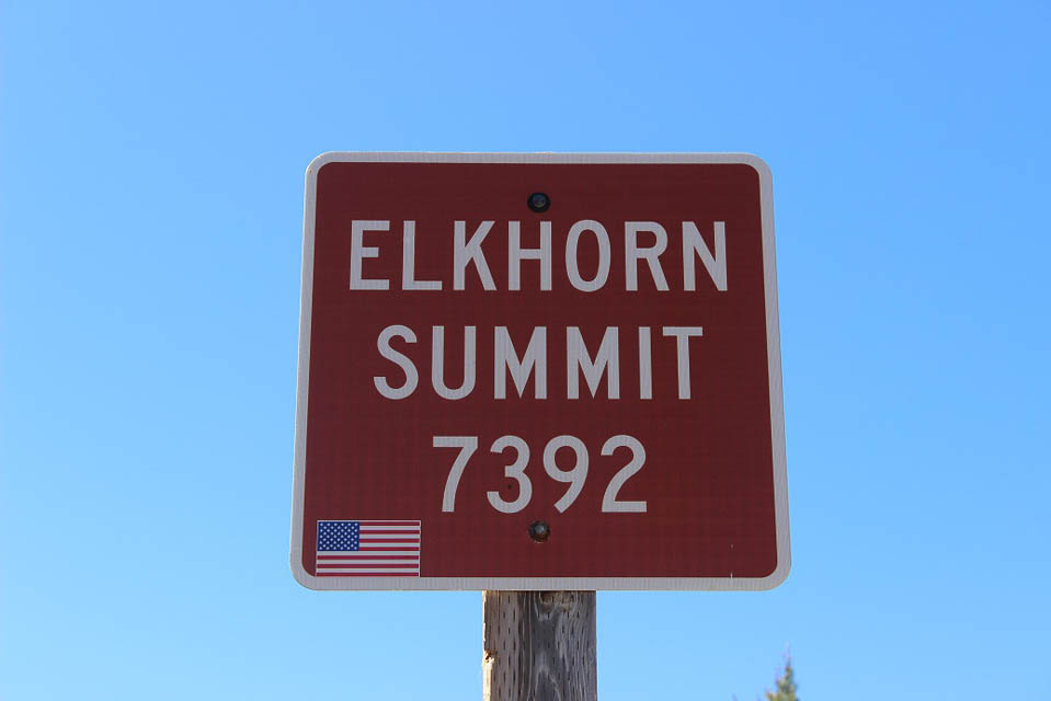
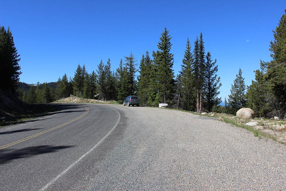


At 7392', Elkhorn Summit along the Elkhorn Scenic Drive is the second-highest paved road in Oregon. There is a large wide spot for parking at the summit.
Propagation will mainly be north to south toward the west, although some easterly propagation is possible. Western Oregon and Western Washington can easily be worked from here.
The Scenic Drive is not maintained for winter travel past the Snow Park a mile down the road to the east. The Forest Service typically will not plow the route open until the 3rd or 4th week of June, so don't plan on operating the June VHF contest from here. A less ideal substitute is to operate from the Snow Park which is about 200' lower in elevation.
Cellphone coverage is minimal to non-existent.
Baker Valley Overlook, DN04wx34
| 44.975475, -118.138981 |
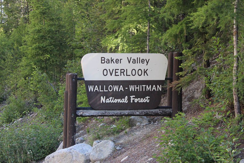
The Baker Valley Overlook is located along the popular Elkhorn Scenic Byway at 5550' northwest of Haines, Oregon. There is a campsite next to the overlook.
Main propagation will be from north to south toward the east. This can be a busy location, especially on summer weekends, with folks stopping to take in the view.
Cellphone coverage is excellent.
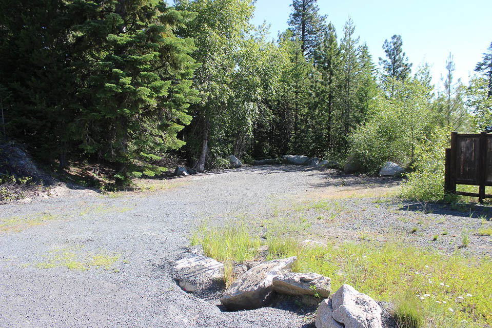
Meadow Brook Summit, DN04lw24
| 44.936826, -119.059310 |
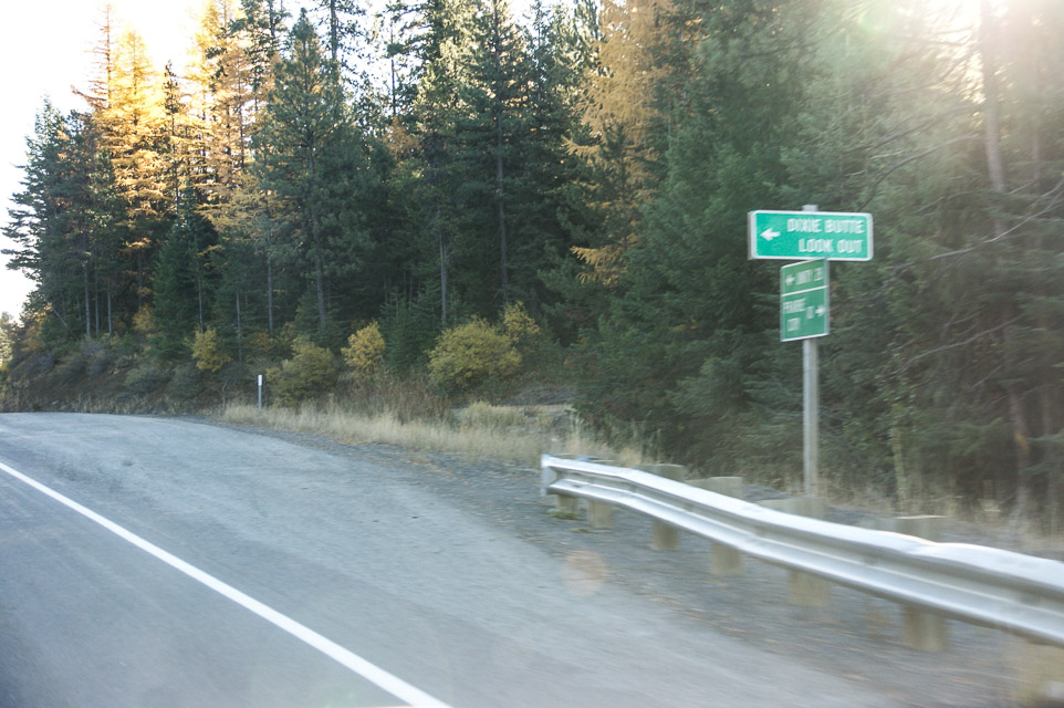
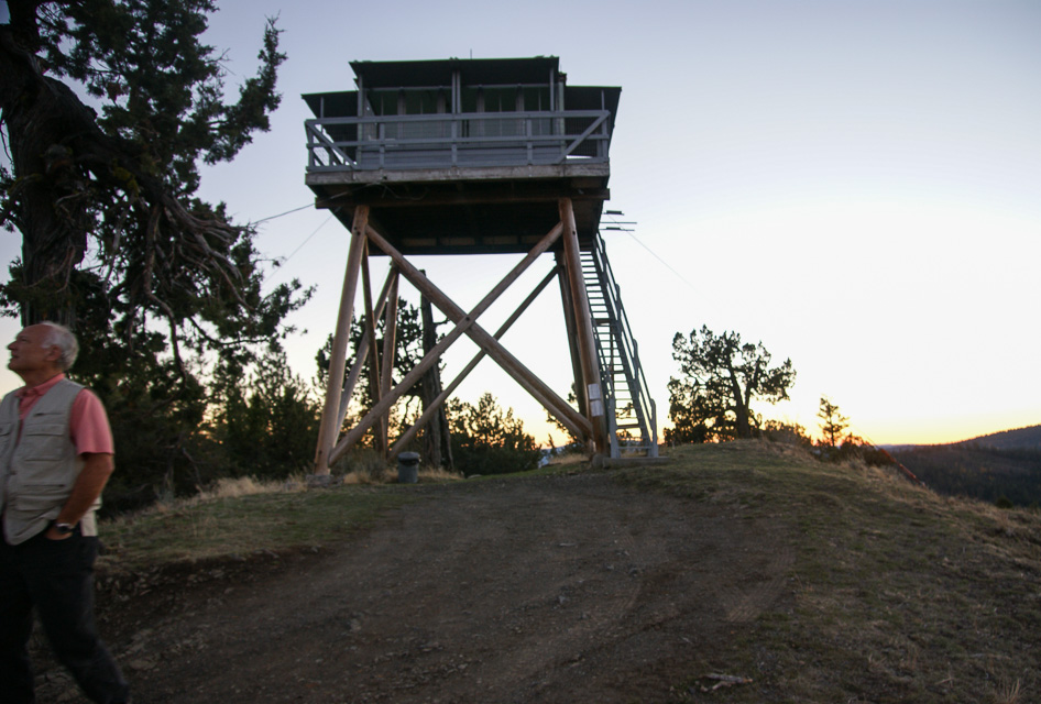
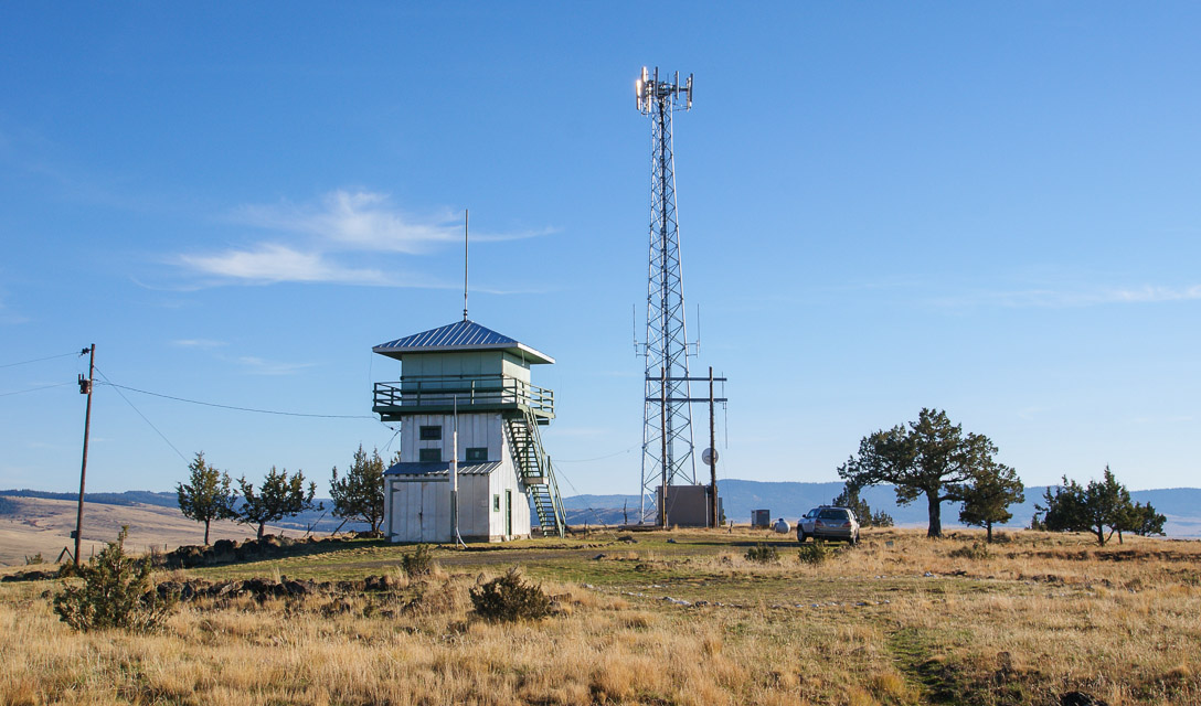
Dixie Butte, DN04qn49
| 44.582778, -118.626944 |

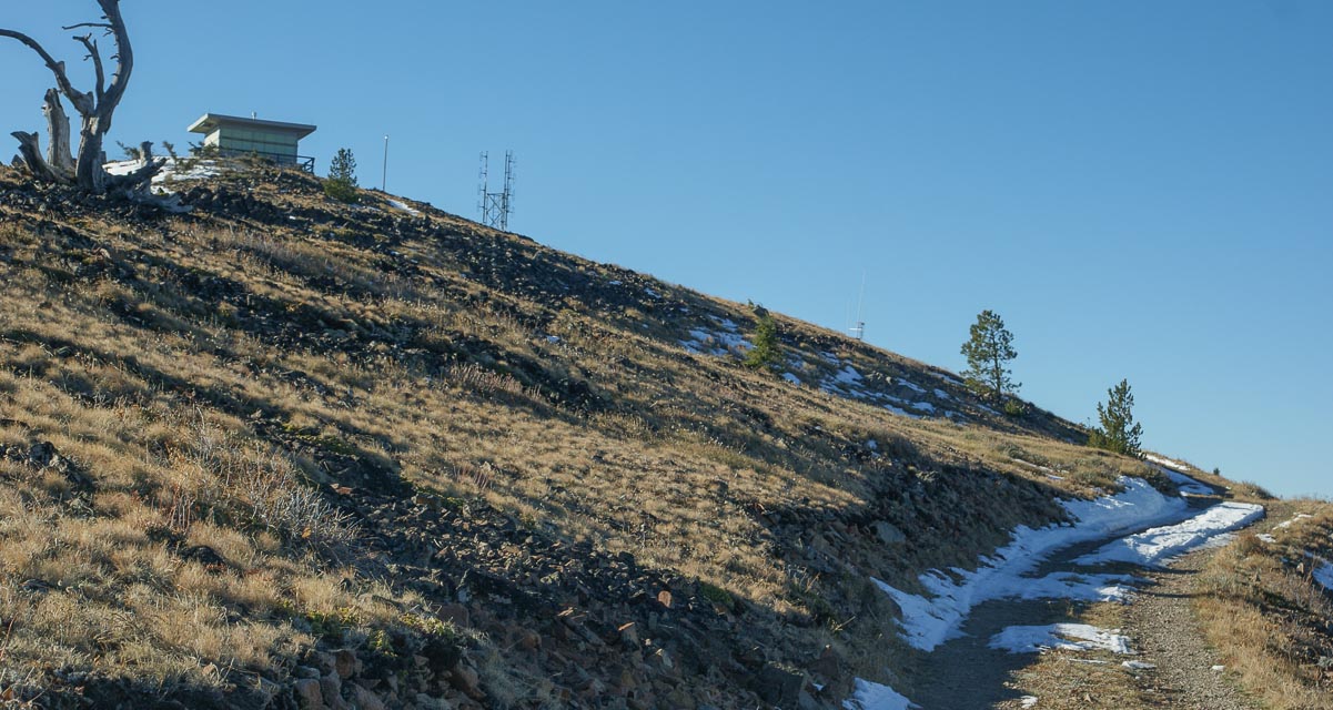
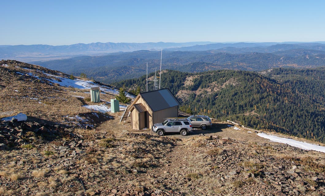
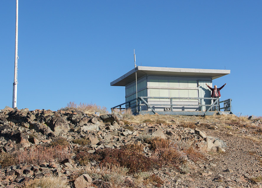


Summit is open with no trees to block the view. There are a couple of VHF repeaters on site.
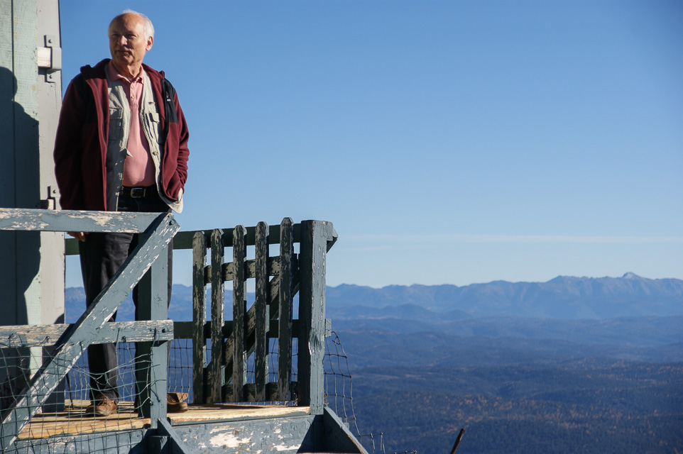
Lookout cabin on top sits on the ground. It is staffed in the summer, but you might want to check ahead with the Forest Service, as the lookout might be occupied during your visit. We found the cabin shuttered and locked in October 2013.
Driving directions: Forest Service lookout 15 miles northeast of John Day, OR.
The road is very rocky, narrow and steep with few places pull out. Not for the feint hearted.
Allow 45 - 60 minutes to drive the four miles from the main highway to the top.
Fall Mountain, DN04lh40
| 44.293333, -119.042500 |
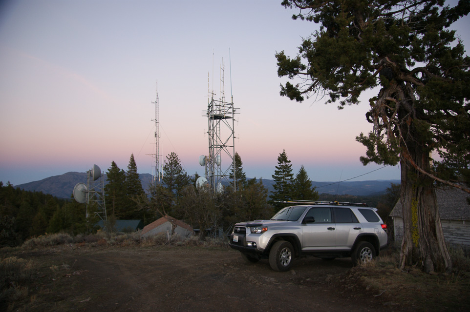
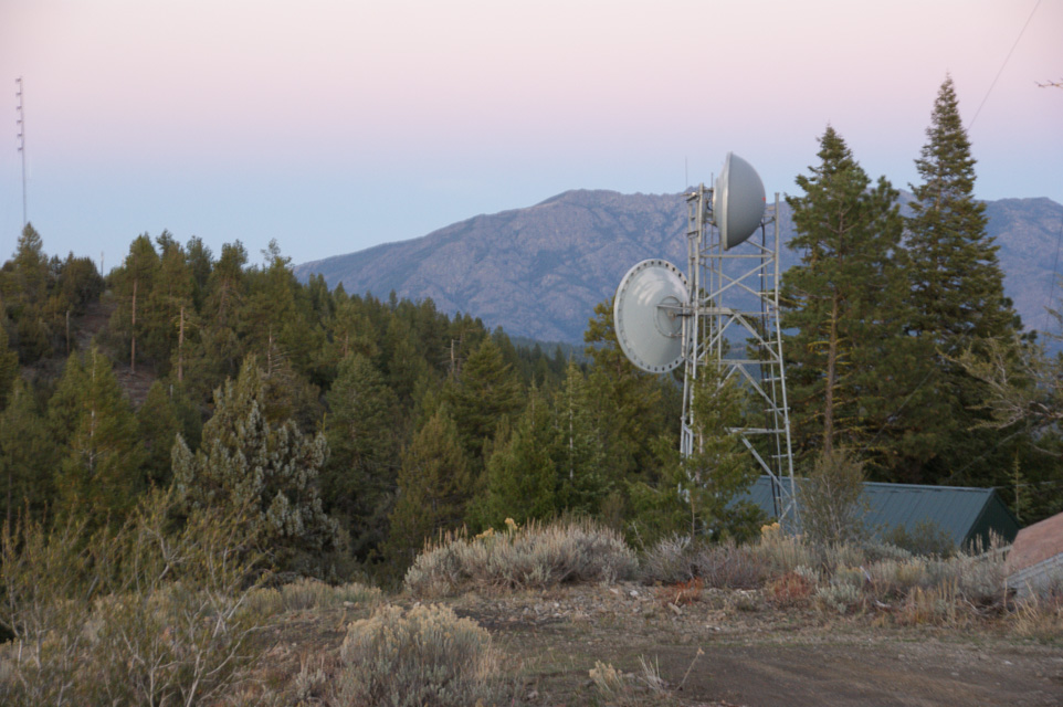

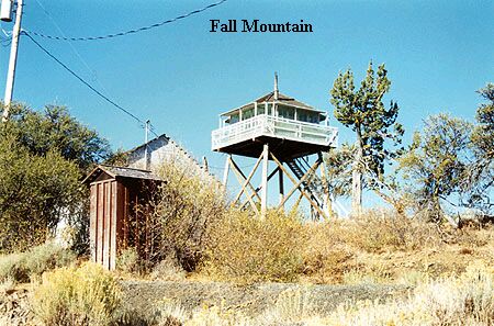
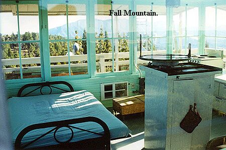
Site has several communications facilities including an FM radio station. Lookout tower on top can be rented and has electricity. Drawback is the mountain does not prominently rise above the surrounding terrain and is somewhat shielded to the east by the Strawberry Mountains.
Driving directions: Forest Service lookout 9 miles SSW of John Day, OR.
It has a nice road to the top and easy access off Hwy 395.
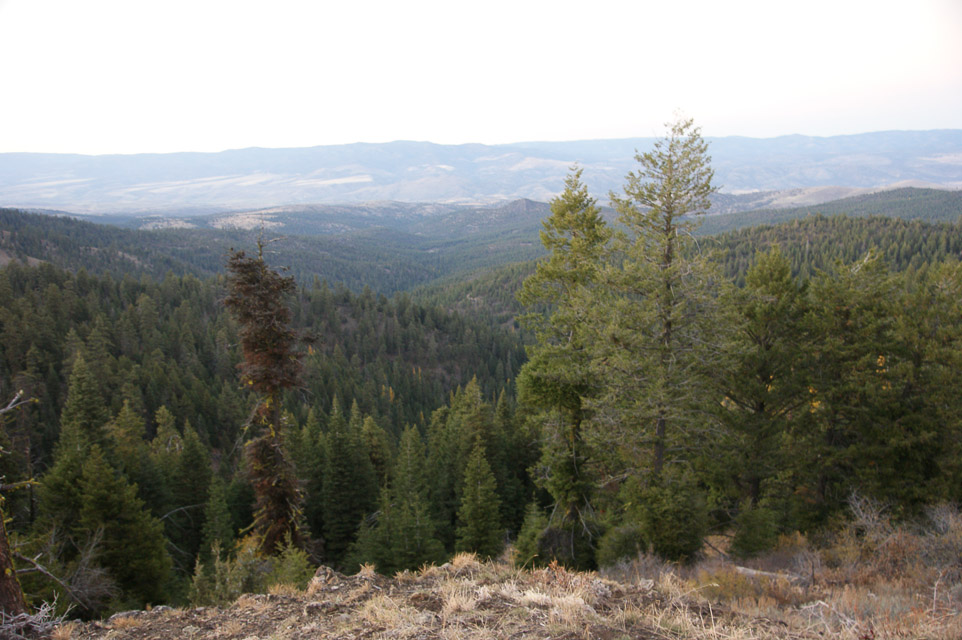
Ritter Butte, DN04lu10
| 44.833633, -119.071583 |

This is a fire watch tower that is approximately 3/4 mile west of hiway 395. It is in plain view of the hiway, so you can't really miss it. The dirt road going to the lookout is smooth and accessible to all vehicles. There is no access to the cab of the lookout, but there is good propagation in all directions.
This is an excellent hit and run location for a rover operation.
Driving directions: Forest Service lookout is approximately 35 miles north of Mt. Vernon on Highway 395.
Table Rock Lookout, DN04ui20
| 44.333620, -118.316390 |


Lookout cabin on top sits on the ground. 12 miles southwest of Unity, OR.
It is staffed in the summer, so you might want to check ahead with the FS, the lookout on duty probably won't appreciate company for a whole weekend. There are a couple of VHF repeaters on site.
Driving directions: The road is not too bad - typical lookout road.
Nice parking area on top with no obstructions.
| < Previous | Page 10 of 27 | Next > |
©1998-2026 Barry Hansen